
Table of Content
- Introduction
- The journey
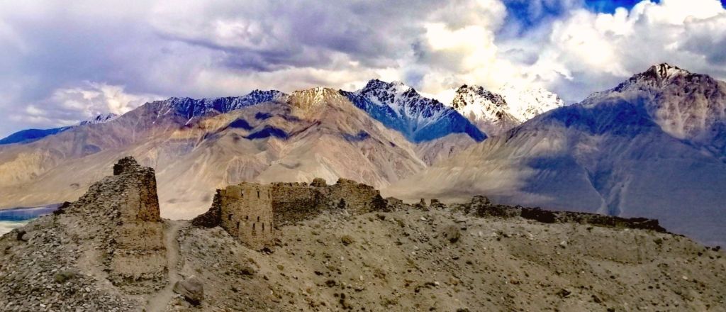
- Day 1 – Dushanbe to Qala i Khumb (8.5hr, 350km)
- Day 2 – Qala i Khumb to Jizeu (9.5hr, hike 1.5hr, 201km)
- Day 3 – Jizeu to Khorog (hike 1.5hr, 2hr, 66km)
- Day 4 – Khorog to Langar (10hr, 240km)
- Day 5 – Langar – Hike Pik Engles, (return 17km, 7hr)
- Day 6 – Langar to Murghab (8hr, hike 3 hr, 230km)
- Day 7- Murgab to Karakul (3.5hr, 165km)
- Day 8 – Karakul to Tulparkul (6.5hr, 185km)
- Day 9 – Tulparkul to Osh (5hr,hike 3.5hr, 240km)
Introduction
My journey started from Khyber Pass through the Hindu Kush in the Kalash and Swat Valleys. Continued on the magical ancient Silk Route – Karakoram Highway (“8th Wonder of the World”) to Kashgar via Khunjerab Pass. Continued west into Central Asia’s legendary Silk Road cities – Samarkand, Khiva and Bukhara, through Irkestam Pass in Tien Shan mountains. Finally through the Fann mountains to begin my Pamir journey.
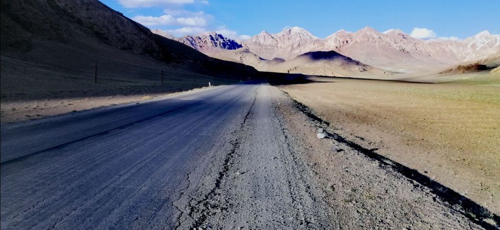
The legendary Pamir Highway, also known as “Bam-i-Dunya” or Roof of the World. It is the second highest highway. Once an ancient Silk Road, it transverses the high desert-like Pamir Mountains. The route passes through Afghanistan, Uzbekistan, Tajikistan, and Kyrgyzstan. Known as M41 (Dushanbe to Osh), a Soviet-built road, covers over 1200 km. Damage from erosion, glaciers, and landslides is common. I liked it because it slowed down the pace of travel. This allowed one to look and immerse oneself in this harsh yet unique environment. This is rough travel and perhaps the world’s last true adventure.
To see my journey , go to my Travel Map
To help plan and organise your journey, see my Pamir Highway Basic Guide
The journey
My journey began on 10th June 2024 from Dushanbe. It included an exploration of the Wakhan Valley. I rejoined M41 at Bulunkul to finish in Osh – 1530km. With three other travelers, 10 copies of passport and GBAO, on an organised 9 days tour which included a 4WD and Norbuk – local Krygis driver.
“A 1500km epic journey through desolate winding and perilous roads with over 2000 years of civilisation over awe-inspiring landscapes and sparsely populated areas promised adventure – high passes bound by soaring rugged icy peaks, lush fertile valleys and meadows fed by life giving glacial rivers and witness the resilience of the Pamiri people whom call this harsh environment, home”
Day 1 – Dushanbe to Qala i Khumb (8.5hr, 350km)
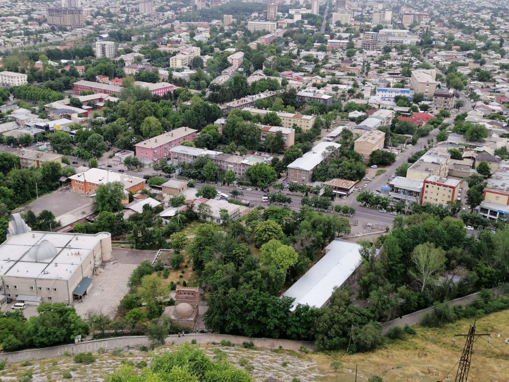
After fuelling and stocking up with water, fresh fruits and snacks, I was excited to leave Dushanbe (700m) at 11am. Dushanbe lies in the valleys of Gissar Range in the western part of the Pamir-Alay mountains. Just on the outskirts of Dushanbe, instead of going Northeast onto M41- ‘aka Pamir Highway’, we turned Southeast onto Highway E008 towards Kulob.
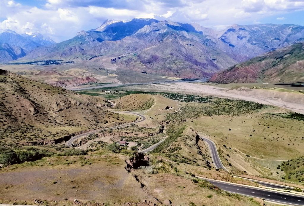
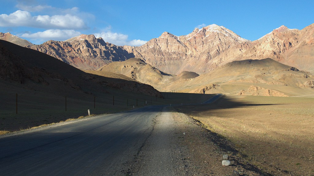
The sealed road steadily climbed as we crossed Vakhsh River. We entered Karotosh village, which is popular for fried fish from the surrounding waters. Further up, the picturesque bluish water of Nuruk Reservoir. Good place to stock up on dried fruits and nuts. Drove passed through two tunnels, into wide valleys cultivated with various crops. Around midday, road was busy with traffic. We passed historic Hulbuk Fortress. It is the Palace of the Governor of Kulbhuk in Pingan. It is near the confluence of two rivers. The fortress is said to guard the Western entrance of Pamir Hwy. The current structure is not the original. We arrived at Kulob at 2pm. Good place to grab some lunch.
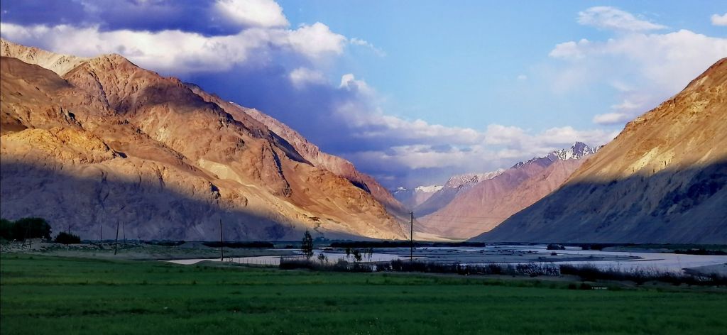
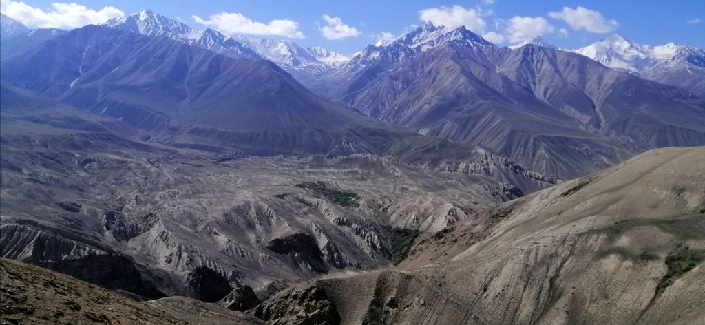
After Kulob, at Shurabad Pass, we reached a viewpoint at 1250m. I had my first views of the Panj River. It separated Tajikistan and Afghanistan. Formidable brown and grey mountains rose beyond the banks of the Panj with scattered icy peaks and settlements. In the foreground, a mottled landscape with scrub dominated Tajik side and a winding road descended towards Panj Valley. The earlier heavy traffic weaned off. This is the beginning of Gorno-Badakhshān region.
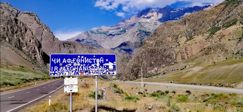
After a series of switchbacks, we descended along Panj river with Afghanistan sometimes just meters across. We stopped to watch. Women washed cloths in the river. I can hear their voices. Nearby, village homes made with stones blended with the environment. A gravel road, like the Pamir Highway, was cut onto the mountain slopes along the Panj. It ran parallel on the Afghan side. There was hardly any traffic. We stopped near Tajik and Afghan border post where a red bridge connected the two. The huge road sign pointed to the direction of Afghanistan. This border crossing is closed. On Saturdays, people can cross into Afghanistan to visit the bazaar. The paved road continued to cut through a gorge that narrowed and widened along the Panj River.
The landscape with the setting sun was quite dramatic. It was past 5pm. The Panj is fast flowing and raging in places. 2nd check police post near Zigar. Passed a substantial Afghan village. Homes had satellite with corrugated roofs and brick walls. Blue coloured roofs of a school seemed out of place against the brown hue of the landscape. Transportation on the gravel roads were by walking, backs of donkeys and occasional motorbikes. Women laid a large cloth under walnut trees to harvest the nuts. Some dried these nuts. Idyllic village life perhaps. On Tajik side, paved roads with cars and public transport.
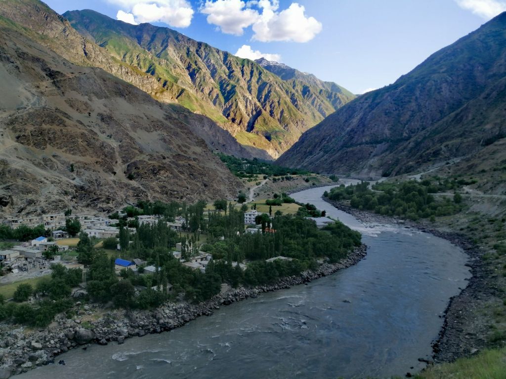
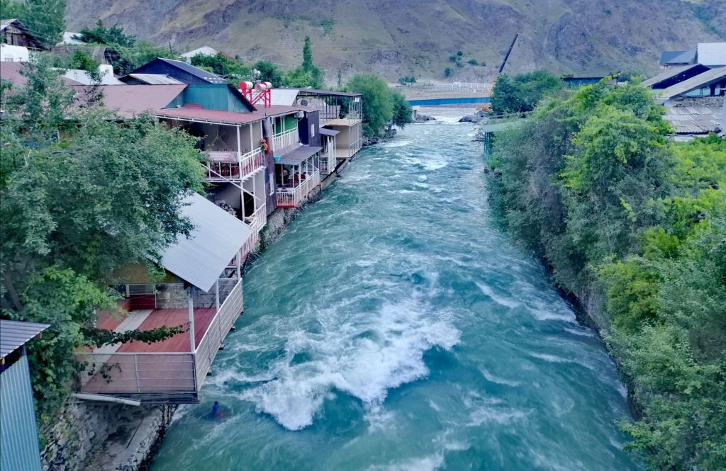
The villages, on both sides, set deep in the gorge, with the Panj dividing the two, is quite dramatic. We arrived at Qala i Khumb (1200m) at 1830. The setting sun casted shadows on the mountains. Roads were good. In front of a monument, a Markhor statue. On the main road, share taxi drivers gathered. Kids played football on the road and side streets. While walking along the river at 1900, I heard Taliban boys training with live firing across the Panj. The locals said its normal and they don’t trouble anyone. Qala i Khumb is surrounded by rugged mountains with the Panj River dividing Tajikistan with Afghanistan. We stayed at picturesque Jurev Roma Guesthouse (200TjS), perched over the fast flowing Khumb River, a tributary of the Panj. Meals are challenging if you don’t consume (less) meat, like me.
Day 2 – Qala i Khumb to Jizeu (9.5hr, hike 1.5hr, 201km)
Early breakfast with condensed milk on bread and black tea! My kind of breakfast. Left at 0700 on a bright and sunny day. Immediately after leaving town, sealed road turned into a dusty gravel road under construction. Snowy peaks appeared after 30 mins. More construction – a tunnel under construction that lead away from the Panj. Across Panj, more stone houses along the rugged mountain slopes in Afghanistan. Women in bright dresses hauled up barrels filled with water. Just before Toghmay village, our journey was delayed for an hour as diggers continued to reshape this ancient road. Across the Panj, an Afghan village mostly made with stones. Donkeys brayed as few villagers walked along the slope cut road. Mountain slopes on Afghan side were covered in trees.
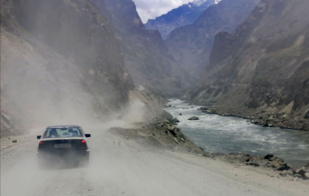
Unfortunately, at 0930, another road closure. With nothing to do, we sought shelter in our 4WD as the bright sun shinned down. Fortunately, Norbuk cut up a watermelon. We only managed to get away after two hours. Norbuk pointed out a patch of marble hills with cut block waiting for collection. At Bahvani Tag, valleys widened and the Panj became segmented and slow moving. A lone cyclist ploughed through the dust. A challenging journey indeed. At midday, passport and GBAO was checked at a police post at Vanj Valley road junction. Lunch stop at Kalot. I settled for fried eggs , potato chips and cucumber salad. Taking a south route, gravel road turns north east and Panj River resembled a lake. At Baroshon, road conditions improved. Unfortunately, it was only a tease. I’ve noticed a few decorated shelters that look like bus stops of a bygone Soviet days. Paused by the Panj near a shared van taxi and cheery passengers. People here smile easily.
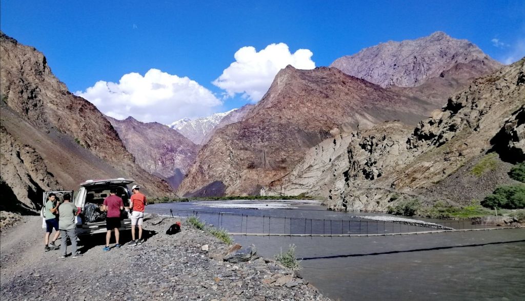
Getting into Rushon, on paved roads lined by lush trees, we entered a modern town. Soon, we detoured into Bartang Valley. The rocky road sometimes hugged onto vertical cliffs as it weaved along a stream with views of snow peaked mountains. Eventually we passed the wider Bartang River through a spectacular gorge and idyllic villages. A couple of locals packed into 4WD headed towards upper Bartang Valley. That gravel road led all the way to Karakul Lake to rejoin M41. That would be an adventure in itself.
A short distance later, we reached a suspension bridge across a slow moving Bartang River at 1630. The sun was just above the mountains. The bridge, fastened onto the cliff face, was rickety but steady. I was excited just to walk. It was just an overnight hike. With just a day pack, we crossed the suspension bridge with views of barren vertical mountains and setting sun. The track immediately ascended over a narrow rocky path. Mostly over shale, followed a stream, which disappeared, amongst green shrubs and short trees, underground only to emerge later. We continued to hike upstream sandwiched between mountains. The setting sun was intense. It was refreshing as we crossed the now fast flowing stream.
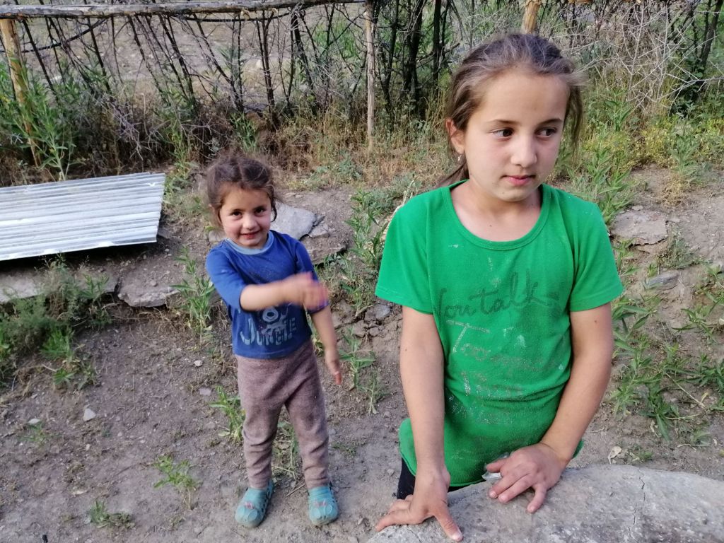
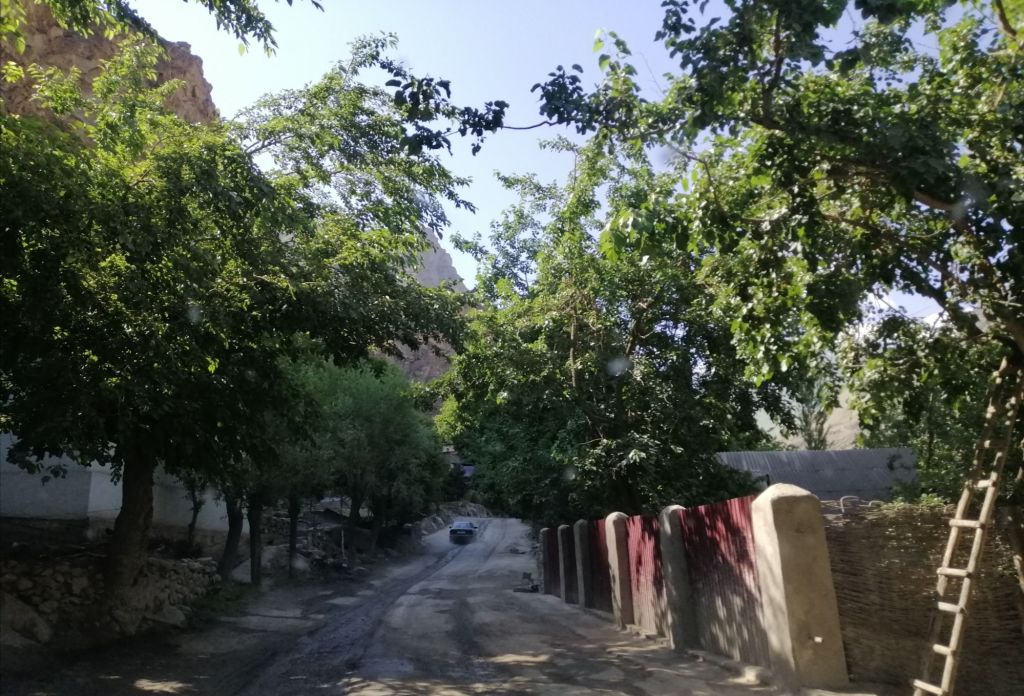
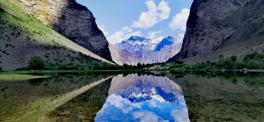
We approached a meadow and spotted a stone shed with thatched roof and cluster of mud brick structures. After 1.5 hrs of easy 5.5km trek, at 1800, we reached Gorhan Homestay (250TjS), the first homestead in Jizeu Village. We were greeted by Gorhan and his wife. Then, their two adorable daughters. Its a typical village – crop fields and animal husbandry but against a backdrop of icy peaks. We sat under almond trees and sipped hot green tea. On the table, an assortment of tasty treats. I explored upstream while the sun was still up. Reached a placid shimmering lake, the source of the stream we had tracked along. The peaks reflected on its surface. It was a tranquil place. A trail led beyond the lake to more homesteads and villages. Due to delays getting here, time was limited. Perhaps another day is required to visit these villages. For dinner, a special mixture of rice and vegetables.
Day 3 – Jizeu to Khorog (hike 1.5hr, 2hr, 66km)
After an early breakfast, walked around Jiveu Lake taking in the stunning reflection of snow peaked mountains. A couple of local ladies from the upper villages walked briskly towards Gorhan’s place. A pair of ducks foraged near the banks.
Left after 0900 to meet up with Norbuk at 1100. The return walk was much easier. A couple of women shepherded a few goats and cattle towards Jizeu. Always smiling and pleasant. We noticed Norbuk waiting across the bridge. With a last steep climb over smoothed rocks, we crossed Bartang River. Time was 1100. Made our way out of Bartang Gorge and valley. Day turned from sunny to cloudy. However, it was a pleasant drive. Back on the main road, we headed south. At the junction, another old Soviet bus stop. I noticed that each had a unique design decorated with stones and tiles. Once again, our journey continued along Panj River with Afghanistan on the opposite bank. We stopped at a police check post after Pashor village. This is quite regular along the Pamir Highway. The roads we’ve travelled so far were sealed.
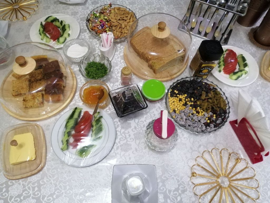
As we approached Khorog (2200m), the landscape became urban. Green trees lined the roads as we passed an airport. We arrived at our homestay Tat Mizro Homestay (250TjS) at 1300, just before the city. We were greeted by our host and invited for some tea. On the table, a array of tasty snacks, homemade apricot and chocolate cakes. They were delicious. Rooms were tidy and had an outdoor platform under almond tree to lounge. Best accommodation so far.
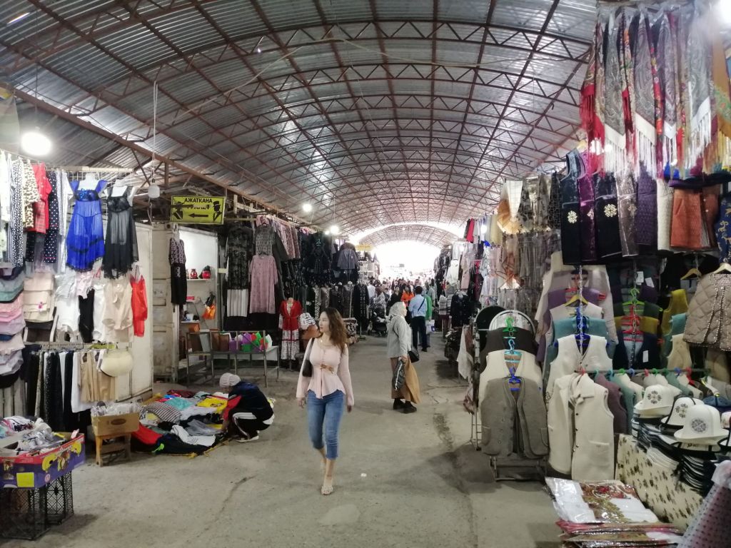
Lunch in Khorog on Lenin Street near World Cuisine restaurant. Typical Tajik fare. Khorog is the capital of Gorno-Badakshan, a substantial town with supermarkets, banks, atm and café. From hereon, there is limited opportunity to get cash. Norbuk suggested to visit the Botanical Garden. The heat was intense, I gave it a miss. On Saturdays, there is a colourful Afghan market. The Gunt River runs through Khorog to meet the Panj.
“The Panj River formed by five tributaries – Vanj, Bartang, Pamir, Wakhjil and Gunt Rivers. It flows west joining Vakash River to become Amu Darya (the ancient Oxus)”
Further west, a border crossing into Afghanistan (currently closed). We re-stocked at a supermarket and returned to Tat Mizro for some tea and delicious cakes. I headed straight for the outdoor platform. A pair of tourist police interviewed me and the homeowner as to promote Khorog. Dinner was chicken soup with vegetable and salads. Plus, more apricot cakes!
Day 4 – Khorog to Langar (10hr, 240km)
Breakfast was sumptuous. Left after 0800. Khorog is a substantial town surrounded by snow peaked mountains at the confluence of Gunt and Panj Rivers. The Pamir Highway M41 goes east towards Bulunkul and onward to Alichur/Murghab. We continued on the southern route along the Panj and Wahkan Valleys. Half hour later, a police check post. The road ascended and descended into a canyon. Across the Panj, in Afghanistan, a single gravel track on a treeless slope. After passing through another border checkpoint, we arrived at Andarob. We detoured east. Followed a narrow stream through a leafy road to a thermal spring (Ghram Chasma) in Bakor village. It looked set for tourist – several hotels across the stream catered for visitors. Both private and open pools are available. Looking at the large travertine mound, its old. We rejoined the southern route. I noticed for the last three days, a new power towers along the road. Apparently, Tajikistan supply power to Afghanistan and Pakistan.
Just before Ishkoshim, my first views majestic Hindu Kush and Wakhan Valley. Between Yakshswol and Sumchin, the river valley widened with islands and wild shrubs. Green meadows with cows grazing. We passed the Ishkoshim border crossing into Afghanistan. It was closed. On Saturdays, there is a market within the borders in purpose built buildings on both sides. (Due to political indifference, this market/border may be closed). Arrived at by Ishkoshim around 12pm. Lunch stop. Left 1300 and headed east.
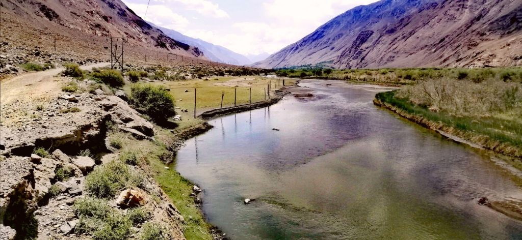
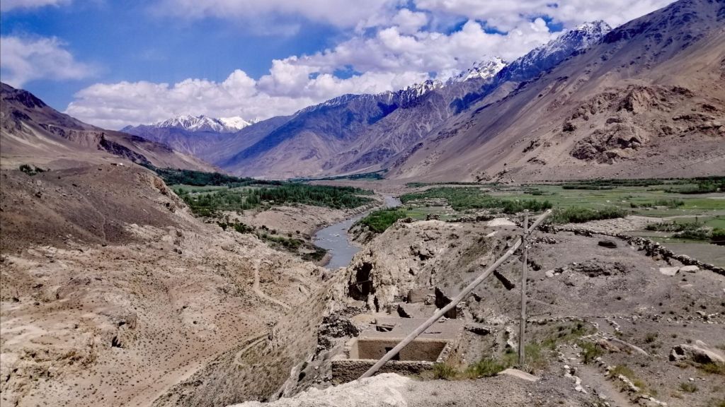
Just past Tokgakhona, the Hwy turns north, along the Wakhan Valleys. Across the Panj, a lone Afghan man walked with a donkey along a single gravel road. Another four men traversed the stony barren landscape. It seems quiet and hardly any people or vehicle movements. Pik Engels glistened in the late afternoon sun. Occasionally, Hindu Kush snowy peaks peeked behind this barren and monotonous brown hued mountains dotted with villages with stone houses. The fertile wide valleys enabled large scale crop cultivation – cereals and fruit trees. Interestingly, the road between villages are devoid of trees. These villages are like an oasis.
In Namangut village, we stopped at the 3rd-4th century Khaakha fortress. This fortress, from the Kushan era, is perched over a small hill. It overlooks the vast expanse of Wahkan Valley. This is an army outpost. An important outpost along the Silk Route.
“Kakhkaha led a fire-worshiping tribe called the Siah-Posh (black-robed). They ruled in the Wakhan. The tribe was defeated around the time of the region’s conversion to Islam. The descendants of the Siah-Posh now live in present-day Nuristan in Afghanistan.”
Did the Red Kafirs in Shahkenendeh village in Kalash Valley (Rhumbur, Pakistan), from here – fleeing Nuristan from forced conversion to Islam? Or from Soviet occupation? They practiced Hinduism with animism (later Islam with animism) but Islam today. Are Kalash people descendants of the “black-robed” Siah-Posh?
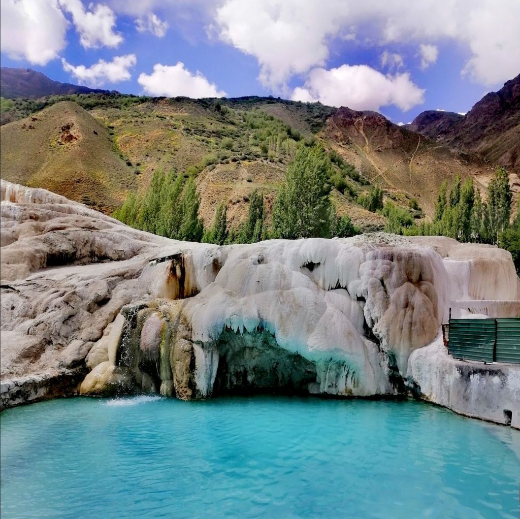
The Panj became a braided river. Sand dunes along the road near Zumudg village. We headed NE and then E. We continued higher through nerve-wracking winding gravel road. Finally, we reached the 2200 years old Yamchun Fortress (3100m). It is perched on a hill with expansive views over the Panj, Afghanistan’s Hindu Kush, and Wakhan Valley. It is on the crossroads of the northern Silk Route between east and west. Nearby is Bibi Fatima Hot Spring(40s). Said to increase fertility in women. Naked and few steps down, entered a turquoise thermal water in a grotto like cave. Soaking in hot mineral water to sound of gushing fall was quite blissful.
In Ymang, we stopped by a small field. A dozen kids played football. A white walled building stood behind – Wakhan Museum. There was a assortment of books, artifacts and musical instruments. Ahmad, a caretaker, eventually emerged. He’s a lively guy. Ahmad explained that this museum is dedicated to Sufi Muboraki Vakhani. He pulled out a book to authenticate his legacy. In the adjoining room, he explained the traditional Pamiri home. He pointed out the skylight with four (elements) beams. These beams descend down on five pillars (of Islam). He went on to play the Rubab (Pamiri lute). Before Islam there was Zoroastrian and Buddhism in these parts. This museum still has the old religions incorporated. Near the road, is an interesting stone solar calendar used by Vakhani.
We made another stop along the tree lined main road in Vrang. Local kids quickly shouted “Buddhist stupa”, pointing up towards a rocky mountain. I could make out the image. A short walk through a potato field brought us to the edge a mountain. A steep and sometimes slippery climb brought us to the tiered stupa. The kids tagged along. Nearby were several rock-cut structures, probably served as meditating cells for monks. A stone inscription described this place as the ancient capital of Wakhan – Kundul. The views of fertile lush green Wakhan Valley on Tajik side in contrast against a desolate arid Afghan was stunning.

We finally arrived at our homestay for two nights in Hisor. Mischa Homestay (450s) is about 2km from Langar (2800m). We got there at 1800. The sun set over the Wakhan Valley, confluence of Pamir and Wakhan Rivers and the formidable Hindu Kush was stunning. Life in the Pamirs is basic. People engage in livestock farming for milk and meat. They grow fruit trees. Wheat is cultivated in the fertile valleys of the Wakhan. So far, this stretch had the most check points and army presence. Perhaps keep an eye on the cross-border opium trade by the Taliban!

Day 5 – Langar – Hike Pik Engles, (return 17km, 7hr)
Today, the plan was to do a 17km day hike to Pik Engles from Langar (alternately, start from Zong). Norbuk dropped us off at the start of the trail head, about 2km, in Langar village(2850m) around 0730. A couple of local girls came over for a short chat. They are always curious and smiling. A few villages tended to the animals and fields. The air was chilly.
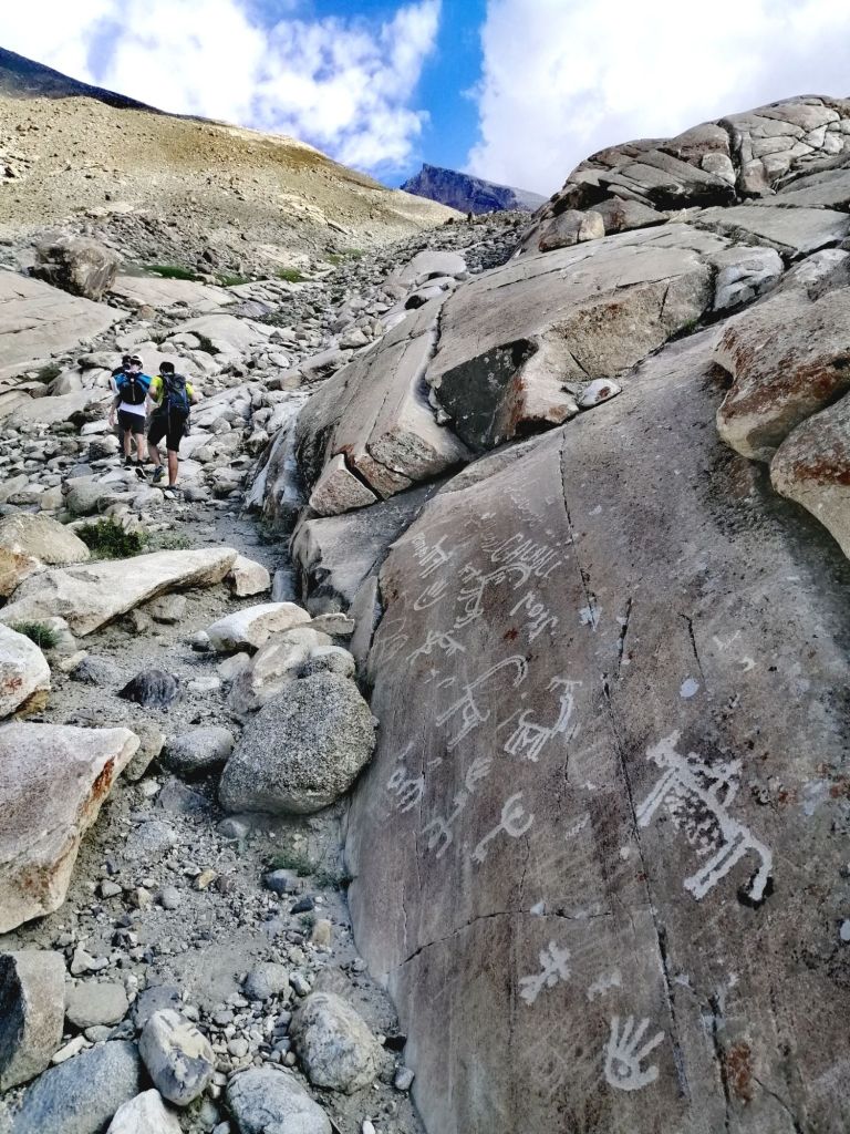
The hike to Pik Engles from Zong is gradual and helps acclimatise but adds 2km more. It meets the trail from Langar, which is steep from the beginning. I pulled out Maps.me to locate the route. The trail at 2850m immediately climbed over a rocky and sandy terrain. A small stream flowed down beside the trail. We gained elevation quickly. After an hours’ arduous uphill hike past numerous petroglyphs etched onto boulders, we reached 3380m. It was a gradual 35-degree incline. It was quite exhaustive. The expansive views of lush green Langar contrasted with a desolate and arid Afghanistan. The Wahkan and Pamir Rivers flowing west to become the Panj. Just after 0900, we had climbed to 3550m. This is the meeting point of the trail from Zong. A concrete water channel with fast flowing water descended downhill.
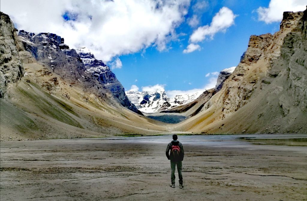
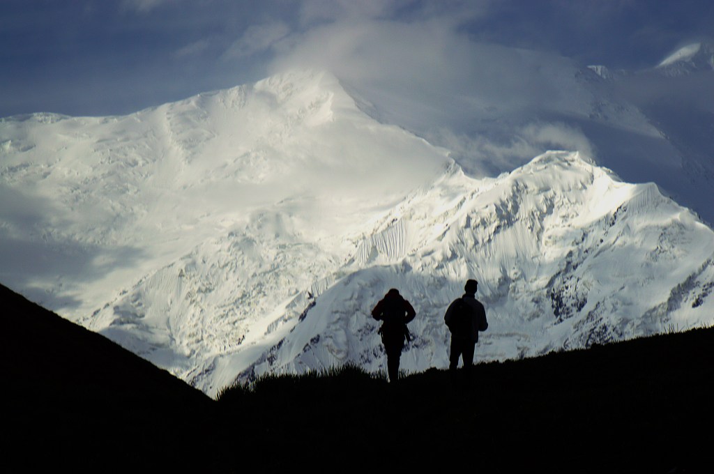
Glimpses of Pik Engles appeared on the horizon. On the right, a steep drop towards Kishtijarob River which carved the valley that led towards Pik Engels. A farmer moved with a few goats along the river. After 3.5 hrs, we reached the grassy Peak Meadows. The views of the winding stream, green meadow with cows and yaks grazing, and snowy Pik Engles was quite a sight. A few shepherds moved a large herd of sheep, few horses and cows along the lakes edge. The weather turned cloudy and temperature dropped. Carefully negotiated the swampy field, we reached the water edge, at 3930m, around 1130. I felt Pik Engles (6510m) was almost within arm’s reach. Karl Marx Peak (6726m) is somewhere on the left.

This is a great sight for camping. There are several tracks that start from here including Moscokvskoy Pravda (6075m), Churlenisa (5794m) and Danilaytisa (5837m). We had an hours’ lunch. The weather changed dramatically as more dark clouds descend on the surrounding mountains in the south. Pik Engles was clearly visible and sunny. At 1230, we quickly retraced our track. Local kids, adapted to the cold weather, stripped and swam in the frigid water. Icy wind picked up. Suddenly, it snowed heavily for half an hour. It faded as quickly as it arrived. The sun returned. Soon we turned left along the canal and descended over a loose rocky terrain towards Langar. This time, there was time to appreciate the numerous ancient petroglyphs etched onto rocks and boulders. They depicted mountain goats, archers, Bacterian camels and rubob (musical instrument). Some are unwanted newer additions.
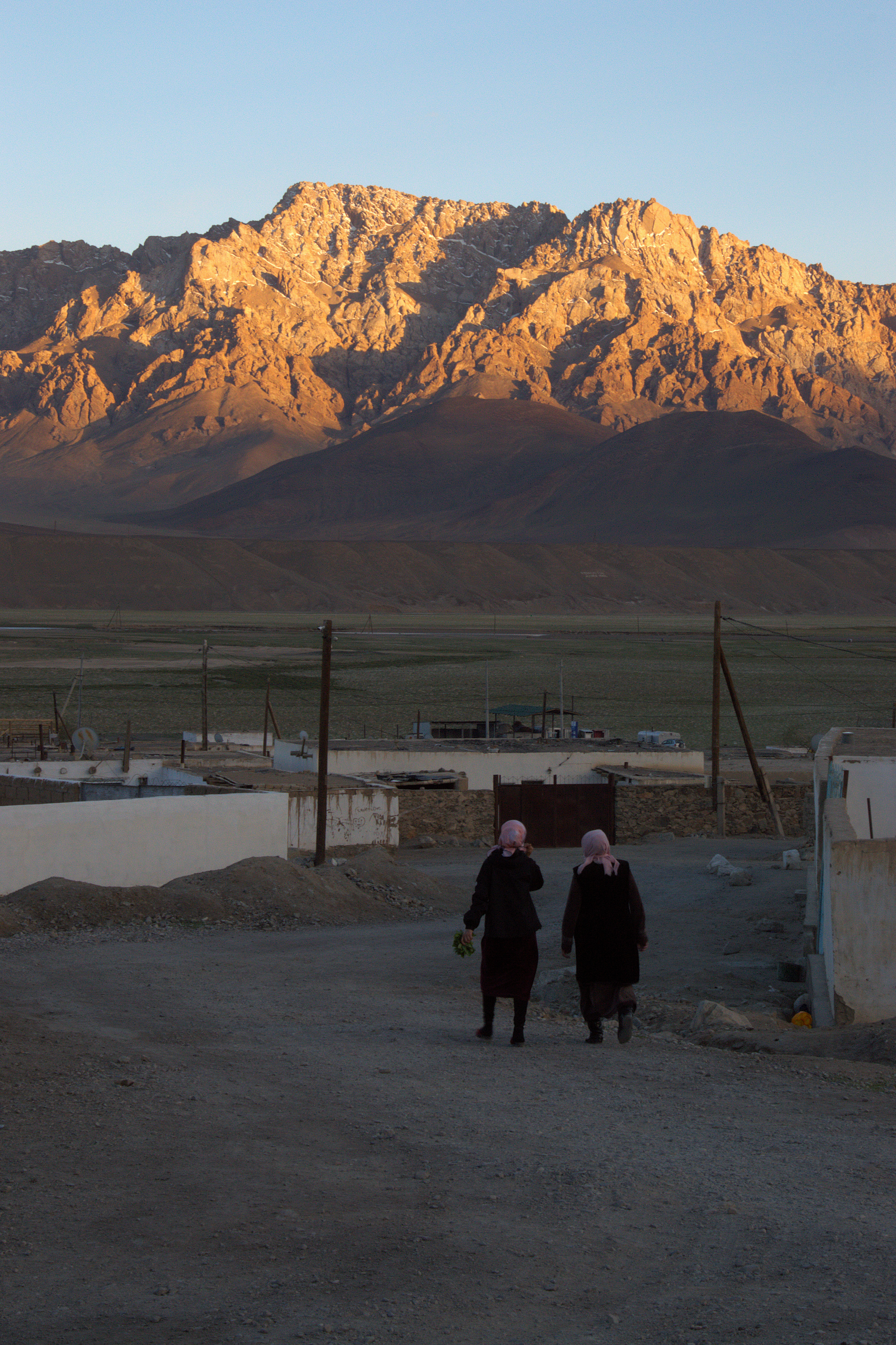
Langar was on the crossroads for caravans plying the Silk Road. A meeting point for civilisation and cultures. The petroglyphs are ‘maps’ left by early settlers. Citing the numerous animal images, Langar was perhaps a rich hunting ground in the Pamirs. Towards the end of the track, at 1530, we passed a cemetery, just above the village. Women were busy in the fields as children played on the dusty roads. Yellow flowers on crops brightened the landscape. Langar seems like the most productive place so far. Local men gathered at the village center. Walked 2km on the dusty gravel highway with reprieve under shady trees to Hisor. Back as Misha, with a hot cup of coffee, I looked far into Wahkan Valley as dusk descended on Hindu Kush.
Day 6 – Langar to Murghab (8hr, hike 3 hr, 230km)
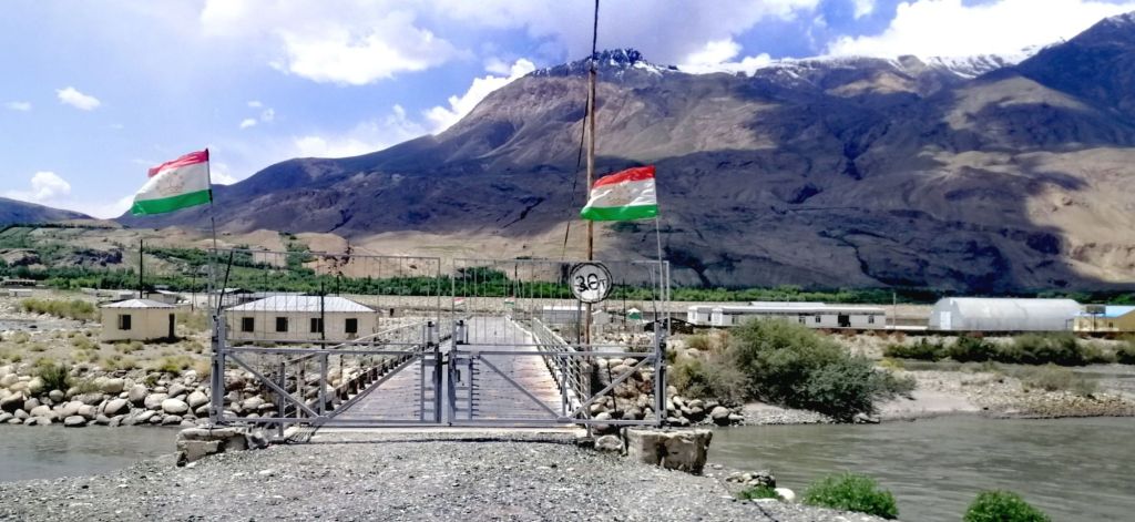
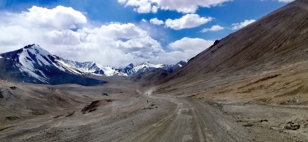
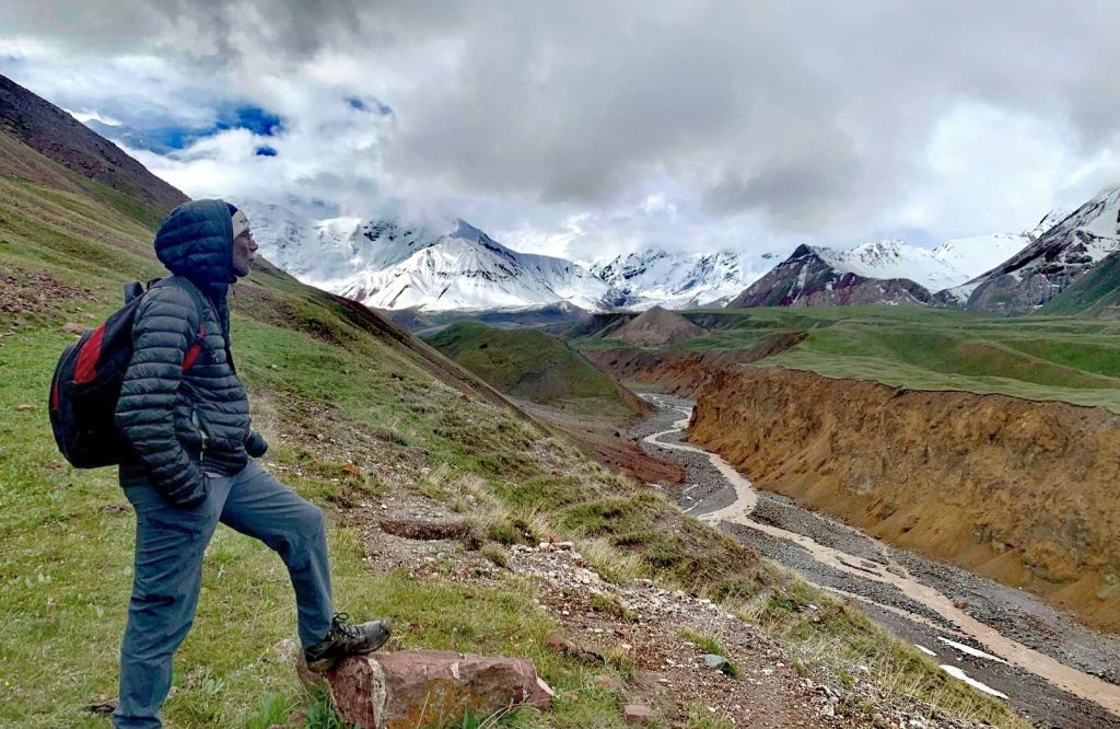
Back on the gravel road, we left Langar at 0730. Just outside the village, a bridge connected to Afghanistan was closed. Trade does occur on Saturdays. Further up, a huge army camp. The gravel road immediately climbed up, zig-zagged and headed North. The formidable Hindu Kush mountains in Afghanistan – barren and snow capped, increased in density. The road is just sand and gravel followed the contour of the mountain slope. At the bottom is Khargush Gorge, carved out by Pamir River flowing south. Suddenly, on the right, a delightful meadows of wild yellow flowers sprouted out of the rocky terrain. It was very localised. On the left of the road, not even a single flower! Within minutes, there was none. That was extraordinary.
Even with the strong sun, it was cold. Khargush Gorge is more than 50km long. We left the formidable Hindu Kush as we headed North. The craggy peaks of the Afghanistan mountains are in close proximity.
Bacterian camels rested along the Panj on the Afghan side. Golden marmots ran around and disappeared into holes. The drive for the last 2 hrs was quite spectacular. The land transformed into an arid desert-like landscape with wide valleys as the road steadily gained altitude. Patches of agricultural oases common along the Panj was sparse here. A shepherd’s dog gave us a chase. Soon, view of Pik Engels was visible in the south. Even in this seemingly desolate place, a shepherd with cattle, goats and donkeys walked along Pamir River in this cold and windy day. We gained elevation as we headed towards Khargush and went further away from the Pamir (headed east) and Afghanistan.
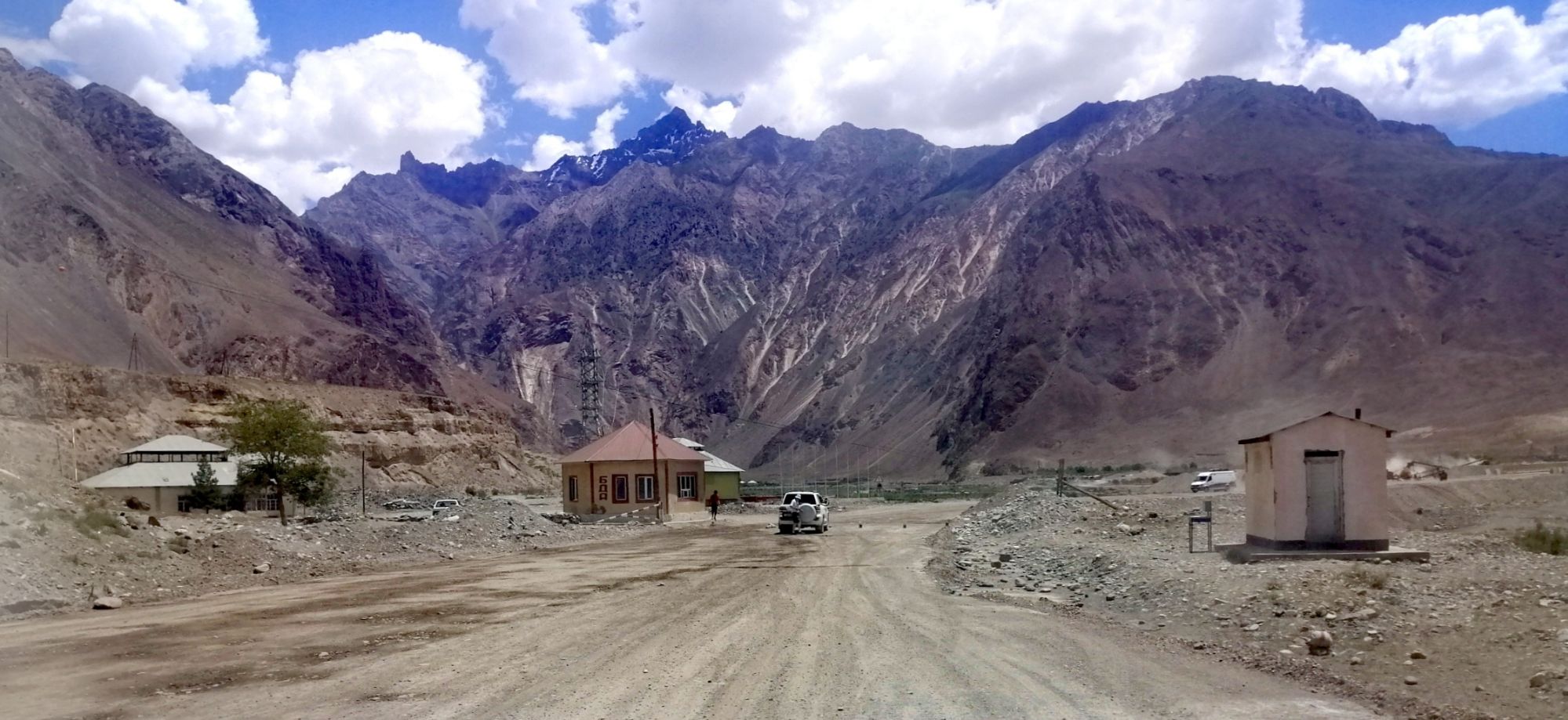
Arrived at Khargush check point (3880m) at around 1000. The small settlement (mainly army) was further lower in the valley. It is certainly high, cold and far away. Icy wind kept the border guard wrapped in warm jackets. Like all other check post, there were no issues. Norbuk gave him some cucumbers and melons to maintain rapport. Afghan and Tajik snowy peaks appeared across stony plains towards the horizon. More marmots appeared. We continued through Khargush Pass at 4344m and passed patches of ice and alpine lake below icy mountain.
At 1030 we stopped by the gravel road, between Khargush and Karadara Lakes, to hike up to Hausibek’s Viewpoint. In my mind, our next stop was Bulunkul Lake. I was unprepared. The first part of the track was a gradual climb on Panorama View trail. Maps.me came in very handy to navigate on this unmarked trail. It was an exhausting climb due to altitude and cold wind. A hare sprinted downhill upon seeing us. There was a couple of false summits. After 1.5 hrs of arduous hike, through icy wind, we reached the viewpoint (4750m).
The views were stunning – in the east, Wahkan Valley heading towards China. The westerly icy wind battered down. I did not have a windproof jacket. It was bitterly cold. The only refuge was a pile of stacked rocks. This is the highest point achieved on Pamir Highway. After some snacks and rest, we returned via a steep slope with loose rocks. It took only 3/4 hour to reach our transport. There was no wind here and the sun was intense, still cold. Norbuk prepared a sumptuous picnic lunch. Khargush means valley of hare. We saw more marmots than hares.
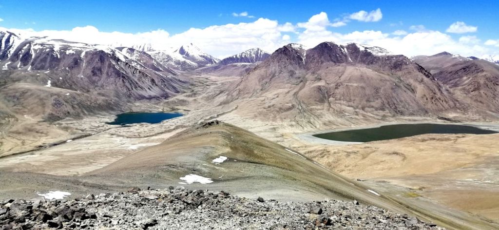
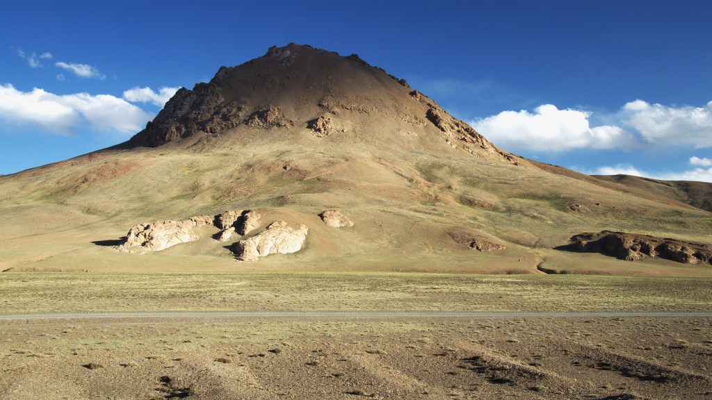
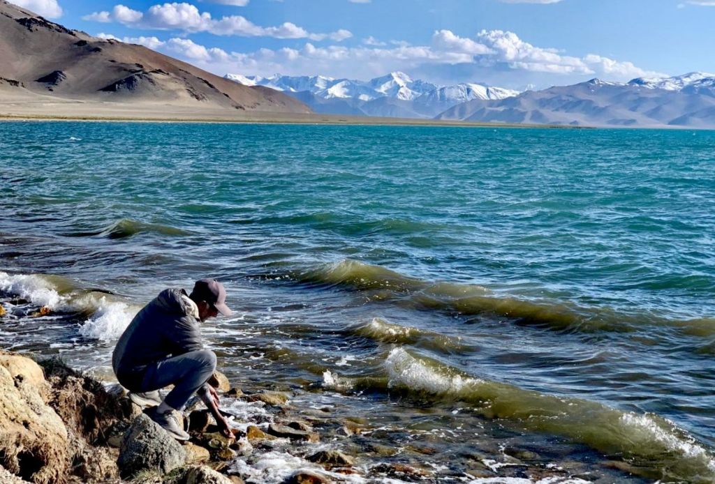
We paused at another saline lake – Chukurkul (3945m). This is a great camping site. We rejoined M41 – Pamir Highway and turned left towards Khorog. Only for short distances before driving onto a flat sandy path towards a cobalt blue Bulunkul (3775m). The sky was blue and the sun intense. A small winding stream connected Bulunkul to the larger Yashikul (3700m) further up. Norbuk informed us that lake area is now a national park with an entry fee of 180 TjS. However, he drove us to the park’s border (may have gone further) to view Yashikul. Both lakes were surrounded by snow capped mountains. We returned to M41 and continued our journey east passing three salt water lakes- Chururkul, Tuzkul and the larger greenish tinged Sasykul. It was almost 1630.
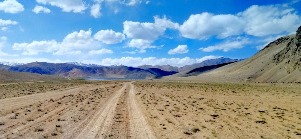
Although the highway is a sealed, there were many pot holes. We passed two lorries with breakdown. Self reliance is critical in these sparsely populated and low traffic Eastern Pamirs. We entered a desolate and wide Alichur Valley. A short drive past Alichur River that meandered through the village, at 1630, we arrived at Alichur (3990m). It is a neatly organised white washed village, sits on a wide flat valley. It has a school. Temperature -60°C in winter is common. Farming, hunting and a little tourism are the main source of income.
Our original plan was to stay a night here. However, we continued towards Murgab. Soviet built vans and trucks are still in use here. Just out of the village is a small lake with trout in Jun /July. A shepherd ushered goats and sheep on this parched almost grass-less land. Once out of the long wide valley, the road quality improved. The scenery became a lunar landscape. The craggy and rounded mountains took on shades of brown, green and red. Shadows and changing hues on the mountains cast by the setting sun were spectacular.
Marmots basked in the sun while a fox foraged at the edge of a bush. While driving, Norbuk, spotted 6 rare Marco Polo (sheep) grazing on the mountains slopes. Later, I spotted another family of Marco Polos, around 8. I was excited and quite happy with our sighting. Norbuk quipped, not all tourists are lucky to see Marco Polo. We continued through a narrow valley with reddish mountain – Mamadiar Valley. It was past 1800. The play of light on the multi-hued rocky mountains were quite dramatic.
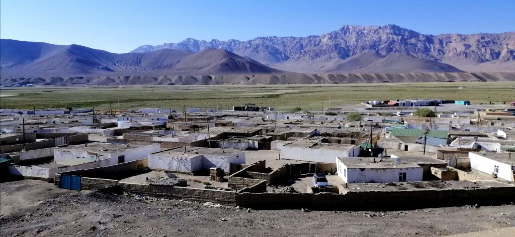
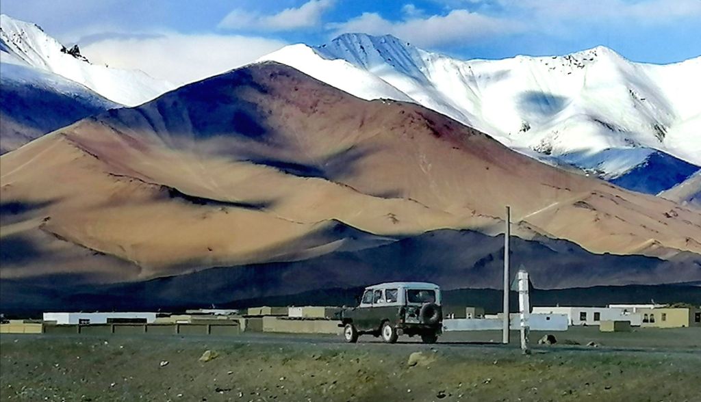
At Murgab (3618m), another police check post. To keep a good rapport, Norbuk gave some cucumbers to the guards. Another substantial village with satellite dishes on roof tops. We passed Lenin’s statue and a few Soviet styled buildings. It was 1930 when we arrived at our accommodation (East Pamir Eco Tour Guesthouse 220TjS). Very comfortable indeed. Many families are of Krygis origin and interestingly, they follow Osh (Krygis) time. Tomorrow is Id Adha. As we arrived, dinner was served. The meal included borsook (small fried puffy pillow), veg soup, Non (flat bread), rice with veg, and fried brinjal. A father and son also arrived today but from Karakul. Both suffered a degree of altitude sickness (started from Osh). Thus, a major disincentive to start high (Ak Baital Pass and Karakul Lake) from Osh. Relaxed after a long day.
Day 7- Murgab to Karakul (3.5hr, 165km)
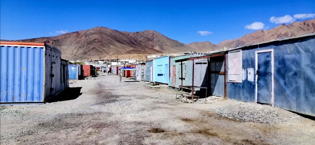
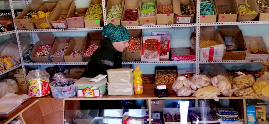
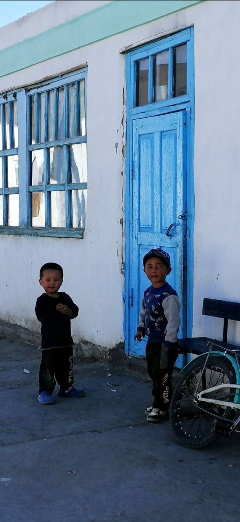
Early in the morning, the local men congregated at the mosque to celebrate Id Adha. This morning, there was no rush as we planned to leave for Karakul, just 3hrs drive, at noon. The family was busy preparing food and delicacies for today’s celebration. Food was laid on the floor in one of the rooms. At breakfast, I tried the traditional shirchoy – milk tea with salt (sometimes butter is added). It tasted like yak butter tea. After breakfast, we wandered around this white-washed village. Today, being Id Adha, the bazaar was closed. It is an interesting collection of containers. All locked. There is almost no greenery here. In fact, hardly any since Alichur.
The dry air, almost artic, picked up and was chilly. However, the morning sun was intense. Kids walked with plastic bags from house to house collecting snacks and sweets. A tradition here during Id. We found one magazine (shop) open. Bought some fruits and snacks from a lovely Krygis lady. Nearby, a health clinic and ground water pump. Across the main street, a petrol kiosk. There is also hamam. Popped in and coal burnt in the boiler room. Smoke bellowed from the sooth filed chimney. There was no one to be seen. Perhaps at the mosque. A school provided basic education. For higher education, children need to move to Dushanbe.

Murgab is a high altitude, windswept, arid and desolate place with little to do. It was called Pamirskiy Post – a Soviet outpost set up during the “Great Game” between the Russian and British Empires. With the demise on the Union, locals returned and continued their lifestyle, albeit a harsh environment. It’s the Pamiri way!
The locals tended to livestock and provided food and accommodation to passing tourists and truckers. Its proximity to China and Kyrgyzstan is idle as a truck stop. South-East of Murgab is Qolma Pass that connected Pamir Highway to Karakoram Highway at Tashkurgan. However today, there were no trucks passing at all. Murgab is also a good place to explore the surrounding valleys – Pshart Valley and Madiyan Valley. Perhaps Rangkul and excursions to view (hopefully) the rare Marco Polo sheep. At midday, we headed to Pamir Hotel for lunch. Like all meals on the Pamir, it was challenging but manageable.
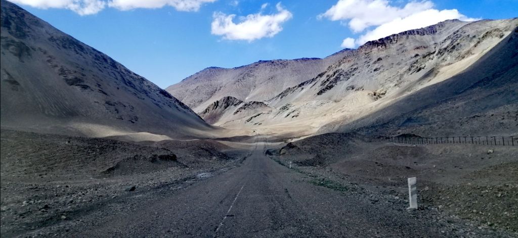
At 1300, we left Murghab on the M41. We entered Ak Baital Valley. The Pamir is a harsh place to live particularly in places like Alichur and Murghab. Drivers have to be skilled and resourceful. Breakdowns are common particularly lorries hauling heavy loads on depleted roads. An off road lead towards to Rangkul (3784m). The road is straight and sealed with fewer potholes.

As we traveled, a fence appeared along the mountains. This is the border, a no man’s land of 10km, between Tajikistan and China. Both Tajik and Chinese patrol this endless and deteriorated fence. There were no guards spotted at all. In places, the Chinese fence runs just meters from Pamir Hwy. At times, they disappeared and then reappeared. Abandoned stone structures built by Tsar Nikolai 2 along the border is vivid reminder of the past Soviet presence. We finally reached Ak Baital Pass (4655m) just past 1400. In this cold, windy and desolate place, it is the highest point on the Pamir Highway. Its a long gravel road with vast expanse. We passed a couple of tourist sorting out their 4WD and another two on motorbikes, heading towards Karakul.
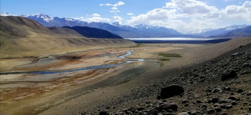
Another of Nicolai’s abandoned buildings with a picturesque view by the river and China border. Occasionally, patches of frozen ice laid in flat areas. In the middle of nowhere, a small settlement, rather a collection of delipidated buildings with a luminous green Lada. Were they herders? The almost straight sealed road headed towards the horizon. With thick clouds above, a thin blue line – the high altitude Karakol Lake. We detoured left to view the western edges of the turquoise lake before approaching the township.
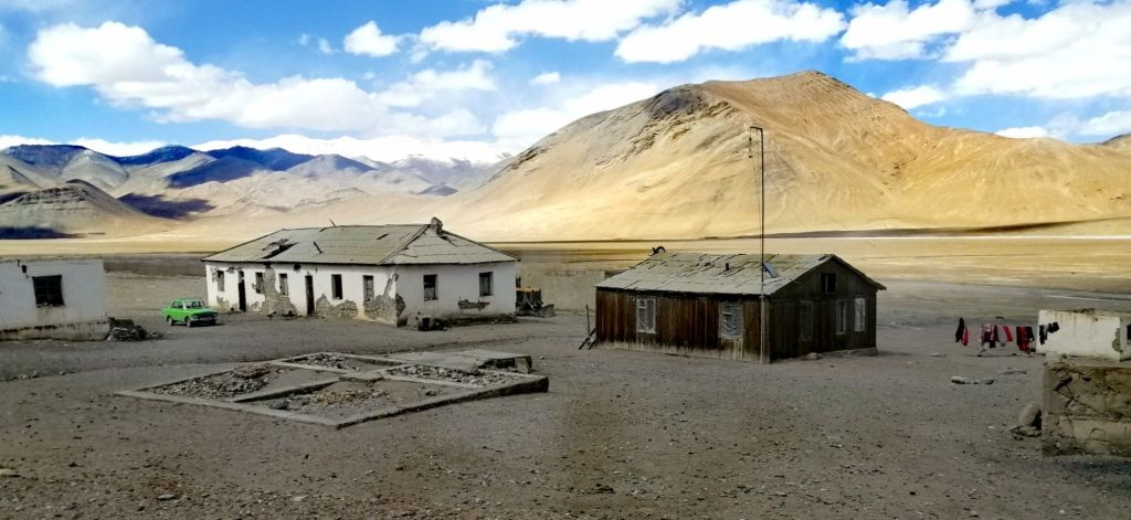
The valley is surrounded by by soaring snow capped peaks including Peak Lenin on the Trans- Alay mountains. There were no roads. Instead over a sandy flat grassland. Yaks roamed freely foraging on the meager grass. We checked into Alichur Guest House (220TjS) at 1630. This is the last settlement before reaching Kyrgyzstan. Like Murghab, all the residents here are Krygis. The languages of Krygis, Uzbek, Azerbaijan, Kazakhs are Turkish origin and Tajik is Farsi origin. No one at the check post and modern buildings occupied the right side of the road – army camp. The China border fence is just meters from the road which goes round the camp.
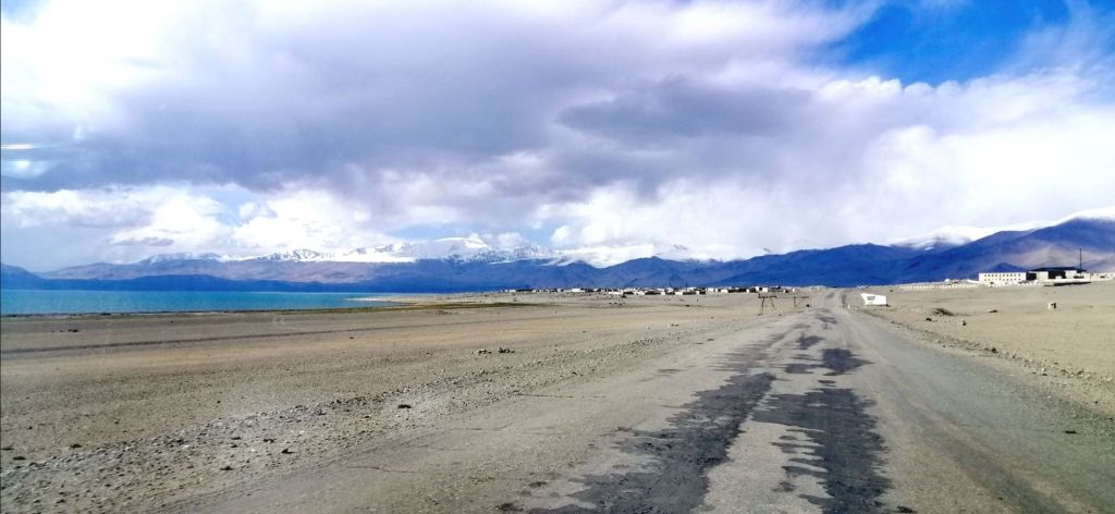
Karakol Lake, a salt water lake at 3895m, is one of the highest lakes in the world. The village has about 700 people. Living conditions are hard – the icy wind, the intense heat and the remoteness. All fruits and vegetables are brought in as the weather is unsuitable for cropping. Cattle, yak and sheep are reared for milk and meat.

Karakul is the second coldest place in the Pamirs (- 40°C) after Alichur (- 60°C in winter). Like Alichur and Murghab, white-washed houses are built low to retain heat. Roof tops are flat. We had heaters in the room (effectively heat from the kitchen used for cooking). The Chinese fence is visible along the mountain, away from the lake. A few residents milled about the village. Some traveling away in Soviet made trucks. All well dressed for Id celebrations. At the windy water’s edge, a band of salt, yak grazing and abandoned water tanks. Its freezing cold and its not winter yet.
Back in our cozy and heated guesthouse, a teacher (from Murghab) and doctor hooked a laptop powered by a generator. For dinner- hot vegetable soup, manti (local dumpling), fresh salads and bread. Norbuk enjoyed the heat in the kitchen.
Day 8 – Karakul to Tulparkul (6.5hr, 185km)
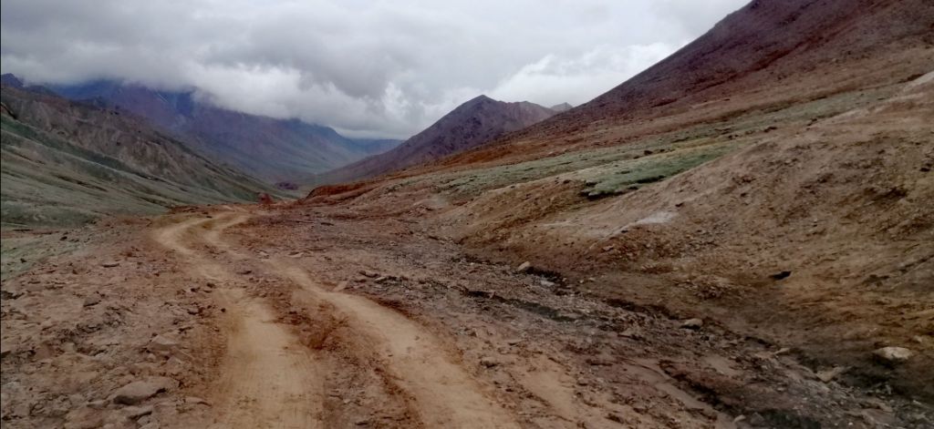
Unlike yesterday, it wasn’t cold or windy this morning at Karakul Village. It was quiet. We left after a lovely breakfast at 0745. The sealed road, often straight, goes through the wide valley towards the horizon. The Chinese fence ran parallel to road. Apparently, it stretched for 200 km. The weather was gloomy. Reached Tajik border at Kyzyl Art Pass (4280m) at 1000. It was quite spectacular. A statue of a Marco Polo at the gates. Border army guys kept shuffling their hands in pockets to keep warm. One replied, its not too bad today. It felt like below zero. Norbuk passed a cigarette to the soldiers and walked into ramshackle of buildings including re-purposed containers. Inside, we handed our passports and the GBAO permits. Stamped. Within 30 minutes, back to our vehicle and escorted by a soldier not far into no man’s land. We are required to exchange vehicles and drivers. Three other vehicles were also waiting for their customers.
We bid Norbuk farewell as he passed a bag to the Krygis driver. Norbuk’s home in Osh is so close, yet he can’t cross. Tajik and Krygis are prohibited from crossing this border due to a political dispute. Foreigners are permitted, since July 2023, with pre-approval. We hoped ours were sorted by Visit Alay. Krygis times is 1030. Road conditions deteriorated to a muddy clay track but the views were spectacular with low clouds and filtered light. Our new driver Gerkin skillfully negotiated the descending steep and slippery track. The surrounding mountains were clothed in mist. Next to the road, a wide river. It was still gloomy. By 1110, we reached Bor Dobo (3400m), Kyrgyzstan border. One by one, the border guard manually went through a register to check our names. I was last. Yeah, approved and finally cleared immigration at 1130. Both Tajikistan exit and entry into Kyrgyzstan was straight forward and cordial.
We left the Pamirs and now descended into Alai Valley (Alaika) – an extension of the Tien Shan Mountains. Wide grassy plain dotted with yurts, horses, cattle and herds of sheep. The Pamir Mountains headed westward. Lenin Peak (7134m) amongst them. On the northern horizon – Alay Mountains. On the north East – to Irkestam border – China. My initial entry into Kyrgyzstan from Kashgar, China. The sun peaked through dark clouds onto the grassland. There was even two observatory. Plenty of horses roamed the grassland.
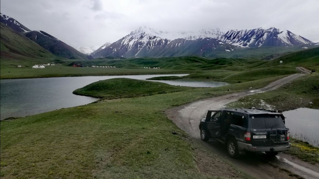
After lunch 1300 at Sary Tash (3170m) , headed SW towards Sary Mogul (3700m). The Pamirs were almost invisible. Finally, the heavens opened up and rained heavily. More storm clouds accumulated in the west. At Sary Mogul, we went off the main road towards Tulparkul. Deeper into the Alay Mountains and crossed a vast grassland. After rain, patches of ice on the grass as we neared conical mountains. Shepherds have set up yurt camps. The wettish road wound uphill over muddy paths.
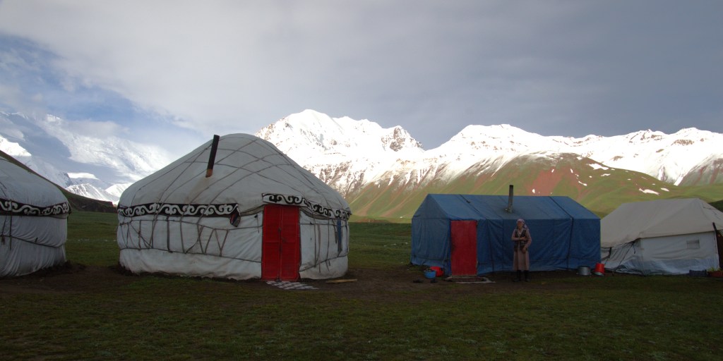
Several lakes – Tulparkul(3500m) with yurt camps scattered around. These catered for locals and tourist. Lenin Peak (7134m), partially obscured by clouds, rose in the background. Gherkin continued past and finally we reached our campsite, the last one, at 1430. My first experience staying in a traditional Krygis yurt. This is a wild place. We were welcomed by a Aiesha. Her face was weathered, from the harsh environment but always had a smile. Rain was eminent but held for now. We had 4 beds. It was cozy. The fire was already going as more coal was added. I visited the loo, pleasantly surprised that it had sitting toilet. A luxury considering its location. Having experienced squat toilets in Pakistan for a month was enough for my ‘inflexible knees’.
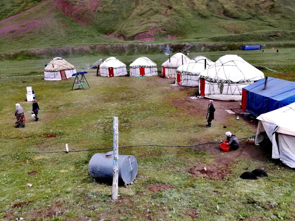
I got out my thermal top and layers before venturing out. The day was gloomy and dark at 1500. It was cold with slight wind. A kid on horseback and another on a bicycle herded some cattle back to its stall, somewhere. It started to drizzle. We headed back to our yurt. Sure enough, it rained. The is no power and let alone Wi-Fi. The is no phone reception either. Just chill and listen to the rain. Aiesha diligently checked the fireplace. The were no views of the mountains. Kids played football in the rain. A hardy lot indeed. A need to survive in high places like this. Outside, vapor emerged with every breath. With nowhere to go, we rested on the bed and waited for dinner at 1900. Only 3 hrs to go!
Occasionally, the Aiesha would come to top up coal pieces. Just before dinner time, we played football with the local kids for a while. As I entered the dinner yurt, I was taken aback by the glittering gold plated table ware. It was as if, a banquet for royalty. We sat in soft cushions on the ground. Another three tourists joined us. These yurt camps only operate in summer (roughly from June to September) about 4 mts when snow has melted. The yurts also served as high camps for herders. A good supplementary income for these hard working people here.
Day 9 – Tulparkul to Osh (5hr,hike 3.5hr, 240km)
My bed was slightly titled and felt like falling off. Sleep was light but not cold. Surprised that the yurt kept warm. It rained twice early morning. We decided to have an early breakfast 0630. The summit of Lenin Peak shined like a beacon. There are two hiking options – Trek to Travelers Pass (4130m) or Lenin Peak viewpoint (3800m). The morning sun was hopeful with blue skies in the east. Dark clouds hung low over the peaks in the west and rain was eminent. Secondly, the was heavy snow on the path towards Travelers Pass. The return is about 6 hours. Due to expected poor weather, poor views and accessibility, Travelers Pass was not probable. Lenin Peak viewpoint it was.
The track is on the left of the stream. It is well worn but in places, due to recent rain, it is slippery and muddy. Also, steep in some places. Across the gorge, at the Lenin Peak Base camp, there was little activity. The low clouds began to decent onto the mountains. We were not sure if Lenin Peak would be visible. As we came round the mountain, the majestic snow capped Lenin Peak. After an hour, we reached the view point. By then, clouds had descended. The weather was more menacing than earlier. Travelers Pass looked completely snowed in. We retraced our track back to our yurt camp. Although slippery in places, otherwise a moderate hike of 3.5hrs. Gherkin and Aiesha relaxed on a swing, awaiting our return.
It started to drizzle heavily as we packed our stuff. As we drove off Tulparkul, it rained. It was the right decision to hike the viewpoint track. It rained all the way to Sary Tash with no views of the Pamirs or Tien Shan mountains. We stopped for lunch at the same place on the way to Tulparkul. This is my second time on winding Taldyk Pass (3615m). On both occasions, it rained with obscured views. At several points on the road to Osh, traffic was halted by herds of sheep, goats and horses driven by shepherds. It was quite a sight. We reached Osh in the late afternoon.

What a journey this has been. Perhaps, one of the last wild adventures on earth. To think that my journey began “just” on the other side of the Hindu Kush at Khyber Pass. Then, through the Karakoram Highway following the Ancient Silk Route through Khunjerab Pass into China. Then crossing over the Tien Shan Mountains into Kyrgyzstan, Uzbekistan and Tajikistan into the Pamirs. It has been a privilege indeed.

Absolutely gorgeous photos, so impressive!