
Introduction
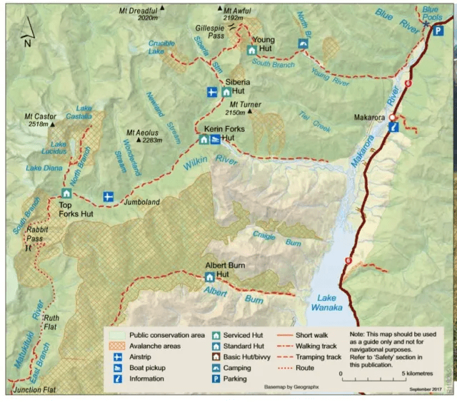
Gillespie Pass Circuit in the Mt Aspiring National Park is 58km taking 3 to 4 days. It can be done in either direction. We choose the clockwise as it offered easier accent on the steep climb at the pass. The track is through unspoilt wilderness, untouched native forest, alpine pass, waterfalls and glaciers, towering peaks and river valleys. It is essentially walking from Young River to Wilkins River via the Gillespie Pass and Siberia Valley. A road less travelled where nature and weather dictates. Rated as advanced by DoC as risk from high rainfall could cause stream crossing difficult, and the alpine pass covered in fog, snow or ice with slippery surfaces. Be warned, fatalities had happened! Beware of the weather, know your limits and be well prepared. The safe thing to do is just wait for the water to subside. For more information and booking, go to DoC. The 20 bunks serviced hut is on a first come, first served basis with a back country hut ticket (NZ$16). However, booking is required for the 20 bunk Siberia Hut(NZ$20). The track start and end at Makarora, about 62km from Wanaka.
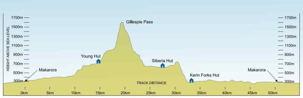
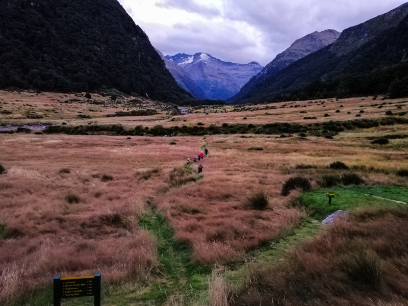
Day 1 – Makarora to Young Hut (20km)
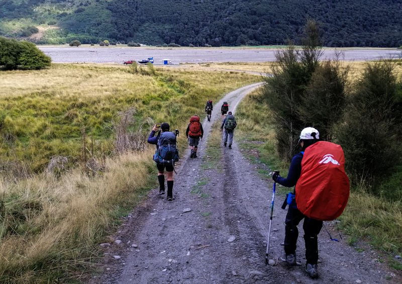
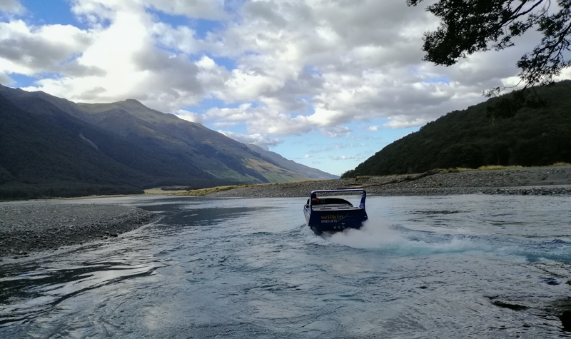
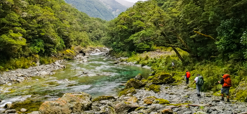
We stayed the night at peaceful Makarora. The weather was mixed and possibility of rain was high. We were prepared to turn back should the latter happen. Unsure about the weather, we took an exhilarating 10 minutes Wilkin River Jet ride (NZ$25) to get across to the starting point – the confluence of Makarora and Young Rivers. We hopped onto the left bank of Young River at 0915. Beware, sandflies are plentiful. A family forded the river (from sign posted car park on the Makarora – Haast Road) with some sections just above their knee. Two guys carried a tent and raft each, planning to raft back on the Wilkins River and perhaps on the lake. Good to be young. Awareness of the water level and preparedness is critical for the river crossing. If Makarora River is high, start at the Blue Pools – at the confluence of the Blue and Makarora Rivers (add 4km).
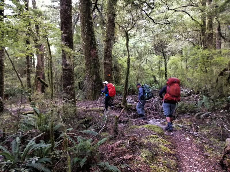
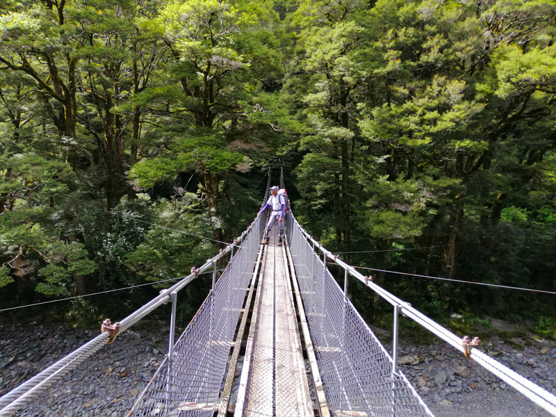
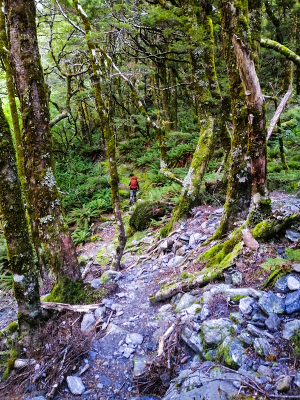
Young River was shallow as we entered a forest dominated by Beech. It was a pleasant walk. The weather seem to be improved as the walk progressed. Within half hour, we emerged onto a grassy flat valley. Although cloudy, nearby mountain peaks were visible. The track continued between mossy forest and grassy plains until we reached Young Forks suspension bridge. We crossed the North Branch Young River and emerged out of the forest and followed the left bank of the South Branch Young River. The track became steeper, harder with gnarled tree roots to negotiate and kept going. Despite being cloudy, the sun was out with occasional blue sky.

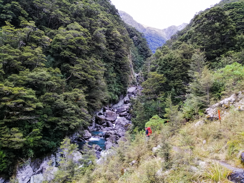
The track crossed several slips and dry rocky river beds. In poor weather, streams can become torrent instantly. Birdsong can be heard but not seen. Fortunately a couple of illusive Rock Wern came close. The most common were the affable Robins and cheeky Fantails. We crossed Stag Creek via a wooden bridge and from hereon, the track climbed higher along the boulder filled South Branch. This section of the track had several incidents of landslides. One happened across the river only hours ago. Fine chalk dust covered the entire area and still floated in the air. I was just keen to reach Young Hut. Progress seemed slow. Hut seemed distant. Fortunately the fine but cloudy weather held. Finally, at 1645, through some bush I caught sight of Young Hut (740m). What a relief. A quick body wash in the cold water and respite at the hut was a good feeling. Only nine beds were filled.


Day 2 – Young Hut to Siberia Hut via Gillespie Pass (12km)
We left the Young Hut at 0830. The sky was cloudy. We anticipated a hard climb and descent today, and risks crossing the pass. We hoped that our weather forecast was “exceptable”. The track immediately entered the predominantly beech and mossy forest. As in day 1, the uphill walk required some ‘skill’ in negotiating exposed tree roots and dry rock river beds. We emerged out of the tree canopy and into shrub vegetation. Fortunately, track markers helped to stay on the track. In the shadows of the mountains, about an hour later, amid waterfalls and snowfields, we walked into a grassy Upper Young Basin with Mt Awful in the background. Kea calls were heard overhead. We crossed a small bridge over a shallow stream. In a short time, walked through grassy flats filled with beautiful purple flower heads and reached the start of the Gillespie Pass track on the left.


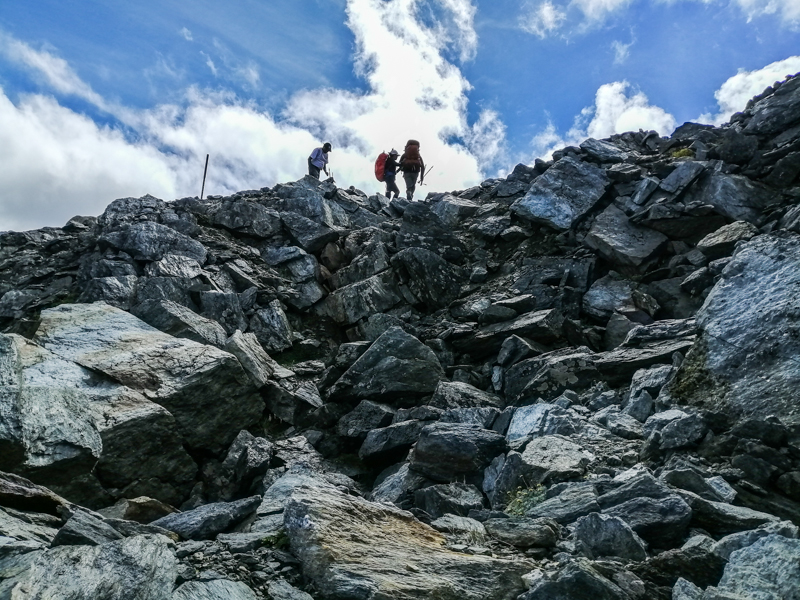
From hereon, it is a steep exposed uphill hike alongside a rock bluff which zig-zagged amongst snow grass, away from the valley. It was tough and progress was slow. In the north, Mt Awful dominated the skyline. Grabbing onto plant roots and calculated scrambling over rocks became a norm. Vertigo issues are challenged here. The mantra here was to climb slowly but progressively and taking short rest and repeating the same. As we gained elevation, the mountain views expanded to reveal the alpine and moraine sections. Glaciers hung on mountain gullies. The sun eventually rose above the eastern mountains. The sky was blue. Turned out to be a stunning day.
After 5 hours of walking (and scrambling) up 400m from the valley floor, we reached Gillespie Pass (1500m). I was elated and the pleasantly surprised by the 360 degrees clear panoramic views of mountain peaks, glacier and valleys. The burden of getting here dissipated as the sun warmed the surrounding. There was not even a breath of wind. The views towards the west stretched towards Mts Alba and Dreadful, and Siberia Valley. Towards the east, the Mackerrow and Young Ranges. Somewhere in the midst of the Southern Alps lies Brewster Hut and Mts Armstrong and Brewster. This is an ideal place for lunch. I savoured my time here, while waiting anxiously for my tramping mates to arrive. In the back of my mind, the weather could turn anytime.
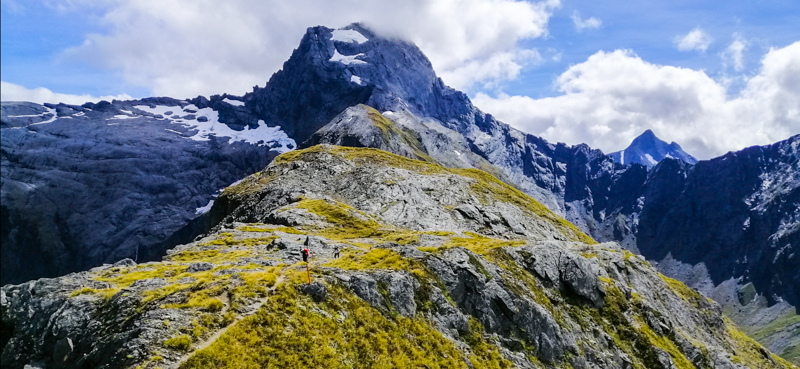


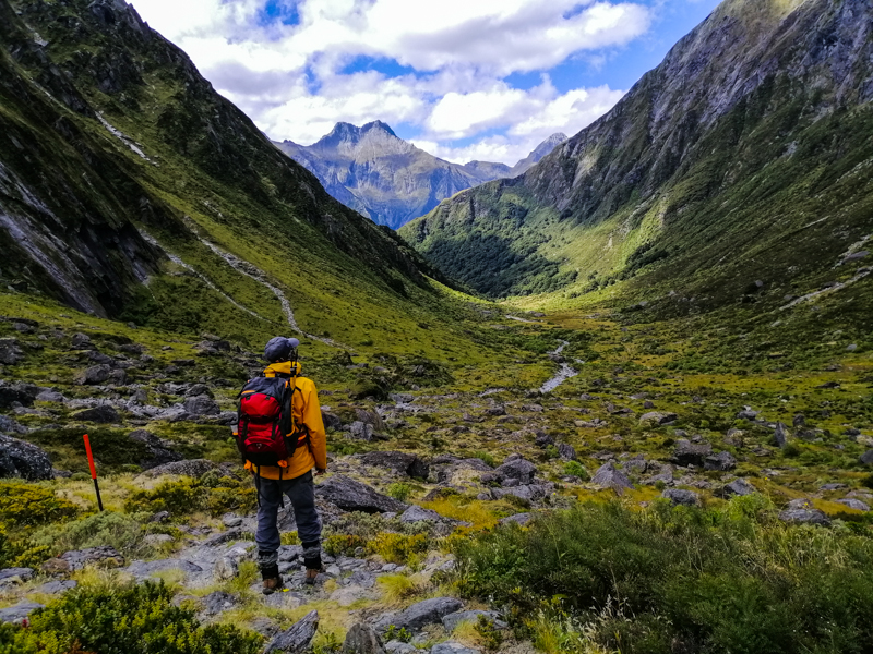
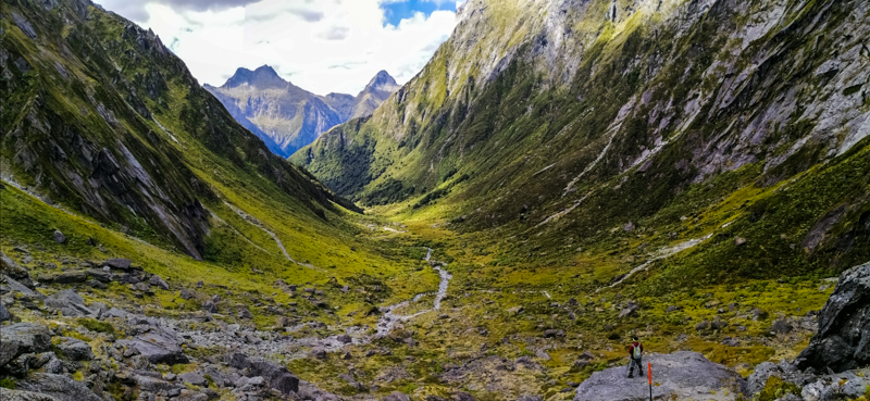
We made our way down over boulders and loose rocks in the shadow of Mt Awful. After a short climb, we reached the highest point of the pass at 1600m. The lush green valley below seemed far away. The long descent trail zig-zagged down towards Siberia Valley. The moraine surface is loose and slippery. Once we reached the bush line, the track was more ‘managable’. The Gillespie Stream sometimes emerged close to the track. The descent, a 1000m, was relentless until we reached Siberia Stream.
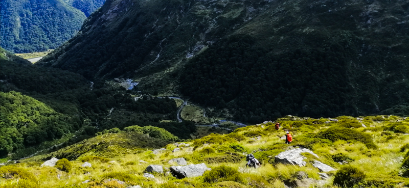

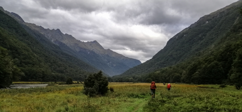
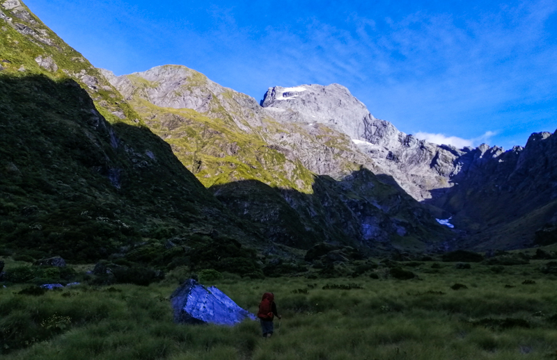
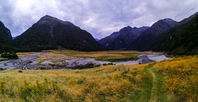
Here, two options – cross the stream and continue towards Lake Crucible. Or, veer left and head towards Siberia Hut. We choose the latter as we had another day booked at the hut. After an initial walk through the forest, climbing through a dense network of tree roots, we emerged out of the tree line. A flat Siberia Valley, hemmed between mountains, greeted us. Golden grasses and flowering shrubs filled this meadow. The constant sound of the fast flowing Siberia Stream soothed our walk. It would take another hour, a river crossing before reaching Siberia Hut. What a relief. The hut is tucked into the mountain side with a waterfall nearby. A hot meal after a long day was satisfying. While sitting on the deck looking north with Mt Dreadful framed, soothing sound of Siberia Stream, I recalled the tough hike today. Potentially, numerous dangers exists in foul weather. Mostly from flooding where harmless looking creeks turn into streams which turn into torrent rivers. You may not even access the hut if the stream, a few minutes before the hut, is flooded. The weather gods had indeed blessed us with the best hiking climate.


Day 3 – Siberia Hut to Lake Crucible (14km return)
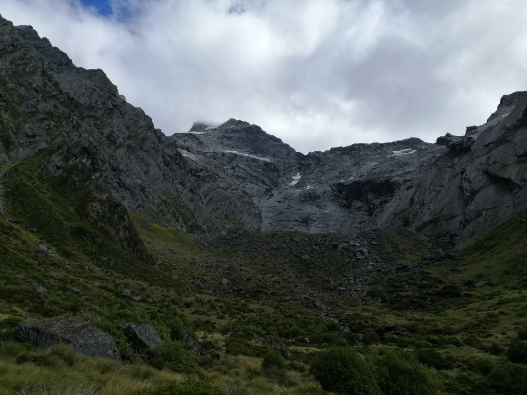
With no packing, breakfast was at leisure. The day was warming up nicely and promised to be good. I decided to head up to Lake Crucible. Only one of my five tramping mates was up for it. The previous day’s walk had taken a toll on them, Perhaps, more wisely, refuse to scramble up the steep mountains hanging dearly onto tree roots and loose moraine. We retraced our walk back on the Siberia Valley and followed the sign posted markers. The track veered left and headed towards Siberia Stream. The is no option but to ford across the stream. Fortunately it was shallow. Sandflies are plentiful. We reached the tree line in an hour. From here on, it was a steep uphill climb, over 400m, clutching onto beech tree roots. It was tough.The track followed Crucible Stream for most of the way. We weaved through the beech forest and after half an hour, crossed the fast flowing Crucible Stream. Fortunately, the steep climb ended.


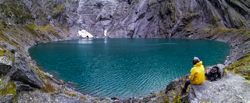
Soon, we emerged out of the tree line and entered a flat grassy glacier gauged u-shaped valley. Another half an hour later, I reached the rocky moraine. Mt. Alba dominated the skyline with a hanging lake, still invisible. After huffing and puffing for another half hour, the stunning almost circular deep blue Crucible Lake appeared. There was no wind. The air was cooler. Sky was blue. Sun was filtered. I was stunned by its serenity, colour and location. This glacier carved hanging lake, at the belly of Mt Alba, surrounded by glaciers, is quite spectacular. Waterfalls dropped vertically into the lake. The 3.5 hrs walk with an accent of 550m here is worth it.
We soaked in the raw wilderness while having lunch. Rene’, a fellow tramper, introduced me to snow berry shrubs, an alpine vegetation, that dotted the mountain sides. The white berries are refreshing. Cold wind suddenly blew across the icy lake as mist accumulated on the surrounding peaks. Time to leave perhaps. With one last look at the spectacular alpine scenery, we descended and retraced our steps back to Siberia Hut. The sun continued to shine as we neared the hut. After fording Siberia Stream, we laid down on soft grass, basked in the sun to the soothing flow of the stream. Pleasantly surprised that sandflies were absent here. Today’s side track to Lake Crucible had taken us 8 hrs. After a quick splash at the waterfall and hot chicken soup in hand on the deck, I was contended. However, bad weather is expected tomorrow. Hikers planning to go towards the pass decided to sensibly wait the weather out for a day. However, we planned to head out as our 7km hike to Kerin Fork is relatively ‘manageable’. A hiker quipped that the hike is akin to a great walk track!
Day 4 – Siberia Hut to Kerin Fork (7km)
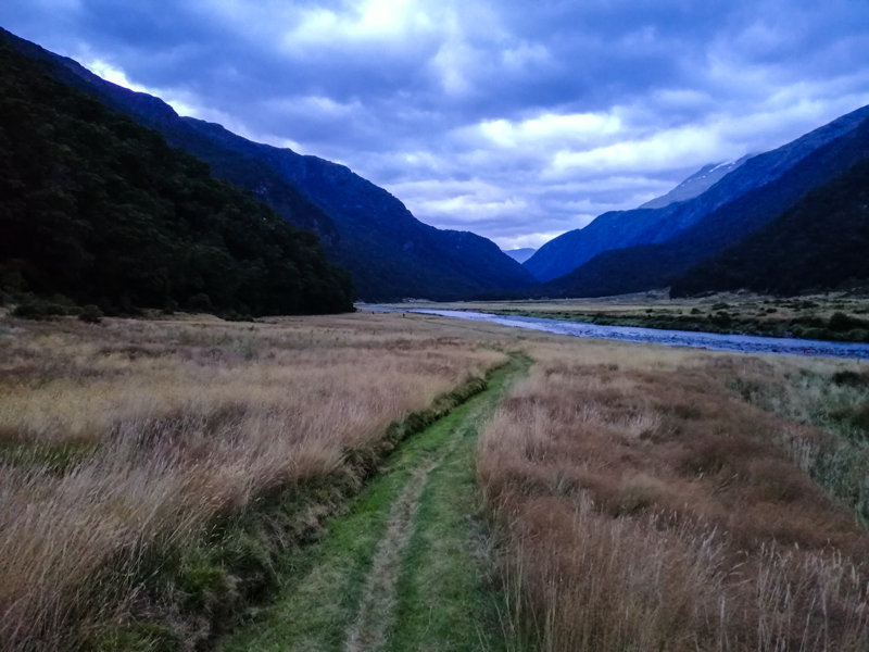
This morning, there were a flurry of activities at the hut. The family of four and two girls headed out at 0730 and all planned to walk all the way back to Makarora (22km), which included crossing the Makarora River. With rain expected, hopefully, it was manageable. The weather was cloudy with occasional drizzle and windy. We left at 0800 to avoid walking in the rain. We had booked Wilkins Jet to pick us up at Kerin Forks at 1330. There was plenty of time. With one last look at the rather gray and windy Siberia Valley, we entered the forest and followed Siberia Stream downstream. The track, as mentioned, was well laid and walk was straightforward. The track initially climbed high above Siberia Gorge through matured beech forest. We were sheltered from the cold wind.
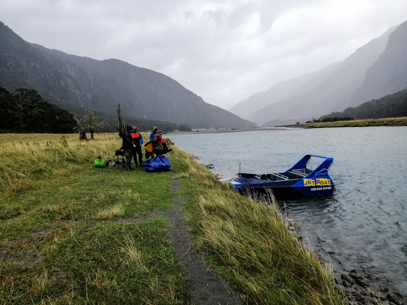
Eventually, it descended zig zag through beech and kauri forest towards Wilkins River Valley. The intermittent rain continued and cold wind picked up. It was an uneventful walk until we reached the confluence of Siberia Stream and Wilkins River. Kerin Fork Hut laid across the river. We continued a little further to the jet boat pick up point on a grassy and exposed river bank. However, the wind force was strong combined with rain. We arrived 3 hrs early. We donned our wet gear and huddled behind some matured trees, a quick lunch. Beyond Kirin Fork, lay upper Wilkins River. Around 1300, the much awaited jet boat arrived. We quickly jumped in and away we went. Raindrops felt like pins on our faces. However, the excitement of the speed and manoeuvre was exhilarating. We passed the family and two girls. We arrived at Makarora at 1330, drenched in rain.
It had been a tough journey but a rewarding experience of New Zealand’s alpine and river valleys.
