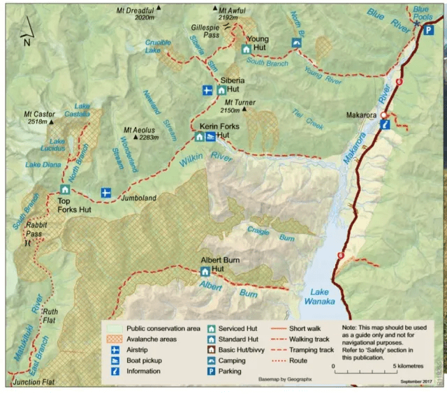
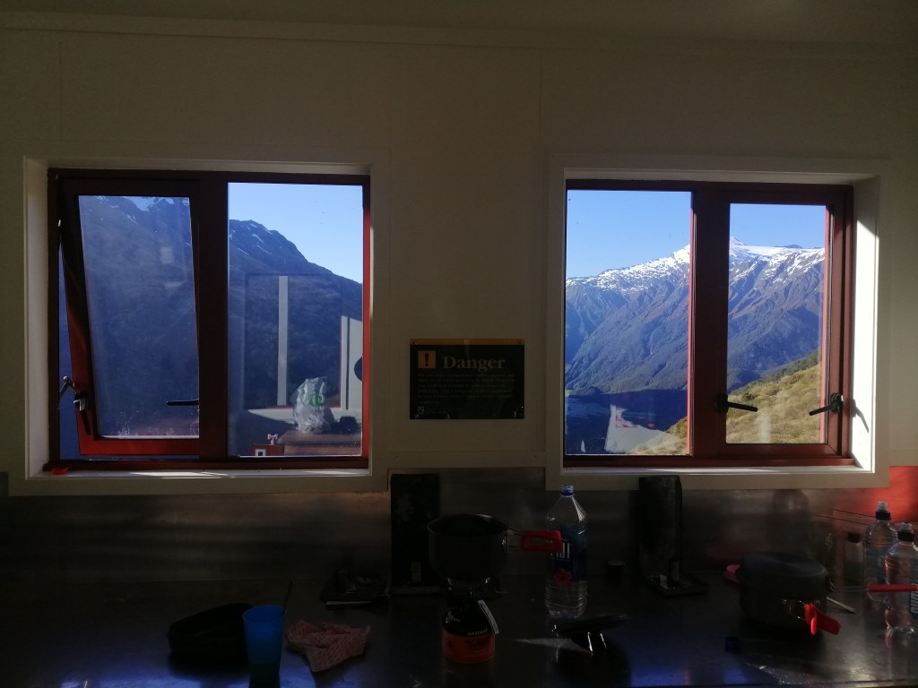
Category Archives: New Zealand

Hiking Liverpool Track

Information

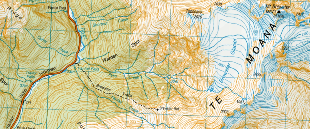
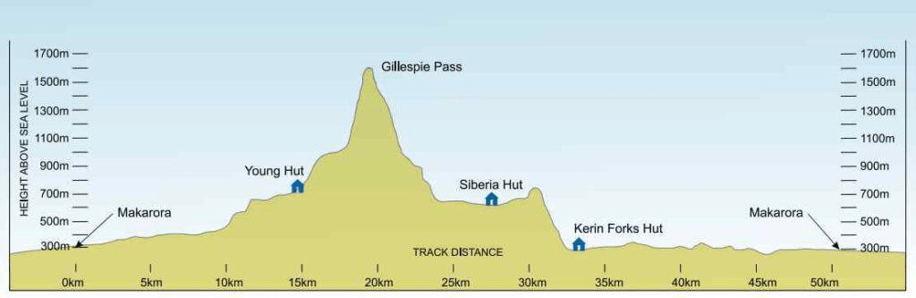
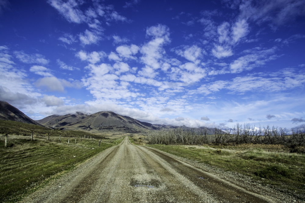
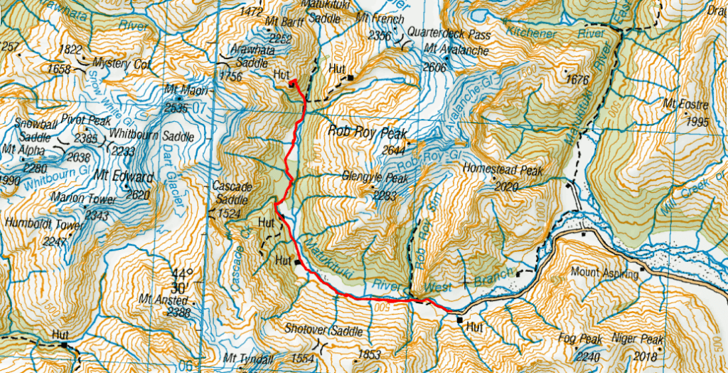
Liverpool Hut Track is located 52 km from Wanaka, of which the last 30km is on gravel road, in the West Matukituki Valley, Mt Aispiring National Park. It takes between 1 to 1.5 hours with several rocky streams to ford. A high clearance vehicle is preferred. Booking is required for the 12 bunk hut and purchased online at DoC. This track is rated as advanced and for experienced hikers. The last 1.5km is very steep. Avalanches, wet weather and mist are potential hazards.

This track is open all year round. During the winter months, this track is doable for the well equipped and experienced. The last 1.5km is challenging even in summer. Let alone is winter! Furthermore, days are also shorter. Bookings are not required in the off season (May – November) but Hut passes are required. Can be obtained at DoC office in Wanaka. As usual, report to DoC before embarking on the track. Carrying a beacon is recommended, if hiking alone.

Day 1

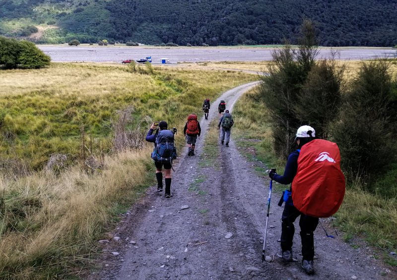
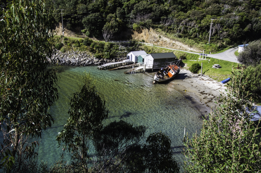
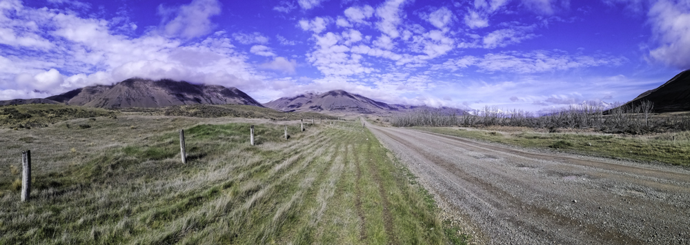
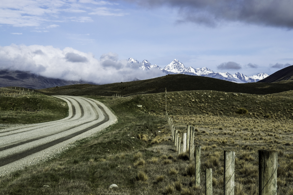
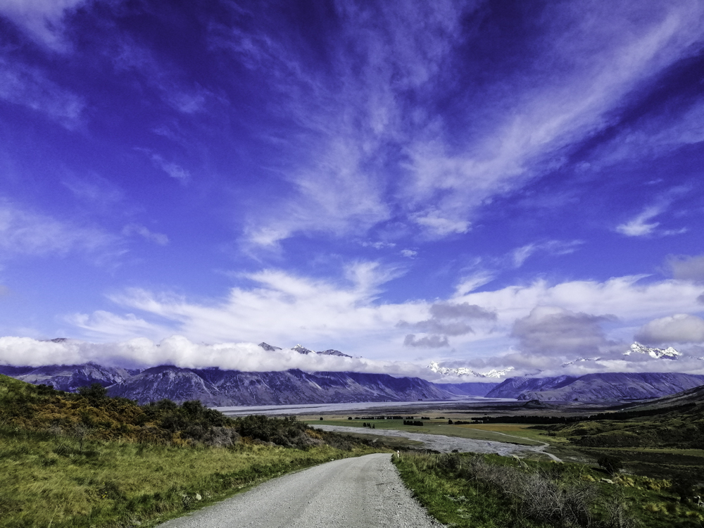
After leaving Mt Cook National Park, partially (discontinued as crampons and ice axe were required due to snow and ice) completing Mueller Track, we arrived at Wanaka. We had originally planned to stay a night at Aspiring Hut but was closed for renovation. With a couple of days rest, we left Wanaka at 7am and arrived road’s end at Raspberry Car Park at 0800. There were already a few cars here. Some seemed like they camped here. Travelling in a group of varying age, fitness and tramping experience is always a challenge. I find myself in that situation again. I planned to go solo. Therefore, responsible for myself.

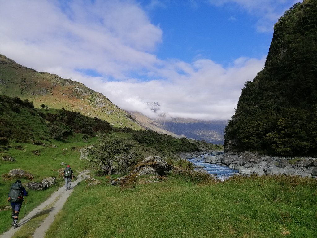
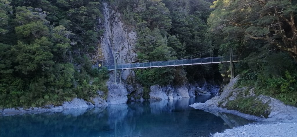
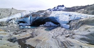
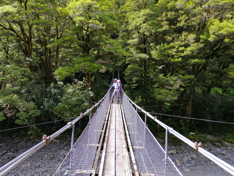
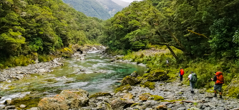
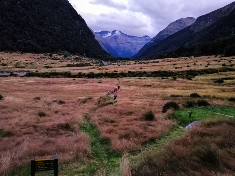
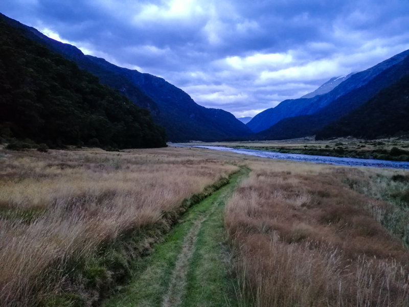
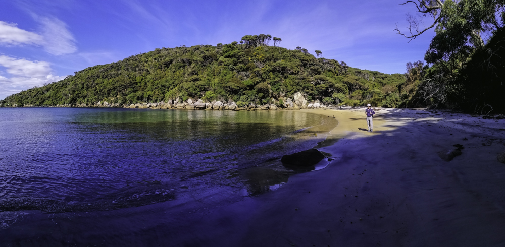
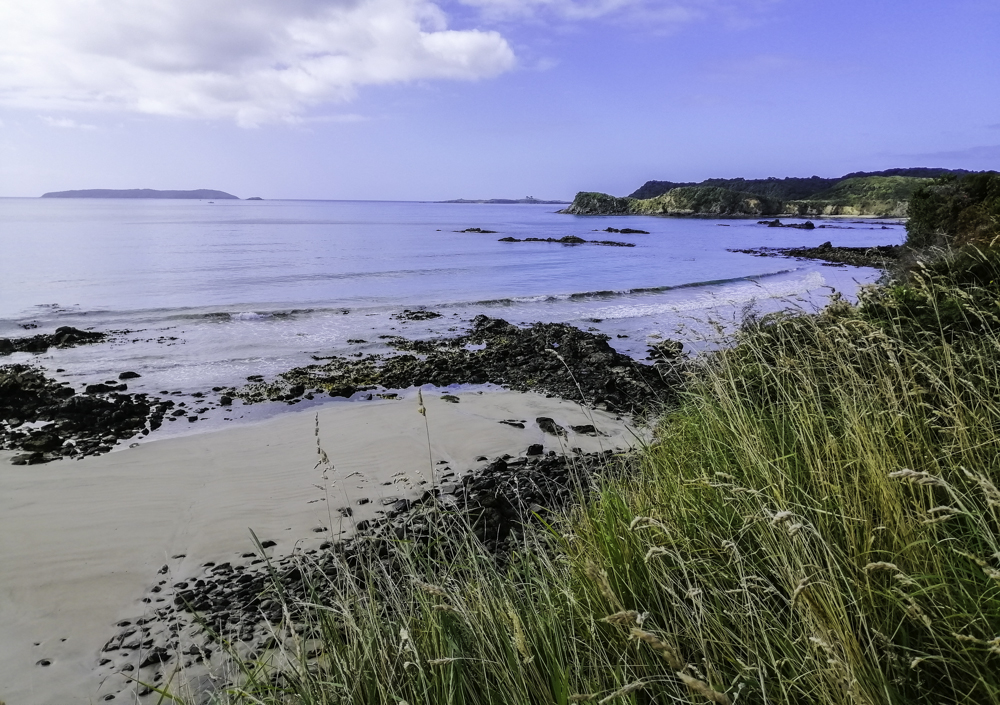
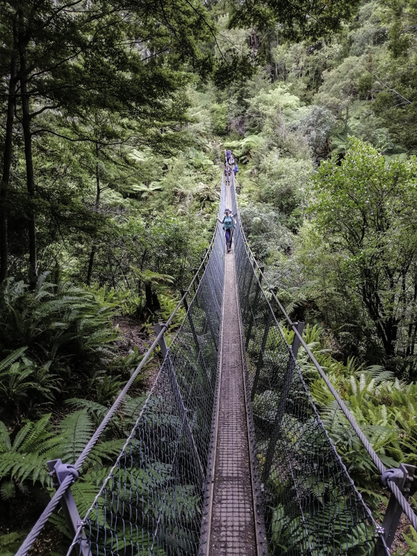
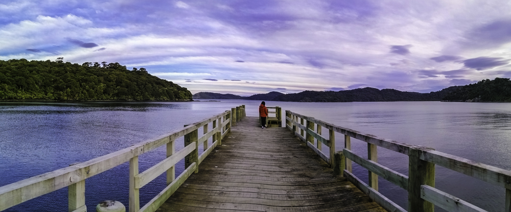
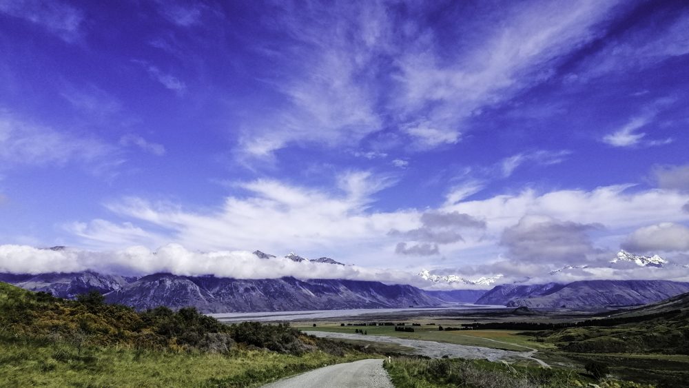
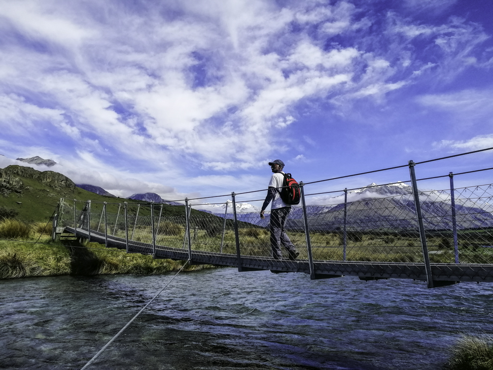
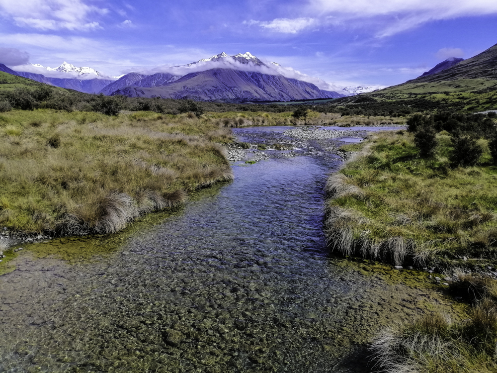
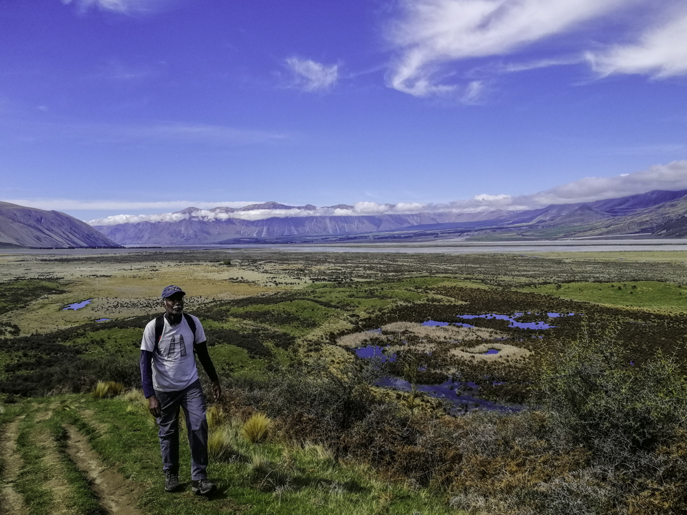
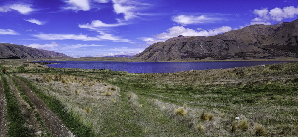
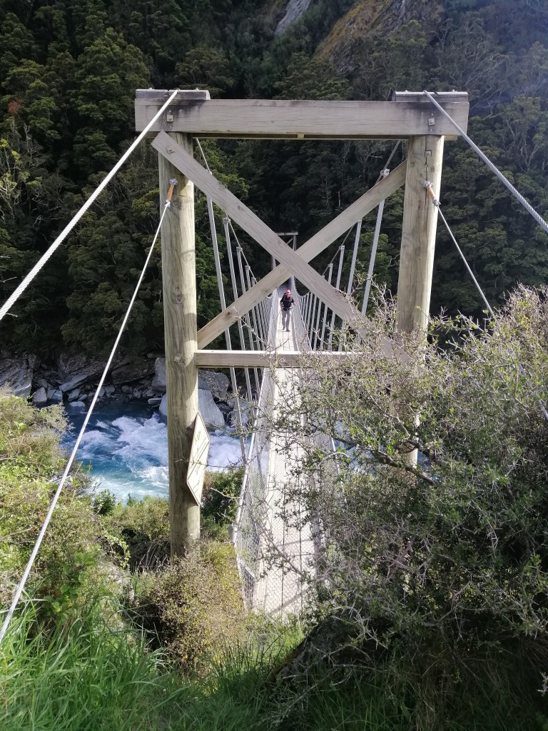
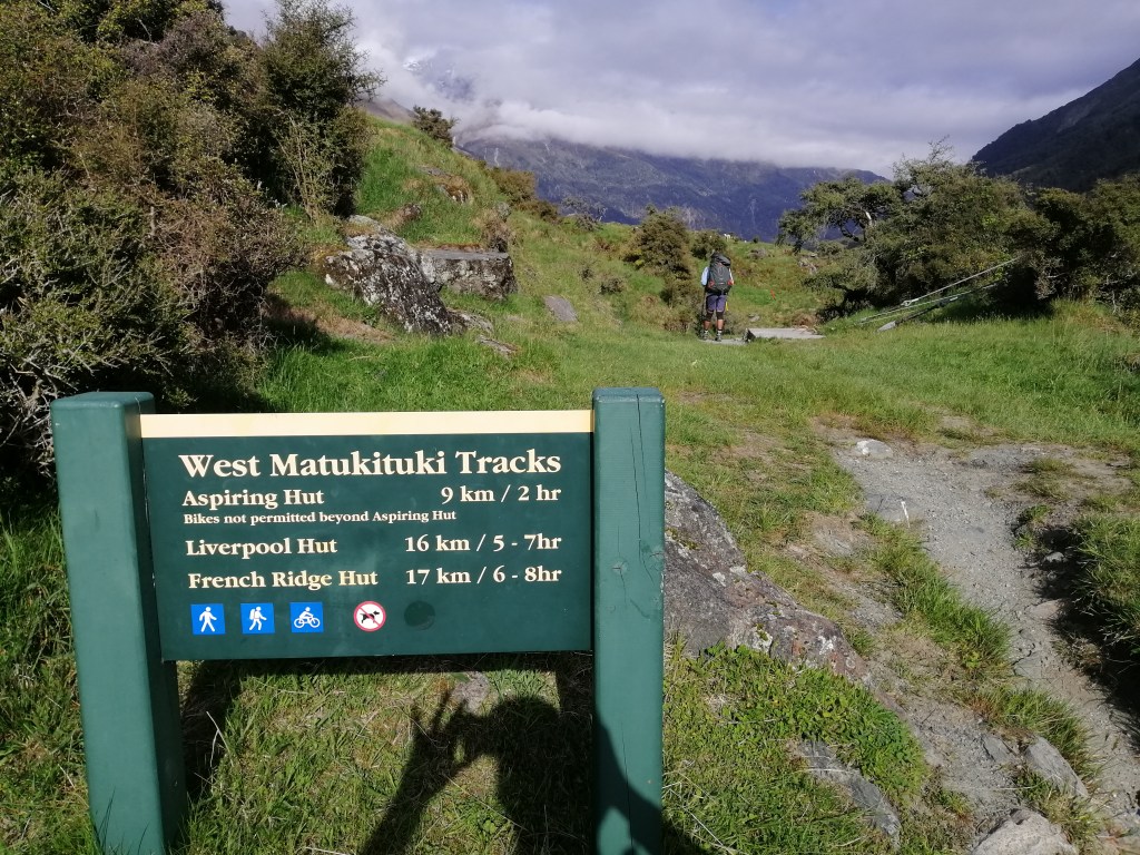
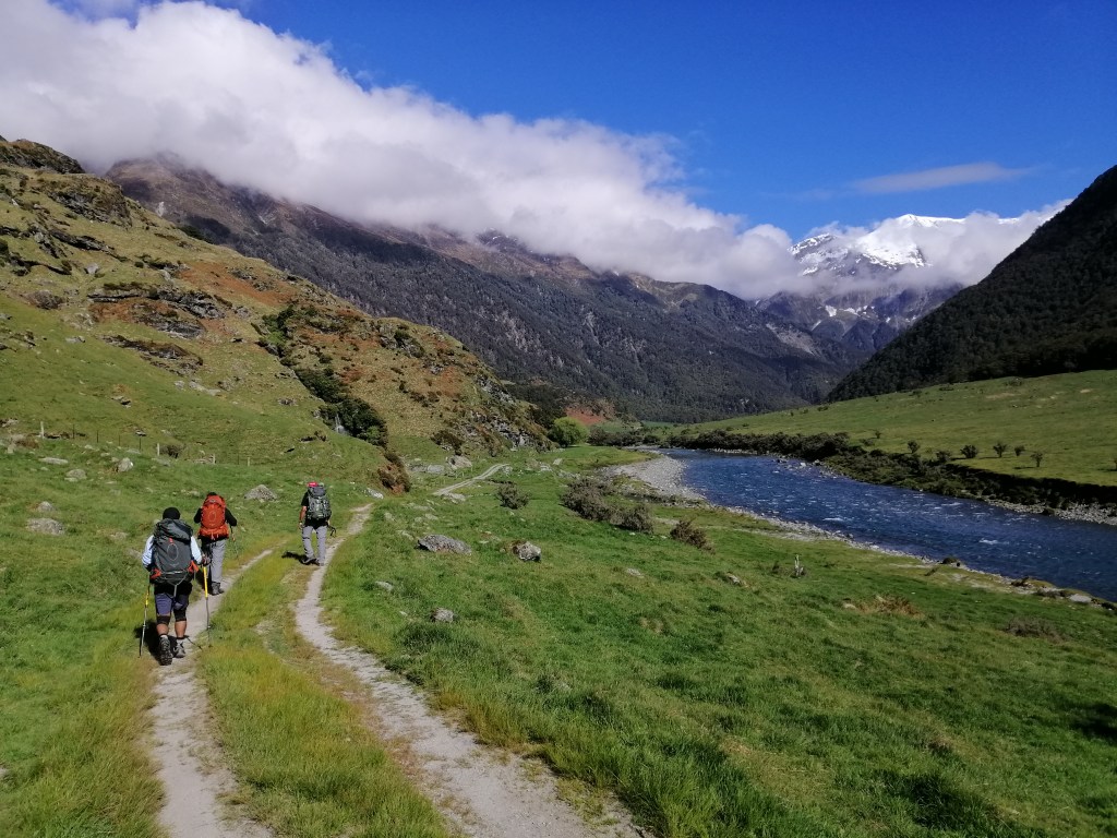
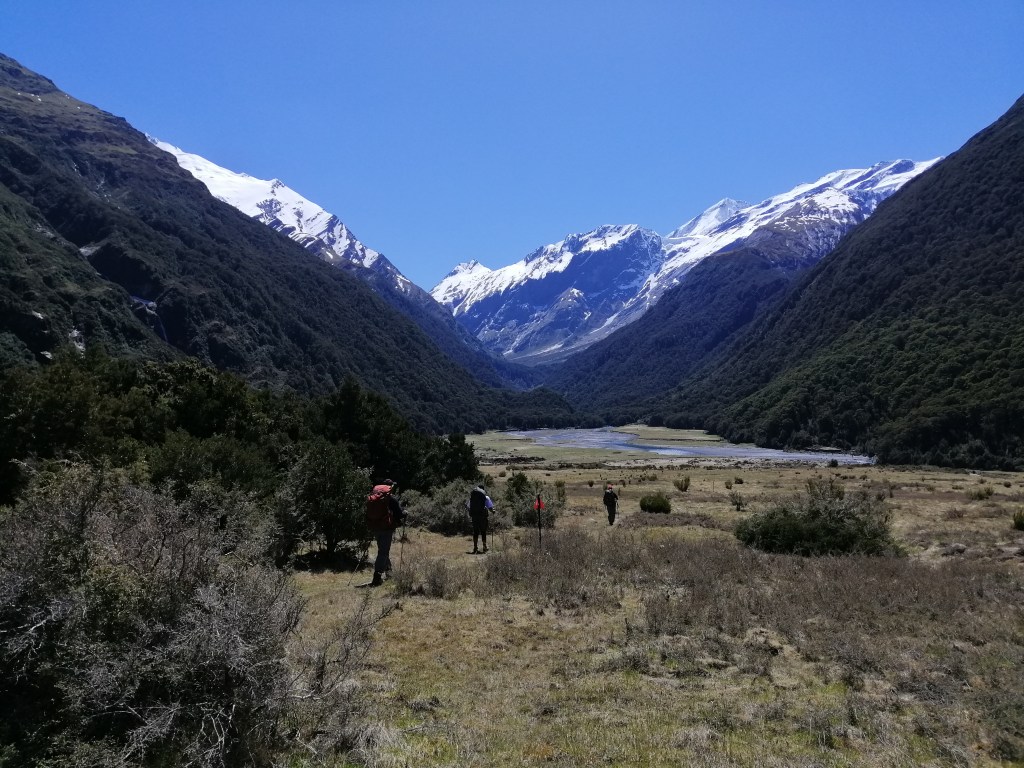
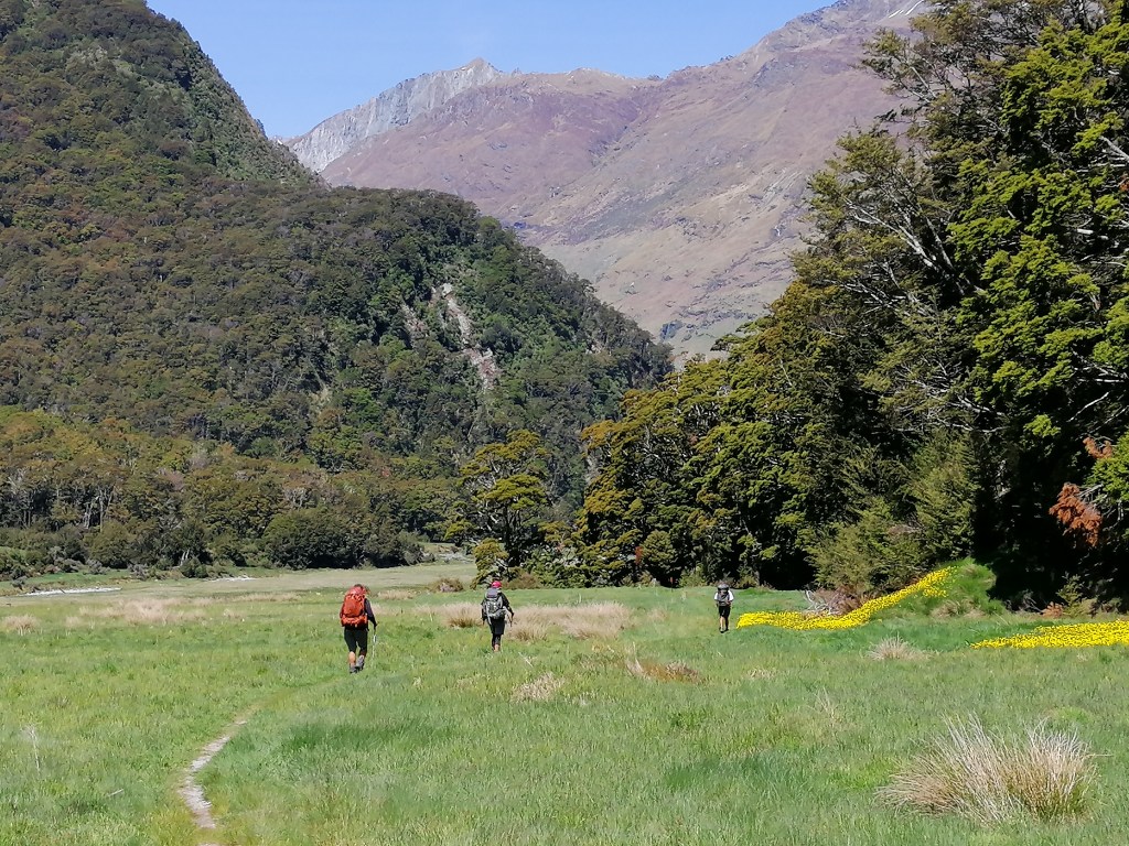
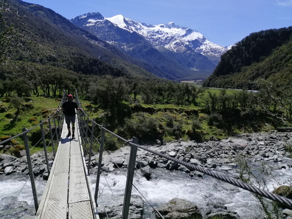
After slapping on sunblock and sandfly repellent, we started the track at 0830 along the fast flowing bluish braided Matukituki River West through Matukituki Valley, with craggy mountains on either side. The track is basically a walking acess through high country farmland – Mt Aispiring Station. It was lambing season with sheep and lambs everywhere.  Within 30 minutes, we reached a suspension bridge over Mutukituki River. This 2hr easy track lead towards wonderful hanging Rob Roy Glacier. I hiked here in March this year. Liverpool Hut is 16km (5-7hrs) away.

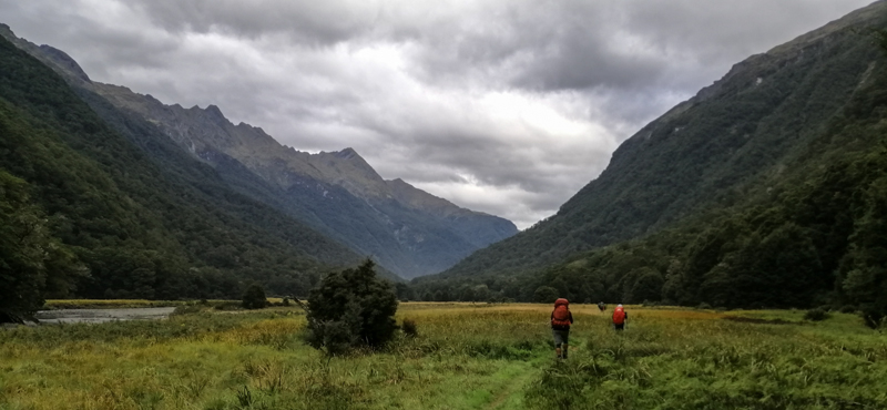
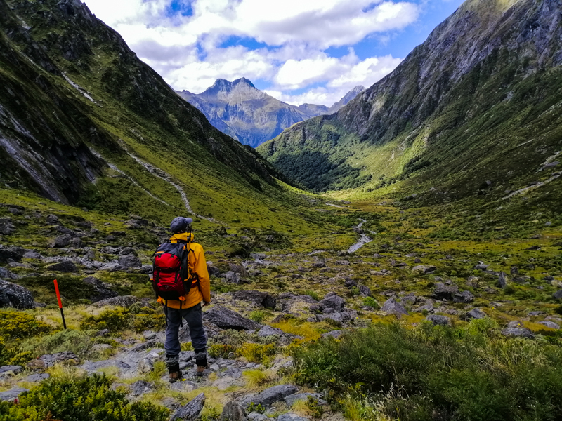
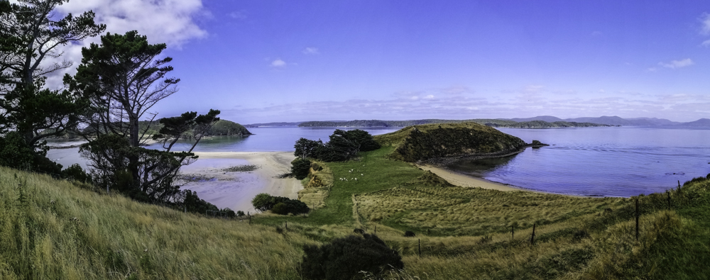
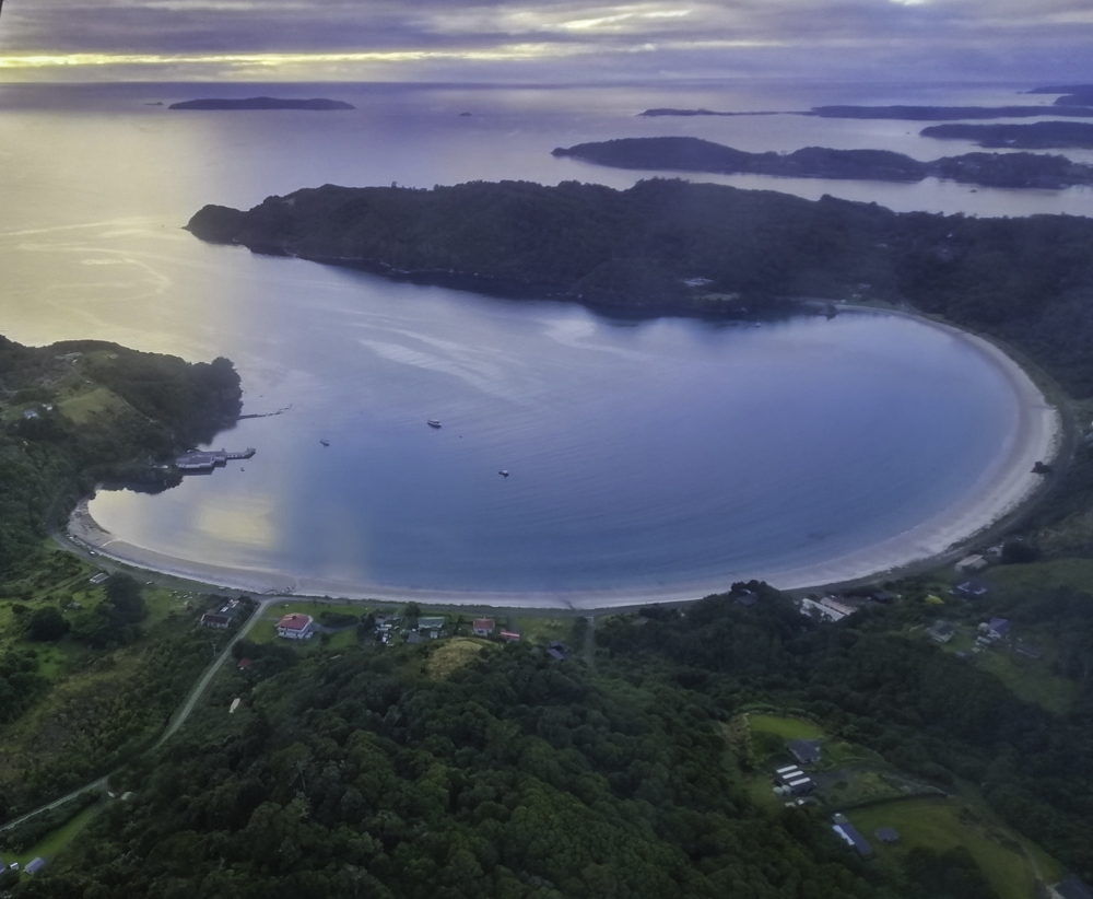
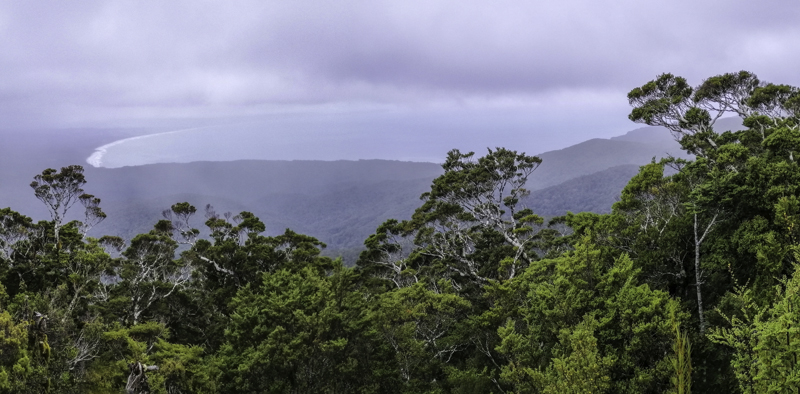
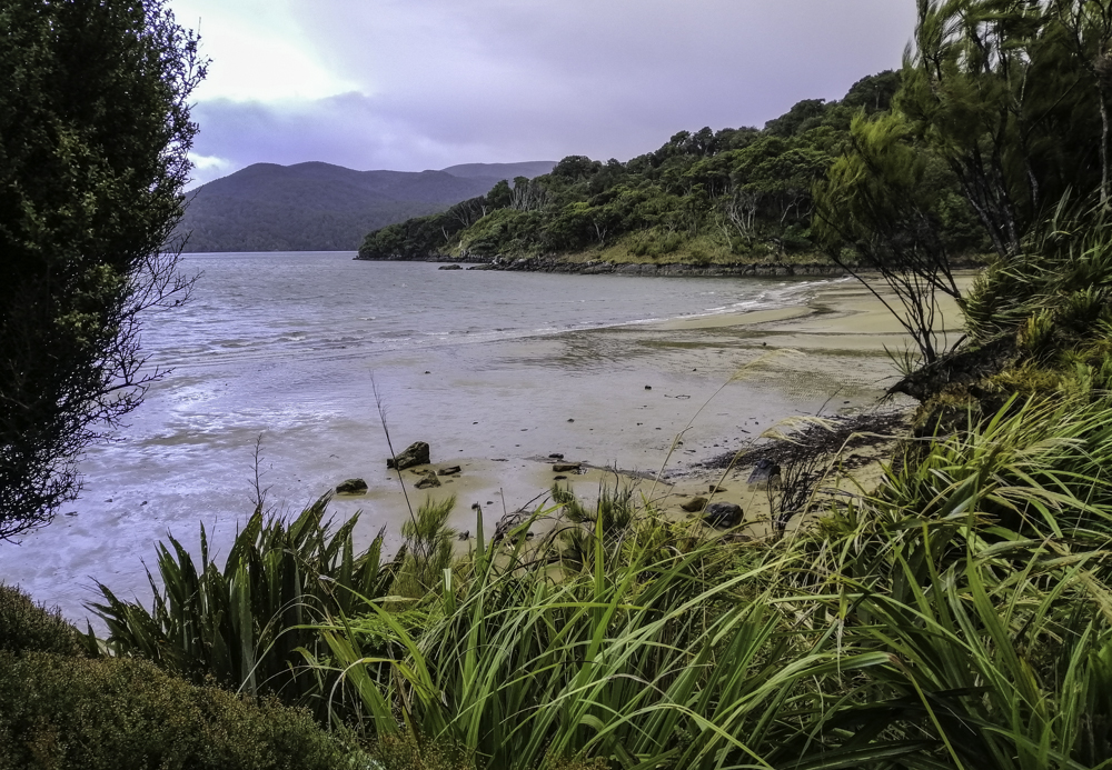
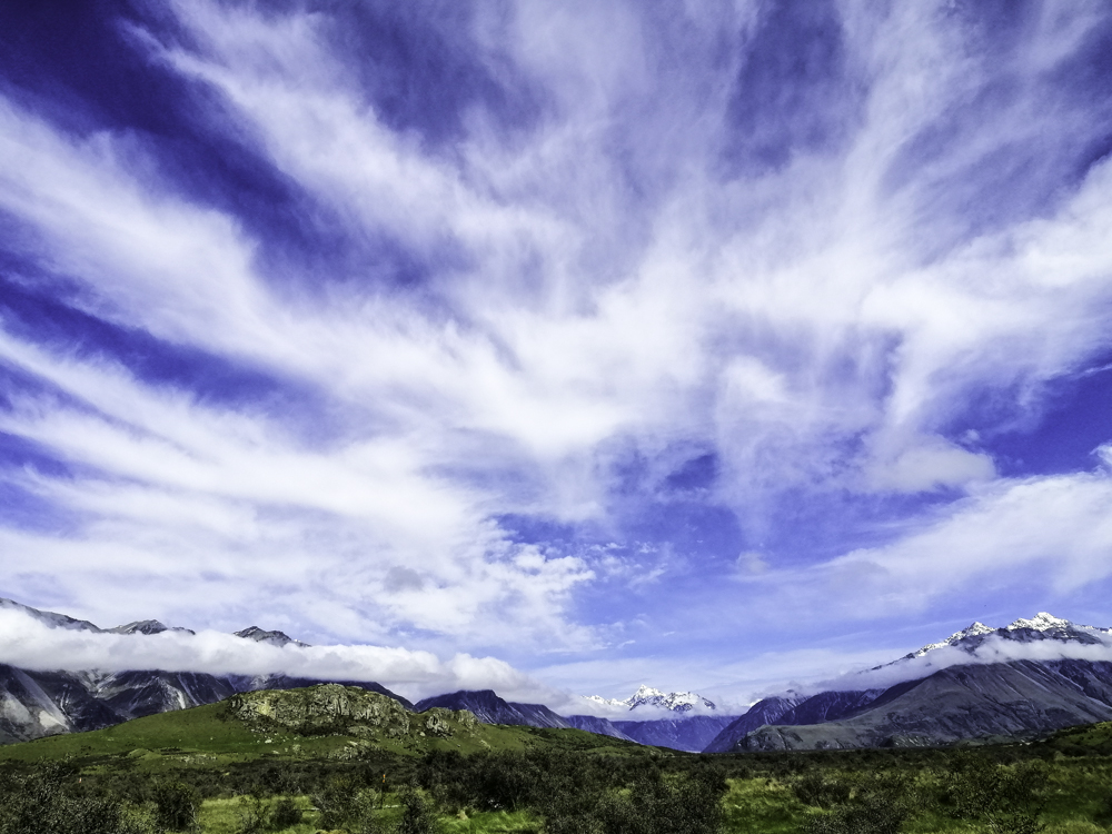
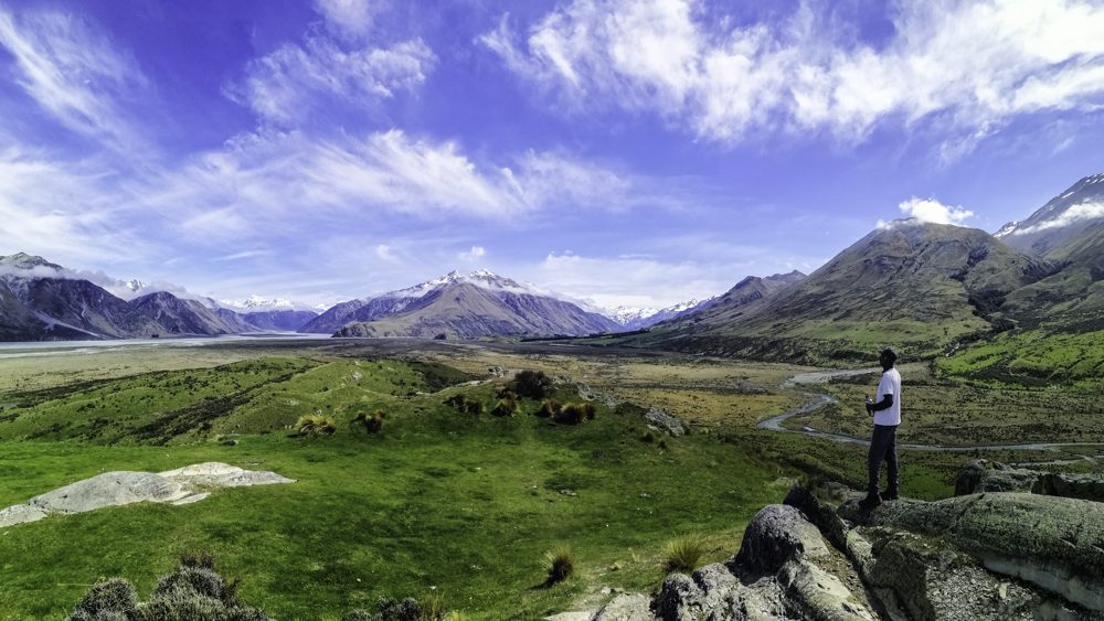
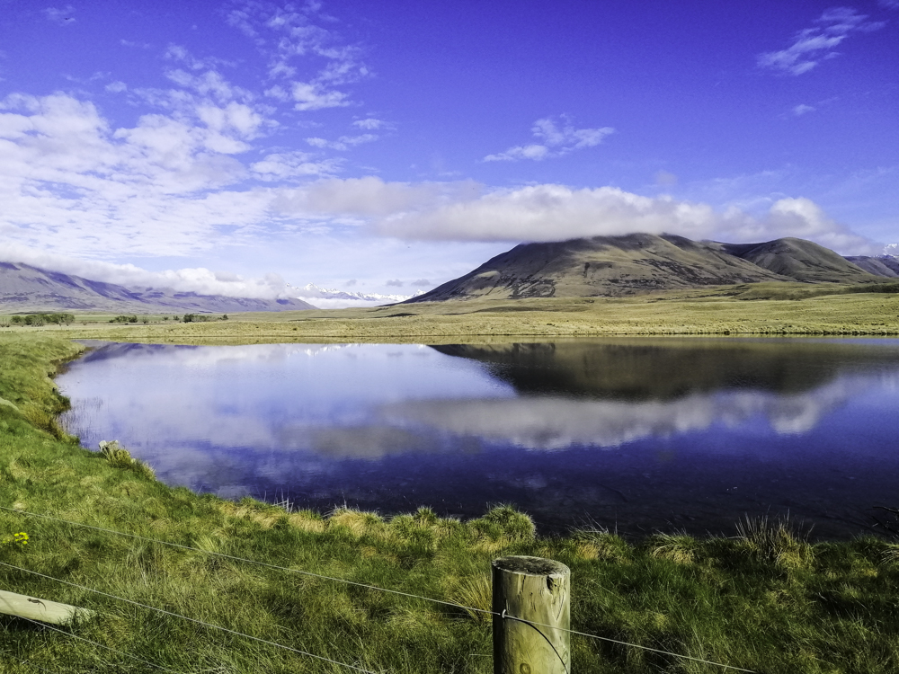
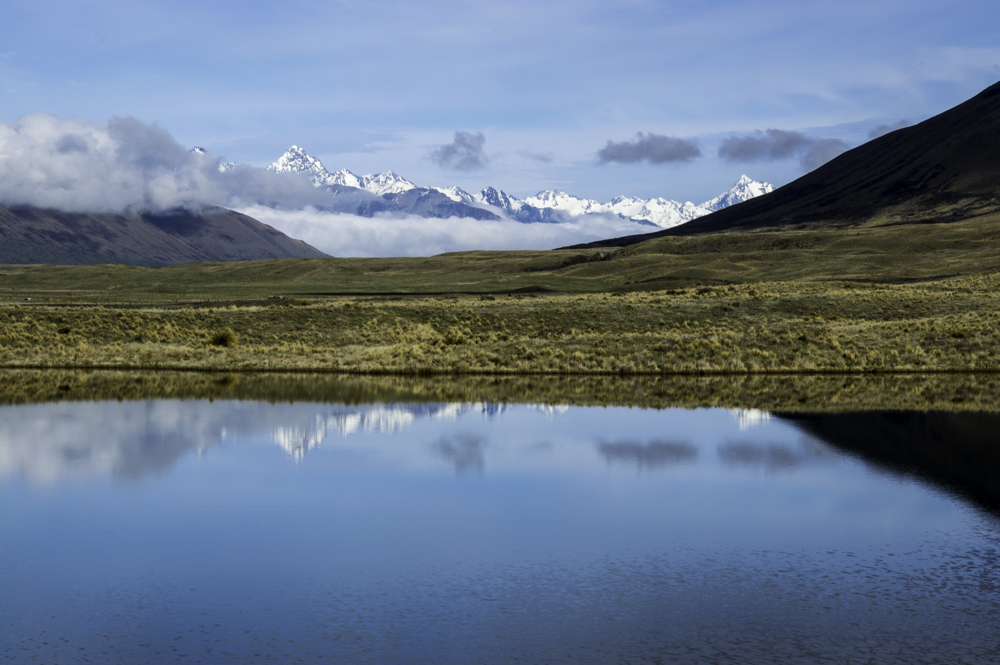
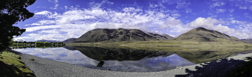
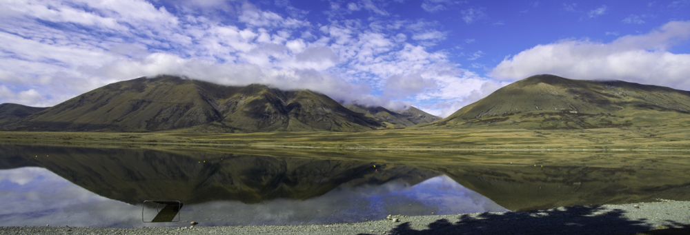
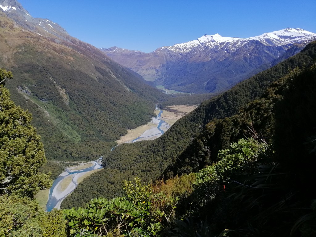
The views across the glacial carved valley, snow peaked mountains and hanging glaciers were stunning. Low morning mist partially obscured the mountains. Mt Aispiring loomed at the end of the valley. It seemed distant. Somewhere amongst these mountains is Liverpool Hut. This track is also the access to French Ridge Hut and Upper Matukituki Valley.

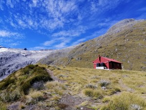
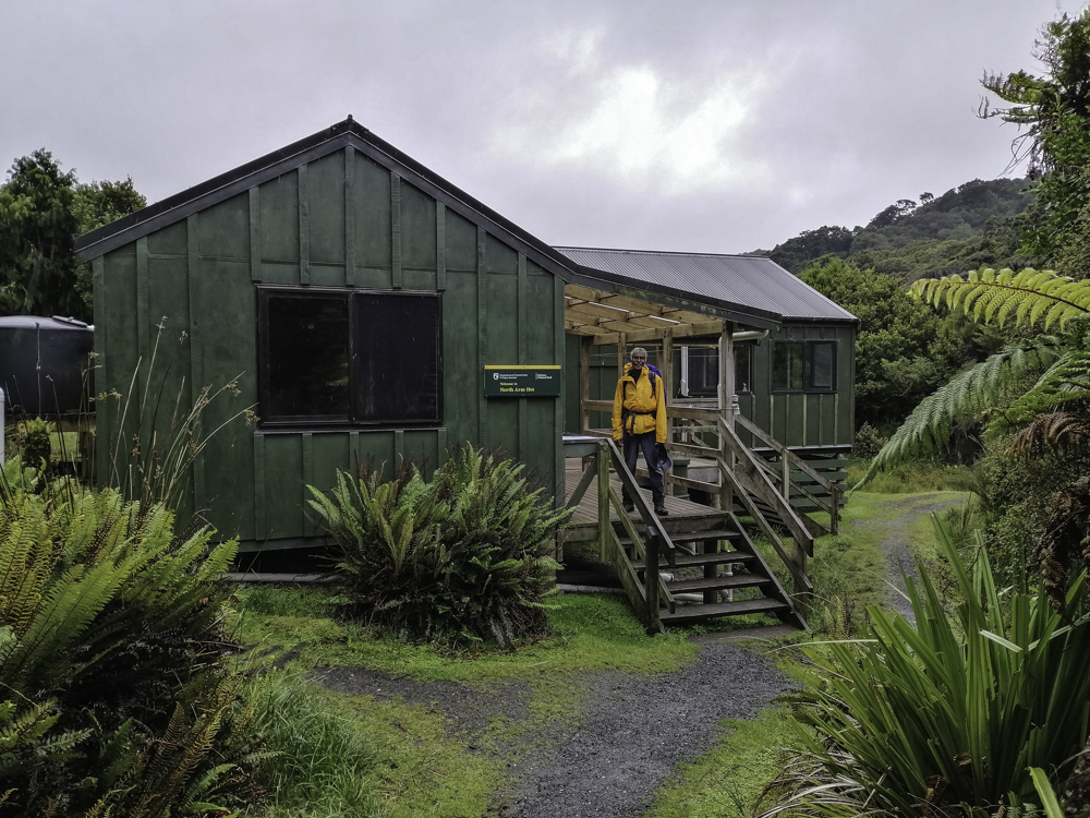
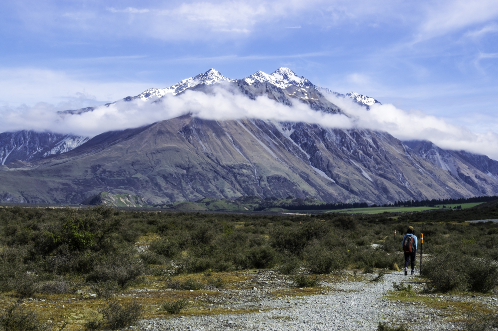
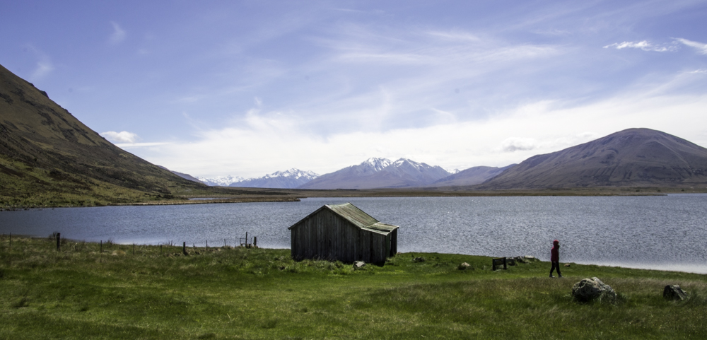
Reached Aispiring Hut at 1130. It was closed with renovation in full swing. Planned to open in  mid-January 2023. Looks like a lodge than a hut. Lunch on the deck of the wardens residence.  It was a relief to get out of the scorching sun. From here, there is acess track to Cascade Saddle and Dart Hut. These tracks are classed as advanced due to steep terrain and prone to avalanches.

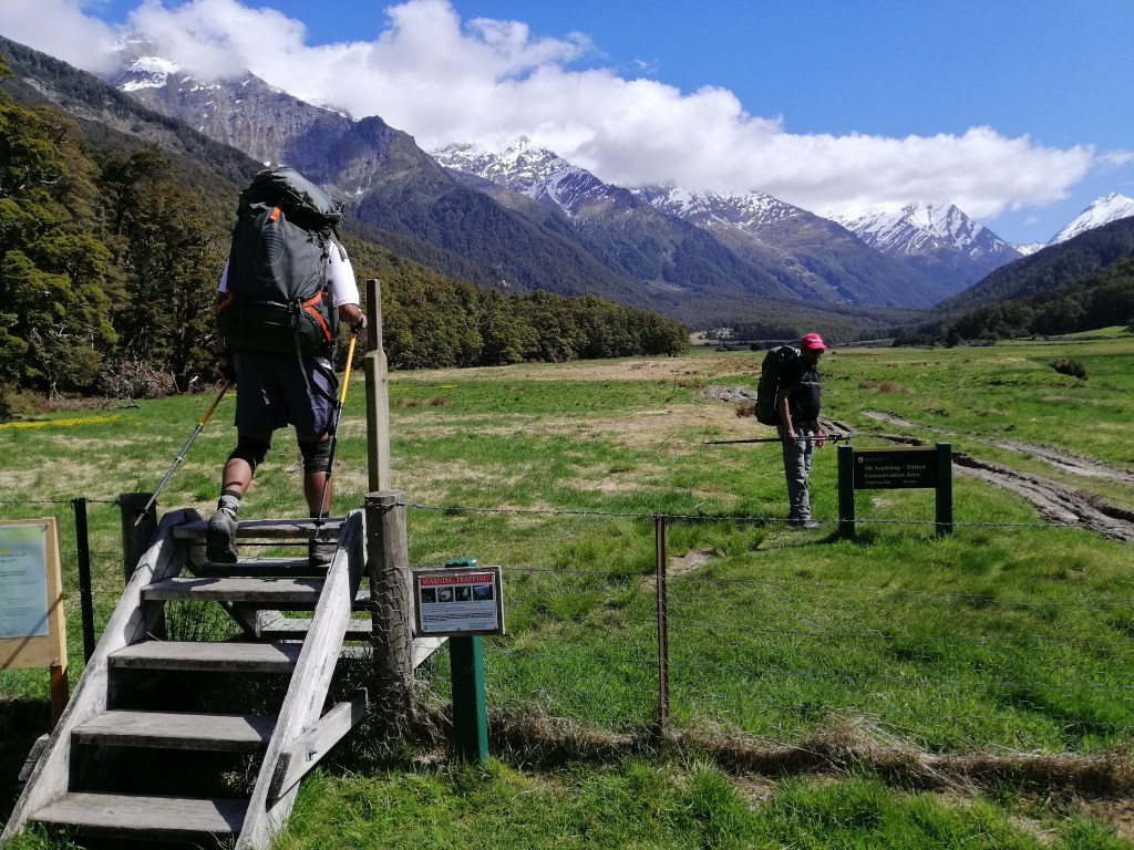
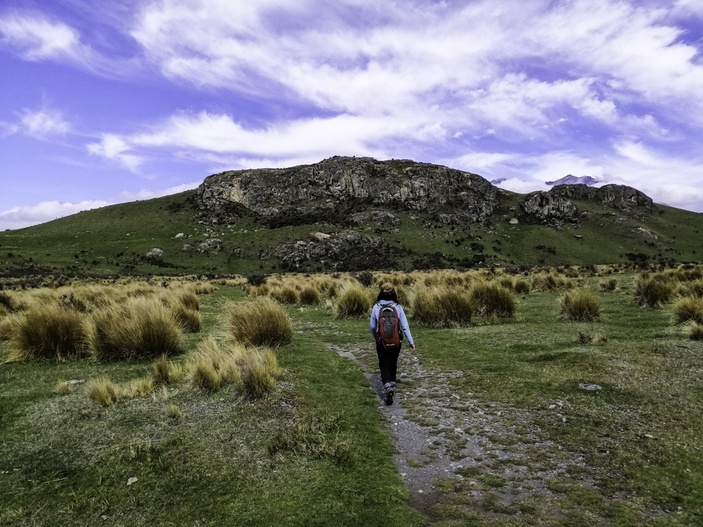
Just after Aispiring Hut, we met the warden for Liverpool and French Ridge huts. She estimated we should reach the hut by 4pm. In my mind, probably 5pm. Starting early benefited us with a long day. The relatively flat track has a gradual acent.

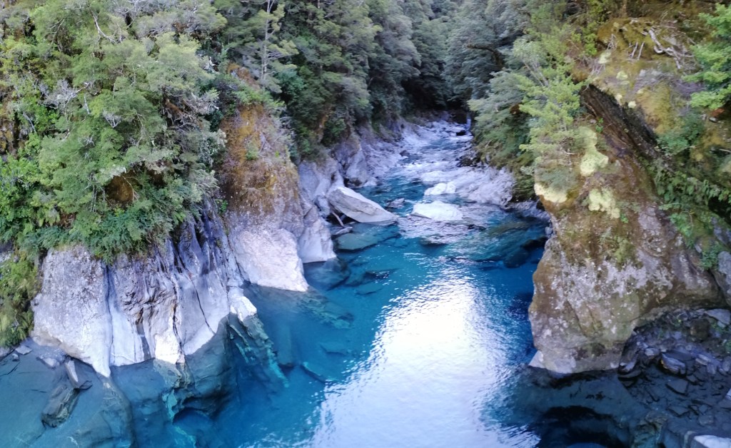
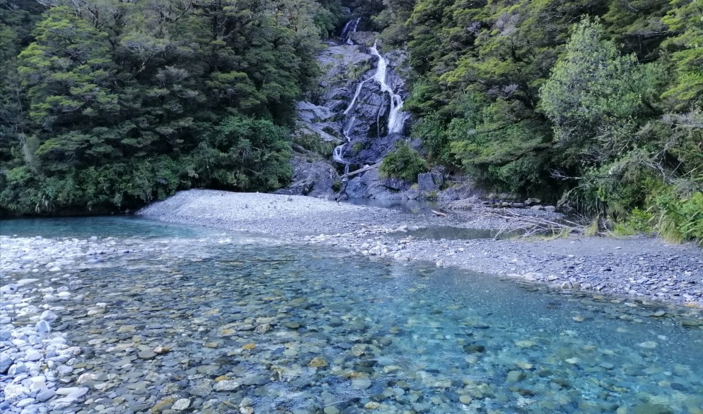
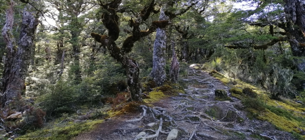
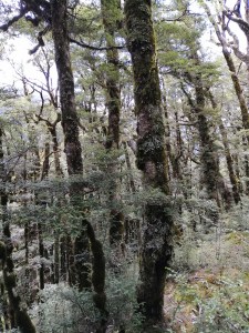
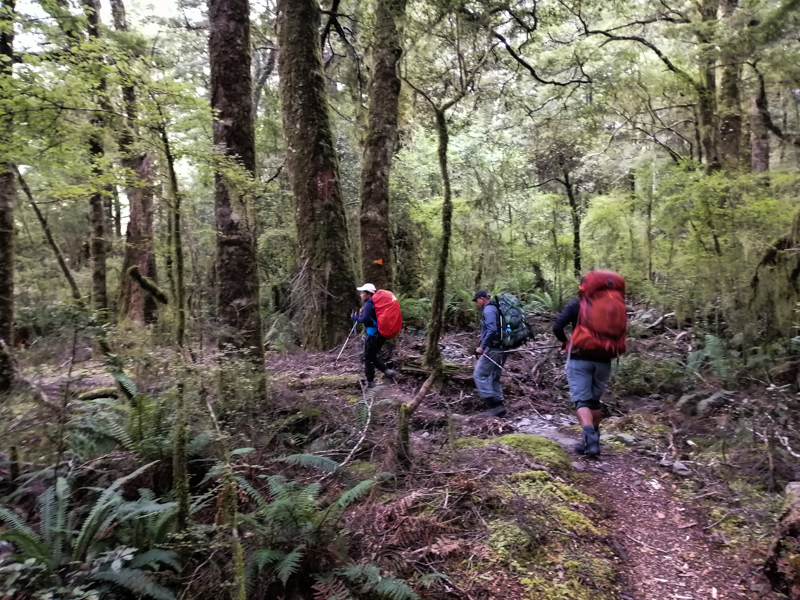
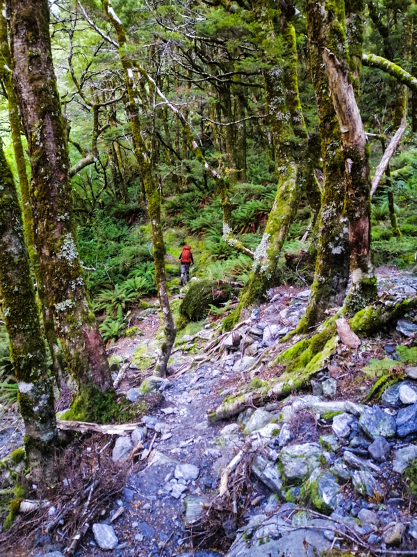
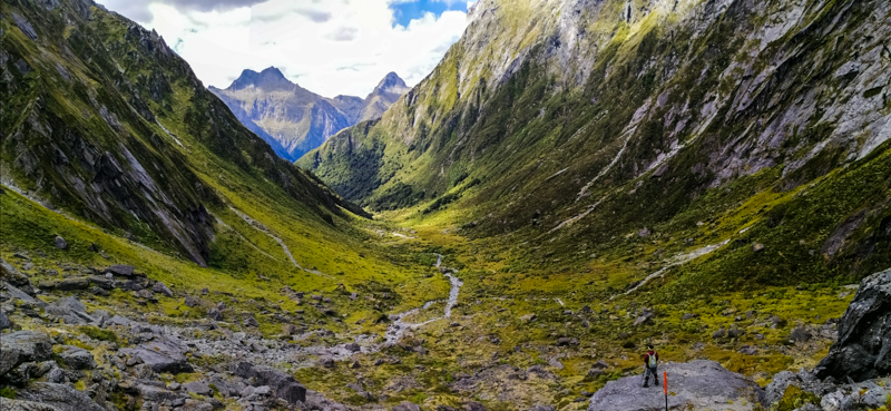
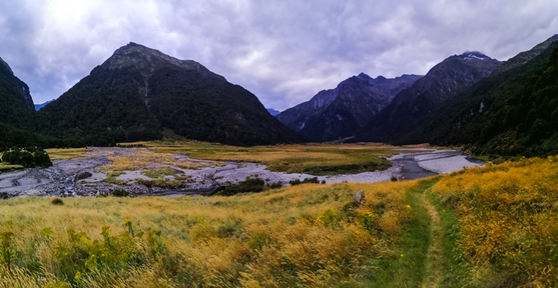
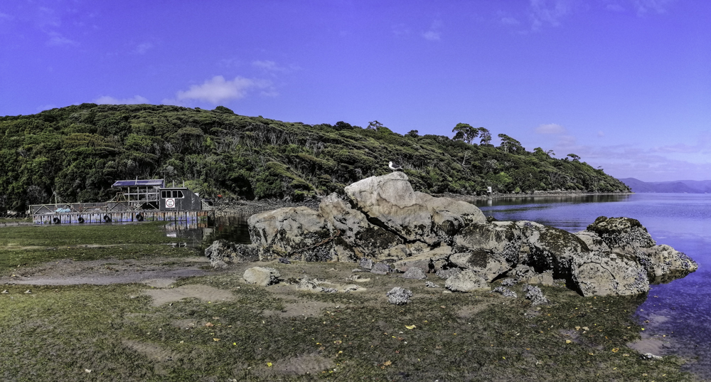
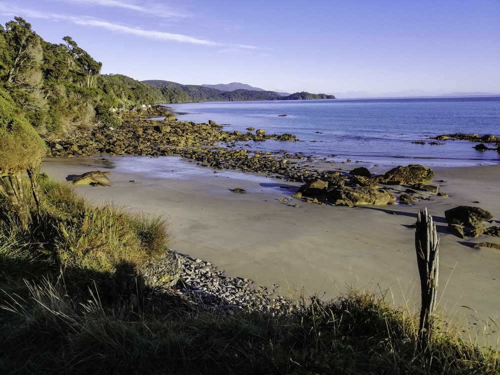
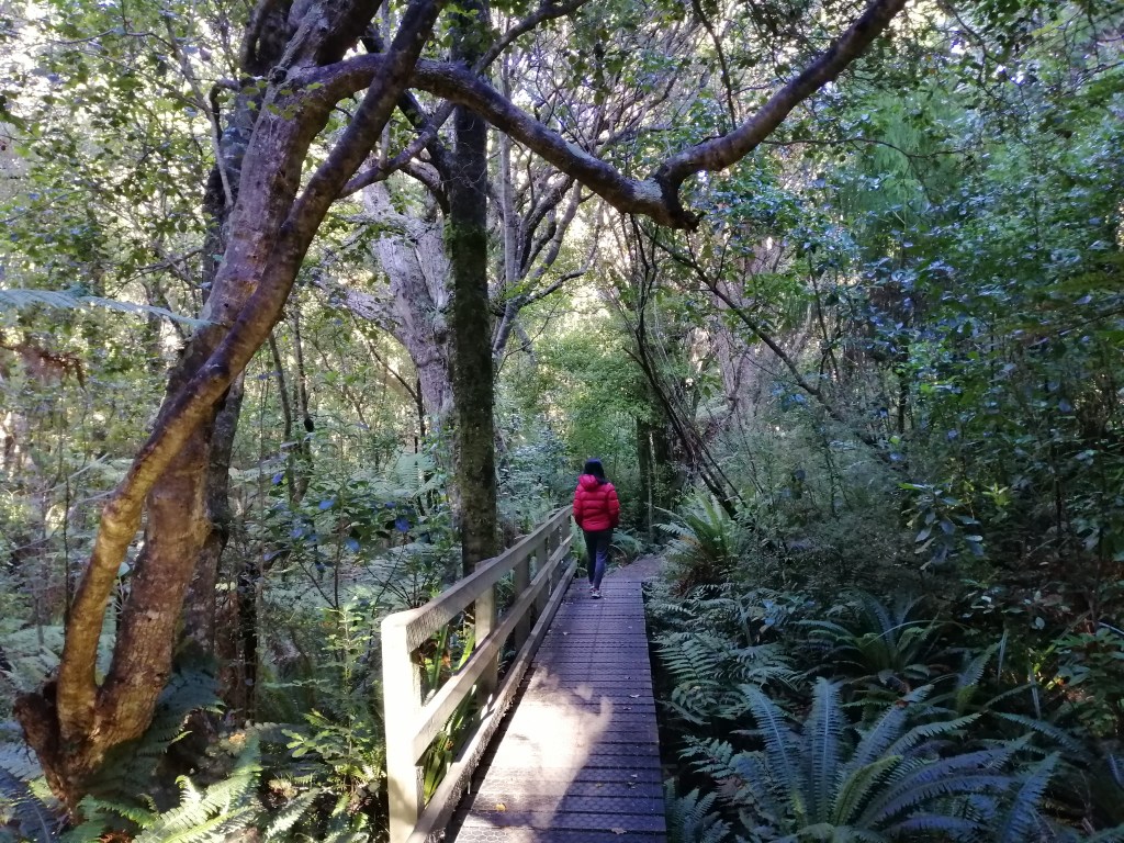
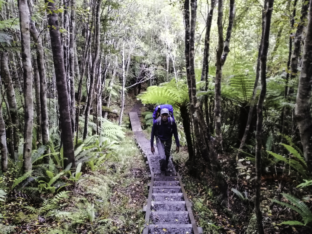
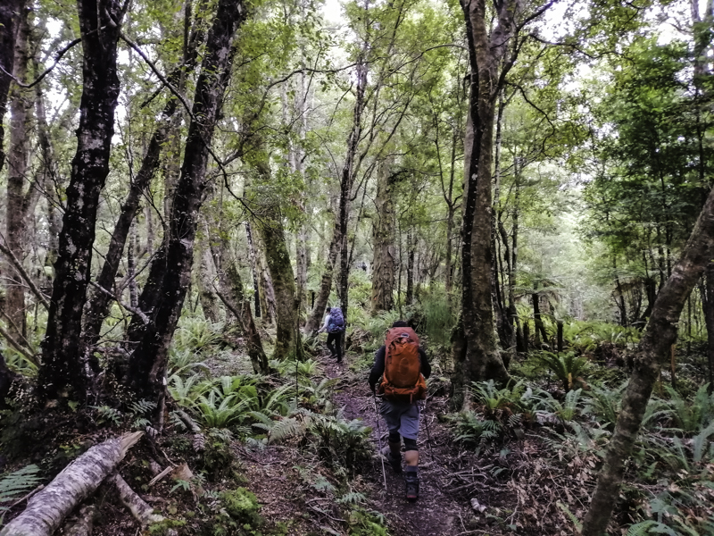
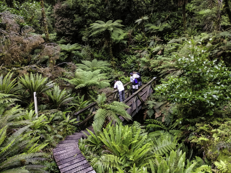
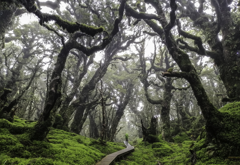
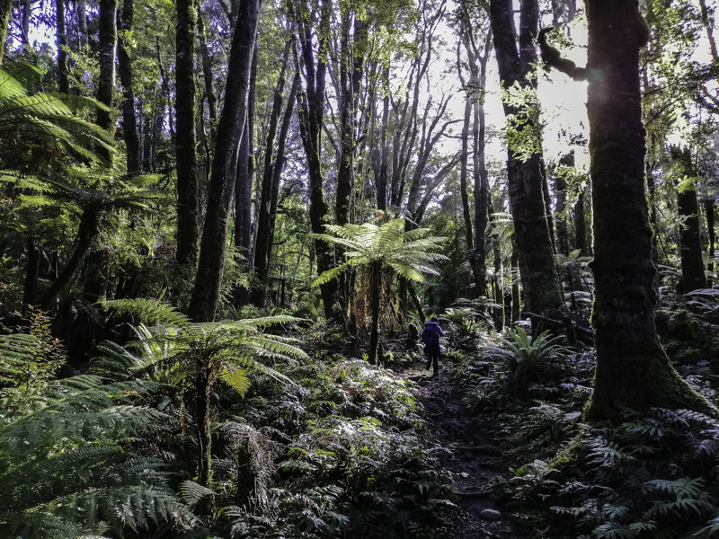
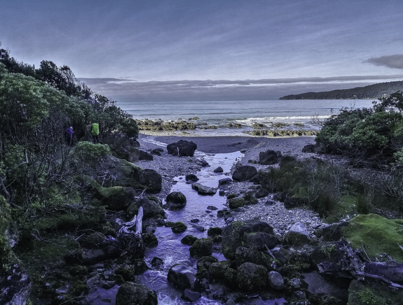
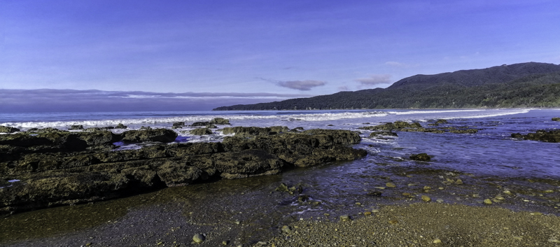
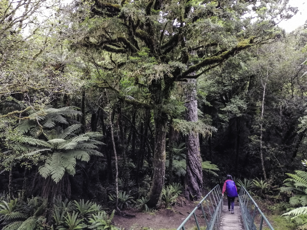
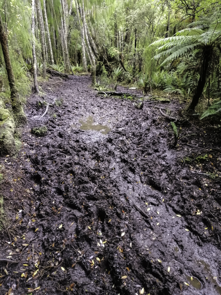
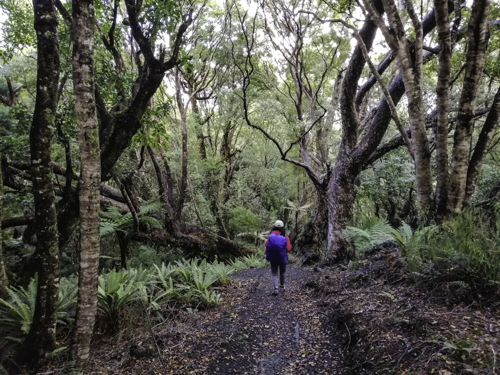
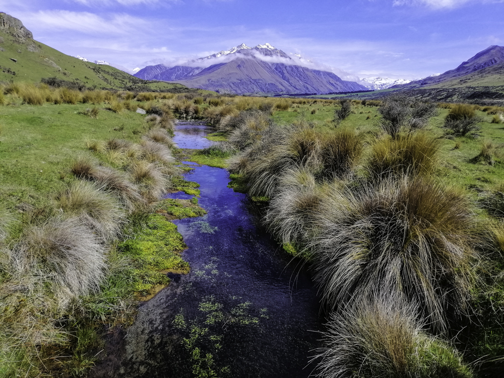
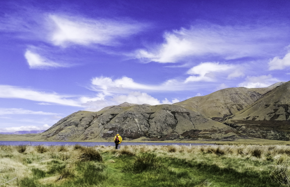
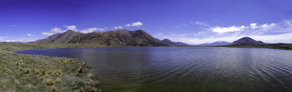
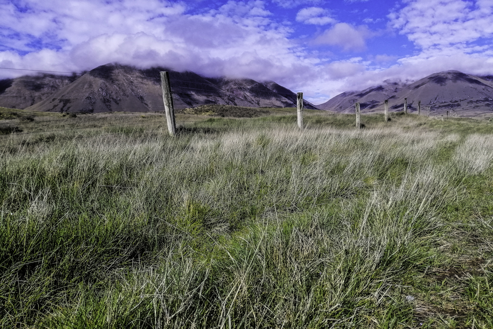
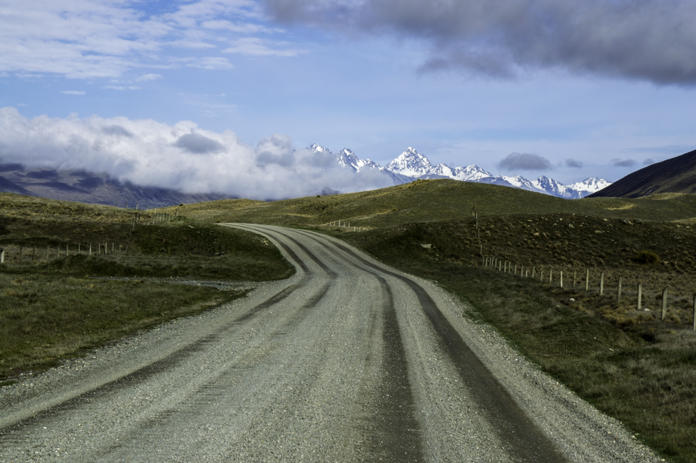
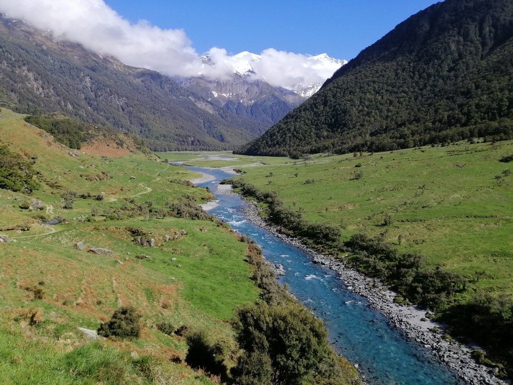
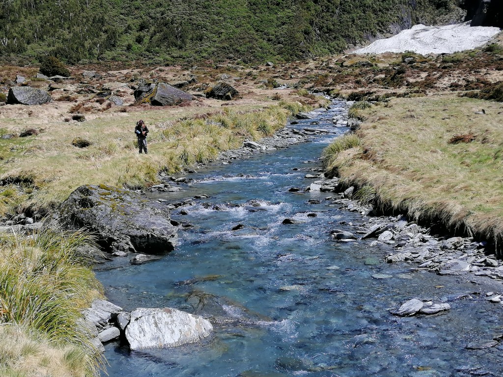
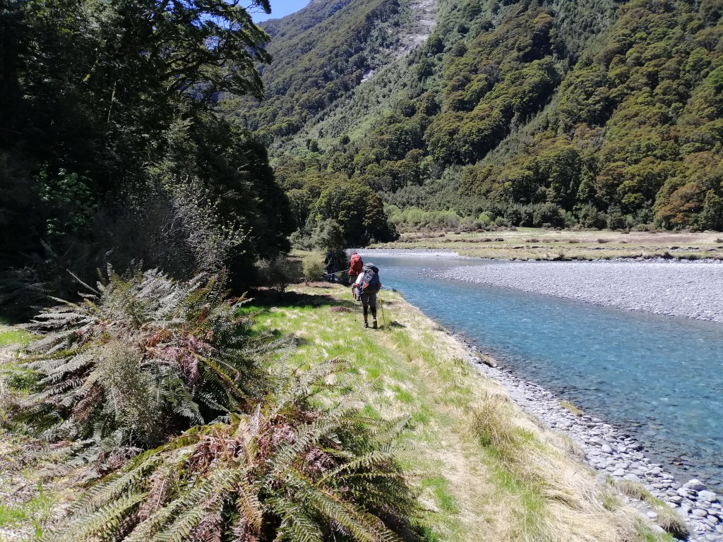
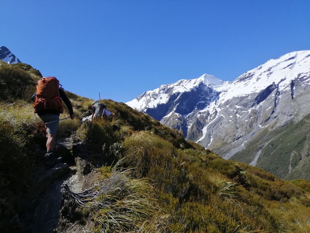
Within 10 minutes of leaving Aispiring Hut, we entered a humid beech forest. Shortly, the track entered the forest and crossed Cascade Creek via a suspension bridge. Then into the open valley and yet into another forested section and into Shovel Flats around 1230. Back into the sunny shrinking valley. The forested mountains closed in. Reached Pearl Flats at 1300. The gradual elevation gain from the car park to Pearl Flats is 400m. It was a long walk (15km) along the glacial meltwaters of Matukituki River West crossing several streams that criss-crossed the track. Waterfalls of various intensity are constant along the steep mountain sides. All draining into Matukituki River. The sky was blue, no wind and the sun was scorching. The sound of the moving water was constant.

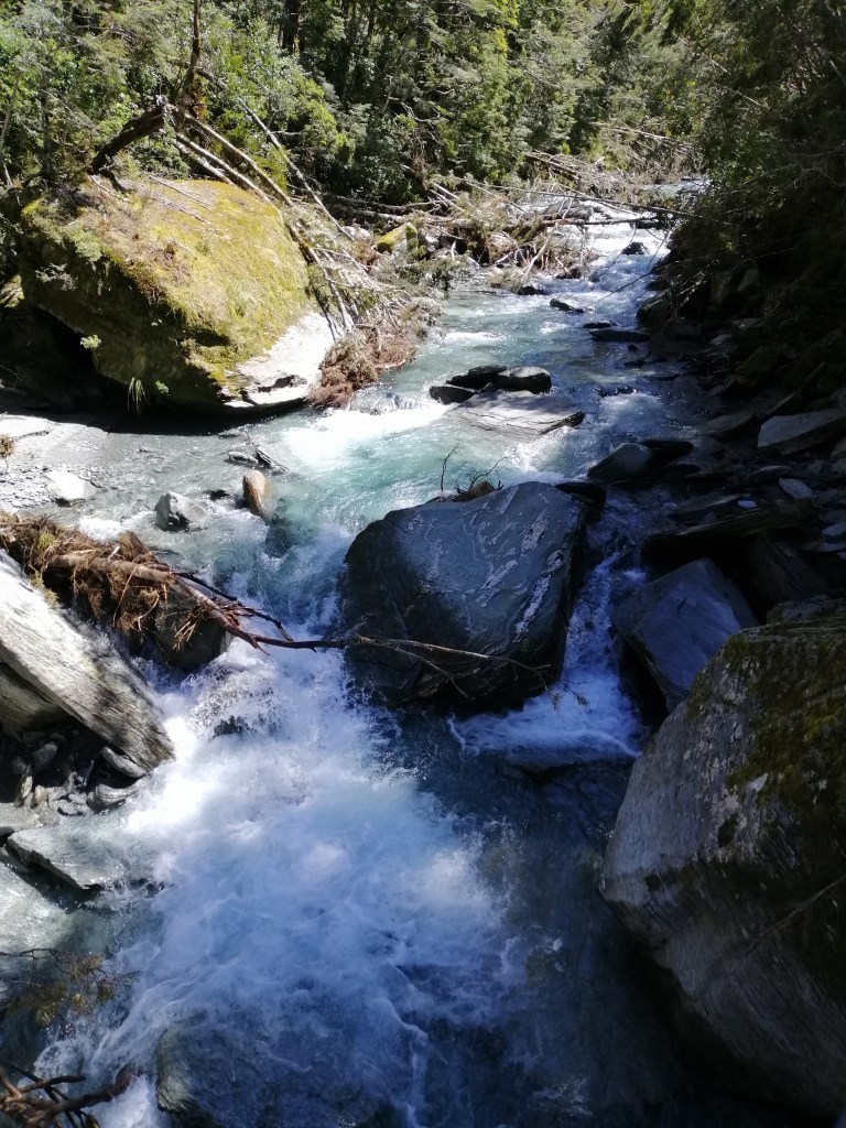
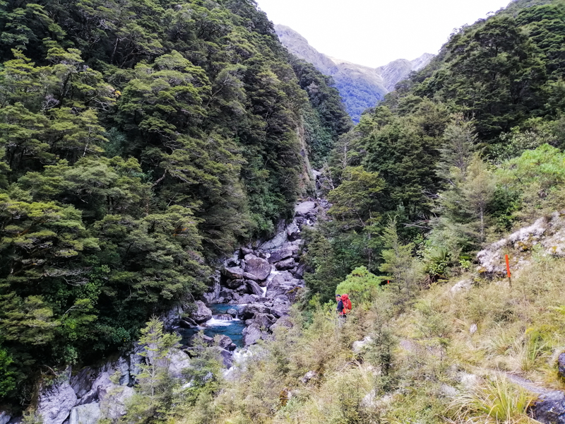
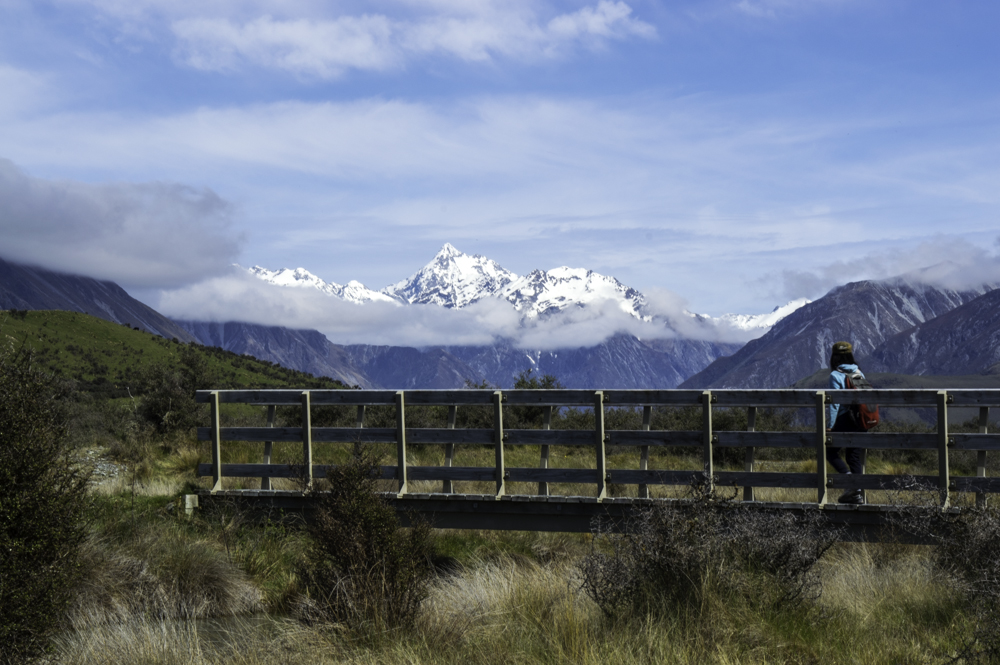
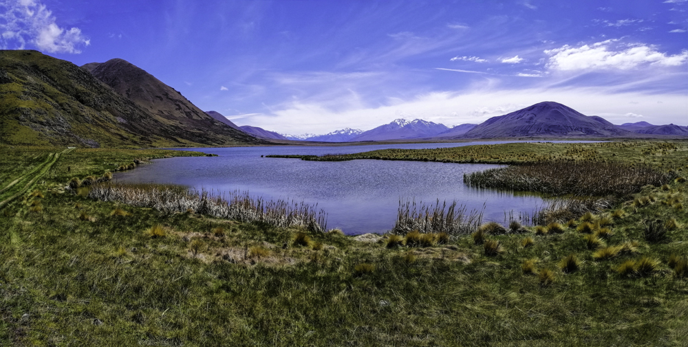
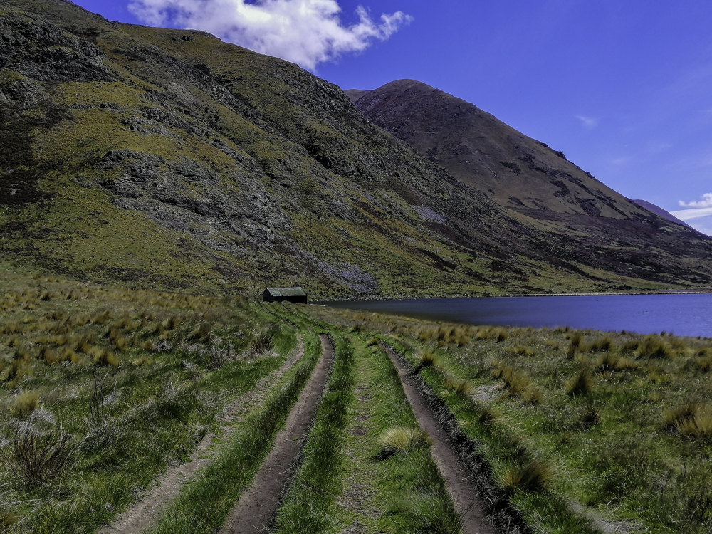
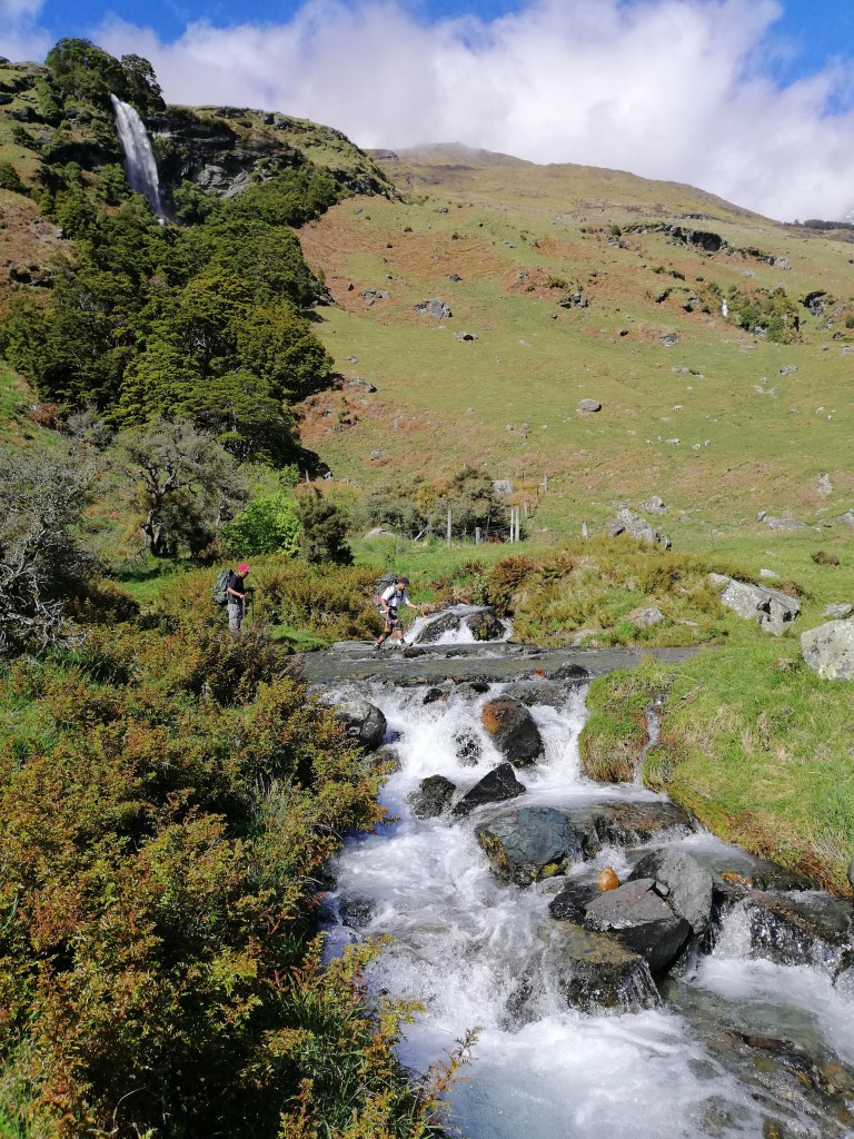
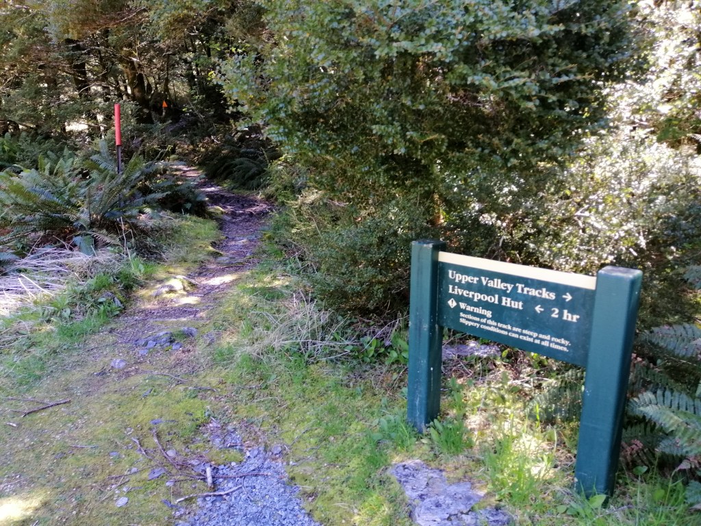
A DoC signage pointed to three directions – French Ridge Hut, Upper Matukituki Valley and Liverpool Hut. We crossed Liverpool Stream over a bridge and refilled our water bottles. For safety, we stayed close as well as hired a beacon from Doc.

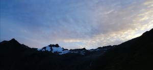
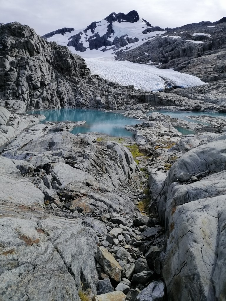
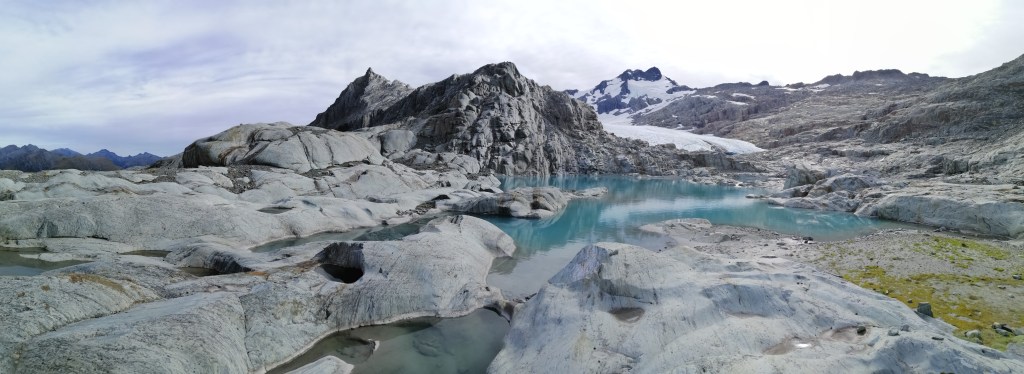
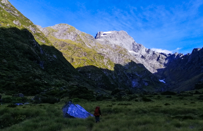
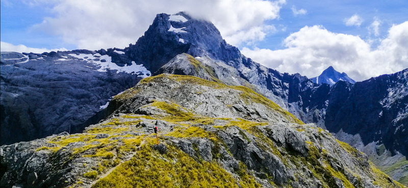
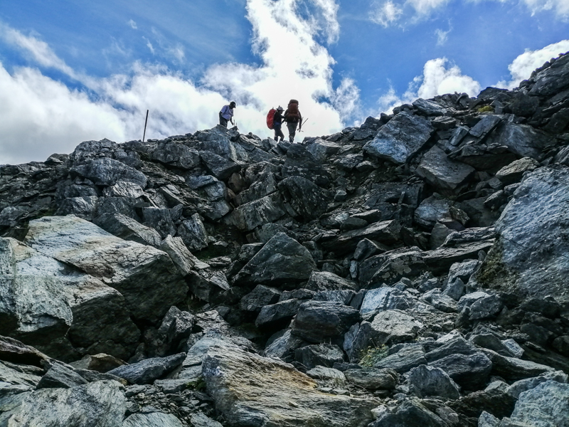
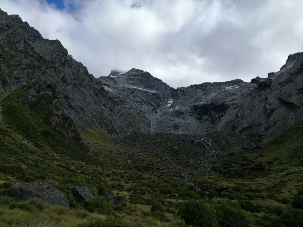
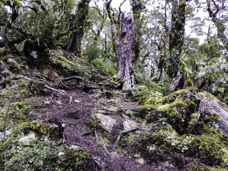
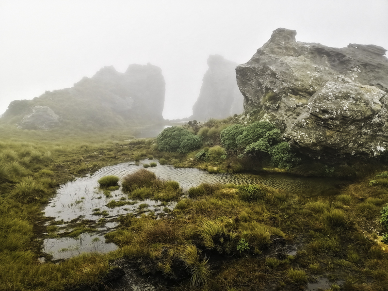
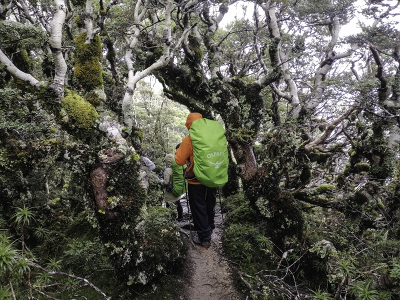
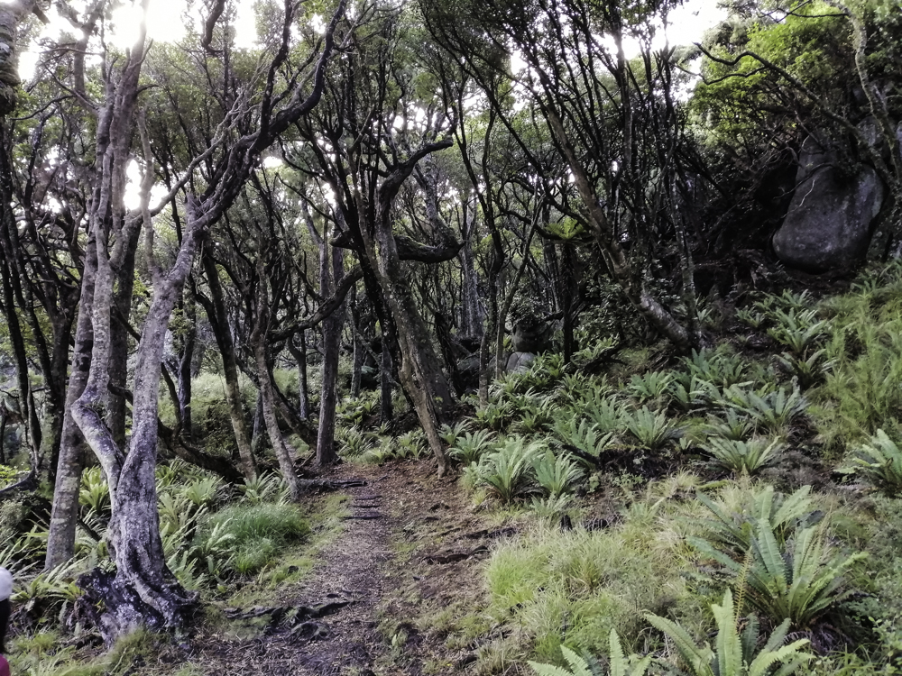
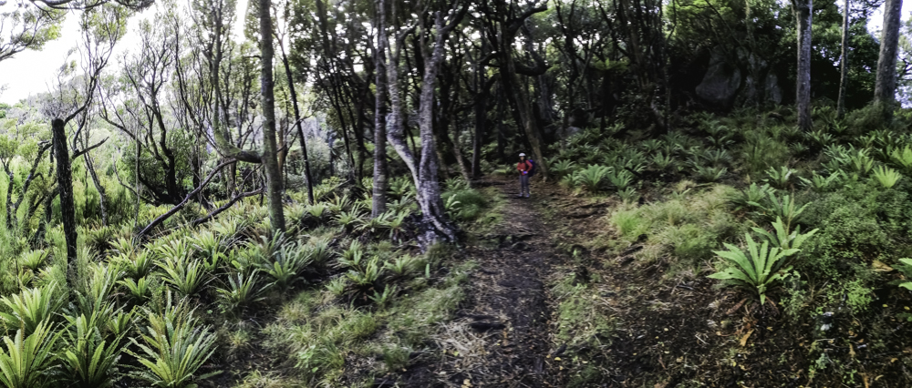
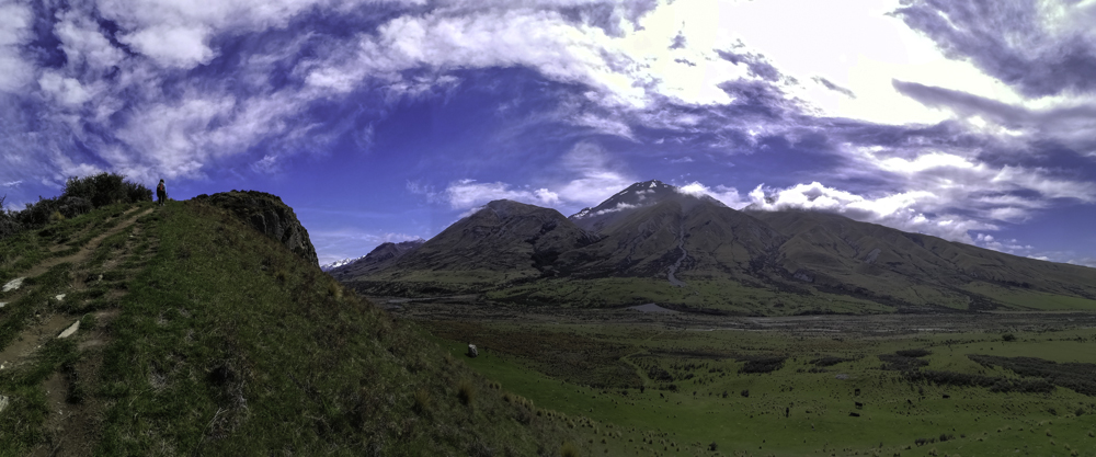
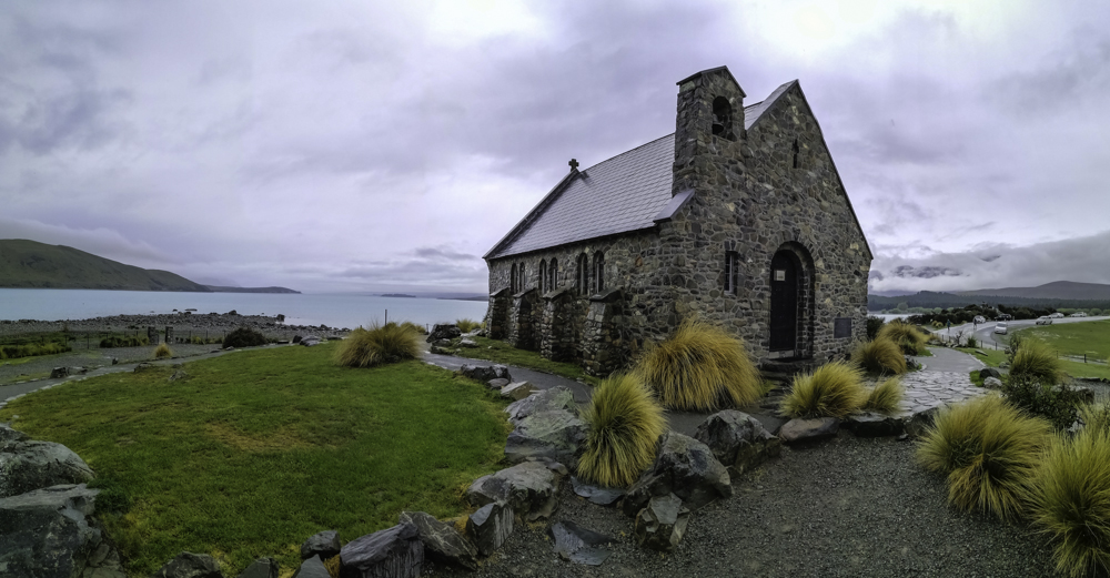
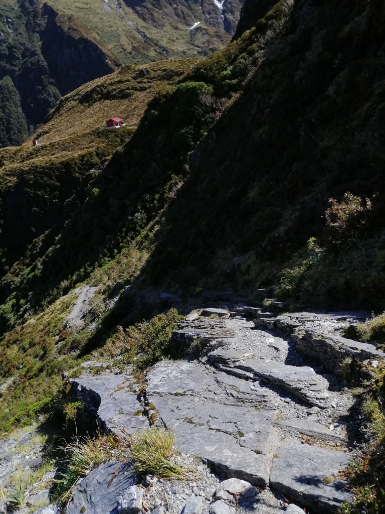
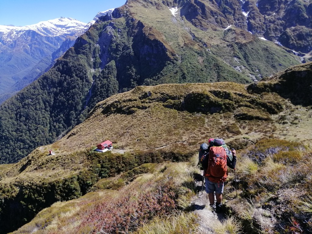
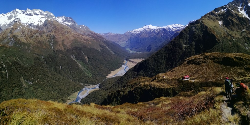
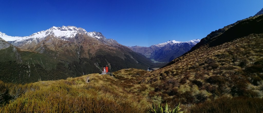
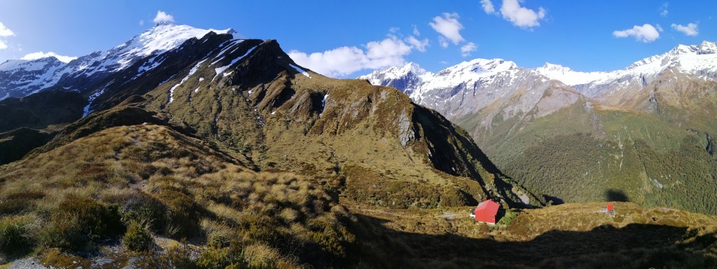
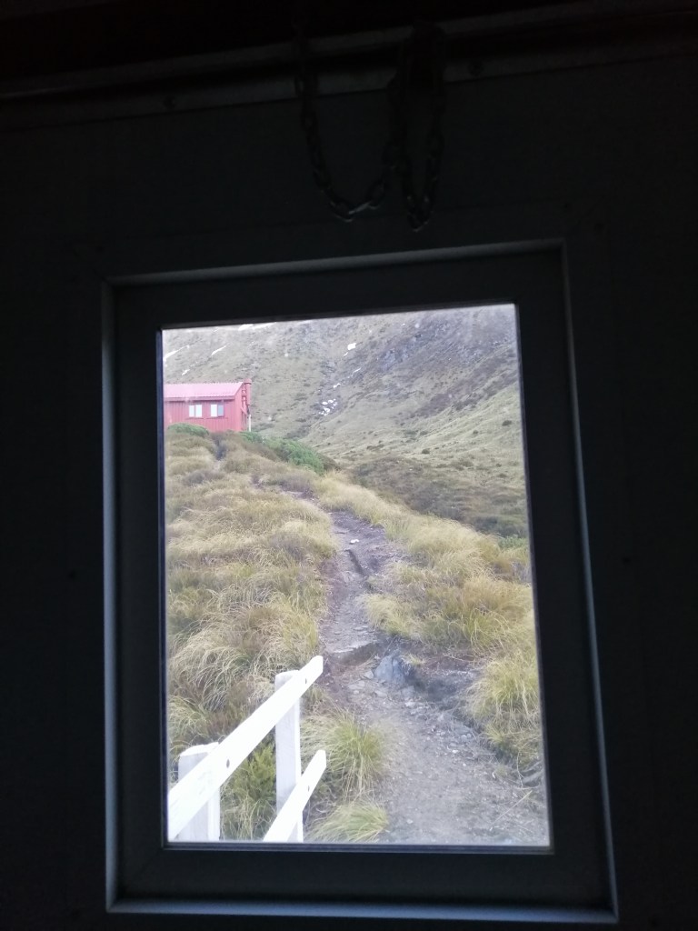
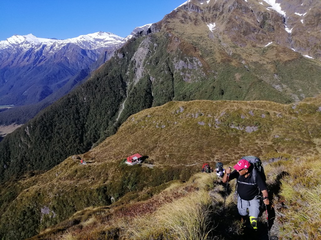
Left at 1330 and after a steep climb aided by beech tree roots and rocks, we heaved up towards Liverpool Hut(1065m). The hike is transformed into a climb. Its always going up a steep incline up to 700m. Looking through the forest and into the Matukituki Valley below, we quickly realised how high we’ve climbed in a short time. There are several nervous moments to negotiate. Just focused on the climb than looking down the steep drop-offs. Eventually, we emerged out of the tree line. The views of the glacial carved Mutukituki Valley with the bluish river snaking out of the valley was stuning. Several glacial covered mountains emerged. This is an exposed area with rocks and tussock grasses. Through the native shrubs and flax plants,  I spotted the precariously placed red roofed toilet. It was a great relief. Soon the red roofed hut itself came into view. In the background, Mt Liverpool (2482m) . Across the glaciated valley – Mt Aispiring (3083m) .

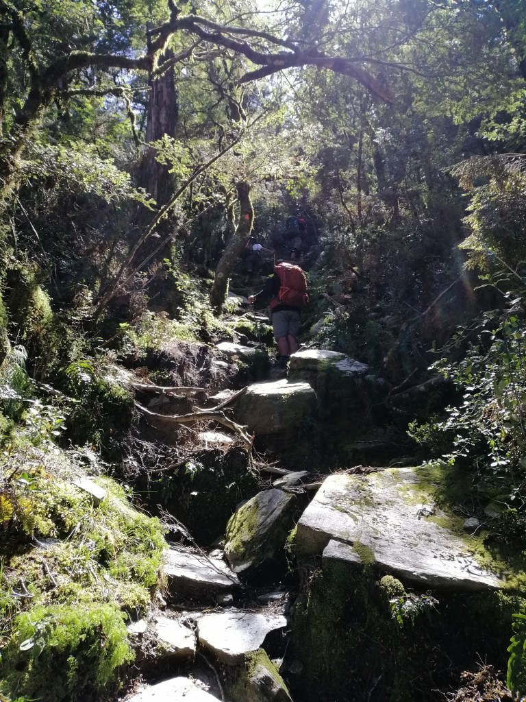
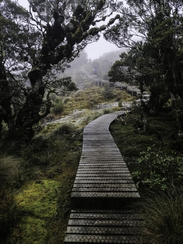
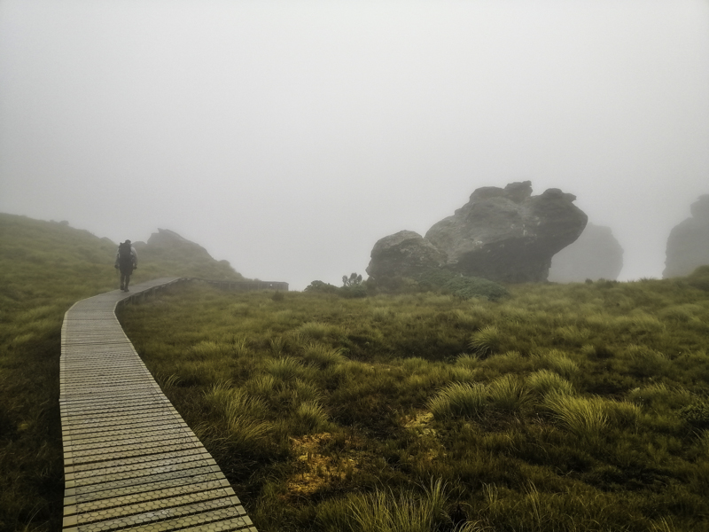
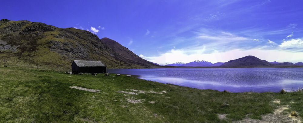
Another precarious steep walk across a series of flat shingle with steep drop offs. I was advised by DoC, to take it slow here as the width in only a metre wide. It can be slippery when wet. Slowly, clinging onto tussock grasses and small steps, we reached the top. You might be tempted to cut across to the hut. Don’t! Follow the markers which took us higher. At 4pm we reached the highest point 1110m before descending towards the hut at the base of Mt Braff (2252m). Blue sky, scorching day and hardly any wind. In the south, Matukituki Valley winds out of the mountains. Elsewhere, we were surrounded by formidable mountains and glistening hanging glaciers. What an awsome sight. We crossed a small stream before reaching the hut. There was only 4 of us here today. Perhaps, more might arrive later. It had taken us just over 2 hours to climb this 1.5 km steep and sometimes treacherous climb. The consolation is most of the hard climb is under the beech forest canopy.

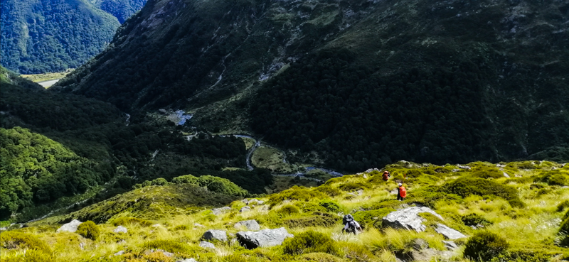
I collasped onto the deck and was transfixed on the stuning views – glistening glaciated mountains, hardy golden tussock grasses and alpine vegetation, and thin blue lines of Mutukituki River meandering out of the valley. We have walked about 16km. Boots off, sand fly spray on and just reminisced our arduous climb for the last 2 hours. At the forefront was, how are going to do this on our return the following day. I would lying if I said I wasn’t concerned. Anyway, we’ll deal with tomorrow.

Across the valley, lay Mts Aispiring and French. The sun’s reflection from the glass window of French Ridge Hut (1480m) blinded me. Having just reached here, my thought drifted – French Ridge Hut might be next. My hiking mates dared not even to contemplate.
In March, I climbed to Brewester Hut and to Lake Crusible in the Gilispie Circiut. They were tough climb but nowhere near ‘dangerous’. To date, the most nerve wrecking (not to dispair – only in three short sections) hike I’ve done in NZ. The worst life threatening must be the final verticle rock climb on the Butterfly Valley to Faralya hike in Turkey. It rained just 5 minutes after we climbed over the edge. My wife and I wouldn’t be able to acend or descend on the slippery smooth rocks. Furthermore, no one knows of our whereabouts! I still get goosebumps thinking about it today.

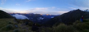
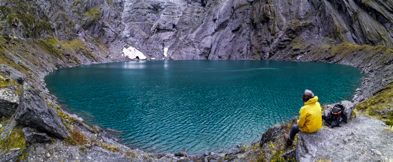
The hut warden did inform us that there is no water as the pipe is broken. So we headed down to the little stream we crossed earlier. After a hot cup of soup and snacks, I was ready to explore this mountain top. The blazing sun began to drop behind Mt Liverpool. A little path lead up through the bush onto a clearing. Now, this came with expensive views. There was not even a breeze. The only sound heard was falling water. Suddenly, a loud bang, an avalanche somewhere on Mt Aispiring. It was out of view. Avalanches are common here. It was worth the walk many times over. All I could do is sit and be awed by the beauty and solitude of the mountains. I knew it was time to head back to the hut as the mountain shadows crept in. There were several little used path on the hill top. Perhaps, one of these might lead towards a distant summit of Mt Aispiring. Distinct Kea (alpine parrots) calls resonated across the valley.

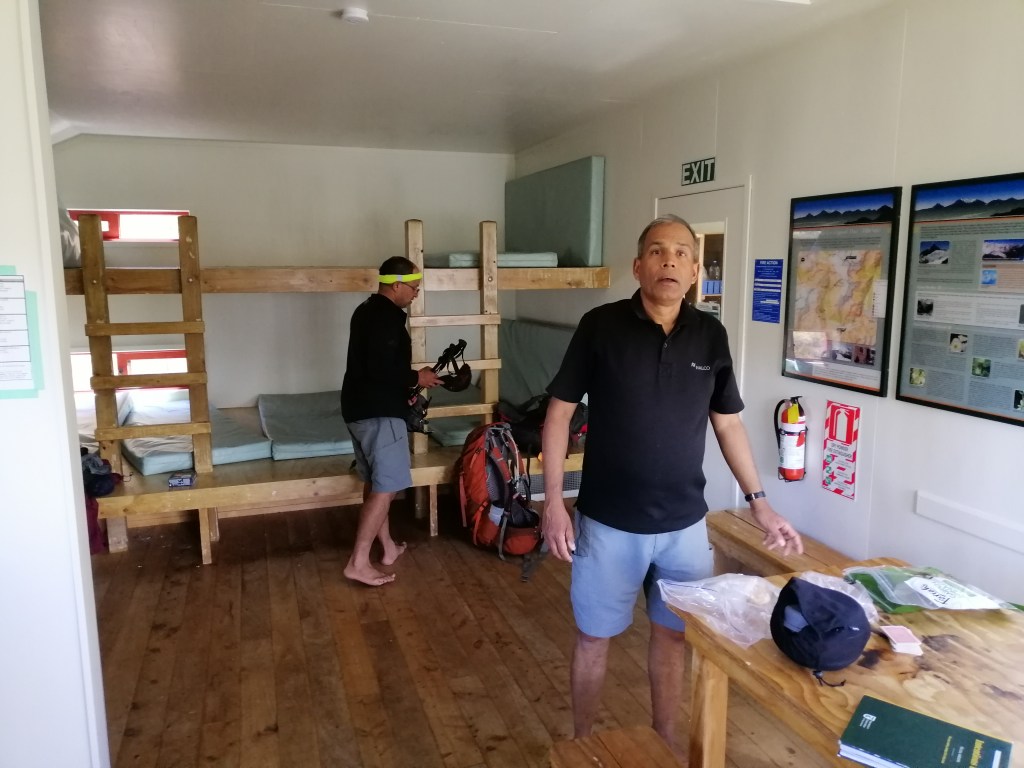
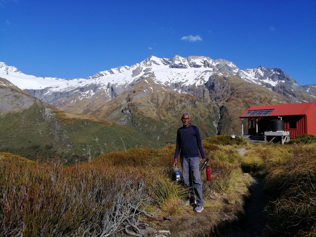
We now realised that there were only 4 of us today. This 10- bed Liverpool Hut is cozy – sleeping, cooking and dining are all in one space. We all quickly settled into our routine – cooking, dining and preparing for the night. Unexpectedly, it was a warm night. Having dinner on the deck with twilight creeping in and the sky lit up by numerous stars was quite etheral. The sun set sometime ago but the light lingered on until 2130. A kea came calling. I immediately surveyed any items left outside the hut. These Keas are very inquisitive and might just carry anything away.  Nothing to do but bewilded by the stars, galaxies and man-made satellites. Later that night, my mates watched 29 starlink setellites pass.

Day 2


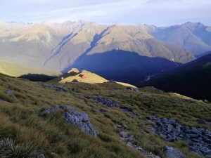
It turned out to be a very warm night. Perhaps the insulation in the hut was great. I usually don’t get good sleep in huts and this, although only four of us, was no different. A kea caused a raucous on the roof, probably around 5am. That woke me up. Another glorious sunny day was emerging. The peaks of Mt Braff and Aispiring reflected strongly in the bright morning sun. The air was still but pleasantly chilly. After breakfast and the usual tidy up, we left the hut around 9am. As the organiser of the hike, I took the lead and the ‘difficult’ sections of the stone slabs was first. It seemed easier going down. Sometimes on our bums. Eventually, we descended the same way as we arrived here – hanging on dearly to the tree roots and rocks. Our decent was slower. I was focused in every step and root to hold. In many places, it was easier turning around and climbing down.

Without realising, I could hear waterfall crashing over boulders. Through the trees, I could make out the grassy flat valley below. We decided to have some lunch under the tree canopy and away from the dreaded sandflies in the valley. We met two men planning to get to Mt Aspiring summit by day’s end. They waited patiently for us to pass as it is generally a one-way track. I admired their humbleness. The weather is expected to turn into rain the following day. Hence, their reason to attempt today. I would not be coming up here if rain was expected. Could be quite a treacherous hike. Finally, at 1230 we reached the suspension bridge over Liverpool Stream on the valley floor. It was easier than I had anticipated. Even, the two other ‘dangerous’ sections were a non-event. It was a relief nevertheless. Now, perhaps, dared to consider French Ridge Hut next!

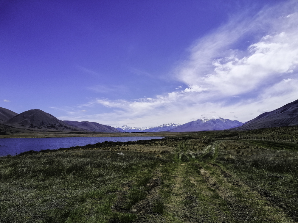
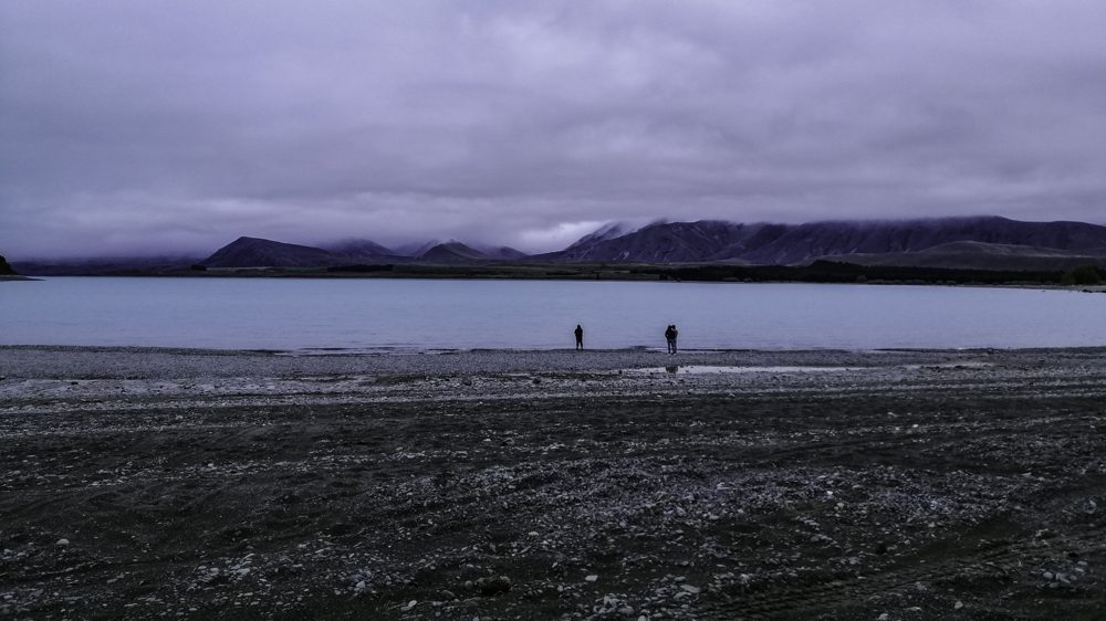
Now, it was a long hard slog back to Raspberry Creek Carpark under a scorching sun. Fortunately it was a gradual decline. We immediately refilled our water bottles in the streams. The waterfall along the way looked inviting. However, we carried on down the familiar valley. Now, turning back, I was able to spot Liverpool Hut. The many streams we forded yesterday seem to have higher volumes of water. We arrived at Aispiring Hut at 2pm. After a short rest, we continued out of the valley. A cool breeze helped a little. It was a relief to spot the suspension bridge leading towards Rob Roy Glacier. We finally reached the car park at 4pm. I was quite dehydrated.

Summary

Liverpool Hut Track is a fantastic 2 days track but certainly not suggested for inexperienced hikers. The images don’t really show the difficulty, especially the steepness of the climb. Fitness is valuable as with familiarity with avalanche and river crossings. I would highly recommend this track to those seeking isolation, a challenging 1.5km climb in a stunning location surrounded by hanging glaciers.

Advertisement

Brewester Hut Track

Information

Brewster Hut Track (5.3km return) is within Mt Aspiring National Park, about 10km from Makarora on the Haast Pass – Makarora Road. Starting point is Fantail Fall car park. Brewster Hut is at 1448 m, an elevation gain of 954m (3-4 hours steep climb). The stunning Brewster Glacier (1600m) can also be accessed via a steep and sometimes slippery slope. Climb Mt Armstrong (2174m) for incredible views. However, the routes are unmarked but assisted (sometimes unreliable especially in poor weather) with rock cairns. Booking is required for the 12 – bunk hut and purchased at DoC. This track is rated as advanced and for experienced hikers. Avalanches, wet weather and fog are potential hazards.

Day Zero

In early March, the drive from Wanaka to Makarora (63 km) is quite spectacular – between Lakes Wanaka and Hawea. Beyond Makarora, the road weaves through dense rain forest along Makarora and later Haast Rivers via Haast Pass.

I know it was going to be tough as the track is straight up, to 1450m. From the topo map, the ‘path’ towards Mt Armstrong and Brewster Glacier climb even higher and steeper! I booked the hut for two nights. At DoC office, I was informed to be the only occupant (with no other bookings) – taking isolation due to covid to the extreme!

To get an early start, I stayed at Makarora at Wonderland Lodge, at the base of Mt Shrimpton. Due to covid, the restaurant and office were closed with no staff present. I had to be self sufficient. However, there is a fully equipped kitchen.

Just a short drive away is the captivating Blue Pools. Its a 3km return walk through beech and podocarp forest in Mt Aspiring National Park. On my previous visit, the water was emerald green. Standing on a swing bridge over the Blue River near the Makarora River, the pool was stunning blue. The colour of the river is determined by the volume of rock flour (fine dust created by glacial movements). Walk down to the river to get a different perspective. Beware, sand flies awaits!

The Track – Day 1

The following day, Brewster Hut Track started at Fantail Falls car park. First, a short walk to Fantail Falls across Haast River is an interesting start. Rock cairns on the shallow river added some interest at the refreshing falls. Back at the car park, at 0930, a short walk across a shallow but cold and fast flowing Haast River is the start of the Brewster Track.  The water was knee deep. The crossing is only advised when shallow. A large DoC orange triangle marker indicated the start of the track. It was a heave up the steep river slope aided by tree roots and immediately into dense beech forest. From hereon, the track is steep and essentially clambering up through intertwined beech tree roots. Numerous times legs and hands were needed. The ground under the tree canopy is covered with lime green sphagnum moss and ground crown ferns. Some of the matured tree trunks and branches  were covered with black fungus. The strenuous steep climb over difficult terrain was made ‘pleasant’ by the shady tree canopy.

At 1130, after climbing relentlessly, I emerged out of the bush line into the exposed tussock grasses. With no tree canopy for shade, the sun took its toll. The track is still steep and sometimes through water eroded gullies. Bare mountain peaks on the west of Haast Valley became visible. With elevation, the views of Mt Aspiring NP and Southern Alps became more panoramic. In the forested valley below, Haast highway snaked alongside Haast River towards the west coast.

With elevation gain, tussock grasses were replaced by alpine vegetation. The track is a narrow path through the tops of several narrow mountain ridges with steep drop-offs. Mts Brewster and Top Heavy loomed in the east. With slow progress, at 1230, Mt Armstrong appeared on the horizon. It was still a long way to go. However, the views at this point were already outstanding. On the exposed ridges, the sun was intense and there was hardly any wind. At the end on one ridge, there was another and another. It seemed unending.

After much “grunt, gasp and pant”, I was happy to see the drop toilet against the backdrop of Mts Brewster and Armstrong. Who would have thought that the sight of a toilet would bring some respite! I finally arrived at the cardinal red Brewster Hut at 1245. The ardours climb had taken me 3.5 hrs. On the hut’s deck, the 360 degree view was stunning. At 1450m,  the peaks on Aspiring Range were almost at eye-level. The hut’s location, tucked in the middle of the Southern Alps, is absolutely amazing. My original plan was to hike here in early December with some lingering snow (postponed due to covid lock – downs).  Today, I just imagined it. It was a good feeling. Two hikers were about to descend. No one else.

As I gazed towards Mts Armstrong and Brewster, a tramper advised me to follow the unofficial marker, piles of rock cairns. Soon, they left. I was alone, not knowing if there would be anyone else today. After a hot soups and short rest, surprisingly, I found myself keen to continue walking uphill! So I decided to climb Mt Armstrong to gain elevation. I started to ascend at 1400. The uphill path is uneven and unstable as rock and stones move with every step. With a lot of grunt, I inched up the mountain. The sky was blue and sun was intense with no breeze. Brewster Hut was barely visible against a backdrop of rising peaks and ribbon-like Haast River.

Stunning views of Brewster Glacier and its turquoise lake appeared in the east, flanked by Mt Brewster and Top Heavy. As much as I followed the random rock cairns, I ended up scrambling up sheer cliffs of the rock face. Many times, I had no idea where I was going, but just up. Perhaps, above 1600 meters, I was lost. I looked for signs but just sharp rocks and boulders spewed all over. It had taken me about two hours to get here. I looked up and perhaps, just 30 m away seemed to be the top. Beyond that, over to the left, a little peak jutted out.  

Out from nowhere, thick clouds descended from the west and covered Mt Armstrong. Visibility was limited to just a few meters. I was undecided as to ascend or descend. I waited for 20 minutes and the cloud cover did not recede. In haste, I descended straight down the mountain slope. The clouds suddenly disappeared and I caught sight of the red hut. I then realised, the effort to get up again was too much. With regret, I headed down back to the hut. I was so close to seeing what laid beyond that 30  meters. It turned out to be a brilliant day.  Seven hikers at the hut today sat on the deck for dinner and enjoy the rather cloudy sunset. Surprisingly, it was still warm at dusk. A thick band of clouds blanketed Mts Brewster and Top Heavy. The night sky was brilliant as the hazy band of stars -the milky way, crossed the sky. Everyone picked a spot and watched in silence. The effect of nature’s beauty.

The Track – Day 2

It was cold and really quiet this early morning. The sun was just emerging but hidden behind Mt Brewster. Pockets of fog filled Haast Valley. However, the Makarora – Haast road was visible. One by one, fellow hikers picked a spot at the edge of this mountain, outside the hut. No words were spoken. Each in their own little world admiring the dawn break before them. One by one, the peaks of unnamed mountains began to glow. Magnificent views of the Southern Alps. It was quite spellbinding. This is the enduring power of remote mountains and high places.

After breakfast, around 0830, I ventured out towards Brewster Glacier. As with Mt Armstrong, there are no clear marking to follow but randomly placed stone cairns left by previous hikers. It was a clear day. The track behind the hut lead eastwards towards a steep slope with a gully running through it. The morning sun beamed brightly onto the red roofed hut.  However, the route to the glacier and Mt. Brewster remained dark. As I gained elevation, Brewster Glacier came into view. Crossing over a couple of large rocks on the path seemed to be the only permanent clue to the direction of the glacier. Always keeping left. A gully on a slope in the east is visible from here. Crossing the gully is not for the faint hearted as it is steep and the ground unstable with moving rocks.  Furthermore, the route is unclear, although the randomly placed stone cairns are reassuring. However, if visibility is poor or the surface is wet, the crossing will be treacherous.

At 1000, I reached the top of the rocky mountain and viewed not only the full grandeur of the glacier but also it mercurial glacial blue lakes. The sun had disappeared behind thick clouds.   To descend, I headed left until I reached a deep gully that lead towards the lakes. Carefully descending down, I was ecstatic on reaching the lakes. The rock formations were stunning. Hardy vegetation clung onto the rocky terrain. Now, reaching the glacier face became a possibility. The smooth rock face carved by the advancing glacier, the blues lakes , the glistening glacier and the cold air made this walk today highly rewarding. Water overflowed from the lakes  and drained through a rock gully carved out by water. The previously formidable black Mt Top Heavy  seemed accessible. The only alien to this dramatic landscape is the meteorological measuring instrument. The smooth exposed rock surface is evidence that Brewster Glacier is retreating. With the earth warming, it is receding fast.

After an hour, I made my way towards the glacier at about 1650m. Crossing the lakes along its edged enabled me to get to the glacier terminal face. How many places can you get close and personal with a glacier in the middle of the Southern Alps? A huge chunk of the ice had collapsed and created an ice cave. Some of the ice hung precariously. It was a just matter of time. The size of the glacier is only evident when standing face to face. Brewster Glacier stretched over 2.5km towards a cloudy sky.  The terminal face is over 1/2km wide with a height of over 5m. I was tempted to go into the blueish ice cave. However, with no one around, I hesitated. Melt water flowed out from the glacier into small fast streams cascading over the rocks and drained into the larger lakes below. Being so close to a glacier was mesmerising. Walking to Mt Brewster looked possible. However, without proper gear- crampons and ice climbing gear, it is not advisable. Although cold, I was reluctant to leave.

I retraced my steps back towards the hut. I had to cross the steep slope and  into the gully and back out. I looked up at Mt Armstrong in the late afternoon and thought of attempting to the summit. Perhaps another day. I finally reached the hut at 1430. It was a pleasant day walk. I had booked for the second night. However, I decided to track down. The return hike was not as demanding as the previous day’s climb. I weaved through the beech forest and negotiated the steep decent. The weary and tiresome  look on the hikers ascending told a familiar story. Their frequent question was “how far is the hut?” Around 1700, I reached fast flowing icy Haast River. Crossed it bare footed one more time, and onward to Wanaka. The weather gods had been good today.

Summary

Brewster track is tough hike as the track weaved through exposed beech roots and a steep terrain. However, the reward at the top is the wonderful views of the Southern Alps, Haast Valley , glaciers and the stunning milky way in the night skies. The unmarked track to Mt Armstrong and Brewster Glacier is challenging but enormously satisfying. Crossing Haast River in the beginning and end is subject to water level. This track to the hut can be done as a day track and return.

Hiking the Gillespie Pass Circuit

Introduction

Gillespie Pass Circuit in the Mt Aspiring National Park is 58km taking 3 to 4 days. It can be done in either direction. We choose the clockwise as it offered easier accent on the steep climb at the pass. The track is through unspoilt wilderness, untouched native forest, alpine pass, waterfalls and glaciers, towering peaks and river valleys. It is essentially walking from Young River to Wilkins River via the Gillespie Pass and Siberia Valley. A road less travelled where nature and weather dictates. Rated as advanced by DoC as risk from high rainfall could cause stream crossing difficult, and the alpine pass covered in fog, snow or ice with slippery surfaces. Be warned, fatalities had happened! Beware of the weather, know your limits and be well prepared. The safe thing to do is just wait for the water to subside. For more information and booking, go to DoC. The 20 bunks serviced hut  is on a first come, first served basis with a back country hut ticket (NZ$16). However, booking is required for the 20 bunk Siberia Hut(NZ$20). The track start and end at Makarora, about 62km from Wanaka.

Day 1 – Makarora to Young Hut (20km)

We stayed the night at peaceful Makarora. The weather was mixed and possibility of rain was high. We were prepared to turn back should the latter happen. Unsure about the weather, we took an exhilarating 10 minutes Wilkin River Jet ride (NZ$25) to get across to the starting point – the confluence of Makarora and Young Rivers. We hopped onto the left bank of Young River at 0915. Beware, sandflies are plentiful. A family forded the river (from sign posted car park on the Makarora – Haast Road) with some sections just above their knee. Two guys carried a tent and raft each, planning to raft back on the Wilkins River and perhaps on the lake. Good to be young. Awareness of the water level and preparedness is critical for the river crossing. If Makarora River is high, start at the Blue Pools – at the confluence of the Blue and Makarora Rivers (add 4km).

Young River was shallow as we entered a forest dominated by Beech. It was a pleasant walk. The weather seem to be improved as the walk progressed. Within half hour, we emerged onto a grassy flat valley. Although cloudy, nearby mountain peaks were visible. The track continued between mossy forest and grassy plains until we reached Young Forks suspension bridge. We crossed the North Branch Young River and emerged out of the forest and followed the left bank of the South Branch Young River. The track became steeper, harder with gnarled tree roots to negotiate and kept going. Despite being cloudy, the sun was out with occasional blue sky.

The track crossed several slips and dry rocky river beds. In poor weather, streams can become torrent instantly. Birdsong can be heard but not seen. Fortunately a couple of illusive Rock Wern came close. The most common were the affable Robins and cheeky Fantails. We crossed Stag Creek via a wooden bridge and from hereon, the track climbed higher along the boulder filled South Branch. This section of the track had several incidents of landslides. One happened across the river only hours ago. Fine chalk dust covered the entire area and still floated in the air. I was just keen to reach Young Hut. Progress seemed slow. Hut seemed distant. Fortunately the fine but cloudy weather held. Finally, at 1645, through some bush I caught sight of Young Hut (740m). What a relief. A quick body wash in the cold water and respite at the hut was a good feeling. Only nine beds were filled.

Day 2 – Young Hut to Siberia Hut via Gillespie Pass (12km)

We left the Young Hut at 0830. The sky was cloudy. We anticipated a hard climb and descent today, and risks crossing the pass. We hoped that our weather forecast was “exceptable”. The track immediately entered the predominantly beech and mossy forest. As in day 1, the uphill walk required some ‘skill’ in negotiating exposed tree roots and dry rock river beds. We emerged out of the tree canopy and into shrub vegetation. Fortunately, track markers helped to stay on the track. In the shadows of the mountains, about an hour later, amid waterfalls and snowfields, we walked into a grassy Upper Young Basin with Mt Awful in the background. Kea calls were heard overhead. We crossed a small bridge over a shallow stream. In a short time, walked through grassy flats filled with beautiful purple flower heads and reached the start of the Gillespie Pass track on the left.

From hereon, it is a steep exposed uphill hike alongside a rock bluff which zig-zagged amongst snow grass, away from the valley. It was tough and progress was slow. In the north, Mt Awful dominated the skyline.  Grabbing onto plant roots and calculated scrambling over rocks became a norm. Vertigo issues are challenged here. The mantra here was to climb slowly but progressively and taking short rest and repeating the same.  As we gained elevation, the mountain views expanded to reveal the alpine and moraine sections. Glaciers hung on mountain gullies. The sun eventually rose above the eastern mountains. The sky was blue. Turned out to be a stunning day.

After 5 hours of walking (and scrambling) up 400m from the valley floor, we reached Gillespie Pass (1500m). I was elated and the pleasantly surprised by the 360 degrees clear panoramic views of mountain peaks, glacier and valleys.  The burden of getting here dissipated as the sun warmed the surrounding. There was not even a breath of wind. The views towards the west stretched towards Mts Alba and Dreadful, and Siberia Valley. Towards the east, the Mackerrow and Young Ranges. Somewhere in the midst of the Southern Alps lies Brewster Hut and Mts Armstrong and Brewster. This is an ideal place for lunch. I savoured my time here, while waiting anxiously for my tramping mates to arrive. In the back of my mind, the weather could turn anytime.

We made our way down over boulders and loose rocks in the shadow of Mt Awful. After a short climb, we reached the highest point of the pass at 1600m. The lush green valley below seemed far away. The long descent trail zig-zagged down towards Siberia Valley. The moraine surface is loose and slippery. Once we reached the bush line, the track was more ‘managable’. The Gillespie Stream sometimes emerged close to the track. The descent, a 1000m, was relentless until we reached Siberia Stream.

Here, two options – cross the stream and continue towards Lake Crucible. Or, veer left and head towards Siberia Hut. We choose the latter as we had another day booked at the hut. After an initial walk through the forest, climbing through a dense network of tree roots, we emerged out of the tree line. A flat Siberia Valley, hemmed between mountains, greeted us. Golden grasses and flowering shrubs filled this meadow. The constant sound of the fast flowing Siberia Stream soothed our walk. It would take another hour, a river crossing before reaching Siberia Hut. What a relief. The hut is tucked into the mountain side with a waterfall nearby. A hot meal after a long day was satisfying. While sitting on the deck looking north with Mt Dreadful framed, soothing sound of Siberia Stream, I recalled the tough hike today.  Potentially, numerous dangers exists in foul weather. Mostly from flooding where harmless looking creeks turn into streams which turn into torrent rivers. You may not even access the hut if the stream, a few minutes before the hut, is flooded. The weather gods had indeed blessed us with the best hiking climate.

Day 3 – Siberia Hut to Lake Crucible (14km return)

With no packing, breakfast was at leisure. The day was warming up nicely and promised to be good. I decided to head up to Lake Crucible. Only one of my five tramping mates was up for it. The previous day’s walk  had taken a toll on them, Perhaps, more wisely, refuse to scramble up the steep mountains hanging dearly onto tree roots and loose moraine. We retraced our walk back on the Siberia Valley and followed the sign posted markers. The track veered left and headed towards Siberia Stream. The is no option but to ford across the stream. Fortunately it was shallow. Sandflies are plentiful. We reached the tree line in an hour. From here on, it was a steep uphill climb, over 400m, clutching onto beech tree roots. It was tough.The track followed Crucible Stream for most of the way. We weaved through the beech forest and after half an hour, crossed the fast flowing Crucible Stream. Fortunately, the steep climb ended.

Soon, we emerged out of the tree line and entered a flat grassy glacier gauged u-shaped valley. Another half an hour later, I reached the rocky moraine. Mt. Alba dominated the skyline with a hanging lake, still invisible. After huffing and puffing for another half hour, the stunning almost circular deep blue Crucible Lake appeared. There was no wind. The air was cooler. Sky was blue. Sun was filtered. I was stunned by its serenity, colour and location. This glacier carved hanging lake, at the belly of Mt Alba, surrounded by glaciers, is quite spectacular. Waterfalls dropped vertically into the lake. The 3.5 hrs walk with an accent of 550m here is worth it.

We soaked in the raw wilderness while having lunch. Rene’, a fellow tramper, introduced me to snow berry shrubs, an alpine vegetation, that dotted the mountain sides. The white berries are refreshing. Cold wind suddenly blew across the icy lake as mist accumulated on the surrounding peaks. Time to leave perhaps. With one last look at the spectacular alpine scenery, we descended and retraced our steps back to Siberia Hut. The sun continued to shine as we neared the hut. After fording Siberia Stream, we laid down on soft grass, basked in the sun to the soothing flow of the stream. Pleasantly surprised that sandflies were absent here. Today’s side track to Lake Crucible had taken us 8 hrs. After a quick splash at the waterfall and hot chicken soup in hand on the deck, I was contended. However, bad weather is expected tomorrow. Hikers planning to go towards the pass decided to sensibly wait the weather out for a day. However, we planned to head out as our 7km hike to Kerin Fork is relatively ‘manageable’. A hiker quipped that the hike is akin to a great walk track!

Day 4 – Siberia Hut to Kerin Fork (7km)

This morning, there were a flurry of activities at the hut. The family of four and two girls headed out at 0730 and all planned to walk all the way back to Makarora (22km), which included crossing the Makarora River. With rain expected, hopefully, it was manageable. The weather was cloudy with occasional drizzle and windy. We left at 0800 to avoid walking in the rain. We had booked Wilkins Jet to pick us up at Kerin Forks at 1330. There was plenty of time. With one last look at the rather gray and windy Siberia Valley, we entered the forest and followed Siberia Stream downstream. The track, as mentioned, was well laid and walk was straightforward. The track initially climbed high above Siberia Gorge through matured beech forest. We were sheltered from the cold wind.

Eventually, it descended zig zag through beech and kauri forest towards Wilkins River Valley. The intermittent rain continued and cold wind picked up. It was an uneventful walk until we reached the confluence of Siberia Stream and Wilkins River. Kerin Fork Hut laid across the river. We continued a little further to the jet boat pick up point on a grassy and exposed river bank. However, the wind force was strong combined with rain. We arrived 3 hrs early. We donned our wet gear and huddled behind some matured trees, a quick lunch. Beyond Kirin Fork, lay upper Wilkins River. Around 1300, the much awaited jet boat arrived. We quickly jumped in and away we went. Raindrops felt like pins on our faces. However, the excitement of the speed and manoeuvre was exhilarating. We passed the family and two girls. We arrived at Makarora at 1330, drenched in rain.

It had been a tough journey but a rewarding experience of New Zealand’s alpine and river valleys.

Things to do in Stewart Island

Contents

Introduction

Stewart Island or Rakiura is NewZealand’s third island with about 85% as reserve land. Early Maori arrived here to hunt for Mutton birds. Settlers arrived and started with whaling and hunting fur seals. This was followed by the timber industry. The first settlement on the main island was at the Neck. The past can be witnessed today in varying state of decay. Besides tourism, which is on the rise, fishing for cod, crayfish, oysters and paua continued. Access to Stewart Island is via a 1 hour ferry from Bluff across the unpredictable Foveaux Strait or a 25 minutes flight from Invercargill. We came here with the intent to do the 3 days Rakiura Track but ended up staying for 7 days. There are lots to see and do especially if you like the wilderness and the isolation. This is literally “old New Zealand”.

See my Stewart Islands Photos

Oban or Half Moon Bay is the hub of the island with restaurants, museums, transportation, accommodations and one store. Its only a short walk from the ferry jetty. However, its laid back attitude, remoteness and picturesque views are unforgettable.

(1) Walk to Ackers Point (3hrs return)

From Oban go past Lonnekers Beach with a backdrop of matured Blue Gum trees. Walk along the road past Leask and Jensen Bays to road end. Then walk along the dirt track to historic Ackers Cottage on picturesque Harold Bay. Continue on through coastal bush past Fisherman’s Bay to Ackers Point Lighthouse. There are fantastic views of Foveaux Strait and scattered Muttonbird/Titi Islands – including Pukeokaoka, Herekopare and Ruapake islands can be seen. Titi or Muttonbird (sooty shearwater) can be spotted in late summer. At dusk, there are possibilities of seeing Blue Penguin returning to nest from feeding. Return to Oban the same way.

(2) Walk Ringaringa and Deep Bay

Just before Loneker Beach, go inland through dense bush across Peterson Hill. Birds including Kaka, Tui and Wood Pigeon can be heard and seen. The track leads to a sealed road and headed towards a golf course. We walked through the course and arrived at wild Ringaringa Beach. Strong wind blew across the crescent beach. Continued on past local residents homes to Wohler’s Monument. Just a short walk , we entered a private farmland with sheep grazing. There were panoramic views of Native Island and the surrounding islets. We back tracked to sheltered Deep Bay at low tide. A rusty fishing vessel laid on the silty shore. From here, you can continue towards Golden Bay. However, we retraced our track back to Peterson Hill and onward to Half Moon Bay/Oban.

(3) Bathing Beach

From Oban, past the Four Square and immediately past the ferry terminal, go up onto Kamahi Rd. The views of the ferry terminal and Thompson Bay is stunning. We stopped at the 1904 wooden Presbyterian Church. Just a short walk is the delightful Church Hill Lodge and restaurant. The road continued into a secondary bush and onto Bathing Beach. Its crescent shape, sandy beach and gentle slope is quiet inviting. From here, we continued towards Mill Creek estuary near the sealed main road. Numerous foot prints were embedded on the muddy path along the creek. Was it Kiwi, Weka and just the common sea gull footprint? It is is a great place to explore at low tide. We followed the road back to Oban. This might be a good place to spot Kiwi at night.

(4) Observation Rock

Several roads lead to this iconic place. It beings with a steep uphill walk on the road before diverting into a bush. However, at the top, there were panoramic views of Paterson Inlet, surrounding mountains including Mt Rakehua, Ulva Island and a few islands. Kaka bird calls can be heard. Surprisingly, one landed on a nearby tree. Its’ colours were brilliant. It is a great place to watch sunset and if lucky, Aurora Australis! Perhaps a Kiwi later in the day.

(5) Horseshoe Point

We hired electric bike from a store just past  South Sea Hotel. Everything in Oban is a short hop and walk. With only 28 km of roads, it is easy and great way to explore the island. From Oban, we headed north past Mill Estuary onto Horseshoe Bay Road. We passed the botanical gardens and ended at Horseshoe Bay. The bay is quite spectacular and as the name suggested, it is shaped like a horse shoe. The weather was cloudy and chilly. We ventured along a walking track from Horseshoe Point Rd. The track skirted along the bay. Matured pine leaned towards the bay in defiance. On the shore below, rocks were covered with green algae. Giant yellow kelp boobed in the water’s edge. The track continued round the coast and ended at Braggs Bay. However, we retraced our steps back to Horseshoe Bay and headed towards a fishing jetty. We met a few fisherman preparing their boat and gear. They are fishing for cod. One young man replied that he’d be away for several days. These guys are hardy souls.

Another interesting place to visit is Lee’s Bay, just 3km away. We’ve been there at the start of our 3 days Rakiura Track.

We returned to Oban for a hot lunch and continued our cycling towards Thule Bay. The weather worsened and became much colder. One of the interesting sites around this road are the rustic sheds along the bays. They certainly add ‘colour’ to the isolated windswept landscape. Across the  rough bay, uninhabited Faith, Hope and Charity islands. Ryan Creek track begins from here skirting the bays with views if Via Vole Bay. The 2hr track joins the Rakiura Track at Fern Gully and onward to Oban.

(6) Fuchsia walk

This is a delightful short walk which I had taken several times. From the DoC centre, head west and turn left at Dundee Street. There is a sign post on the right. The walk is filled with fuchsia and several native trees. Bird songs can be heard all the time. I used this track to get to Traill Park.

(7) Ulva Island

This is a pristine predator free island with lush native forest, picturesque sandy beaches and coves, native birds including tui, kaka, kiwi, kereru, weka and saddleback. Occasionally, wildlife on the beach. It has high numbers of brown Kiwi (Southern Tokoeka). You might even see them at daytime. To make it even better, several walking tracks crisscross the small island. We took about 3 hrs wandering. However, on a tour, time is limited. The only way to get here is  a 10 minutes boat ride – regular water taxi from Golden Bay or on a tour. First port of call is at Post Office Bay. Look out for jellyfish and star fish. This is must do in Stewart Island.

(8) Kiwi Spotting

Traill Park is an open field surrounded with matured bush. This a a great place to see wild kiwi birds. However, it is late, after 10 pm. I had been here from 10pm till 1am. No sightings. On the second day, around 1230, I managed to get a fleeting view of a single kiwi foraging at the fringe of the bush. Patience, silence and warm gear is essential. Apparently, these elusive birds do come out onto the field to forage. I was happy with my brief but satisfying encounter. Beware, it can get very cold here. Typical screeching kiwi calls can be heard around the bush. However. sightings can be difficult. An alternate is to join several outfits on a tour ($100). They literally guarantee sightings (at the airport or isolated beaches on a boat).

(9) Star gazing

Stewart Island is the southern most Dark Sky Sanctuary with unimpeded views of the night sky. We gazed at Milky Way and distant stars everyday. The reason, there is literally no light pollution here. You don’t have to walk far either.

(10) Aurora Australis

The possibility of witnessing the Southern Lights is here in Stewart Island. However, the lights depended on geomagnetic activities. I missed the one day in seven where it was on show (low level). You can always be hopeful and it would be a bonus. Good place is Observation Hill.

(11) The boat jetty/wharf

We came here after dinner to hopefully spot resident Blue Penguins returning after feeding all day at sea. Their nests are hidden on the cliffs near the jetty. We did not see any. However, I managed to see a shark swim just under the jetty. This is my first sighting of a wild shark. There are plenty in the water around Stewart Island. At daytime, it is a great place to observe hype of activities of disembarking passengers and goods. After a few days, we’re like locals giving directions and suggestions to the ‘green horns’.

(12) Fish and chips

The Kai Kart is a popular place to sample fresh and hot seafood and chips. It is one of the best I had tasted – prawns, squid, fish, oysters and more. It was served in a typical kiwi style, paper. However, please note the opening times and long queues are common.

(13) Rakiura Museum

This is a great place to get an insight into the history of the island, its pioneering people and native cultures including artefacts and photographs. The locals running it are very accommodating and friendly.

(14) Bunkhouse Theatre

Across the Museum is this unassuming local theatre. We tried several times to get in but was closed. The suggested show then was ‘A Local’s Tail’ .

(15) Fin and Feathers Eatery

This is a great place for dinner, close to the theatre. It is a small kart but makes the best gourmet burgers and many other delicious choices. Like all eateries in Oban, be quick to get in.

(16) South Seas Hotel

The most centrally located and walking distance from the jetty. It has several types of accommodation, restaurant and the only pub in town. Great atmosphere and best place to rub shoulders with the locals. Check out the exterior ‘bus stop’. They are not waiting for a bus either! We stayed here. If you’re nice, they may even let you use their washing machine. Dinner bookings are essential. Try their fabulous cod dish. We enjoyed 2021 America’s Cup and St Patrick’s  Day at the pub.

Another moderately priced accommodation is Stewart Island Backpackers. A great place with private rooms and kitchen. Staples can be bought at the only outlet – Four Squares. There are few accommodations on the island and besides the two mentioned, can be pricey. Early booking is essential as the island is becoming a bucket’s list for Kiwis. Perhaps, consider travelling during the low season between May through October.

(17) Hiking the 3 day Rakiura Track (36km)

This is a walk into native forests, secluded sandy beaches and coves, historic milling sites and wildlife. Hopefully a wild kiwi! Read about my Hiking Rakiura Track and track photos. For the adventurous and well prepared, there is the tough 9 – 11 days North West Circuit and 4 – 6 days Southern Circuit.

hiking Humpridge Track

Track Information

This 3- day (61 km) loop track is in the Waititu Forest at the bottom end of Fiordland National Park – where the Southern Alps ends into the Southern Ocean. The hike goes along the rugged southern coast beaches and rise to sub-alpine zone through lush rainforest of beech, totara, ferns and podocarp forest; historic viaducts and timber mill relics, and diverse landscapes. It is accessed from Tuatapere, a small rural town located between Te Anau and Invercargil. This is a private walk run by a charitable trust – a partnership between DOC and the Tuatapere Community. It is open all year round. A moderate to high level of fitness and appropriate gear is essential. Between six to nine hours walking is required. See my track photos.

“Humpridge Track is poised to become a New Zealand Great Walk in 2022. It is a track through diverse landscape, heritage and nature – moss draped native forest and sublime coasts; climb a 1000 meters from sea to sky; through historic milling sites and crossing bygone era wooden viaducts; experience ‘goblin’ forest, native birds, spectacular views plus treacherous muddy and appreciated boardwalk tracks”.

I organised a small group and booked several months ago. Early booking is essential especially for the private rooms. Booking is easy and done directly on Humpridge track. There are several options, including heli-packing! We chose the Freedom Walk (NZ$245) with an upgrade to Private Room (NZ$100/couple/night) – comes with linen, towels and hot shower. The basic is a 8-bed bunk room. Limited food is available for purchase including the famous Tuatapere sausages. Tip: with the private room option, the idea is to pack as little as possible.

“Humpridge Track hike is themed as more wilderness and less people”.

We were picked up in Invercargil by Humpridge Shuttle ($NZ95/person). In an hour, we reached Tuatapere. The journey here was stunning, along the coast with views of sprawling farmlands, isolated bays and Solander Island. Tuatapere looked like a one road frontier town. Our accommodation Tui Camp, was centrally located. Great facilities with pub and eatery.

Day 1 – Rarakau to Okaka Lodge (20km)

Our arranged shuttle picked us up at Tui Camp, around 0830, and within 1/2 hr, transported us to the starting point of Humpridge Track. Past a farm gate, we immediately entered Waitutu Forest, a mixed coastal lowland forest. On a rather slippery and narrow track, we were encapsulated by giant trees including silver beech, rimu, totora, podocarp, broad-leafs tree ferns and rata. The canopy was not dense. Bird songs filled the forest. Tui and fantails flew close-by. South Island Robin jumped without fear near my boots and tree branches to investigate. High in the canopy, the heavy flapping of the Kereru can be heard. A steep set of steps brought me downhill and through a clearing, view of the crashing Southern Ocean at Te Waewae Bay.

The muddy track continued along a pebbled beach to my first suspension bridge over Waikoau River across a collection of corrugated tin roof houses. Sea sprays drifted inland with swiping views of bluish-green craggy mountains in the background. That is Hump Ridge, the bottom end of Fiordland National Park. An alternate to walking on muddy and sometimes water log track, is to walk on the white sandy Blue Cliffs Beach. This sweeping crescent shaped beach stretched a long way. Beyond in the west, the daunting Hump Ridge Range and a cloudy sky. In the south, the ocean stretched all the way to Antarctica. I could see all the hikers that started earlier than us. I kept a sharp eye for seals and the highly endangered Hector Dolphins. The beach is littered with stones and drift wood. A truck passed us on the beach with a couple of  happy kids and dogs at the back. After 3/4 hour walk on the delightful beach, we re-entered the forest joining the South Coast Track. It is important to observe the orange triangle markers. Around 1030, we crossed Stoney Creek swing bridge surrounded by lush vegetation and rounded stones. We continued on the South Coast Track (past a detour to Teal Bay) onto Track Burn over Waikoko Stream. The track weaved through Maori land and Fiordland NP. The coast is often seen through breaks in the forest. The track so far had been relatively flat but muddy in several parts.

We arrived in Flat Creek at 1130. and the track diverted inland and immediately began to 900 meters climb. It is very sheltered in the bush. The forest ground is dominated by crown ferns. Lime green lichen and moss dripped from matured trees. Moving away from the coast, humidity increased. This part of the track was mostly walking on wooden board walks. The rest of the track was muddy and slippery in patches. The diversity of the forest is stunning. At 1300, we arrived at the half-way point, a shelter near a water bridge. A great place for lunch and refill our water bottle from the stream. A bucket had been conveniently placed on the bridge to scoop. Refuelled, we climbed higher aided by more boardwalks and bridges. Along a ridge, sphagnum moss dominated the ground. However, as we dipped into the valley, ferns reappeared. Besides lichen, with constant rainfall, epiphytic plants, including flowering orchid, flourished abundantly onto matured tree trunks and branches. This is a multi-tiered forest.

My body began to take its toll from the long hike. My pack was weighing me down as I walked slowly to keep track with my hiking mates. The vegetation dramatically changed with altitude gain.

“I walked amongst pristine beech forest – draped in lichen and moss, twisted and stunted. I decided to walk at my pace. Although uncrowded, walking in solitude is quite inspiring” .

Parts of the track was inter-twined with exposed tree roots. A marker indicted another 3km to go. Walking on the Humpridge is uncrowded compared to other great walks. Temperature dipped as mist rapidly flowed through. I scrambled up large boulders and rocks along a ridge. The track is well marked. Finally, I arrived at a clearing – Stag Point at 1615. Dark cold clouds descended rapidly in the west and Hump Ridge was obscured. However, the views of Te Waewae Bay towards the south-east, although hazy, was visible.

“The twisted and structural forest became a magical and dreamy landscape as the mist settled onto the tree canopies. It felt like walking through a primordial landscape”.

Fortunately, aided by more board walks, the hike continued upwards and out of the forest. Trees became stunted and spiky grass-like shrubs dominated the ground.

As the hike progressed higher, this was replaced by sub-alpine vegetation. Once I exited the tree line, apart from the boardwalks winding it way, it was a white-out. Dark dense cloud descended onto the mountains and track. The boardwalk climbed over the ridge and descended into a bush to a junction – one to the Summit Loop Track, the highest point at 1000m, and the other to Okaka Lodge. With poor weather and no views, I arrived the lodge at 1715 . What a welcoming sight. The last 3km, of literally scrambling over rocky outcrops, is demanding.

Then it rained. My arrival could not have been timely. A hiking mate offered some hot tea. It was bliss. The rest of the team arrived half an hour later. The private room is superb. Out on the balcony, the clouds suddenly parted to reveal sweeping views of the crescent shaped Te Waewae Bay, moss drenched stunted forest, tussock land and the Southern Ocean. The brief view was magical. After a hot shower, we settled for dinner with the fire place going. The mood in the lodge was jovial. Quietly, most were just relieved to have completed the hardest part (21 km) of the partially muddy track. Rain continued through to late evening. With a hot water bottle and tucked under a warm blanket, life was good.

Day 2 – Okaka Lodge to Port Craig (21km)

Oats porridge and coffee is offered at the lodge at breakfast. We left the delightful lodge at 0840. The landscape was engulfed by the heavy fog. Although the weather was poor and definitely no views, I headed towards the summit of Hump Ridge. The bush was replaced with golden tussock grasses and alpine tarns. This is the highlight of the hike – a loop boardwalk that encircled limestone tors interspersed with tarns and panoramic 360 degrees views of Fiordland in the north-west and the rugged Southern coastline.

“Today, we were greeted with high cold winds, mist that ‘rained heavily’ and completely engulfed in clouds. There were no views. Even the Kea knows better not to dwell in today’s windswept weather “.

The surface of the tarns were transformed into choppy sea. The wind scooped up chunks of water and spread it along its path. My sense of direction was in disarray. In the same token, the wild and windswept raw beauty of the landscape was captivating.

“It was like wandering on ancient earth .

Back tracking below the ridge, clarity improved. The heavy drench of the mist disappeared. Form hereon, its downhill to Port Craig, on the coast. We descend aided by wooden boardwalk into a stunning “goblin” cloud forest – mountain beech, gnarled trees with gray-green lichen and black fungus, ground carpeted with soft yellowish sphagnum moss and the canopy covered in gray mist and eerie glowing light. It was strangely silent. We emerged out of this enchanting fairytale forest after an hour. The boardwalk, covered with chicken wire mesh, that stretched for kilometres were particularly useful in this perpetually wet weather.

“The forest along the track is extraordinary – twisted ans stunted beech, rata, totara and pines, crown ferns, epiphytes, lichen, moss, flowering orchids, tree ferns, tussock grasses, alpine shrubs and coastal grasses”.

The track descended and acended along a ridge. It was hard to access the distance as visibility was limited to about 50 meters. Still, the expansive views were impressive. We were surrounded with alpine scrub and colourful vegetation. When not on boardwalk, it was a muddy and slippery track. We scrambled carefully under a huge boulder. With wet conditions, we treaded carefully over the boulders. Thank goodness for the boardwalk which aided the steep descent immensely. Took the pressure off my knees. At 1130, we approached the almost invisible Luncheon Rock. We stopped at the nearby shelter for lunch. It was good to get out of my wet gear. My thought were the warm room at Port Craig. Hereon, it is a 600 meters descend. A handsome lean looking man stopped for a chat. He is running the full 3 day track in one! I praised him on his athleticism. His response was humbling – “look at you guys, heavy packs on your back, trudging up and down the mountain. I’ve only got a water bottle and little snacks”. The light rain did not relent. This made the track slippery and muddy.

With descent, vegetation changed with taller trees and broadleafs. It felt drier too. Both, matured and saplings of rimu dominated the forest. At 1445, we reached a junction. To the right, the track led to Wairaurahiri River. The left, is the first wooden viaduct – Edwin Burn Viaduct. In the heyday of the 1920’s timber industry, a 14 km tramway was built between Port Craig and Wairaurahiri River. To cross the rugged terrain and streams, viaducts were built high above the tree canopies. Soon, we approached, the 36 metres high and 125 metres long, Percy Burn Viaduct, said to be the highest surviving wooden viaduct in the world. It was stunning. A piece of living history. The wooden planks loomed wobbly yet sturdy. At the end of the viaduct is the 18 bed Percy Burn Hut. The onward track is a cut gully in the forest. I found it hard on my feet souls with continous pounding on the embedded railway sleepers. Beware, some of the iron railway spikes are exposed. Within 10 minutes, we crossed the 59m Sandhill Viaduct. These are living museum pieces. Then, back on the never ending wet, dark and often muddy gully.

“The monotonous and bleak walk on mud soaked railway sleepers was the low point of the hike. I had to slow down”.

At dragging myself for 7 km, we emerged out into a grassy clearing at the old 1920’s, once thriving, milling settlement. Little remained today. The old Port Craig School is now an 18-bed DoC Hut. We continued on and relieved to reach Port Craig Lodge at 1730. The first to greet were the notorious resident sandflies. I looked forward to the hot shower. However, not before scrubbing off all the mud glued to my boots and rain pants. The common kitchen was buzzing and delicious aromas. With a cup of hot tea, it was good to be indoor…. resting. My feet was happy now!

Just minutes away from the lodge is the Southern Ocean. Next stop is Antarctica. I kept a sharp eye for dolphin and penguins. Not fortunate though. The weather had been kind and presented a wonderful sunset. Time for hot dinner and a yarn.

Day 3 – Port Craig to Rarakau (20 km)

Today’s morning weather was great – blue sky and no rain. We had a relaxed breakfast knowing today’s walk is relatively flat. Furthermore, no more feet hurting tram tracks. We left at 0800 and entered a forest of ferns – ground covered with crown ferns and structural tree ferns. The track skirted along the coasts’ undulating terrain and crossed a few streams, including camp creek. The morning sun penetrated through gaps amongst matured beech, covered in lichen and moss. Occasionally, the coast is revealed. Humidity increased as the hike progressed. Boardwalk helped cross wet and boggy terrain. At 1030, we reached Breakneck Creek. I followed the meandering shallow river towards the stunning Southern Ocean. The beach is lined with picturesque haystack rocks – looked like stacked pancakes. As the ocean crashed onto these rocks, it created spectacular views. The track crossed into Fiordland NP.

Eventually, track led into white sandy Blowholes Beach. I looked back towards the west, Humpridge was cloudless against a blue sky. The weather here is unpredictable. After 15 minutes, we detoured back into the bush as the tide was too high to continue walking along the coasts. If beach walk is not possible, an alternate bush track is available. We rejoined our day 1 track at Flat Creek, the turn off to Okaka. We retraced our hike on Bluecliff Beach towards Rarakau.

“Walking on the beach is definitely refreshing. It also gave the best opportunity to see dolphins and penguins. Stewart island seemed to be engulfed in an ocean of blue”.

We re-entered the forest and crossed a long suspension bridge. The track alternated between the beach and bush. The sea was a stunning cobalt blue. The sun was intense. Visibility all the way to Hump Ridge was clear. Chorus of Tui, Wood Pigeons and Fantails returned. After an hour walk on Bluecliff Beach, we climbed a series of steps into the dense coastal forest. After all the ‘flat’ walk, this was demanding. However, under the tree canopy, it was cooling. We weaved through the forest and arrived at Rarakau at 1400. A little tired but my body held the long hike. The other hikers were just relieved. Our pre-arranged transport returned us to Tuatapere and onward to Invercargill.

The weather played a vital part as views may not appear as suggested. Furthermore, the track, wherever boardwalk is unavailable, can be very muddy and slippery. The distance of 20km a day may further contribute to a ‘bad day’. However, the weather cannot be controlled. Therefore, kitted with appropriate gear is essential. Humpridge Track is still one of the finest tracks I had hiked. The diversity of the landscape and terrain is equally good. Plus, the low number of hikers, ‘luxury lodge options’ and potential to see rare wildlife, made it a desirable prospect.

“the landscape changed from rain forest to alpine scrub, from slippery mountain scramble to easy coastal hike. Walk amongst historic rusty relics, impossible engineering and nature”

Hiking Rakiura Track

Table of Contents

Day 1 – Lee’s Bay to Port William Hut (8km)

Day 2 – Port William to North Arm Hut (13km)

Day 3 – North Arm Hut to Half Moon Bay (Oban) – 12km

Track information

Rakiura Track is on Stewart Island, the third island of New Zealand. This 32 km track is a loop and can be walked in either direction. It is generally referred to as a “muddy track” resulting from the constant rainfall it received. For more track information, refer to DoC – Rakiura Track. Stewart Island (or Rakiura – the Land of Glowing Skies) is an old world charm, laid back where 85% of the land is wilderness; heaps of beaches and isolated coasts; native rain forest; wildlife and spectacular night skies with potential to see Aurora Australis (Southern Lights). This is old New Zealand! See my track photos

Day 1 – Lee’s Bay to Port William Hut (8km)

We organised a taxi to the official starting point at Lee’s Bay. This saved 5 km of walking (2 hrs). Greg, our diver enquired if we had witnessed the Southern Lights last night. We were disappointed that we missed it. There was some apprehension and uncertainty at the time of our walk as both huts had serious infestation of bed bugs. However, DOC assured us that it is manageable and the huts as “relatively safe”.

It was a bright and sunny day with a blue sky when we arrived at Lee’s Bay. The beach is spectacular, strewn with rocks, lush coastal vegetation and washed-up kelp on the white sandy beach. The tip of South Island – Bluff, is visible across the unpredictable Foveaux Straits. On the island, several mountains are visible including the highest – Mt Anglem. Closer, on the track, on the ground, local humour – a metal plaque with the inscription “someday I must go over to New Zealand”.

We started our hike at 9 am after passing through a chain link art installation (Te Puka). In Maori history – Maui fished up South Island (Te Wai Pounamu) and Stewart Island (Rakiura). Then, anchored them to a chain. The dawn sunbathed the beach with a soft glow. The light was amazing. However, the water was cold. A predator fence can be viewed across the eastern hills. After a short walk, we took the high tide route. Crossed a few small wooden bridges. We passed a cluster of multi-trunk kamahi trees. The track ascended along a coastal cliff, mostly under tree canopies of beech, kamahi, tree ferns and broad leaf. There were stunning views at Peter’s Point and along Wooding Bay. Crossed white sandy beaches surrounded by lush vegetation. The track ascended and descended with aid of steps. Bird songs filled the forest. We were always on a look out for the elusive Kiwi bird. Wishful thinking perhaps.

We eventually emerged out of the forest canopy onto the long white sand Maori Beach. Amongst the sporadic shrubs, we spotted a deer. A family was enjoying a picnic lunch. This is an old Maori settlement. Tucked into a collection of tall shrubs, remnants of a rusting historic boiler. Timber industry was big in these parts including Port Williams between 1860 and 1930. We walked along this long beach under a hot sun with yellowish giant kelp washed up on the beach. At the northern end of Maori Beach, a swing bridge spanned over an estuary. We crossed the bridge and the track ascended into the forest. There were less bird songs here. At a junction, a track continued north towards Port William. The left track lead towards the North Arm Hut. After a short walk, we descended towards Magnetic Beach and arrived at the Port Williams Hut around 1230. Be aware, the dreaded sand flies await!

A deer foraged in the compound under a handsome collection of blue gum trees. For now, we were there only ones at the hut. It was quite surreal and quiet. Incidentally, there were lots of bees and tui birds. Nearby is a wooden wharf of Port Williams. Weary of the bed bugs, we kept our packs in the dining hall and planned to sleep here as well. With plenty of daylight, we relaxed under the gum trees and walked along the beach. A single cruise boat anchored at the wharf. Several hikers arrived later in the day. With the bed bug scare, only twelve were here today. The hut warden was absent.

I was excited and hopeful to see wild kiwi birds as Rakiura promised to have a sizeable population of these shy and elusive birds. There are sensitive to bright lights and noise. Armed with a torch wrapped with red cellophane, I was eager to get out on the search. After 9 pm, several red-light beams penetrated through the forest floor. I managed to spot a foraging deer and a possum. A distinctive loud screech of a kiwi echoed in the forest nearby. None was sighted but they are definitely around.

Day 2 – Port William to North Arm Hut (13km)

As expected, the day began as cloudy with dark clouds. Early in the morning, I ventured into the bush looking, rather optimistically, for Kiwi. We finally left the hut at 0830 and retraced our track back along the coast for 1 km. Then divert right and inland. It began to rain lightly. Humidity was high. I was sweating profusely with my rain jacket on. We stopped to check out the historic log hauler site. It was abandoned in 1931 after the timber industry collapsed. The abandoned machines are reminders of an era gone by. Via a long steep wooden step, we descended into the mixed forest -rimu, totara, podocarps, beech and tree ferns. Yellow autumn leaves littered on the track. We crossed little streams and walked past matured trees with twisted trunks. Lichen and moss hung from branches. All added a dramatic image of the forest.

The track undulated with the ebb and flow of the rain forested mountain. There was little birdsong. The track is a combination of earth, gravel, wooden steps, ponga (tree fern) logs and mud. The early part of the track was dominated by tall tree ferns with clusters of broad leaf trees. Patches of mud made walking difficult. This was further exasperated with exposed tree roots resulting from leeching by heavy rainfall. Today’s rain was light and did not contribute to the deteriorated state of the track. Fortunately, several dry days prior, had made walking rather easier than normal (very wet and muddy most of the track).

Mid way point is marked with a ball hanging off a tree branch. More muddy patches to negotiate. The final stretch is a descend towards the coast into North Arm Hut. We were the only hikers here. Several staff and contractors were busy ripping and spraying pesticide to get rid of a persistent infestation of bed bug. The rain eased and surprisingly the sun was out. However, thick clouds hung just below. Strong south-westerlies blew across the coast and hut. Temperatures dropped. We took a shot walk through dense vegetation towards a very small sandy beach. Wind swept trees clanged strongly onto the sloppy shore. A deer wandered into the hut compound.

Dinner time in the hut is full of camaraderie between the hikers. No burners are available in this hut. A few other hikers also arrived from Port William. A wild deer foraged around the hut compound. The wind picked up and rained intermittently. Doug, the warden, gave the usual hut talk. Another young and enthusiastic warden, Ant, offered anyone to spot Kiwi later. “I’ve got a bright red light”.

At 10pm, Ant, turned up and most of were ready for some surprise. The cold wind was relentless. This may have prompted the wild kiwi to stay hidden in the bush. In this cold windy day, I would too. However, the night sky – the milky way, was stunning. LC and I continued our search, Hoping. No sighting though. As a precaution against the nasty bed bugs, we slept in the lounge.

Day 3 – North Arm Hut to Half Moon Bay (Oban) – 12km

Surprising, at breakfast, no one experienced any bites. Perhaps we were just lucky. Left the hut at 0840 and entered a matured forest. Not long after, the track weaved in and out between the forest and the coast. Last night’s rain caused the already muddy track to become worse. New impromptu tracks were created to forge forwards. The walk is quite invigorating especially near water bodies like fast flowing streams. We stood on a bridge listening to the soothing sounds of the crashing waterfall.

Through twisted trunks of native bush, we spotted an abandoned and rusting boiler (used by the timber industry). We later emerged out of the tree canopy and walked along the debris filled Sawdust Bay. It was low tide. The blue sky reflected on the shallow water to create a striking view. The sun was out. The forest began to take on a “refreshing” appearance. Shafts of light penetrated through the goblin like twisted trees. The ground covered with clumps of lime green ferns. The atmosphere was invigorating. Young rimu trees seemed to thrive here.

At 1100, we arrived at yet another historic timber processing site – Gallo’s Sawmill. The only visible reminder is the signage and the stream that was used to power the mill. After crossing a long wooden bridge over an estuary, we reached a short detour to Kapipi Bay. We thought this might be a pleasant place for lunch. However, cold wind blew across the choppy bay. Shellfish clung tightly onto the rocky shore. A few fellow hikers joined us. They were young and boisterous. They too decided it was best not to linger here too long. Yellow Autumn leaves were scattered on the track. We continued walking under tree canopy dominated by tree ferns.

At 1pm, we arrived at a junction. The right track led towards Half Moon Bay via Ryans Creek adding a couple of kilometres (2hrs). We took, the left track via the Fern Gully with a 1 hr return to Half Moon Bay. Incidentally, all the young hikers opted for this choice too. Within a few minutes, we had reached the end of the 32 km Rakiura Track. From here on, we walked on gravel road for another hour to reach Half Moon Bay (Oban). Despite the wet and muddy track and no sight of any kiwi bird (although we heard several screeching calls), Rakiura Track is a delightful track with a mixture of stunning and dense rain forest, enchanting structural native trees, coastal walk and unique ecosystems and habitats.

Hiking Mt Sunday

Just round a bend on the Hakatere Potts Road, across a bridge over Potts River, the expansive views of Mt Sunday – a rocky outcrop carved by glaciers, the glistening backdrop of the Southern Alps and the braided and slow flowing Rangitata River, was stunning. 

From the car park, the hike is estimated 1.5 hours return. The land from here to Mt Sunday is farmland with cattle grazing on the sunny day. A thick band of cloud hung steadfastly just below the summits. Leafless short scrub bush are scattered on the grassy fields. Along a fast flowing Deep Creak , tussock grass is dominant. Asburton Lakes area has some unique plants and animals. One such animal is the rare upland long jaw galaxias (fish) whcih can be spotted in this creek. The Rangitata River and the surrounding creeks are also spawning ground for Chinook or King Salmon.

We crossed a suspension bridge with views of The Pyramids (1748m), Mt Potts (2184m -another hike) and Mt Arrowsmith in the east. The mountains are bare and the bases covered in grass. The walk is relatively flat and the hardest part is wondering how to negotiate around cattle that determinedly stare at you. Give them wider berth as there is room to maneuver.

The final part is a climb over a grassy field towards the top of Mt Sunday. The top is a rocky outcrop. However, the 360 degrees of views of the The Southern Alps, Rangitata River and Potts Range is absolutely stunning against a deep blue sky. The Havelock, Lawrence and Clyde Rivers merged from the Southern Alps to form the mighty Rangitata River. Over the mountains in the west lies Mt Cook and Lakes Pukaki and Tekapo.

Mt Sunday was the site of Edoras in the Lord of the Ring movie. Whether you’re a fan or not, for a little effort, the reward is priceless. On the return, nearing the car park, water birds frolicked in the cold fast flowing creek almost hidden amongst the golden tussocks grasses. This is s good day out. Incidentally, Mt Sunday got its name from the riders in nearby high country stations whom would meet here on Sundays.

Hiking to Lake Emma Historic Hut

On our return journey from our hike to Mt Sunday, on the one main road, we stopped at Lake Emma and Roundabout. The sun was still bright and we decided to hike around the lake to a historic Lake Emma Hut. Against a backdrop of the looming Mt Harper and distant snow peaked mountains, Lake Emma is sits in an idyllic location.

From the car park, it is an easy walk along the shore. The vegetation is a mixture of tussock and grasses. Water reeds populated the water’s edge. A 4WD track, visibly used, led all the way to the hut. In the water, black swans flocked together foraging. We decided to walk all the way towards the historic hut on the south side of the lake.

Lake Emma Hut was built in the late 1860s. It is so quite here. Even the swans dare not disturb the silence. Entering the hut felt a little spooky. Above a cast iron wood stove, graffiti is scribbled all over. I did not linger too long. This hut is not in use. A track led behind the hut, skirted the foot of the Harper Range towards Lake Camp. A side trail detoured back to car park. However, it encompassed wading/crossing a swamp. We opted to retrace our track back to the car park. It seemed like a long slog back in the relentless hot afternoon sun shining directly onto our faces. It is an easy two hour return walk. We returned to Methvan.

Hakatere/Ashburton Lakes Wilderness

This morning we drove back to Mt Sommers and onward to Hakatere Conservation Area via the Ashburton Gorge Road. It covered about 60,000 hectares between two great rivers – Rakaia and Rangitata. The landscape is covered with tussock land, stunning lakes and braided rivers, bog and wetlands, impressive wild snow peaked mountains and farmlands. The Ashburton Lakes included Lakes Clearwater, Emma, Camp and Roundabout. All this just two hours drive from Christchurch.

At a historic Hakatere Station, built in late 1800, sealed road turned to gravel but the sights of snow peaked mountains and stunning lakes lifted my spirits. Driving carefully, I began to take in the ‘wilderness’ of this place. There is something exhilarating when I see clear water and snowy peaks. Here, those views are everywhere. There was hardly any car on the gravel road. We reached Lake Camp. Signs of civilisation. A cluster of permanent homes/batches towards the end of the lake. Interestingly, a public telephone! The Harper Range reflected on the still Lake Camp.

Driving across to Lake Clearwater, another cluster of camper vans occupied the lake’s shores. The Southern Alps, although distant reflected on its surface. The clarity here is astounding. I spoke to a local couple and they mentioned that all accommodation here are privately owned and there is no accommodation available. Perhaps, one or two owners may rent out their property by word of mouth. There are in fact a few properties/lodges available within this conservation area but are priced steeply! This included Lake Heron Station and Arrowsmith Lodge. Campsite and huts on some hiking tracks are available too.

We continued out slow drive on gravel road until we approached what looked like the end. Not really. We crossed a bridge near the mouth of Potts River which drained into the braided and wide Rangitata River. The sight towards the river basin and mountains was stunning. Gorgeous views of the head waters of Rangitata River – with sources from Clyde, Lawrence and Havelock Rivers, Mt D’Archiac, Mt Potts and Mt Sunday. All part of the magnificent Southern Alps. Soon, we passed the expensive Mt Potts Lodge. It is a long slow drive to get here but it is worth it. Plus,with options to climb Mt Potts and Mt Sunday. We choose Mt Sunday – the site of Edoras (Lord of the Ring).

lake tekapo

We left Twizel on Highway 8 in wet and hazy weather. All views of the Alps and Lake Pukaki vanished behind a curtain of gray wall. From our very comfortable lodge in Twizel, we opted for the YHA located in the center of town.

This my first time to Tekapo, in Mackenzie Country. Its location between the mountains and a stunning turquoise blue glacial lake is the major drawcard. We donned our raincoats and headed off the the iconic Church of Good Shepard. Built in 1935 as a memorial to commemorate early settlers. It is in a stunning location – framed between the lake, river and the partially obscured Southern Alps. Nearby is a bronze sheep dog statue to commemorate its valuable contribution to the early farming settlers.

Trying to dodge the unrelenting rain, we headed to Kohan, a Japanese Restaurant. The views of the church, lake and alps is framed through a long wide glass window. The food is amazing too.

Although with cloudy weather, we headed to Mt John Observatory, at least to get a overview of Tekapo. The entrance is closed tot he public today due to poor weather. On a good day, this is the place to observe the southern night sky under the Dark Sky Project. The alternate, perhaps strenuous, way to arrive here is through a short hike on the Mt John Walkway which starts at Tekapo Springs.

Although disappointed, we can’t beat the weather. We continued on the same road and explored the area. We came across Lake McGregor and Alexandria. This is a great place to seek alternate views of Lake Tekapo but also to enjoy a serene environment. Only the swans seemed happy with the weather. Even a small campervan site by Lake Benmore was quiet. Another highlight in this area is viewing the colorful Lupins flowers in late November. We were too early.

Well the only thing left for us to do was head straight to Tekapo Springs. We jumped into the hot pools. It was soothing under the light rain. Besides the hot pools, with different temperatures setting, there are spas, café and a playground. Even a star gazing opportunity is available here. After all the hikes and walking around, soaking our bodies in the hot pools was the best thing.