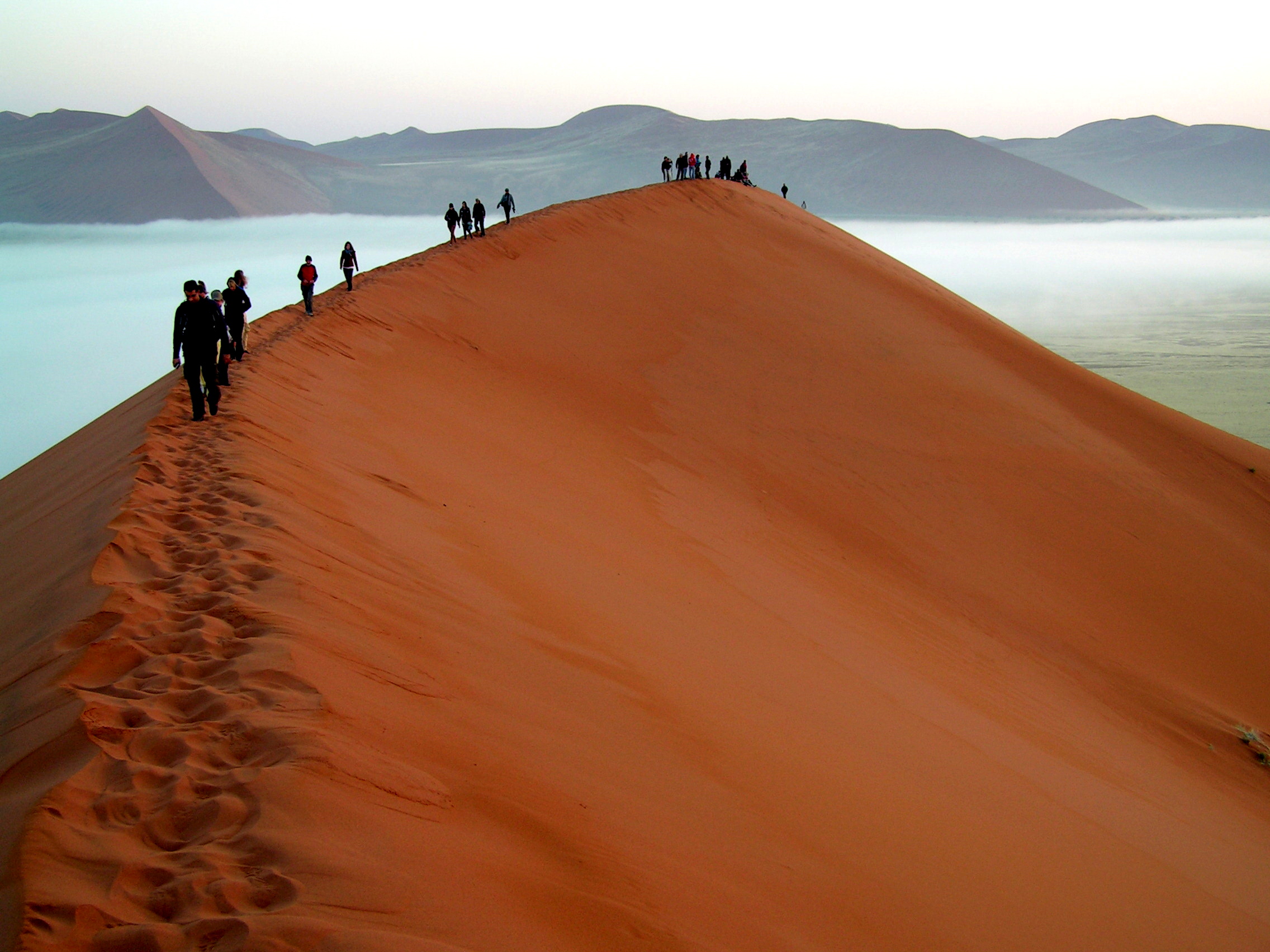
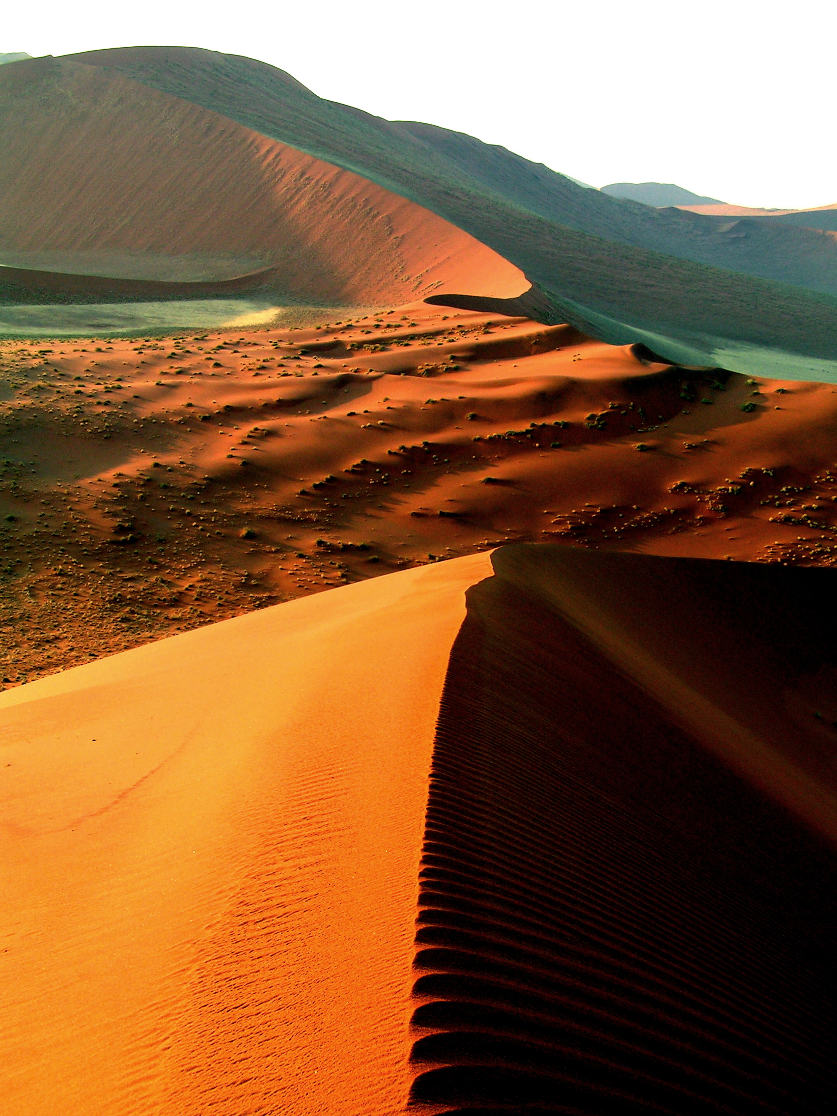
Category Archives: Africa

South Africa, Namibia, Botswana, Zambia, Malawi, Tanzania, Kenya

Swopkomund 2

2 August 2012

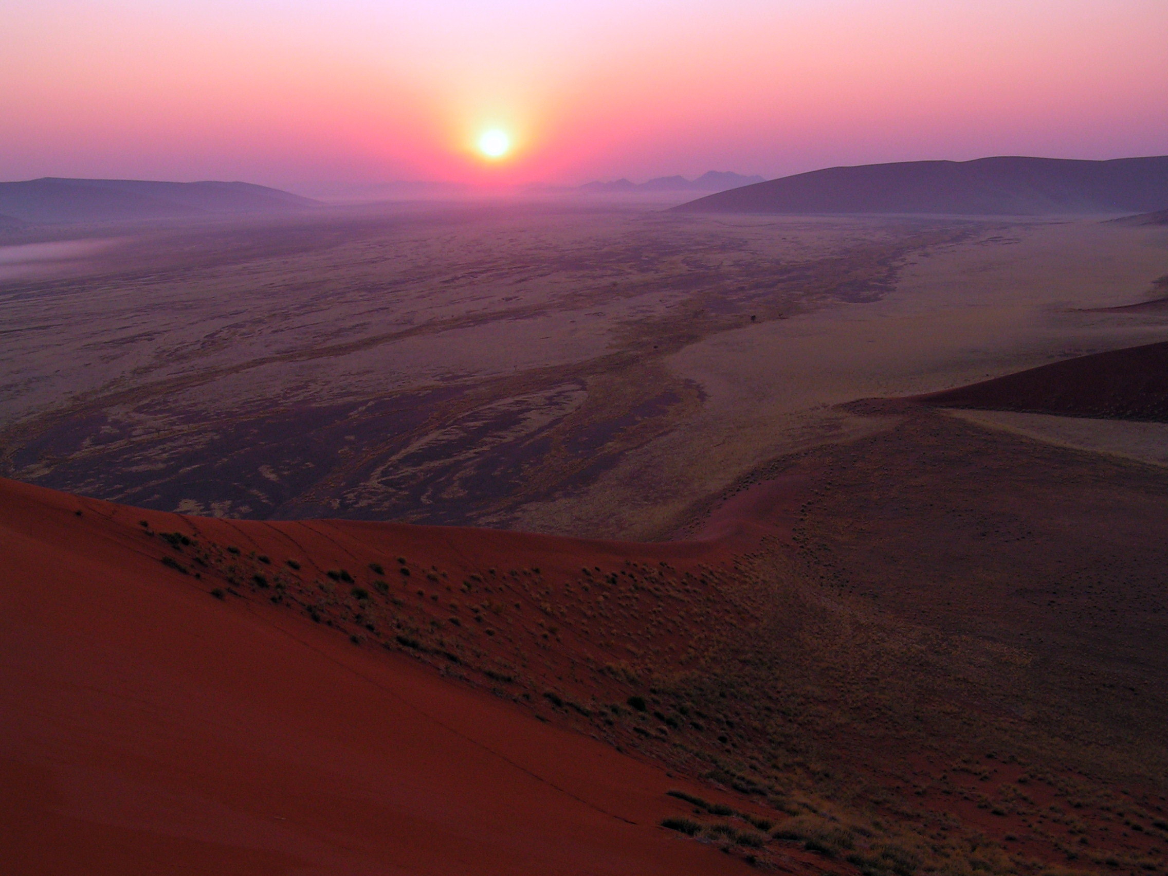
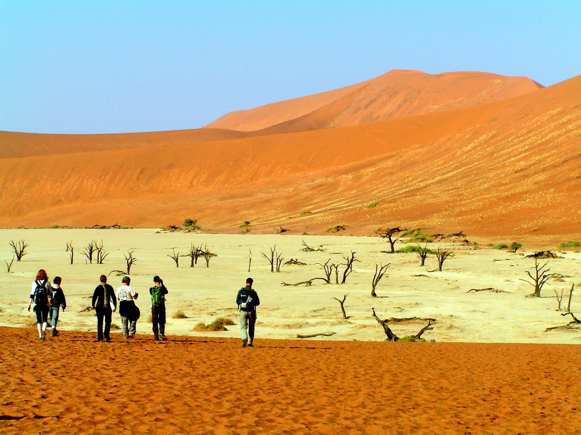
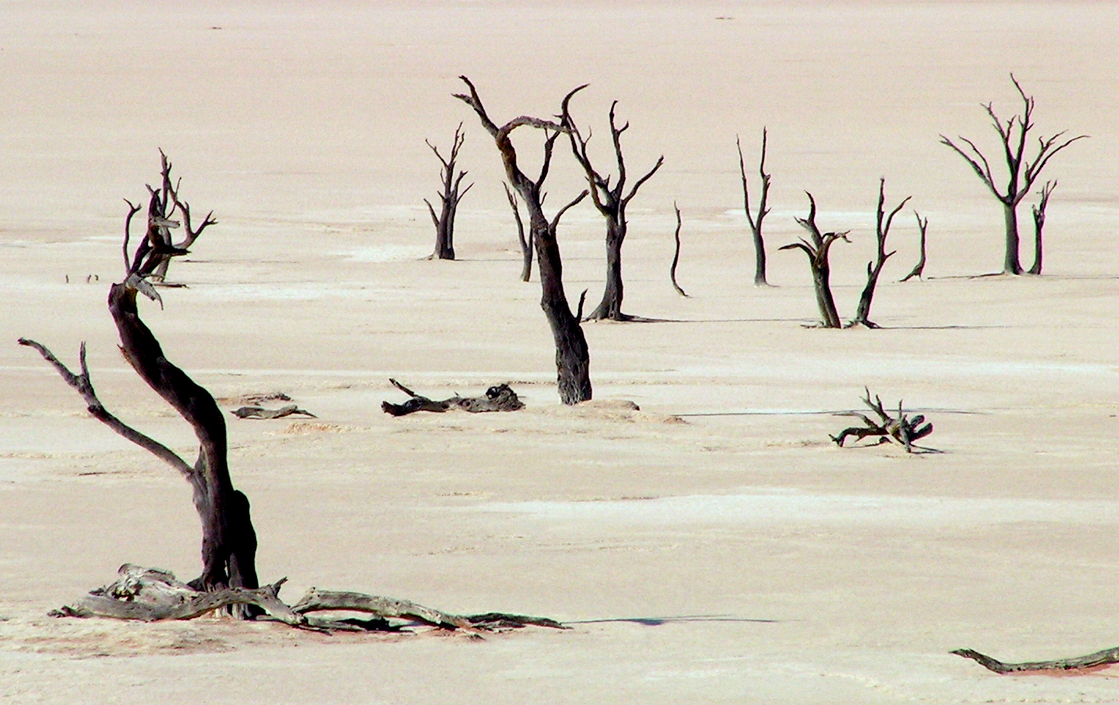
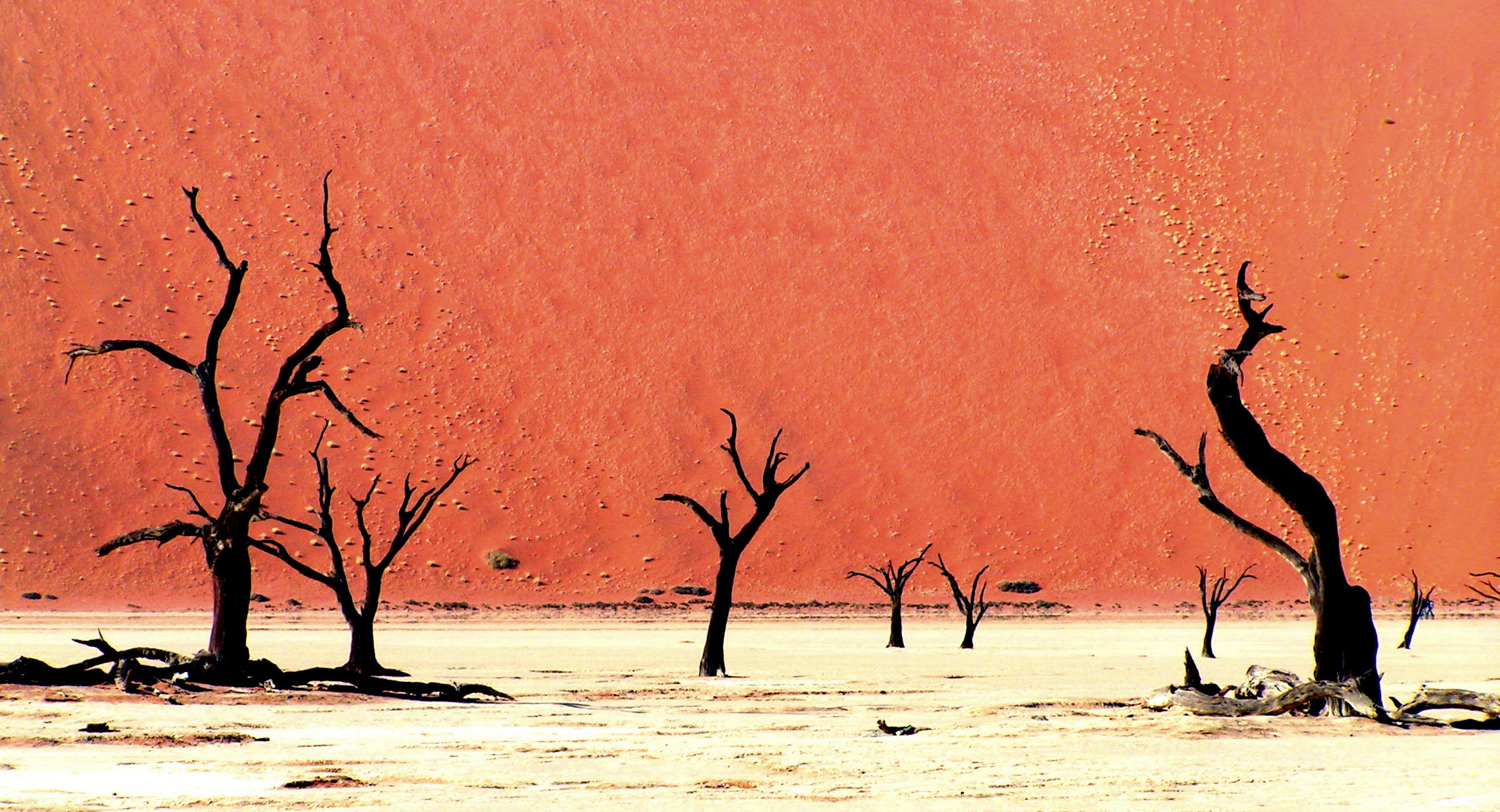
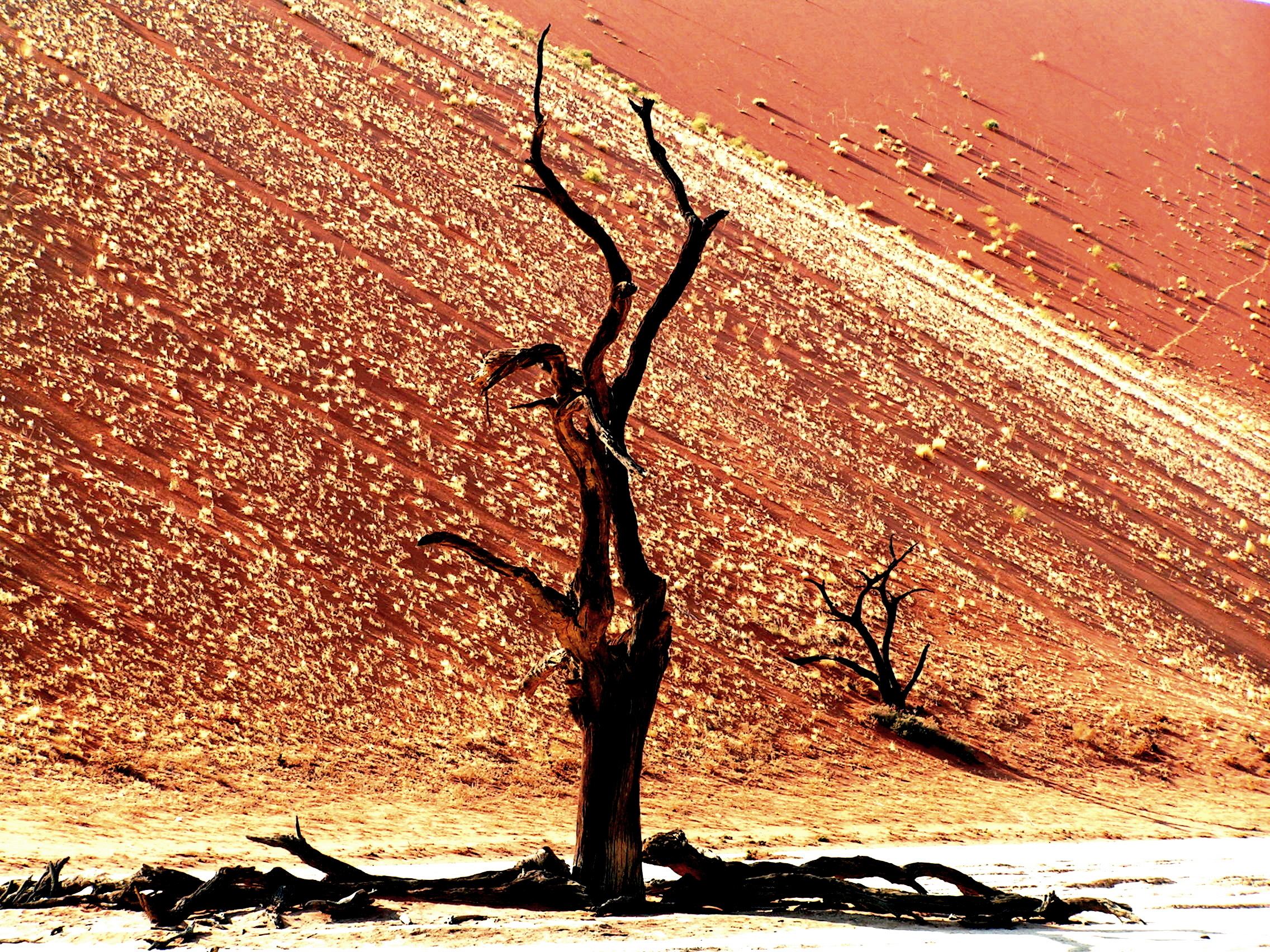
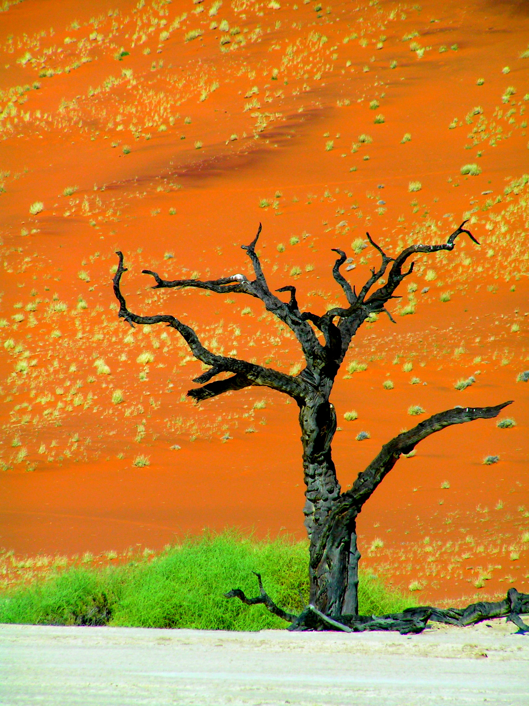
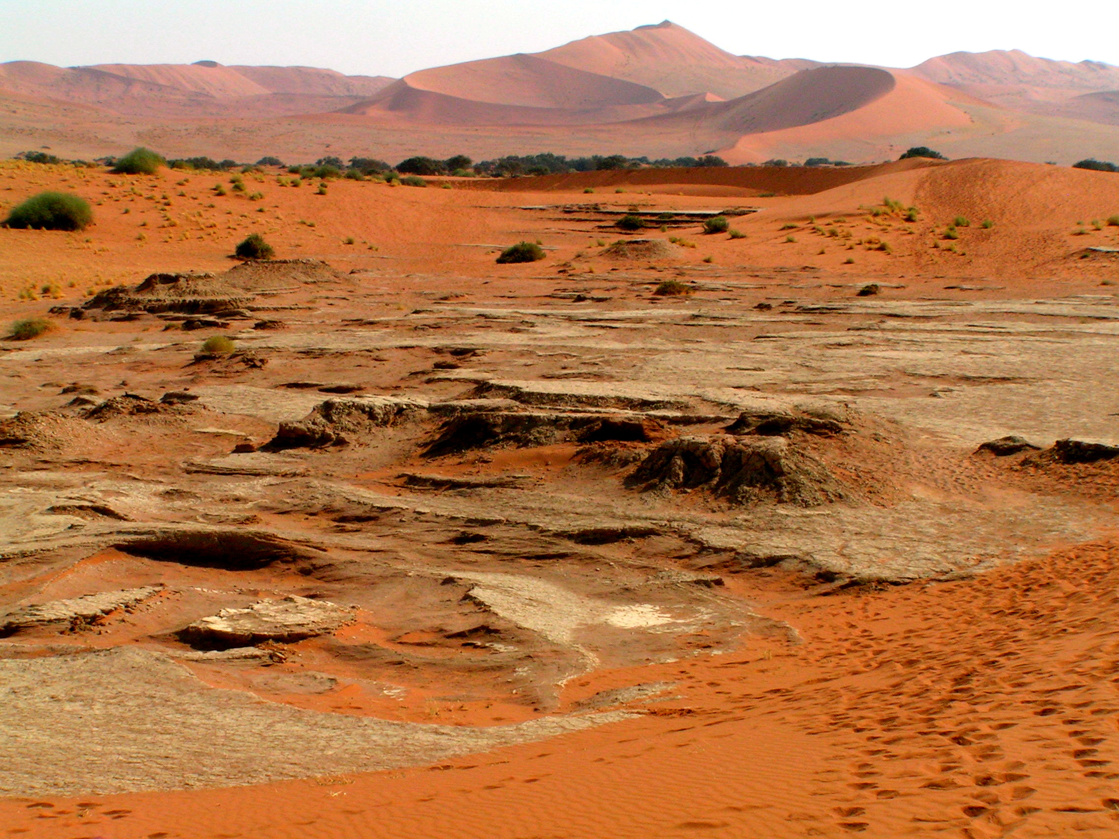
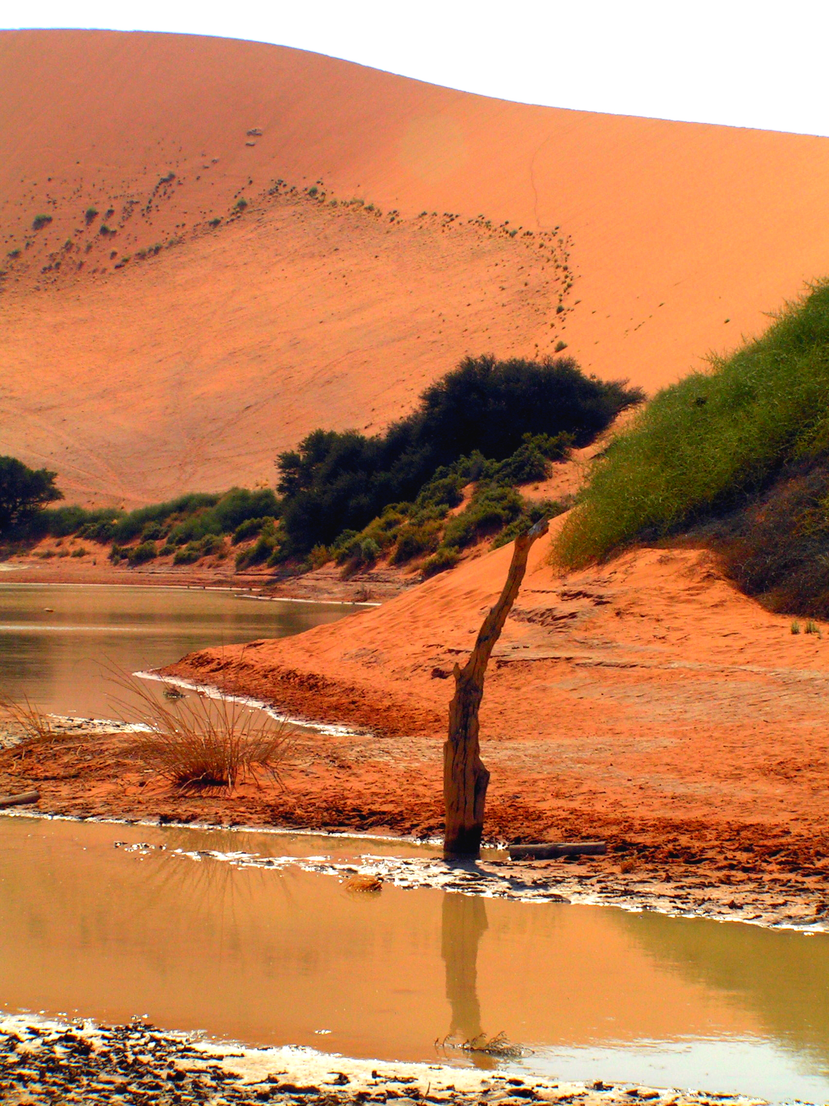
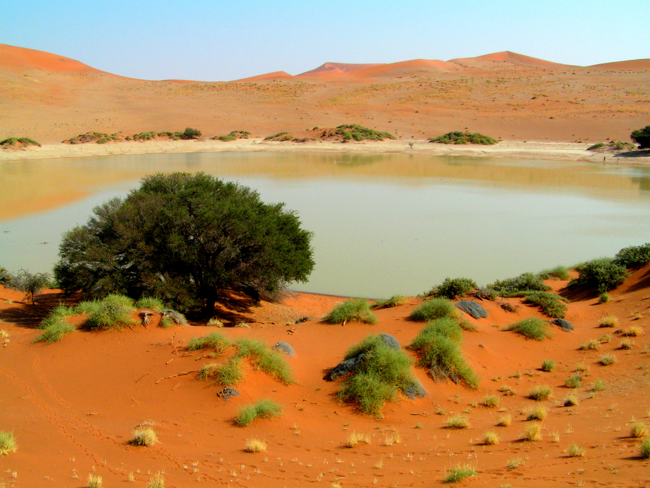
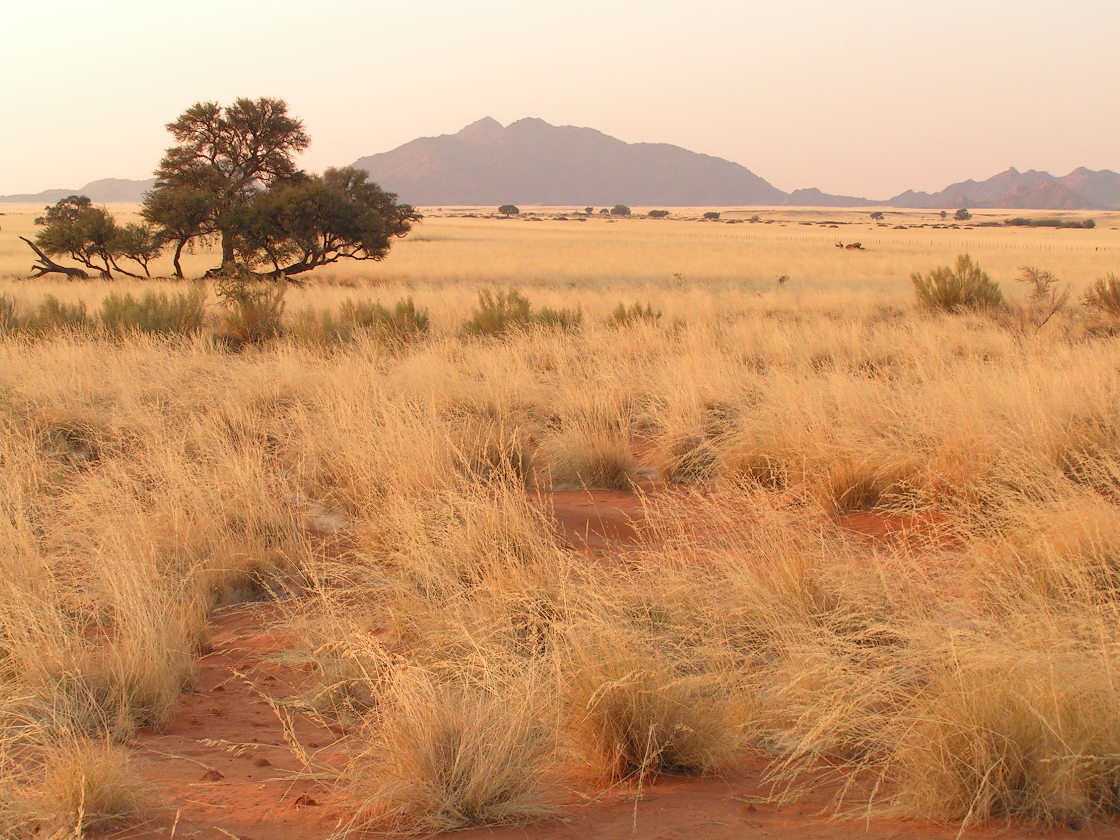
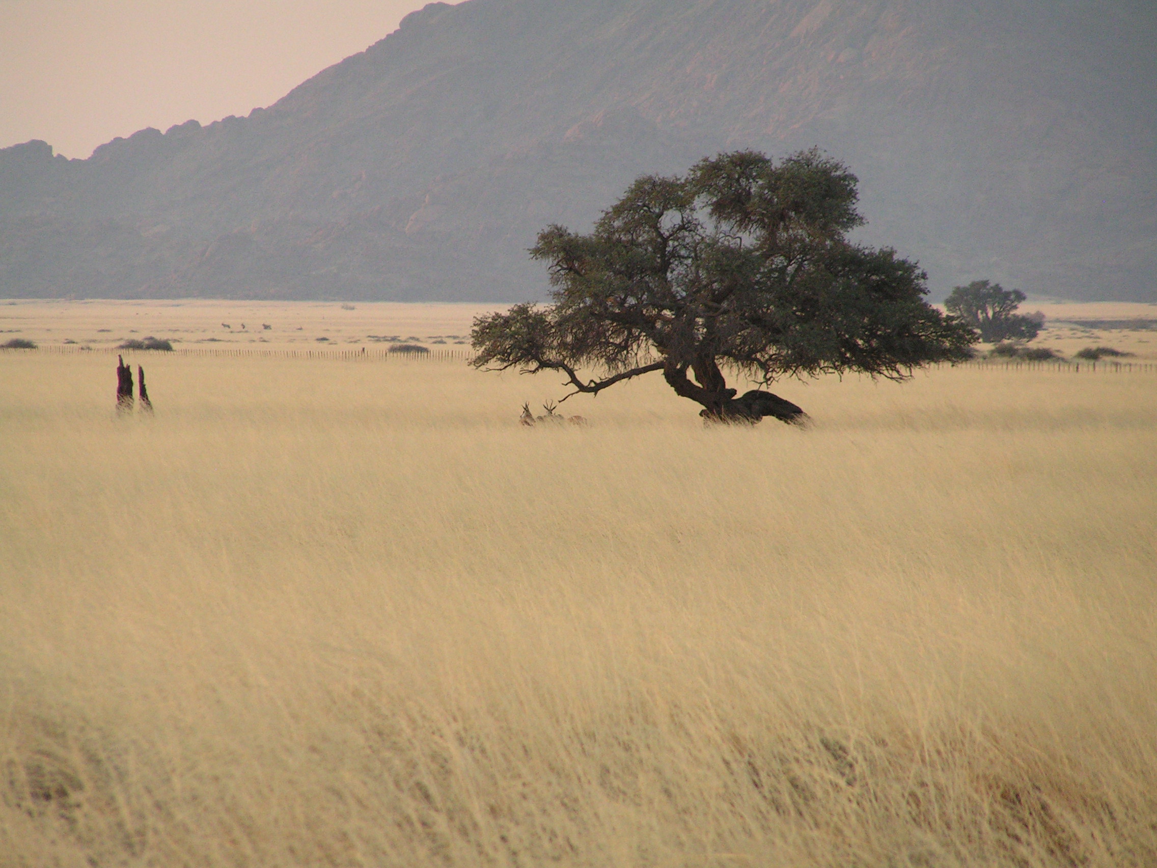
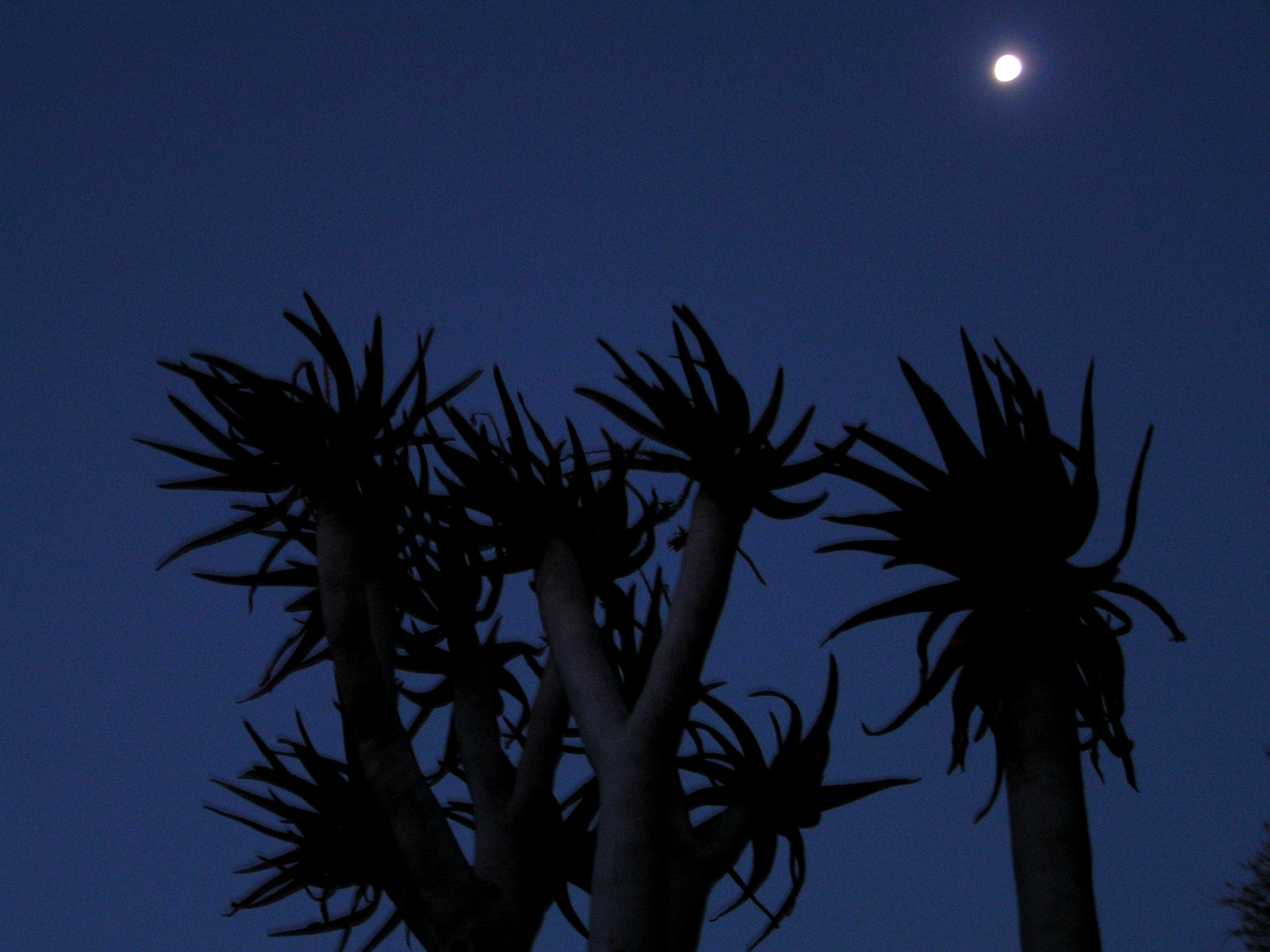
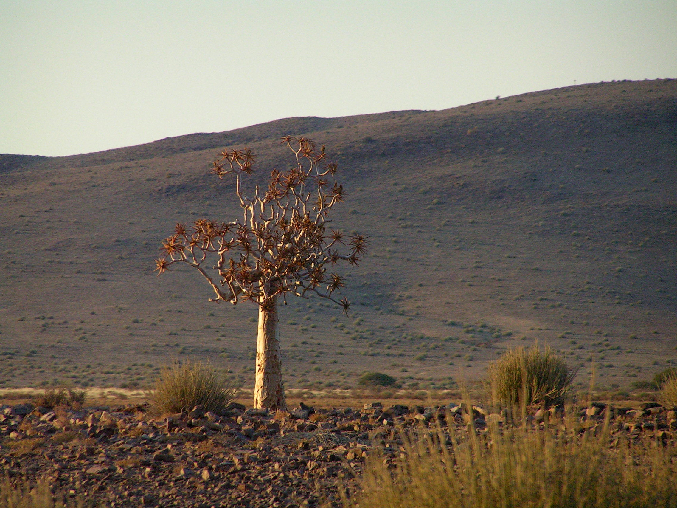
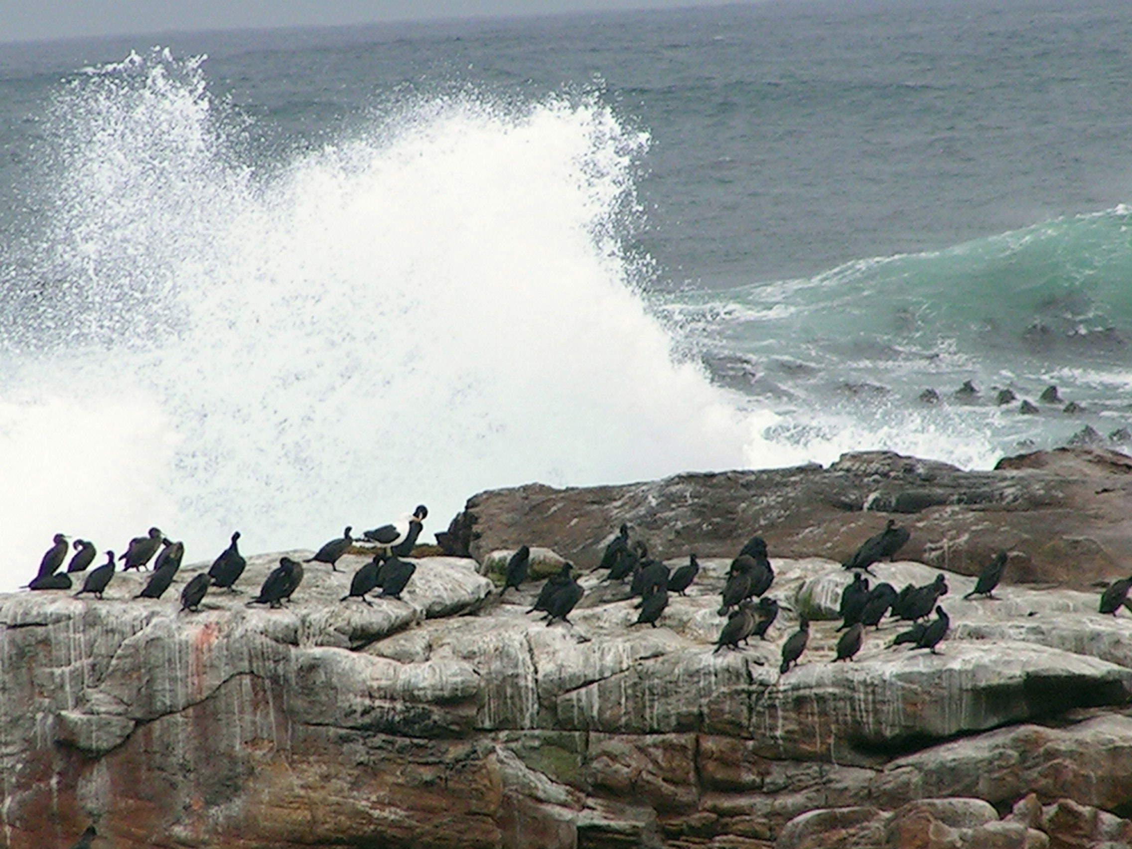
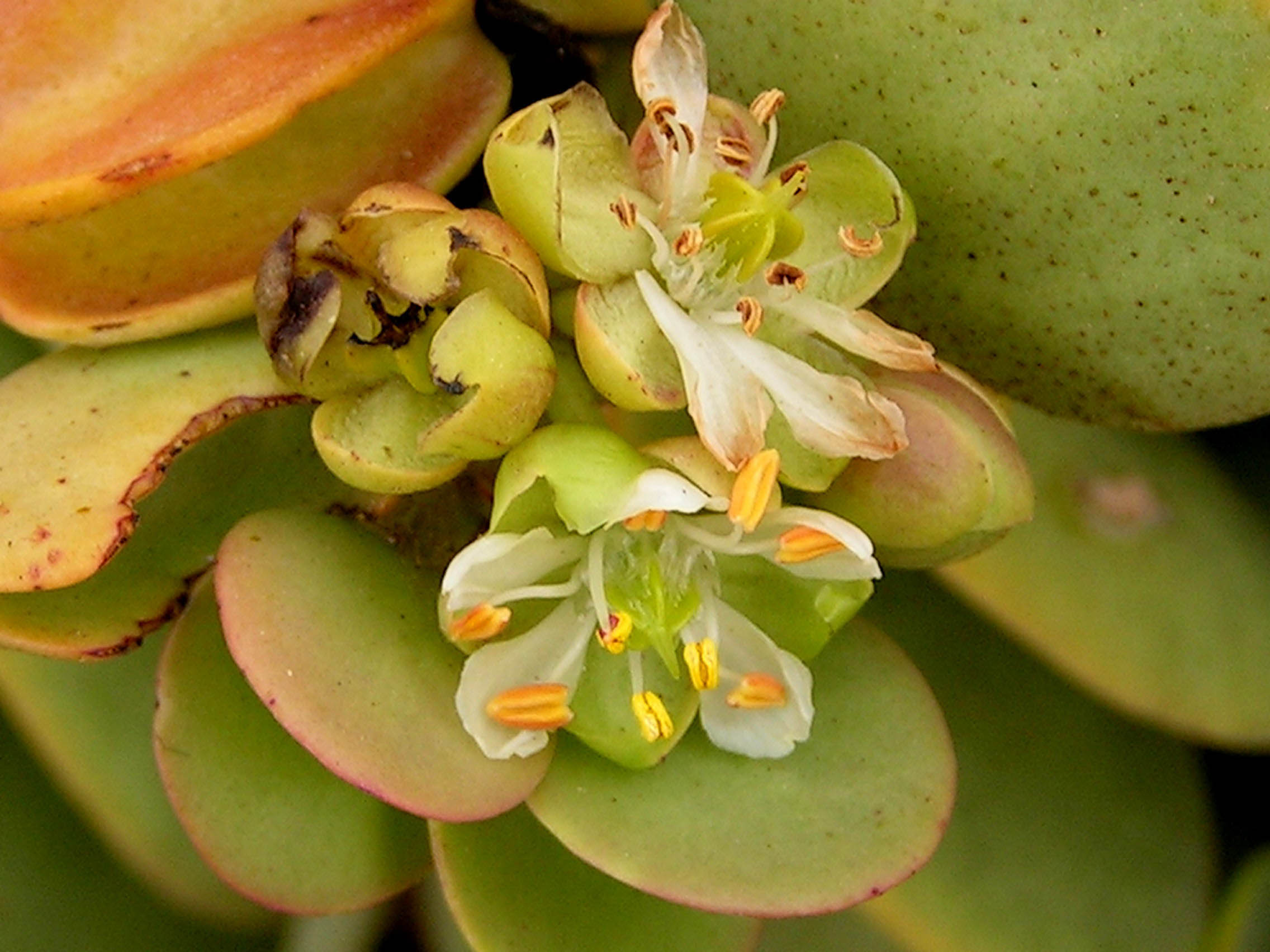
It’s a free day today for both the travellers and more importantly the guides. News at breakfast was not a good one. Our specialized vehicle had more problems. A mechanical or engine part had burst and were awaiting spare parts to arrive. Most of my fellow travellers had planned to do skydiving. There is an assortment of things to do while in town. I choose to get intimate with the desert. A group of us end up with a guide and a FWD and headed into the desert. The trail is almost sandy all the way. It looked totally arid. I can’t imagine life surviving here. Drought resistant plants do survive here. The Dollar Bush is one. Succulent rounded leaves absorb moisture from the air. Nearby was a spindly looking plant. These plants are adapted well to this harsh environment. Rain is very little and sparse. The fog created by the Benguela Current seemed like the only source for both flora and fauna.  In a wide valley, the now dry Swokop River supported a variety of plants including shrubs and small trees. These plants survived by throwing deep roots to tap the underground water. The oasis in turn provided wildlife to thrive particularly birds.

KONICA MINOLTA DIGITAL CAMERA KONICA MINOLTA DIGITAL CAMERA KONICA MINOLTA DIGITAL CAMERA KONICA MINOLTA DIGITAL CAMERA KONICA MINOLTA DIGITAL CAMERA

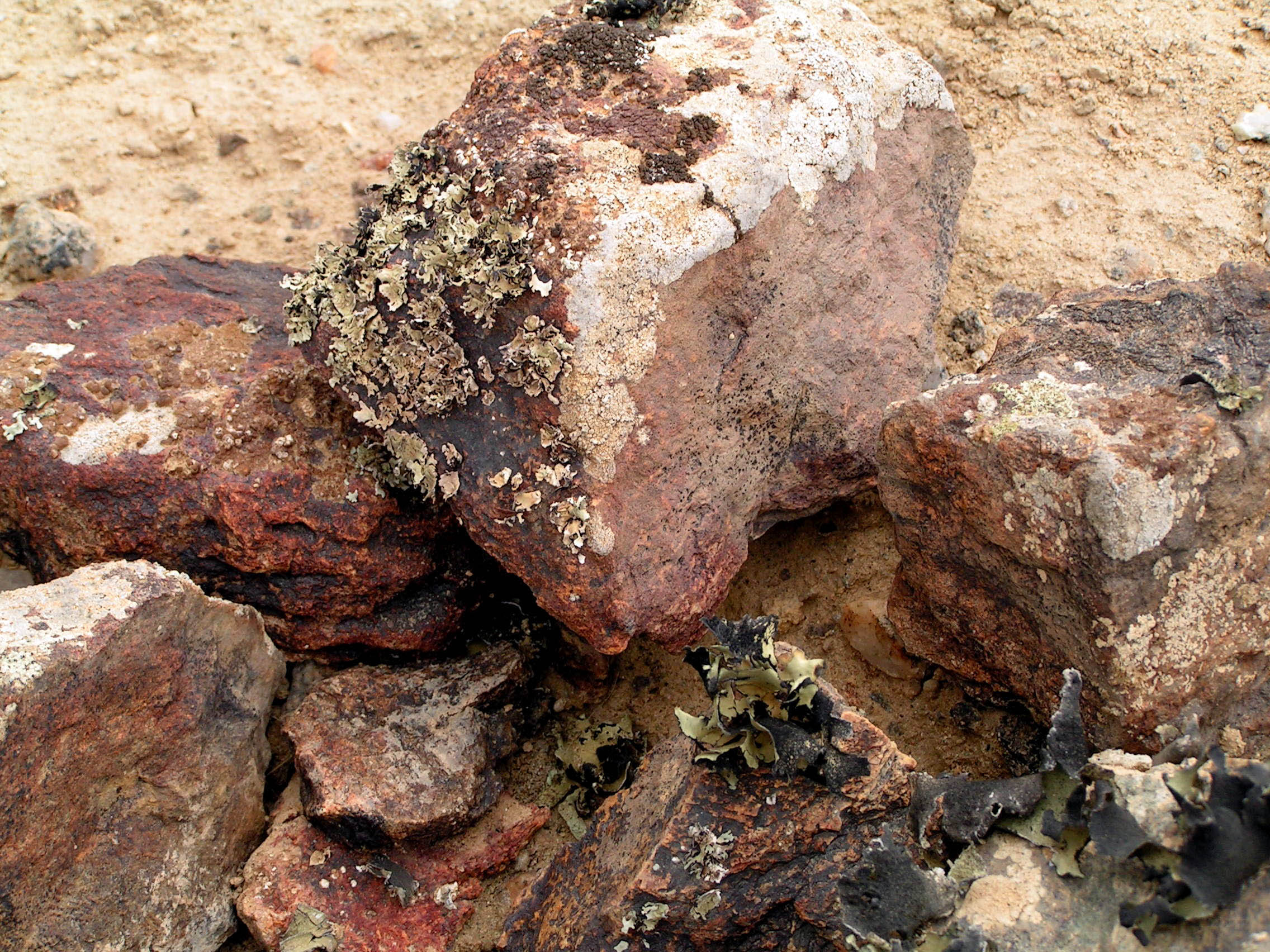
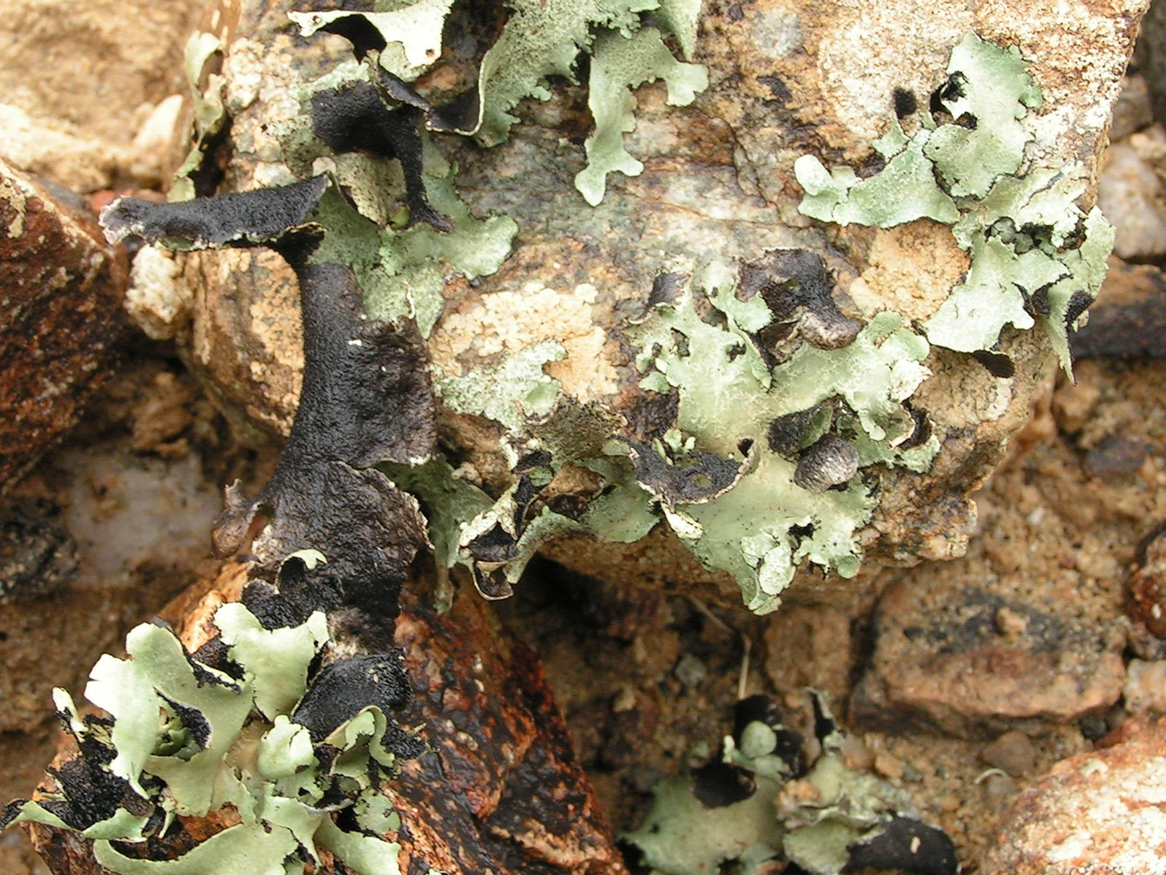
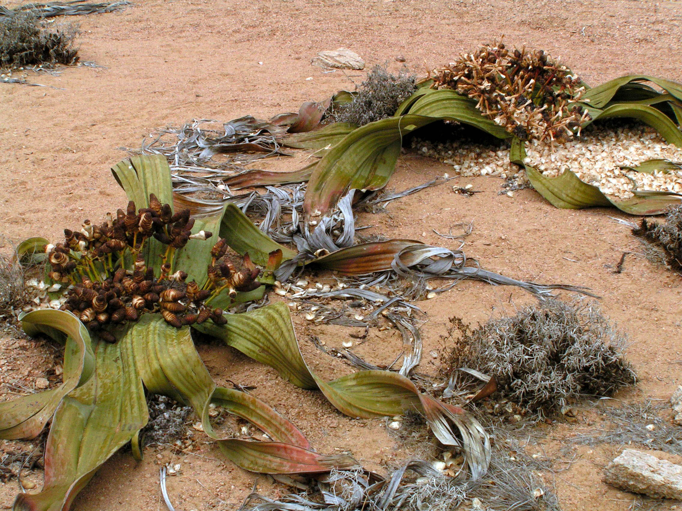
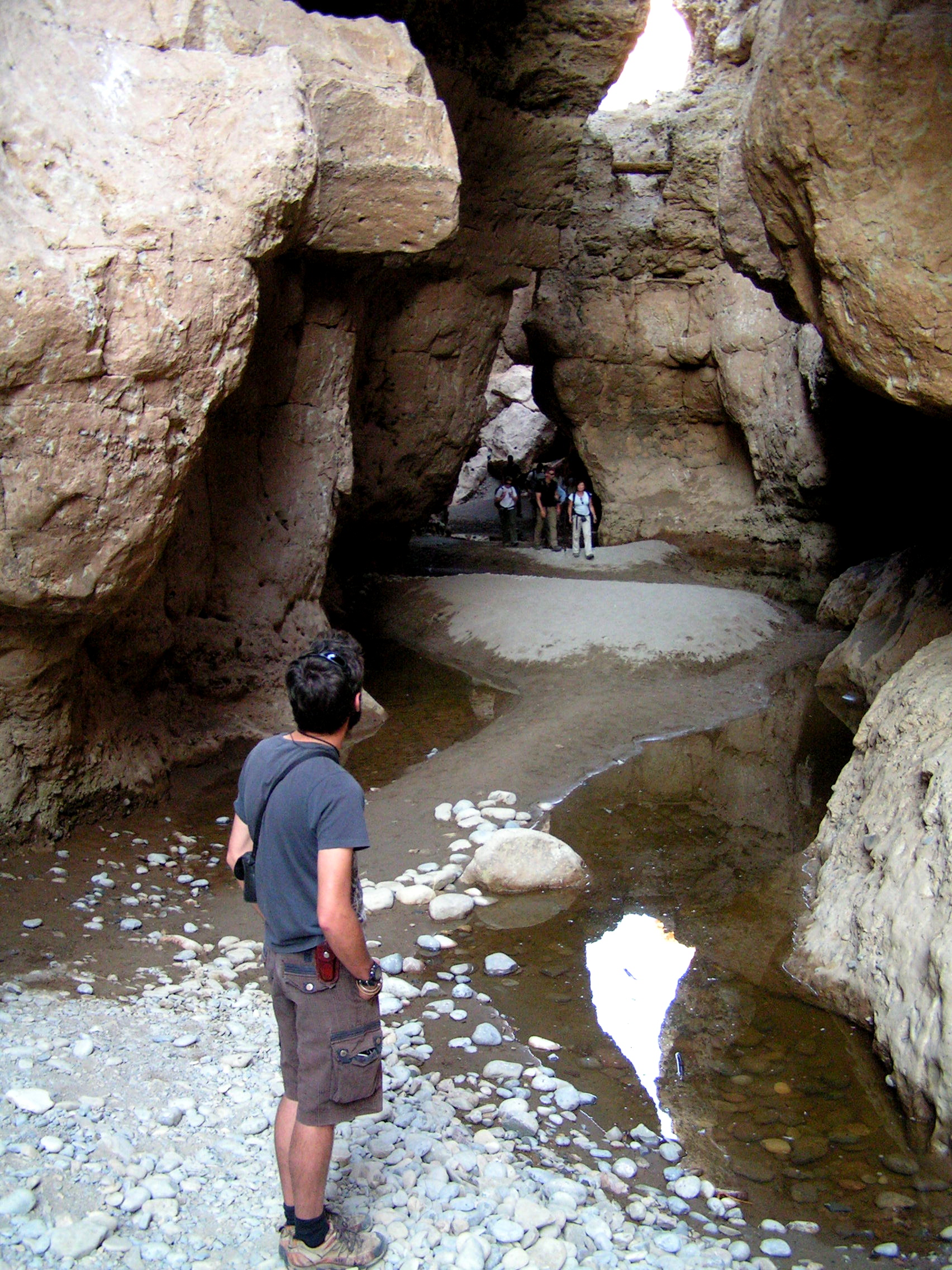
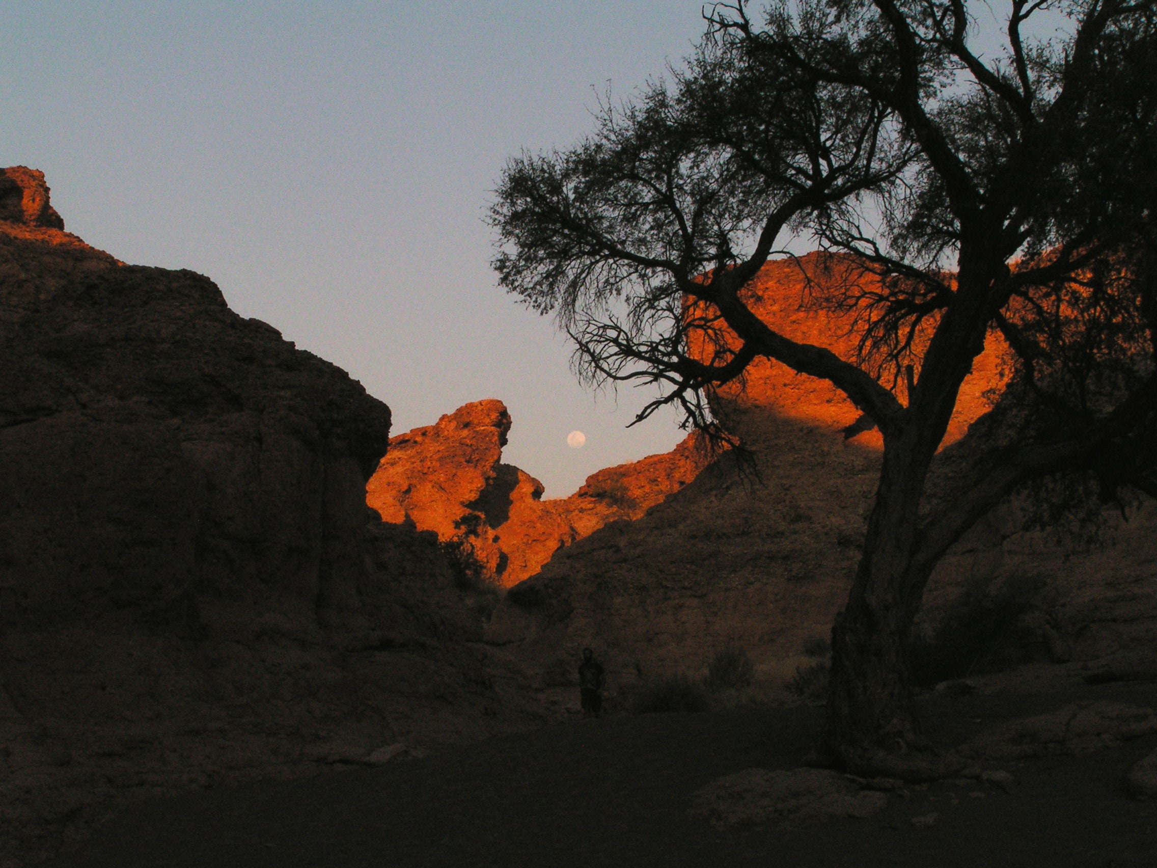
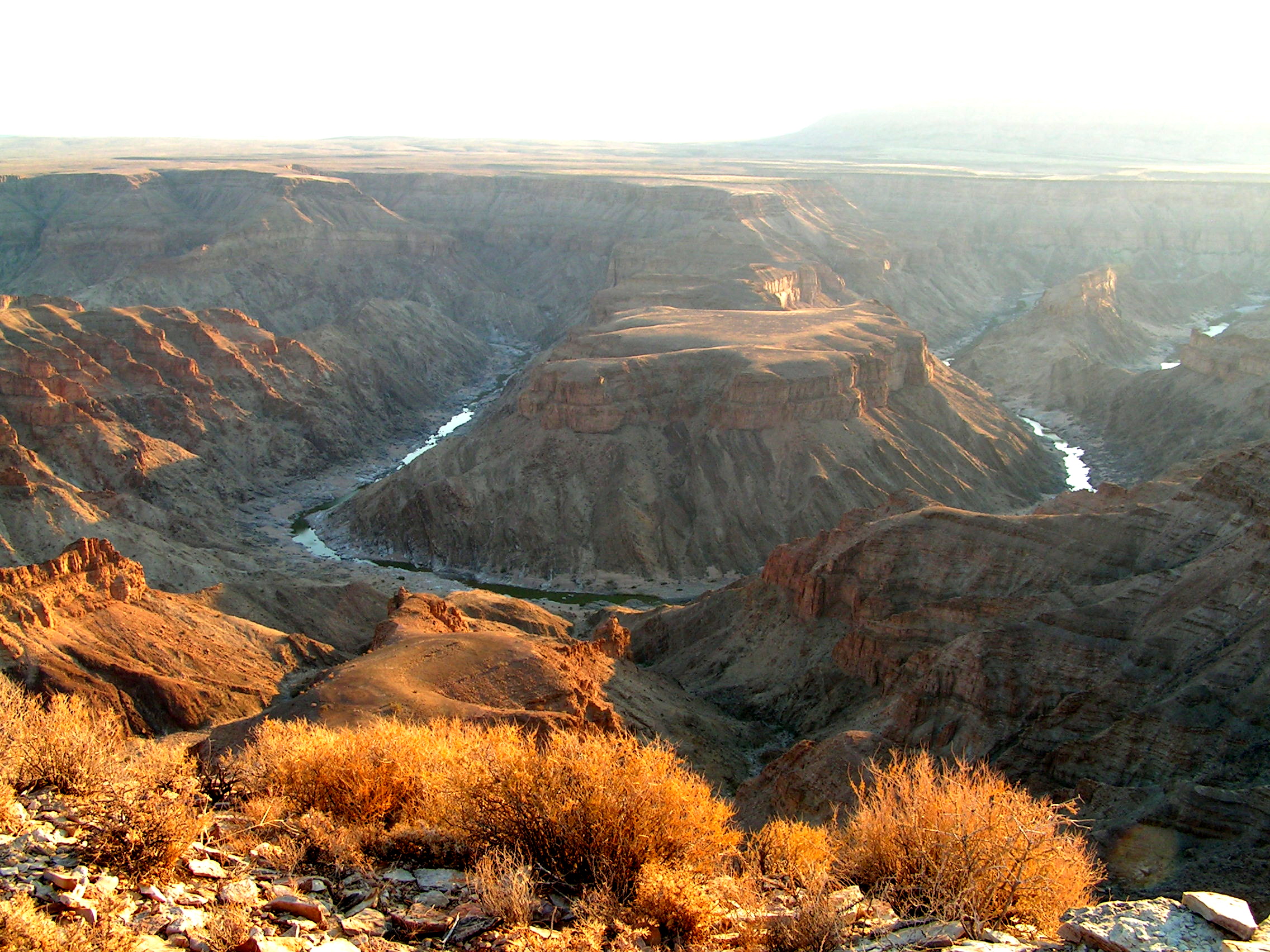
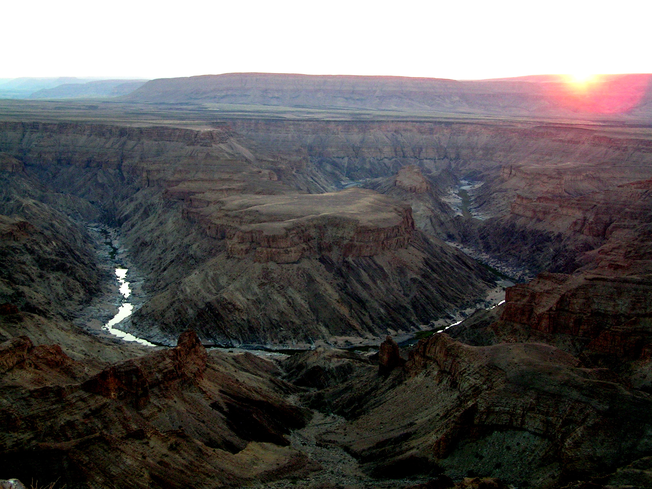
Along the Swokop River was a strange and bare landscape called the Moon Landscape. Soft stones had been eroded by the river leaving behind exposed layers of hard rocks.  At one spot we walked around some boulder rocks. I was surprised to find black fragments of dried lichens attached to the surfaces. When water is sprinkled onto them, like magic, the foliage moved and crackling sound emerged. From shades pale green to bright green, with black under surface. Looking more closely, there seem to be many types around. The desert is not inert at all. A black ridge of dolerite formed on the backbone of the mountains stretched far. This hard rock had remained as erosion had removed the soft rocks. We continued further on the desert sand roads to the witness a rare plant –  Welwitschia mirabilis. These plants are unique to the Namib. Only two leaves are produced in its entire life. As they grow they twist and curl and the edges eventually tear. Its survival is remarkable. Besides the harsh environment, man is assisting its unfortunate decimation. The male and female plants were in flower at this time. The plant also provided a home to a variety of beetles including the tok-tokkie and other colorful insects. In the open planes, wires from telegraph pole stretched to the horizon. Tiny spots of fungus covered vast areas of the arid surface . It is refreshing to witness that the harshest deserts managed to support life in a delicate environment.

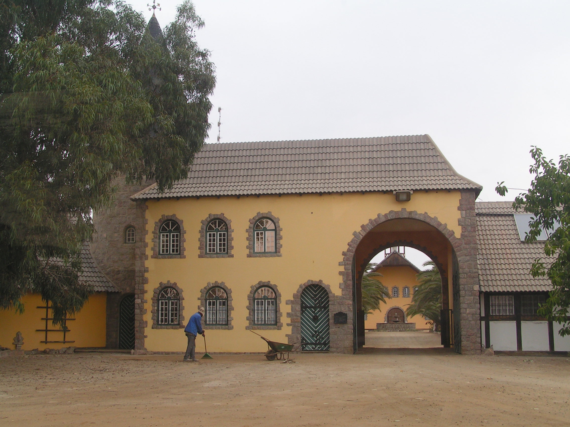
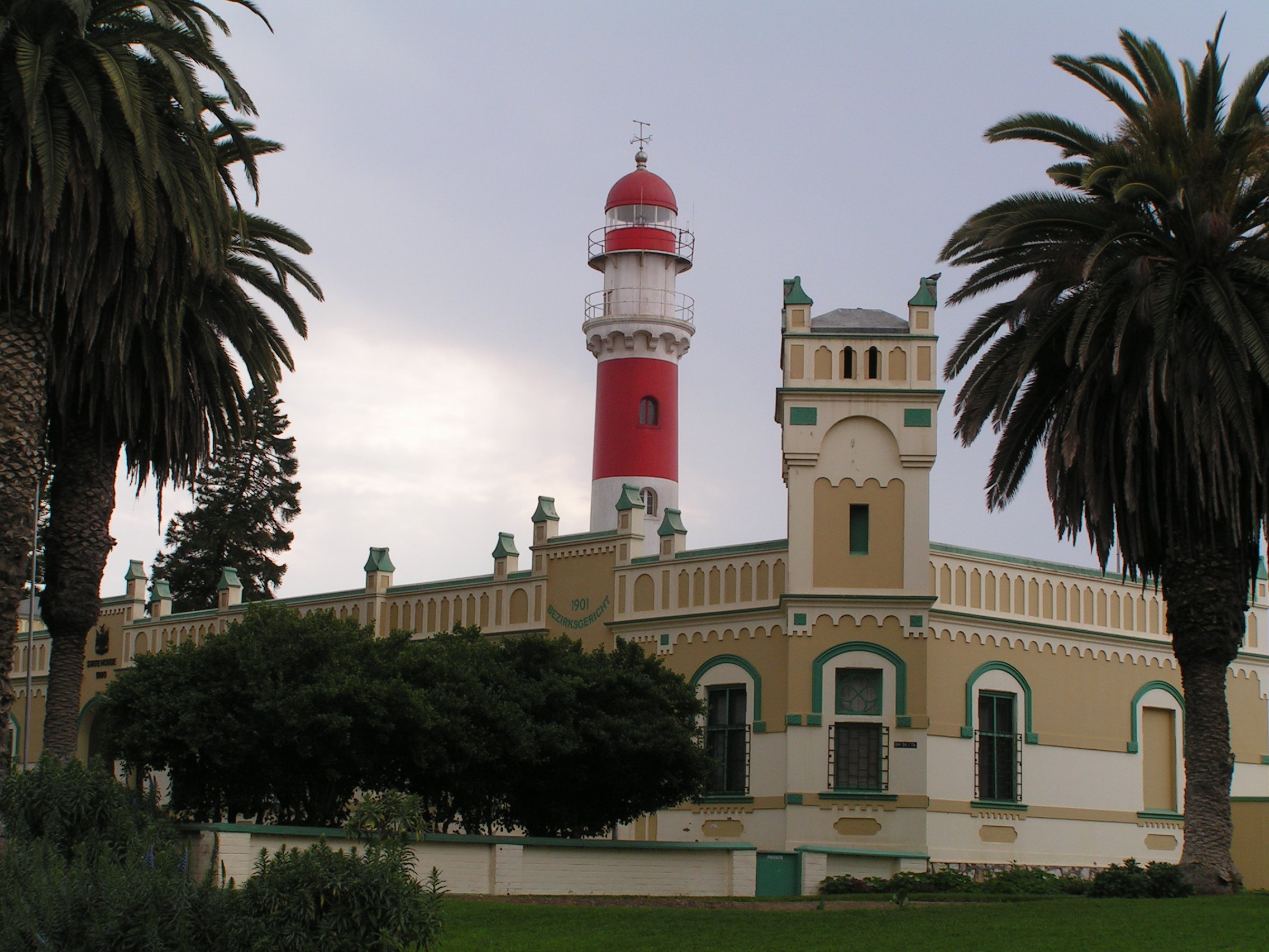
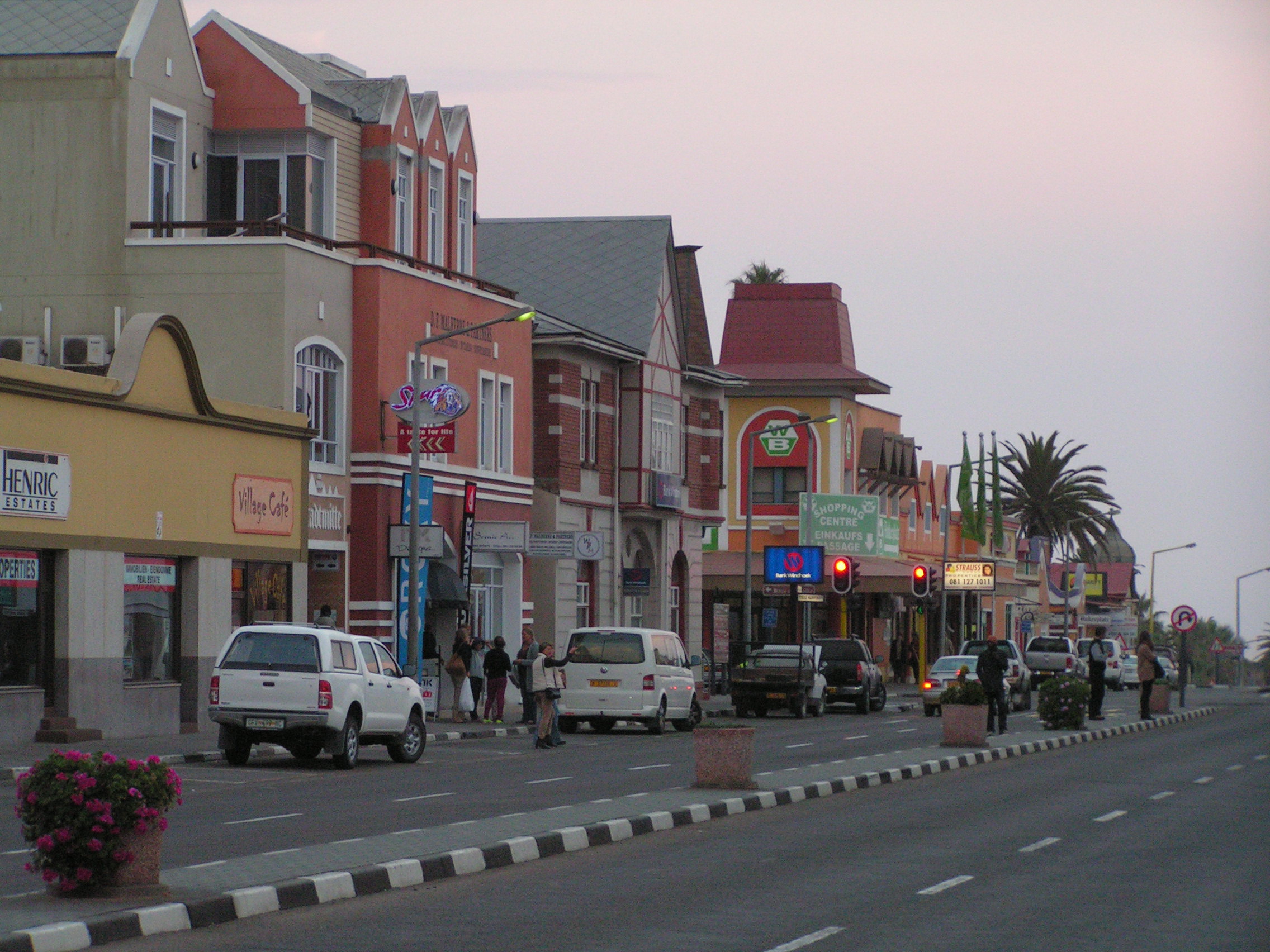
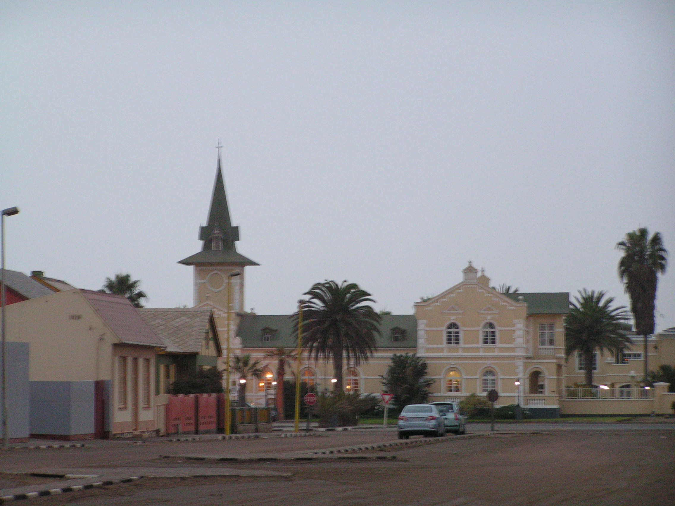
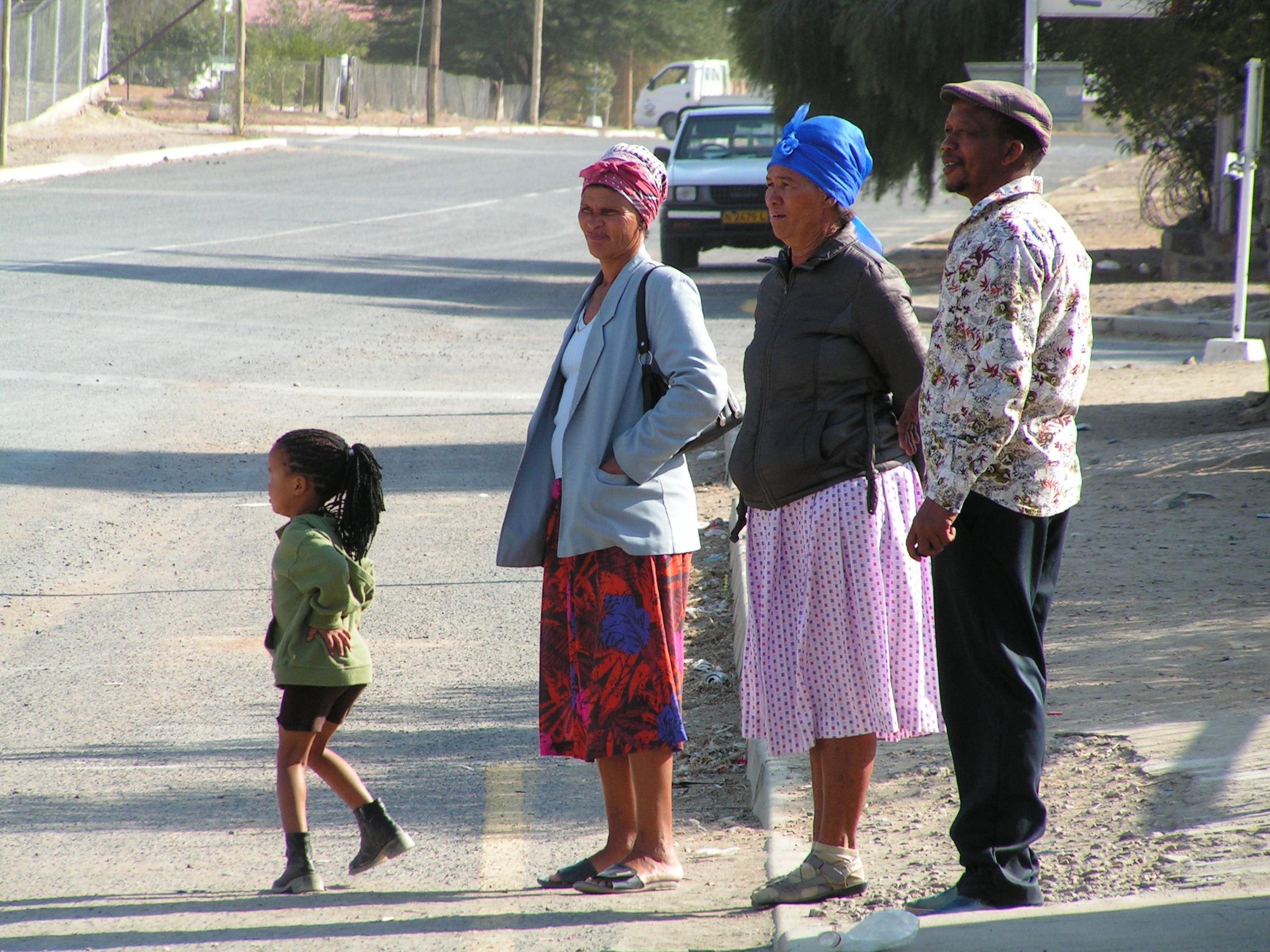
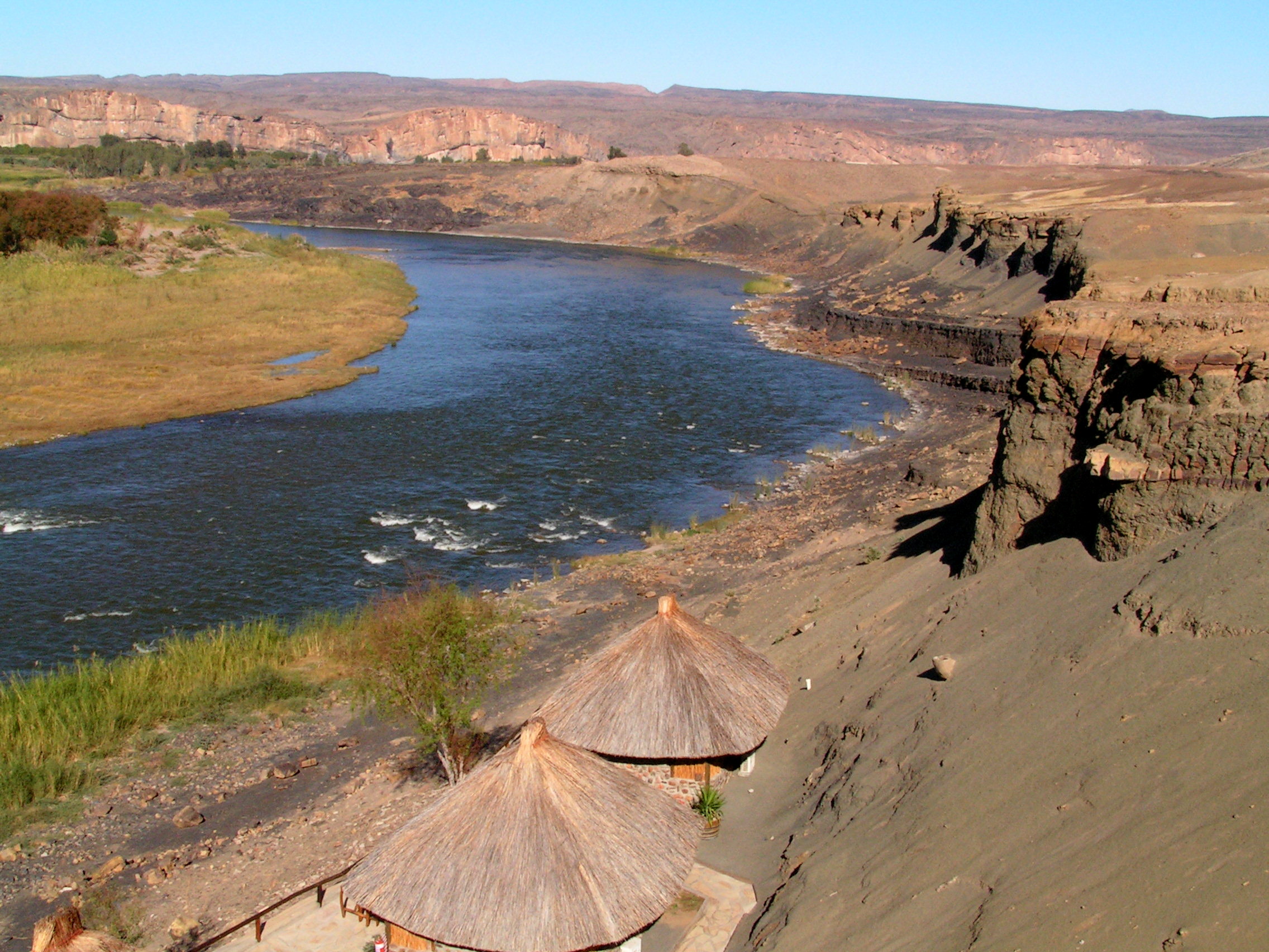
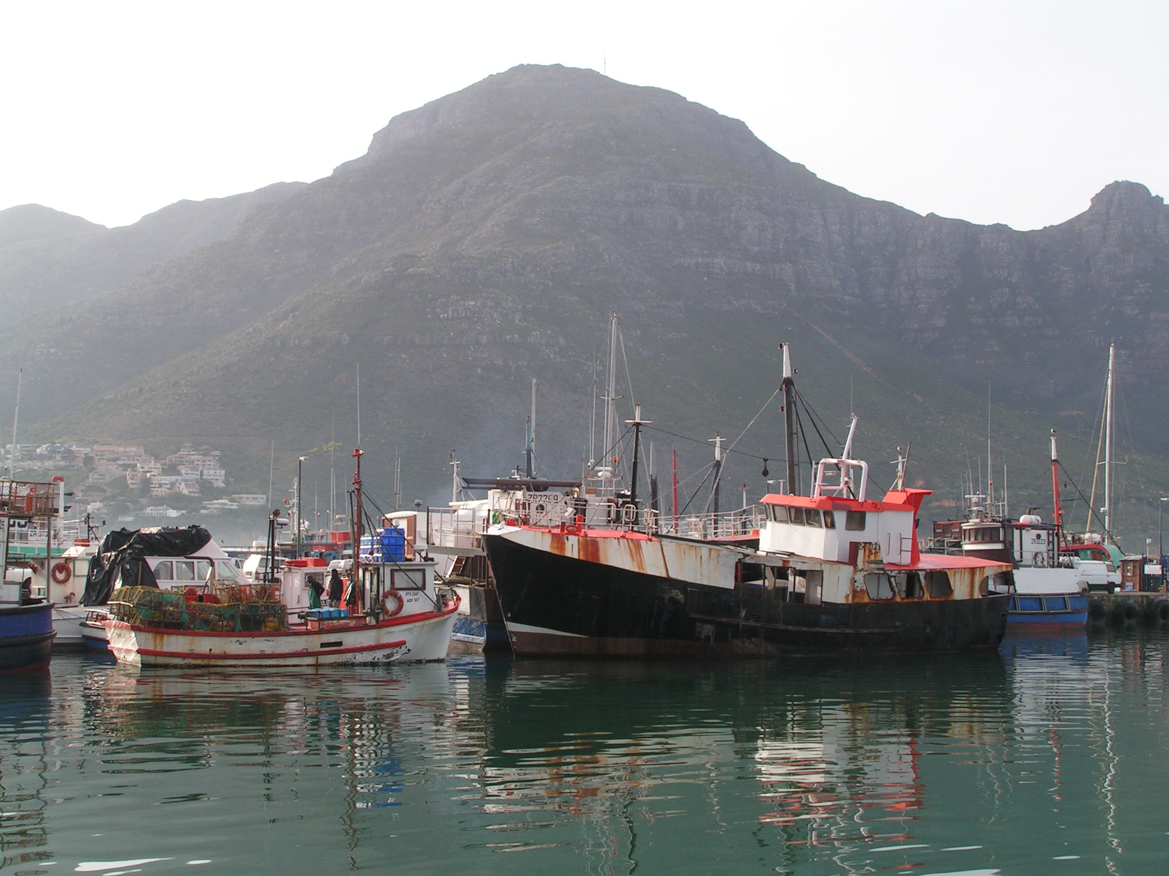
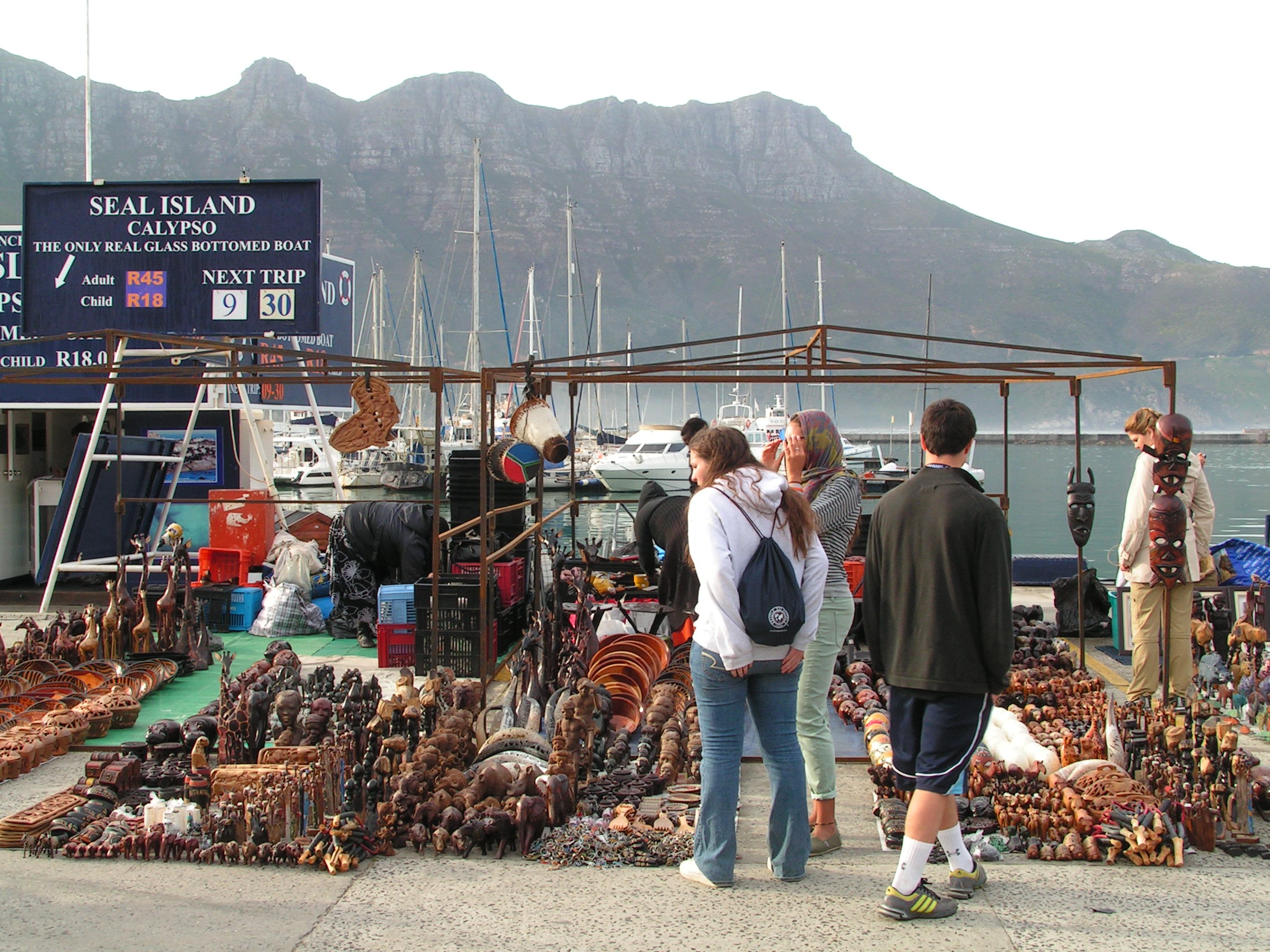
Back in town, I wandered along the coast and came across a group of Himba people making a living selling handicraft and souvenirs under a palm tree. The women had their bodies painted ochre and butter dye. They adorned many jewelries and the hair platted in many patterns. They had chosen to live their traditional way. Namibia is made up many ethnic groups but all seemed get along.  Nearby was another local tribal market. I met our guide Chris. The truck had not been repaired yet!

.

Advertisement

Swopkomund

1 August 2012

Today we headed out of the heart of Namib Desert in southern Namibia towards the skeleton coast. It was a bright sunny day. The heat can be very testing. I wondered about the animals and people whom call this place home. There is some greenery but sporadically. Fiery mountains ranges seem to float above golden grasses of an arid landscape. Spotting wildlife is exhilarating. A small heard of wildebeest foraged on the short grasses. Some distance away, a decent herd of Springbok nervously looked at the passing vehicle. It is simply amazing to see animals live in a natural environment without fences or borders. With the vehicle bouncing rapidly on the unpaved hot desert roads, one window shattered. Chris managed to get a spare attached. However, it continually dislodged just after several kilometres. The red dust spewed into the vehicle. There was some discontent. At the last breakdown, I mentioned to Chris that I had a duct tape in my pack. This incident had already slowed us down by an hour. All the baggage was removed from the truck and managed to get my tape. This was perhaps our last hope. Thankfully it held. Never leave home without a duct tape.

 To survive in the Namib is astonishing. The human endurance is equally amazing. Small outpost like settlement dotted the desert roads providing essential lifeline to travellers – fuel, restocking food supplies and repairs and maintenance.  Solitaire was such a town. It looked desolate. Shells of cars lay rusted in the compound. However, the high point here is the best place to sample apple pie in these parts of the world. A bakery dished out some hot steaming pies and other delights. It was a real treat.

We had reached the imaginary line of the Tropic of Capricorn. Under a blazing afternoon sun, we stood at the signage like we had discovered a new country. It was satisfying just knowing. The trail continued pass dried riverbeds at Gaub and Kuiseb pass. Deep rooted trees survived. These are desolate places of rugged hill and canyons. Winding through, we finally reached a paved road. The noise of the tyres against the unpaved roads of the desert became silent. A loud bang brought the vehicle to a stop. We had a flat tyre. This is the fact about travelling in the wild. We joked; the tyres couldn’t handle the wonderful smooth paved roads after days in the bouncy desert roads. Monumental sand dunes, a railway track and a nearby airport kept us company. With the tyres fixed, we reached Walvis Bay on the Atlantic coast in the late afternoon. A decent sized town at last. The views of water, although gray, were soothing. Namib is fascinating, colourful and although arid is certainly alive in many ways. Lesser flamingos feed in the shallow waters at Pelican Point surrounded by manicured gardens, modern housing and a thriving port. On the fringes of town, the in avertable advance of the reddish desert sand lay several feet high against the barrier walls of houses.

After lunch, we headed into Central Namibia to Swopkomund. The town is surrounded by the desert on one side and the Atlantic on the other. It is Namibia’s premier beach resort and has a unique German colonial architecture. Palm lined trees, neat wide clean roads, street markets, a promenade along the beach and colourful architecture greeted us. All the trimmings of comfort awaited us at a hotel. A group of us headed off to a restaurant on the jetty dining of fresh seafood with the waves crashing against the concrete pillars and the long sandy beach. The proximity of the desert, the heat and dust had faded away for now.

KONICA MINOLTA DIGITAL CAMERA               KONICA MINOLTA DIGITAL CAMERA KONICA MINOLTA DIGITAL CAMERA KONICA MINOLTA DIGITAL CAMERA KONICA MINOLTA DIGITAL CAMERA KONICA MINOLTA DIGITAL CAMERA KONICA MINOLTA DIGITAL CAMERA

Namib Naukluft National Park

31 July 2012

We were up early, before sunrise. It was a relief that we were to spend another day here at Sesriem. No dismantling of the tent. The park gate opened at around 5am. There was already a queue of vehicles ready to enter the park. Once in the park, it seemed like a race on the desert roads to reach ones destination. Chris was good and relaxed. I had confidence in his driving skills. We were at Dune 45. Although dark, it was a colossal, over 150m high. It resembled a pyramid and looked formidable. Some trekkers were already walking on its winding spine. The sand was loose. It was still cold. On the eastern horizon, the sun was rising.  From the top of the sand dune I witnessed an amazing scene unfold. Two life giving force, light and water from opposite directions, diffused at the base of Dune 45. The first light on my face was comforting. Sunlight from the east filtered through warming the land.  On the western horizon, a low dense moisture laden mist gracefully move inland brought in by the Benguela Current from the coast off the Atlantic.  The dune’s surface took on a deep reddish glow and the tough short grasses on the desert floor illuminated a golden hue. The western slopes of the surrounding dunes were darkened in contrast. It was a surreal and wonderful spectacle. The mist continued further inland as the rising light transformed the inert desert sand into beautiful and unearthly colours – mainly hues of red, orange and gold. Trekkers snaked up the length of this dune crescent’s spine and silently watched nature’s gifts to this unforgiving environment. As daylight emerged, the contours now more defined had myriad of patterns and form. Numerous other high dunes appeared all over. Some looked much higher. The desert stretched endlessly. Dune 45 continued further and curved inwards and outwards resembling a mountain than a dune. Here, nature is continually redesigning this extraordinary landscape. The sand deposited here in the Namib originated from the Kalahari Desert. The Orange River that meanders through Kalahari deposited the sand at its mouth on the Atlantic coast. From here, the Benguela Current carried the sediments north and the winds helped to deposit this sand inland into the Namib Desert.

KONICA MINOLTA DIGITAL CAMERAKONICA MINOLTA DIGITAL CAMERA 111 KONICA MINOLTA DIGITAL CAMERA KONICA MINOLTA DIGITAL CAMERA

Only on the decent did I realize the steepness of the dune. However, it is much easier on the decent that on the accent especially with the cold air. A nice hot breakfast waited at the base of Dune 45. Crows lingered nearby on a leave-less tree scavenging for food.  On the valley floor, perhaps a dried river bed, I was surrounded by towering dunes of varying forms. Not all are crescent shaped. The shape is carved by the direction of the wind. Namib Desert is considered as the oldest desert in the world. Our vehicle left behind a trail of desert dust. We reached a parking area. The sight of lifeless trees but standing covered in mist was quite eerie. This is Sossusvlei. From here, we jumped onto a tractor. A short walk past some hardy Inara plants with ball like fruits, we reached Deadvlei – Dead valley. From a distant, the elliptical shaped white salt pan with blackened lifeless trees looked unreal. It was massive. The white salt pan floor, the charred upright branched trees and flanked by monumental orange and red dunes was surreal. The nearest, Big Daddy is over 300m high. Shadows emerged and the colours of the background dunes and pan floor also changed with the light. It is remarkable how these trees had once survived in this oasis. The Tsauchab River that once flowered here is now blocked by the advancing dunes. On rare occasion, apparently there is water here. The Acacia or Camel Thorn trees are over 800 years old. They are chard from the unrelenting sun and preserved by the dry desert air. Patterns formed on the clay’s crust.  Although picturesque, I was saddened by the fate of these trees. Green shrubs survived from the little moisture from the air and probably ground water.

KONICA MINOLTA DIGITAL CAMERA KONICA MINOLTA DIGITAL CAMERA KONICA MINOLTA DIGITAL CAMERA KONICA MINOLTA DIGITAL CAMERA KONICA MINOLTA DIGITAL CAMERA 122

Nearby is another valley. Although the dunes here were smaller in comparison, the pan here held water. A lone lesser flamingo fed undisturbed. Acacia and small shrubs thrived in this area. Lizards moved quickly across the red sand. It was amazing to see water in this arid desert where rain is almost no existent. Groundwater seeped from underground. Green trees and shrubs, a sight for sore eyes, survived in this uncompromising environment. This is certainly a life giving place for the small but thriving wildlife including Oryx and Leopard. All plants and animals in this desert lived on the edge of death.

KONICA MINOLTA DIGITAL CAMERA 124 KONICA MINOLTA DIGITAL CAMERA

We left Sossusvlei and headed back to Sesriem camp towards Sesriem Canyon. It was late in the afternoon. At the edge of this rocky land, I could see part of the canyon deep below carved out by the now dry Tsauchab River.  Sesriem in Afrikaans means “six belts”. In those days, trekkers would tie up six belts of oryx hides and lower it with a bucket to fetch water from the canyon. The canyon sedimentary walls were about 30m deep in places. Pools of water remained in the winding canyon. Trees enjoyed moisture from underground water in this cool environment. The sun was setting fast. Simultaneously, a full moon was rising in the east. The late evening glow of the canyon walls was quite magical casting shadows and glowing surfaces. The fiery red sun set behind sandstone mountains across a grassy plain. The bright full moon rose from the eastern horizon. Time to head back to camp.

KONICA MINOLTA DIGITAL CAMERA KONICA MINOLTA DIGITAL CAMERA KONICA MINOLTA DIGITAL CAMERA KONICA MINOLTA DIGITAL CAMERA

Namib Naukluft National Park – Sesserim

30 July 2012

It was chilly this morning as I dismantled my tent. I could smell coffee nearby. Dishes need to be done, tables dismantled and folded, waste collected and disposed. Getting all the gear packed and stacked into the truck is now more organised. This overland journey is participation camping . All participants chip in to do the daily chores. Alliances are formed by the way individuals contribute! Seating in the transport is random to ensure no preferences are given. Getting along over the next 20 days will be determined by the give and take attitude. Unfortunately some take a little more than others. Group travelling is such. A small group helps.

From the southern Namib desert, we head north. Namib desert is the oldest desert in the world. As the journey continued on gravel roads, the landscape continually evolved. The barren landscape is dotted with the tough Acacia and Camel thorn trees and at time large tracts of golden tall grasses. Occasionally, reddish mountains just floated on the flat surface. The heat from the African sun was unrelenting.  The dust churned by the moving vehicle is blinding at times. The heat from above and the dust from within can be challenging in a “sealed” truck. The desert is beautiful with varying shades of colors, forms and the shifting light. The sky was now laden with puffy clouds. Amongst the tall golden grasses, a handsome herd of Oryx grassed. I was excited to see wildlife as it was meant to be. We passed through several towns. It was interesting to see the wilderness and suddenly small communities in-between. The ethnicity also varied between these townships. After a long ride, we reached our campsite, just outside the park, at Sesserim. A tidy place with a bar, pool and some cottage huts nearby. It looks like the desert town to be. At the bar, I savored sweet ice-cold ice cream. It melted rapidly into my throat. Bliss. Later, I wandered into the nearby grassland with the odd camel thorn trees. Springbok fed on the grasses nearby ubder the shade of a tree. My eysight was peeled in expectation to spot a leopard. Wishful thinking perhaps. The bright reddish African sun was already setting. The distant hills took on a red hue and soon were just silhouettes on the horizon. I stumbled back into camp.

KONICA MINOLTA DIGITAL CAMERA KONICA MINOLTA DIGITAL CAMERA KONICA MINOLTA DIGITAL CAMERA KONICA MINOLTA DIGITAL CAMERA

Fish River Canyon

29 July 2012

After leaving Orange River, the landscape became more arid. Grasses replaced the shrubs. The sun’s intensity increased. Sealed roads gave way to gravel. Surrounded by dust became a norm. A train track in the middle of a desolate landscape led towards the coastal town of Luderith, an old German township. Lonely telephone poles buried in red desert sand linked these remote areas to the outside world. I was excited to witness a small number of Oryx or Gemsbok, the national animal symbol of Namibia, roam in the unforgiving place. Tall hardy grasses replaced the sparse trees. Occasionally, a herd of nimble Springboks  wandered foraging on the meager grasses. After a long hot drive, we arrived at the camp site near Hobas, the first sight of habitation. We immediately departed towards the canyon viewpoints. The second largest canyon in the world was striking and impressive – the magnitude, the colours of the rocks and the deeply gauged out depth of the canyon. Emerald green pockets of water remained deep in the canyon floor. Hardy drought resistant grasses survived. The colours were vivid. The sun was setting rapidly and the canyon wall darkened in contrast. The golden grasses were illuminated and the mineral rock surfaces sparkled. From the viewpoint, it was a steep decent towards the canyon floor. The contours, the ruggedness, the remoteness add an aura of wilderness. Finally the orange sun set behind the canyon wall. The structural quiver trees stood upright in this uncompromising and rocky domain. A couple of Black-backed Jackal scavenged the arid rocky surface for their next meal. It was dark by the time we reached camp. The moon appeared on the opposite horizon against a darkened blue sky. It was chilly that night.

KONICA MINOLTA DIGITAL CAMERA KONICA MINOLTA DIGITAL CAMERA KONICA MINOLTA DIGITAL CAMERA KONICA MINOLTA DIGITAL CAMERA

Orange River/Gariep River

28 July 2012

I slept well and got up early. We left early after breakfast. The journey wound around the mountains and out. The day was hot and dry. The ride in the purpose-built truck was reasonably comfortable. The landscape is semi-arid. From mid-August to September, this land will transform into a meadow of wild flowers. Some were already showing. The mid-day temperatures soared. In the middle of this vast dry region, the residents of the lively township of Springbok were busy shopping. They queued at the cashier counters with trolley loads of provisions and sundries. It is the month’s end and wages had just been paid out. This is the land of the Khoisan. Finally we arrived at the northern South African border town of Vioolsdrif. There were hardly any public transport or local population. Queues of overland trucks lined up for the formalities. Strangely, we were asked to give the serial numbers of our cameras. We diligently did. Finally, we crossed across the Orange River into Noordoewer, the southern border town in Namibia. Our campsite was next to the Orange River. Vegetation along the river was lush but beyond that, barren hill. Birds prospered with seeds from tall grasses and flowering plants. The Orange or sometimes reffered as Gariep River flows partly through southern Kalahari bringing with it tons of red desert sand and eventually depositing it on the Atlantic coast. This campsite is a good place to relax and revitalise. Rafting is a popular sport around here.

KONICA MINOLTA DIGITAL CAMERA KONICA MINOLTA DIGITAL CAMERA

Cederberg

27 July 2012

On the road with a big bright red overland truck was a good feeling. I was moving. Cape Town was organised, modern and was quite unlike an African township. However, just on its fringes on Highway 1, shanty towns appeared. The appearance of cramped houses with corrugated iron roof, narrow dirt lanes, poor hygiene and sanitary, broken down vehicles and clothing drying off strings attached between houses were the tell-tale signs. There were several along the way. It was in contrast to the neat, picturesque coastal townships of Cape Town. Poverty is real and evident here. This is the Cape Flats where during the apartheid days, the black population was forcefully removed from Cape Town and resettled here. This included people from District Six. Little or no efforts had been made to reintegrate these people into mainstream Cape Town. They still struggle to get basic amenities like clean water, power and sewage. Is it deliberate – to divide and rule. On reflection, Cape Town is predominately occupied by the white population. Perhaps there is a conspiracy where the ruling ANC government is sleeping with the white controlled economy!

After a long drive north in a dry landscape, the route diverts inland and a desert like environment. Soon, high mountains dominate the horizon. The journey meandered through the dusty gravel roads, sometimes with river crossings, to reach an oasis dominated by tall trees and vertical orange sandstone mountains. A crystal clear river flowed nearby. The sun was high but rapidly setting against a deep blue sky. This is Camp Algeria. The Cederberg Wilderness, about 300km north of Cape Town, is a world heritage site. It is remote but endowed with stark natural beauty. After setting up the tents, we hiked up a mountain. The flora is dominated by mountain fynbos including mountain protea and tiny yellow daisies. On the dry and rocky surface, a small number of trees struggled to grow, naturally stunted with unique shapes. Dazzies, little rodents, lay in the sun. Across this slope, another mountain range rose from the narrow green valley. Numerous natural rock formations added extra appeal to this dramatic landscape. A hiker’s paradise indeed. A waterfall appeared midway tucked away amongst trees. It dropped vertically into the valley below. The stratification of the rock is enhanced by the moisture. It is a cool reprieve from the scorching tilting sun. As I descended, the setting sun  cast a dark silhouette in contrast with the bright orange and reddish mountain. The waning moon appeared behind the mountain against a deep blue cloudless sky. The temperature plummeted too. The light was luminous and my senses heightened. The comfortable bed in Cape Town is now a distant memory as I bedded down for the first night in a tent. The sense of the African adventure permeated through my mind.

KONICA MINOLTA DIGITAL CAMERA KONICA MINOLTA DIGITAL CAMERA 077 KONICA MINOLTA DIGITAL CAMERA KONICA MINOLTA DIGITAL CAMERA 080

Cape Town to Cape Point – 2

From Hout Bay, the journey continued on the scenic Chapmans Peak Drive. This road is carved onto the rocky steep slope which  dropped vertically below into the blue Atlantic. It twists and turns and provides fantastic sceneries along the way. The road stretched from Hout Bay to Noordhoek. It is best appreciated from the few view points along the road. The journey continued past Noordhoek until it emerged into a wilderness rocky area blasted by strong westerly wind and pounding waves onto the high cliff rocky coastline. This is Cape Point at, the end of the African continent. Not quite. Two oceans, Indian and Atlantic do merge but about 150km east at Port Agulhas. However, for romantic reasons, this is the ends of Africa. Beyond this point south, is Antarctica. This is a wind-swept area. Hardy fynbos vegetation are swayed to one side. To the east, beyond the gray mountains and shimmering sea is a vast gray ocean. To the west, wild open blue water. A cable train helped those with weary legs to the lighthouse above. Baboons gathered in numbers amongst the vegetation.

On the ledges of this rocky cliff, with a precipitous drop, birds perch into tiny nest. The swirling white water pounded onto the cliff base with fury. Mist arose to sprinkle onto whoever venture here. The last outpost is lonely lighthouse. Solidly built in order to perform its function. These are dangerous waters to seafarers.  Cape Point did not form part of my history memory. The names like Bartholomew Diaz, Vasco da Gama and Alfonso de Albuque [Malaysia history] are linked to the discovery of a passage round the bottom end of Africa. The name Cape of Good Hope is etched in my memory.  From Cape Point, I looked out towards the west, a tiny peninsula juts out into the torrent sea – the most southerly point of the African continent. It was previously called ‘Cabo Tormentoso’ or Cape of Storms due to its treacherous conditions for sailors. The adjoining white sandy Dias Beach, a hundred meters below, looked inviting.  In 2009, I was standing in Isla Navirino, wind-swept bitterly cold island just before Cape Horn, where the Atlantic and Pacific met, in South America. It was a good feeling. I walked toward Cape of Good Hope, a handsome pair of ostrich trotted across the flat fynbos vegetation prevalent here. It was windy. Cormorants rested on rocks smashed by strong waves. Numerous patterns remained etched onto the rocky sandstone cliff that told the story of their past. They share similarities with the geology of Table Mountain. This is a highlight for me. It is wild and unspoilt, scenic and rugged.

KONICA MINOLTA DIGITAL CAMERA KONICA MINOLTA DIGITAL CAMERA KONICA MINOLTA DIGITAL CAMERA KONICA MINOLTA DIGITAL CAMERA KONICA MINOLTA DIGITAL CAMERA KONICA MINOLTA DIGITAL CAMERA

From here, we headed east towards Simons Town to a place called Boulders Beach to watch the lovable African Penguins. It rained and soon we were back to the hotel. I relished my lavish abode, at least for one night. At dinner, I was the only vegetarian at this restaurant that specialised in game meat – zebra, kudu, Springbok and a few more. I could not come to terms with it, although all these animals are farmed. I looked forward to my African adventure. The small group looked accommodating and affable. I like travelling independently, but accessibility into Namib is tricky. This seemed like the next best option.

Cape Town – Cape Point


26 July 2012 – Day 1

Overland Tour

I left the cosy hostel as an independent traveller to join an overland truck tour with Sunway Safaris. Although I enjoy travelling independently where public transport is available, sometimes, some places are difficult to reach due to inaccessibility by local transport. I wanted to explore the Namib Desert region through to Ethosa NP in the north. It is mind-boggling to decide the right company to appoint. Thanks to internet, travel blogs and travelogues, some of the questions may be answered. Who do you trust to part with your hard-earned money? More importantly, are you getting your money’s worth and maximum enjoyment? This journey for most, including myself, may be “one in a life-time experience”. There are numerous companies with a myriad of journeys and activities. The best information would be one from a person whom had traveled with a particular company with positive experience. Those with negative experience will also have a valid story and may suggest other companies suggested by other like-minded travelers. My planning and selection process began months before I landed on the continent. I spent hours reading guide books, overland companies websites and travel blogs.

First, the travel itinerary [inclusive of all side trips, treks, walks, sight-seeing, time allocated, etc] and the number of days required. Then its equivalent cost. Second, select five potential companies. Communicate [ask pertinent questions related to the journey – what is and is not provided, cost, extras, group size, type of transport, insurance coverage, medical aid, duration of travel in truck, dietary requirements, emergencies – which may alleviate any lingering doubts] with them and gauge their response. Some are really good but some – refer to website, and some not even a response. Third, make an informed decision. I picked this company which had mostly positive comments and with a suitable itinerary. It did great help when there was a local travel company [in own country] representing this African Overland company. A human voice over the phone and someone you can refer to after the experience.  In my overland journey, I must say we did have several moments of uncertainty but was quickly [at times pleasantly stranded and at times, get me out of here] but resolved. Remember, even the best companies, best planned routes and vehicles, especially the vehicles in our case, can break down due to the sometimes extreme weather, terrain, communication, remote locations [that’s exactly what we wanted] and distance traveled. Besides your gear, preparedness and well-being, a good sense of humor and open-mindedness is a pre-requisite. There are several other members of the group, total strangers! Final step, get there and do it. Other issues to consider – vaccinations, medication, right cloths, visas and the usual travel bits. Malaria is a major concern here in Africa.

Very early in the morning, I checked into Sweet Olive Guesthouse at affluent Sea Point. My room was exceptional. I wondered if I had paid too much for the comfort. I loved it though, a change after five days in a hostel. At breakfast, I met up with my fellow travelers. Our guides were Chriss and Vouther. A mix of ages but all excited. It was also an opportunity to acquaint with the big red overland truck. It was practical, reasonably comfortable and relatively safe. We headed to Signal Hill in Cape Town and later towards picturesque Hout Bay. It was lined with white sandy beach leading towards a bay, homes clustered on the gentle slopes surrounded by towering mountains. The sky was blue with a slight chill near the water. Colorful and rustic fishing boats bobbed up and down with the waves in the calm harbor. A lone seal made this place its home. Sentinel Hill gave a wonderful backdrop to the sheltered waterfront.  Several curio stalls were set up along the waterfront vied for customers. Wood carvings, bone carvings, artificial jewelry, textiles, weaving and many more were on offer. Boats offering trips to view a seal colony was signing up clients. A small band of musicians, brightly clothed, livened up the atmosphere with catchy tunes. My work colleague mentioned about the best thing to do at the pier – eat snook fish or locally called snokie – a type of mackerel. Time was limited. I headed to the Fishermans Wharf restaurant. The interior had the usual trimmings of fish shop. Unfortunately, I was too early. The kitchen grills had just been fired up. Orders were not taken yet. I ordered my fish anyway and explained my predicament. Then, rushed into the reception area. The chef acknowledged my presence. Word had traveled. As the chef handed my prized Snook fish and chip, he quipped, just for you. Our transport was about to move. In the comfort of my seat, not a very atmospheric environment, I savored the steaming fish. It was bony but good. The scent drifted throughout the bus. All eyes were on my lunch.

KONICA MINOLTA DIGITAL CAMERA KONICA MINOLTA DIGITAL CAMERA KONICA MINOLTA DIGITAL CAMERAKONICA MINOLTA DIGITAL CAMERA KONICA MINOLTA DIGITAL CAMERA KONICA MINOLTA DIGITAL CAMERA KONICA MINOLTA DIGITAL CAMERA

Cape Town – Chapmans Peak Trek 2

25 July 2012

In the gusting wind, I heard voices. I climbed towards the top of the peak over some granite boulders. A few Park Rangers were having a relaxed break. I have been walking for over five hours without any human interaction. A small signage indicated this is indeed Chapmans Peak. The views over the entire Table Mountain National Park was stupendous – Sentinel Peak, Lion Head, Devils Peak and Table Mountain and the Apostles were all visible but hazy in the afternoon sun. Chapmans Peak Drive wound and hugged around the steep mountain slopes with some precarious drops into the Atlantic. From the peak, I could see a downhill trek that led in the opposite direction towards Noordhoek. A ranger confirmed this. He too enquired about my return journey to Cape Town and informed that there in no transport to the east coast. I was disappointed. Instead of back tracking, I decided to walk towards Noordhoek. Call me ill-prepared. This downhill trek was steep but gradual, and from the cliffs were vertical drops into the ocean. With a little decent, I was surrounded by the familiar unique fynbos vegetation. Slangkop lighthouse on the coast was like a beacon guiding me to civilisation, hopefully a transport. There were some unique cultivated and manicured vegetation that resembled a cult-like habitat or community. After an hour and a half, descending the last leg on wooden steps, I reached Chapmans Peak Drive road. Noordheok lay several kilometres away. The sun shined intensely. I was tired but determined to continue and await my destiny. I exited this magnificent road after seven hours of walking – longer than I had planned for.  I was curious to find a bus stop sign. Where did the bus go to? Perhaps, to Noordhoek. Eventually one did appear after a half hour wait. I was just happy to see one. My legs were not cooperating well at that point. I entered the bus and stared at the driver, not knowing where this bus was travelling to or where my next destination was. There was silent stalemate. The driver just uttered one word, Fish Hoek! Yes, finally the answer to that pondering question that began before I even started out from Cape Town. Answered in one simple word. In my joy, I sat down without paying the driver which he eventually demanded. I wanted to inform all the people whom said there was no transport from here to the west coast that there was one. I was just happy to relax and enjoy the bus journey.

KONICA MINOLTA DIGITAL CAMERA KONICA MINOLTA DIGITAL CAMERA KONICA MINOLTA DIGITAL CAMERA KONICA MINOLTA DIGITAL CAMERA

The coastal town of Fish Hoek, on the calm shores of False Bay, smelled of fish and seawater. It was sweet. I boarded a train to Simons Town. A curious little kid kept staring at me. The train route followed the delightful coastline. Houses were built from the narrow flat lowland and led uphill. The main roads ran parallel to the rail tracks. Simons Town lies in a sheltered bay on the east coast of Cape Peninsula protected by the high mountains on the west.  From the train station, I walked towards Saint George Street. Classical colonial homes line the waterfront street. Most have been converted into retail outlets. It is a lovely stroll amongst these wonderful architecture buildings. It is not quite “Africa”. From here, a few kilometres lies the popular Boulders Beach. Its popularity comes from the permanent colony of African of Jackass Penguins. Within the conservation area, they build nest into the sand and under the canopy of shrubs. They are not disturbed by presence of humans. At one section, you can get into the water and swim with the penguins. It was an experience seeing these petite creatures going about their daily routine in their natural surroundings. Large rounded granite boulders added a dramatic landscape especially in the setting sun against the deep blue water. In the distant, silhouettes of boats and land created a tranquil setting. I rushed back to town and eventually caught the last Metro Train back to Cape Town passing through lovely and quaint water front towns of Kalk Bay and Muizenberg. It had been a long day but the efforts were worth it. This journey eventually did bring to light about accessibility with local transport on the southern peninsula, west coast to the east coast and vice-versa. I went with little hope and lots of determination and eventually found a, rather relieved, solution.

KONICA MINOLTA DIGITAL CAMERA KONICA MINOLTA DIGITAL CAMERA KONICA MINOLTA DIGITAL CAMERA KONICA MINOLTA DIGITAL CAMERA KONICA MINOLTA DIGITAL CAMERA