Tag Archives: Simons Town

Cape Town to Cape Point – 2

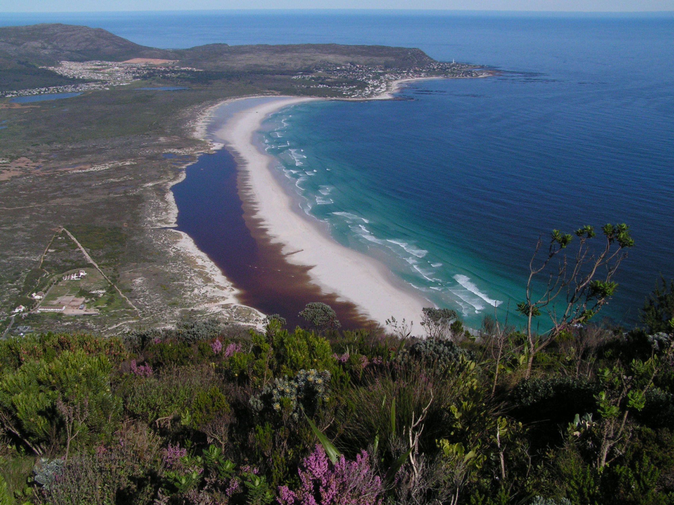
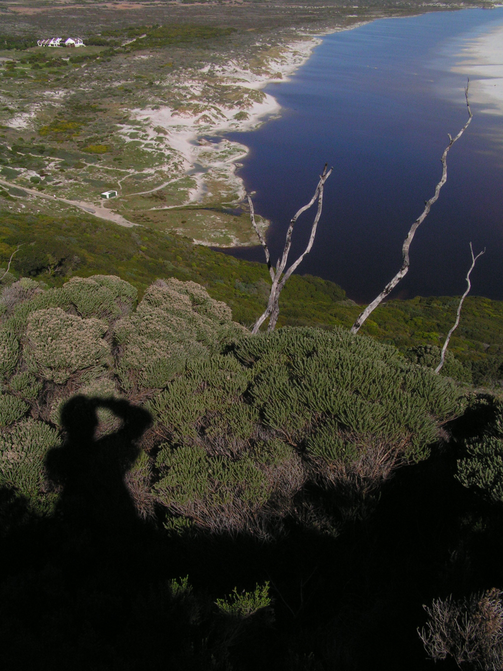
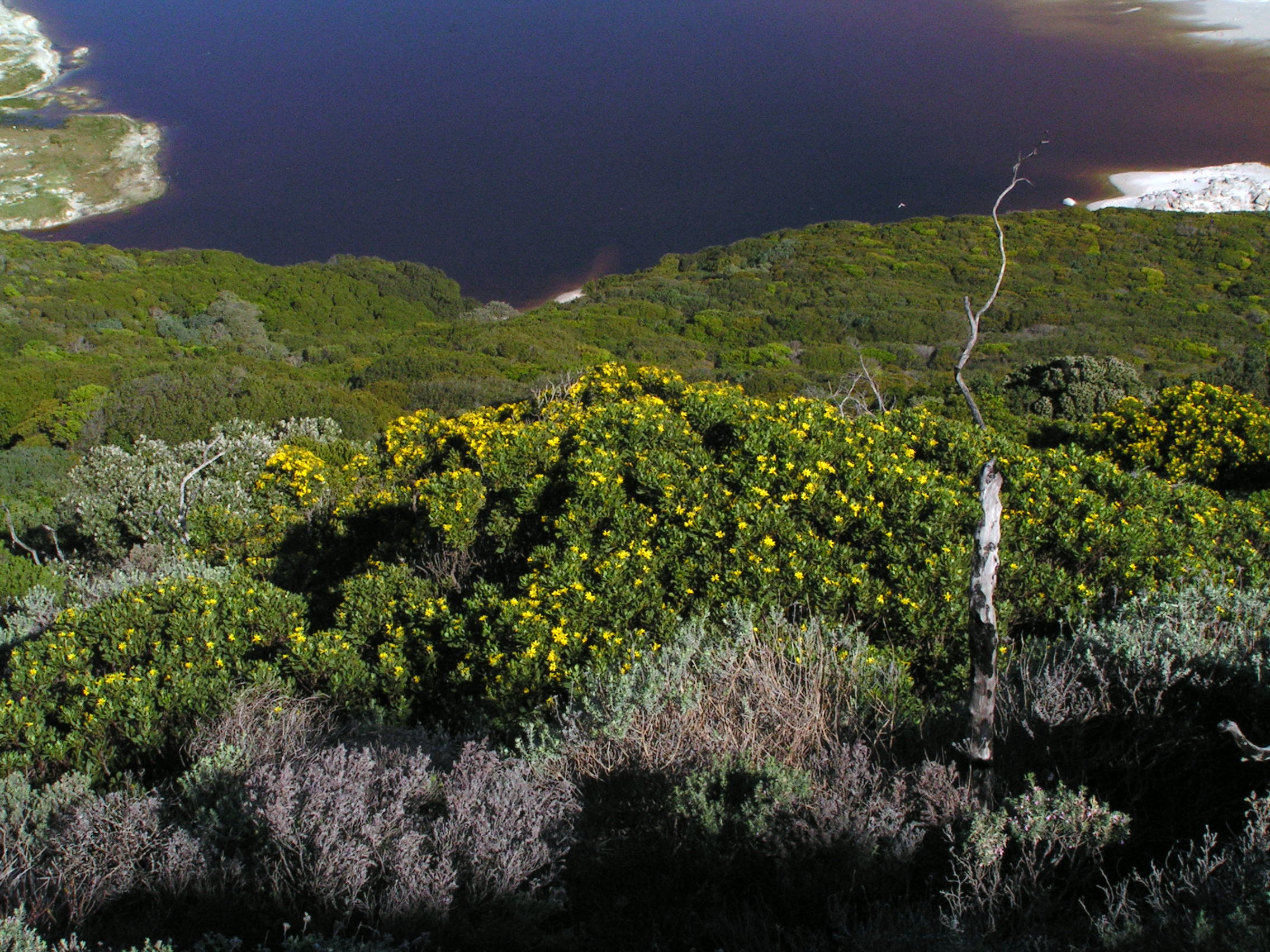
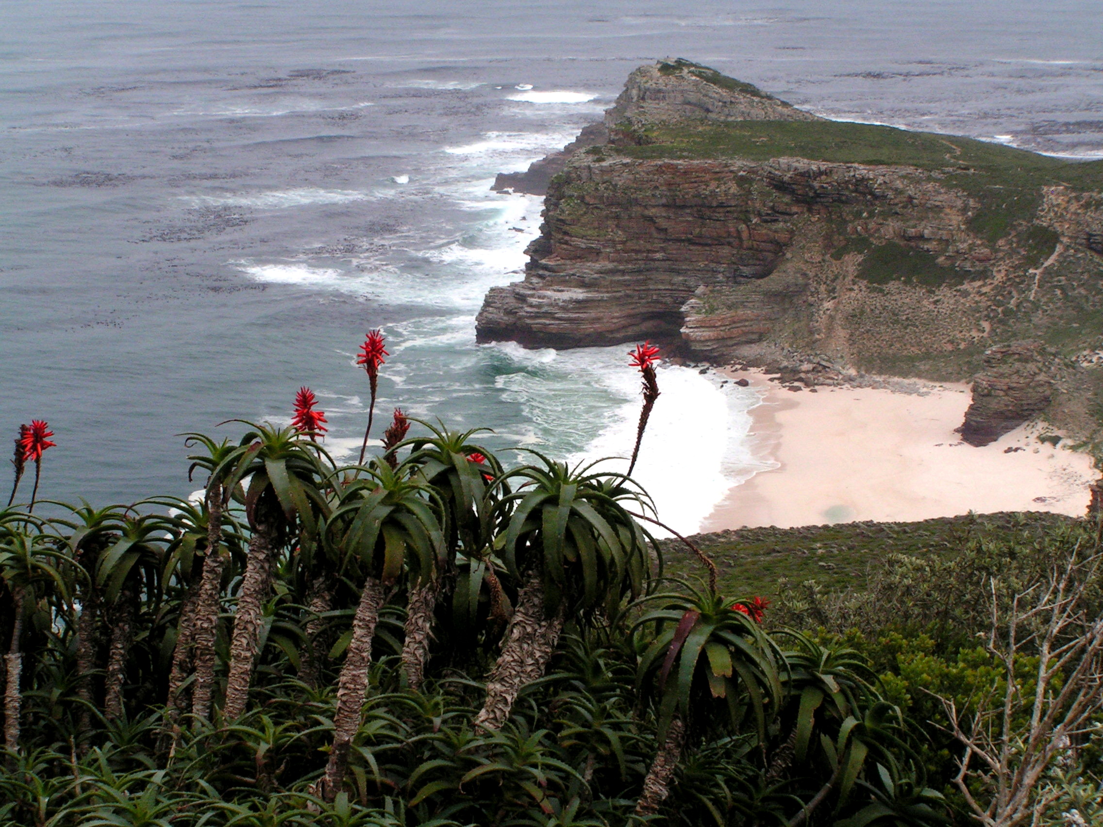
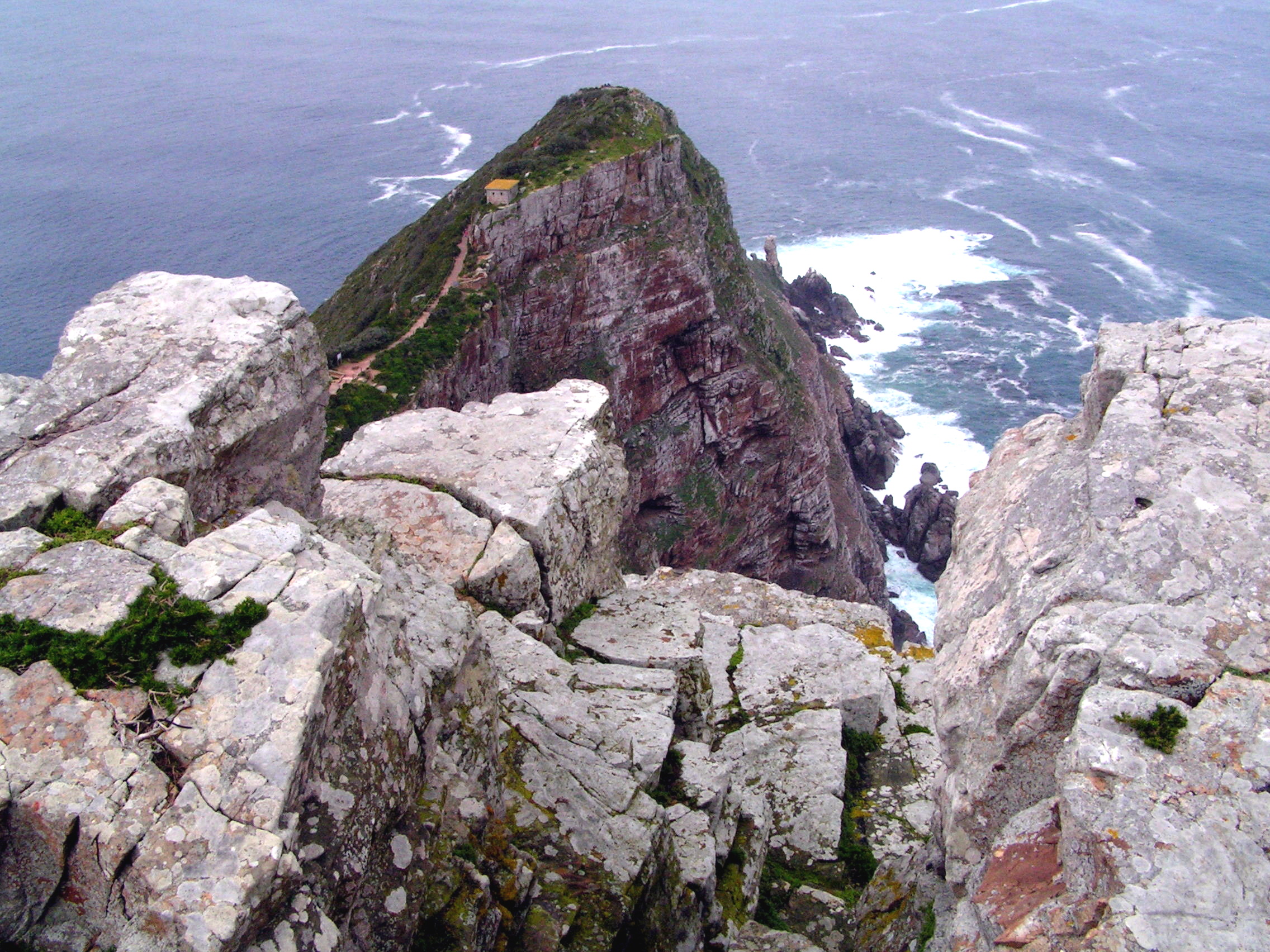
From Hout Bay, the journey continued on the scenic Chapmans Peak Drive. This road is carved onto the rocky steep slope which  dropped vertically below into the blue Atlantic. It twists and turns and provides fantastic sceneries along the way. The road stretched from Hout Bay to Noordhoek. It is best appreciated from the few view points along the road. The journey continued past Noordhoek until it emerged into a wilderness rocky area blasted by strong westerly wind and pounding waves onto the high cliff rocky coastline. This is Cape Point at, the end of the African continent. Not quite. Two oceans, Indian and Atlantic do merge but about 150km east at Port Agulhas. However, for romantic reasons, this is the ends of Africa. Beyond this point south, is Antarctica. This is a wind-swept area. Hardy fynbos vegetation are swayed to one side. To the east, beyond the gray mountains and shimmering sea is a vast gray ocean. To the west, wild open blue water. A cable train helped those with weary legs to the lighthouse above. Baboons gathered in numbers amongst the vegetation.

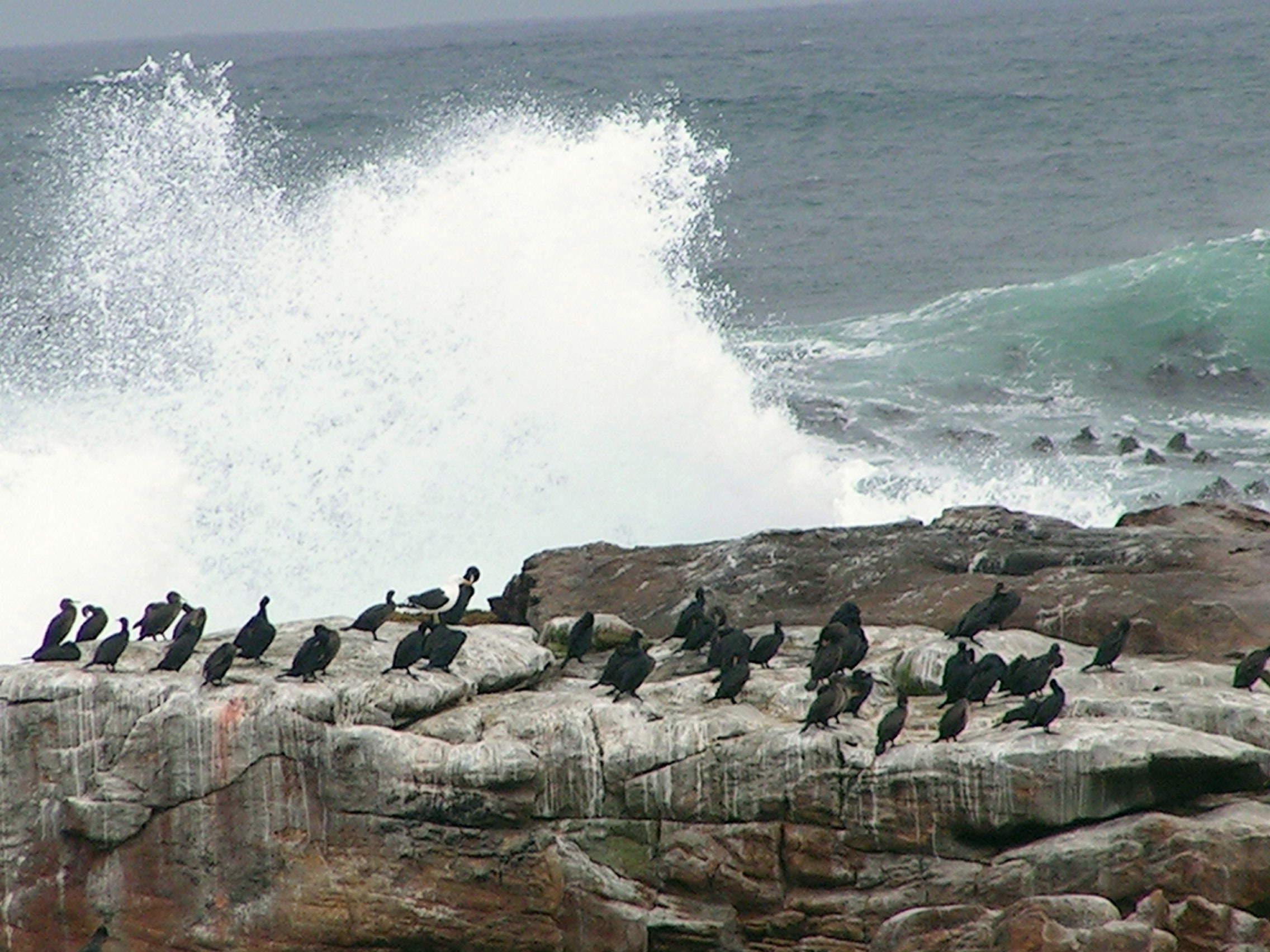
On the ledges of this rocky cliff, with a precipitous drop, birds perch into tiny nest. The swirling white water pounded onto the cliff base with fury. Mist arose to sprinkle onto whoever venture here. The last outpost is lonely lighthouse. Solidly built in order to perform its function. These are dangerous waters to seafarers.  Cape Point did not form part of my history memory. The names like Bartholomew Diaz, Vasco da Gama and Alfonso de Albuque [Malaysia history] are linked to the discovery of a passage round the bottom end of Africa. The name Cape of Good Hope is etched in my memory.  From Cape Point, I looked out towards the west, a tiny peninsula juts out into the torrent sea – the most southerly point of the African continent. It was previously called ‘Cabo Tormentoso’ or Cape of Storms due to its treacherous conditions for sailors. The adjoining white sandy Dias Beach, a hundred meters below, looked inviting.  In 2009, I was standing in Isla Navirino, wind-swept bitterly cold island just before Cape Horn, where the Atlantic and Pacific met, in South America. It was a good feeling. I walked toward Cape of Good Hope, a handsome pair of ostrich trotted across the flat fynbos vegetation prevalent here. It was windy. Cormorants rested on rocks smashed by strong waves. Numerous patterns remained etched onto the rocky sandstone cliff that told the story of their past. They share similarities with the geology of Table Mountain. This is a highlight for me. It is wild and unspoilt, scenic and rugged.

KONICA MINOLTA DIGITAL CAMERA KONICA MINOLTA DIGITAL CAMERA KONICA MINOLTA DIGITAL CAMERA KONICA MINOLTA DIGITAL CAMERA KONICA MINOLTA DIGITAL CAMERA KONICA MINOLTA DIGITAL CAMERA

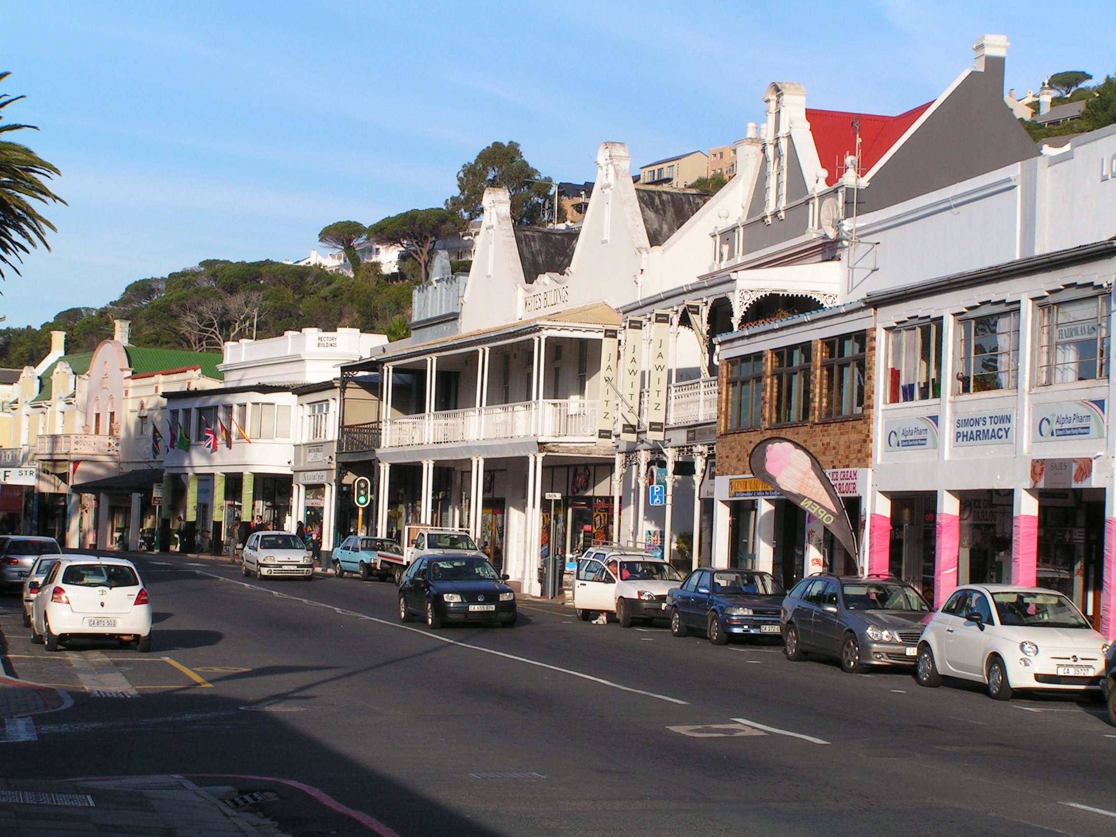
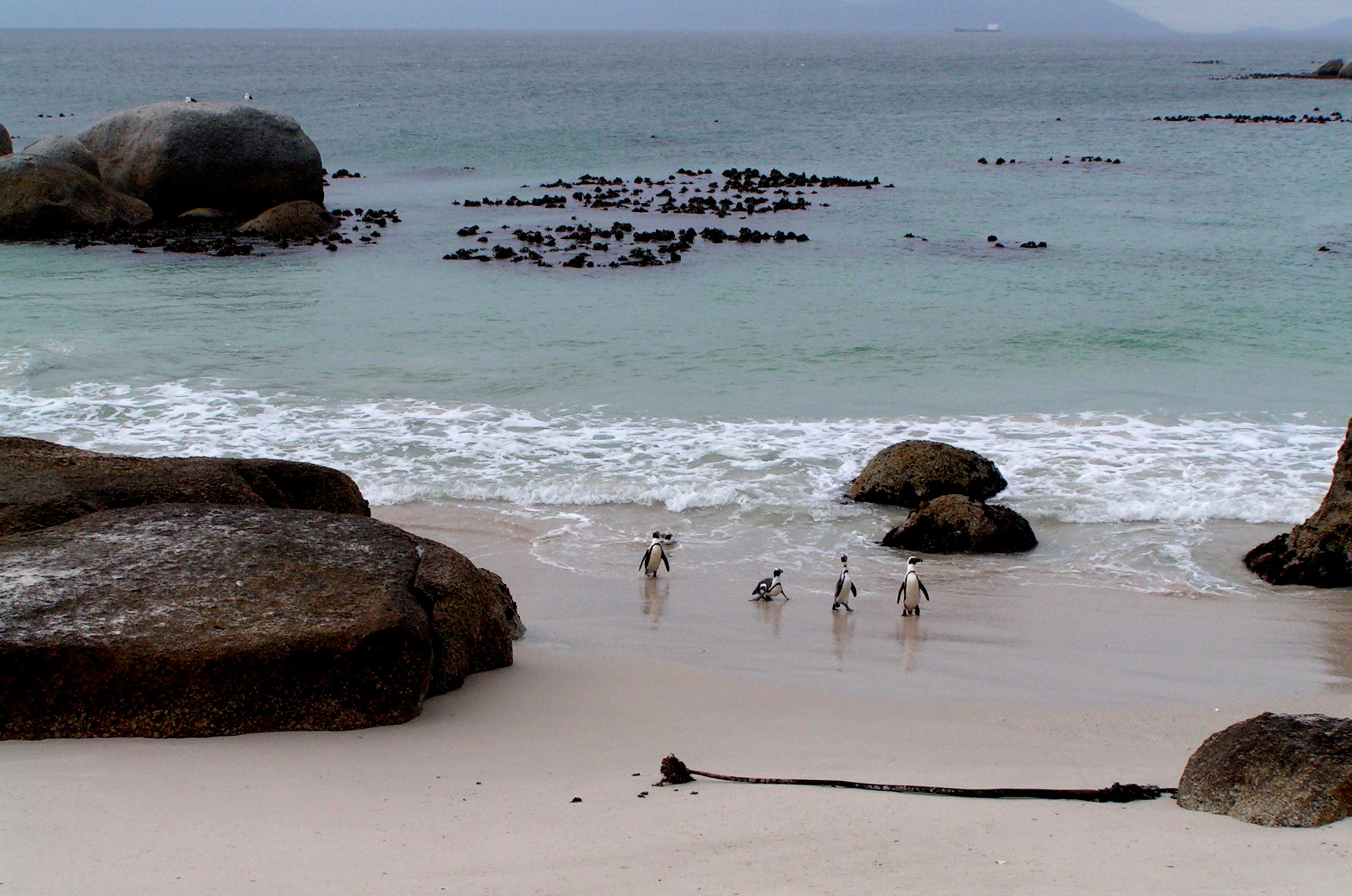
From here, we headed east towards Simons Town to a place called Boulders Beach to watch the lovable African Penguins. It rained and soon we were back to the hotel. I relished my lavish abode, at least for one night. At dinner, I was the only vegetarian at this restaurant that specialised in game meat – zebra, kudu, Springbok and a few more. I could not come to terms with it, although all these animals are farmed. I looked forward to my African adventure. The small group looked accommodating and affable. I like travelling independently, but accessibility into Namib is tricky. This seemed like the next best option.

Cape Town – Chapmans Peak Trek 2

25 July 2012

In the gusting wind, I heard voices. I climbed towards the top of the peak over some granite boulders. A few Park Rangers were having a relaxed break. I have been walking for over five hours without any human interaction. A small signage indicated this is indeed Chapmans Peak. The views over the entire Table Mountain National Park was stupendous – Sentinel Peak, Lion Head, Devils Peak and Table Mountain and the Apostles were all visible but hazy in the afternoon sun. Chapmans Peak Drive wound and hugged around the steep mountain slopes with some precarious drops into the Atlantic. From the peak, I could see a downhill trek that led in the opposite direction towards Noordhoek. A ranger confirmed this. He too enquired about my return journey to Cape Town and informed that there in no transport to the east coast. I was disappointed. Instead of back tracking, I decided to walk towards Noordhoek. Call me ill-prepared. This downhill trek was steep but gradual, and from the cliffs were vertical drops into the ocean. With a little decent, I was surrounded by the familiar unique fynbos vegetation. Slangkop lighthouse on the coast was like a beacon guiding me to civilisation, hopefully a transport. There were some unique cultivated and manicured vegetation that resembled a cult-like habitat or community. After an hour and a half, descending the last leg on wooden steps, I reached Chapmans Peak Drive road. Noordheok lay several kilometres away. The sun shined intensely. I was tired but determined to continue and await my destiny. I exited this magnificent road after seven hours of walking – longer than I had planned for.  I was curious to find a bus stop sign. Where did the bus go to? Perhaps, to Noordhoek. Eventually one did appear after a half hour wait. I was just happy to see one. My legs were not cooperating well at that point. I entered the bus and stared at the driver, not knowing where this bus was travelling to or where my next destination was. There was silent stalemate. The driver just uttered one word, Fish Hoek! Yes, finally the answer to that pondering question that began before I even started out from Cape Town. Answered in one simple word. In my joy, I sat down without paying the driver which he eventually demanded. I wanted to inform all the people whom said there was no transport from here to the west coast that there was one. I was just happy to relax and enjoy the bus journey.

KONICA MINOLTA DIGITAL CAMERA KONICA MINOLTA DIGITAL CAMERA KONICA MINOLTA DIGITAL CAMERA KONICA MINOLTA DIGITAL CAMERA

The coastal town of Fish Hoek, on the calm shores of False Bay, smelled of fish and seawater. It was sweet. I boarded a train to Simons Town. A curious little kid kept staring at me. The train route followed the delightful coastline. Houses were built from the narrow flat lowland and led uphill. The main roads ran parallel to the rail tracks. Simons Town lies in a sheltered bay on the east coast of Cape Peninsula protected by the high mountains on the west.  From the train station, I walked towards Saint George Street. Classical colonial homes line the waterfront street. Most have been converted into retail outlets. It is a lovely stroll amongst these wonderful architecture buildings. It is not quite “Africa”. From here, a few kilometres lies the popular Boulders Beach. Its popularity comes from the permanent colony of African of Jackass Penguins. Within the conservation area, they build nest into the sand and under the canopy of shrubs. They are not disturbed by presence of humans. At one section, you can get into the water and swim with the penguins. It was an experience seeing these petite creatures going about their daily routine in their natural surroundings. Large rounded granite boulders added a dramatic landscape especially in the setting sun against the deep blue water. In the distant, silhouettes of boats and land created a tranquil setting. I rushed back to town and eventually caught the last Metro Train back to Cape Town passing through lovely and quaint water front towns of Kalk Bay and Muizenberg. It had been a long day but the efforts were worth it. This journey eventually did bring to light about accessibility with local transport on the southern peninsula, west coast to the east coast and vice-versa. I went with little hope and lots of determination and eventually found a, rather relieved, solution.

KONICA MINOLTA DIGITAL CAMERA KONICA MINOLTA DIGITAL CAMERA KONICA MINOLTA DIGITAL CAMERA KONICA MINOLTA DIGITAL CAMERA KONICA MINOLTA DIGITAL CAMERA