Why travel someone asked me. I replied, simply exercising the enthusiasm in me to the see the beyond! I have traveled to a few places - some just round the corner; mostly remote with a dash of hiking and beyond. I would like to share these moments especially the people and culture, scenery and the landscape with everyone. Please enjoy.
We left Twizel on Highway 8 in wet and hazy weather. All views of the Alps and Lake Pukaki vanished behind a curtain of gray wall. From our very comfortable lodge in Twizel, we opted for the YHA located in the center of town.
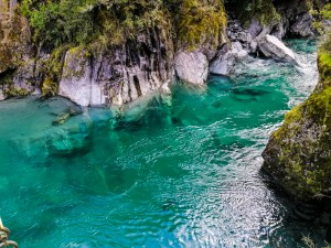
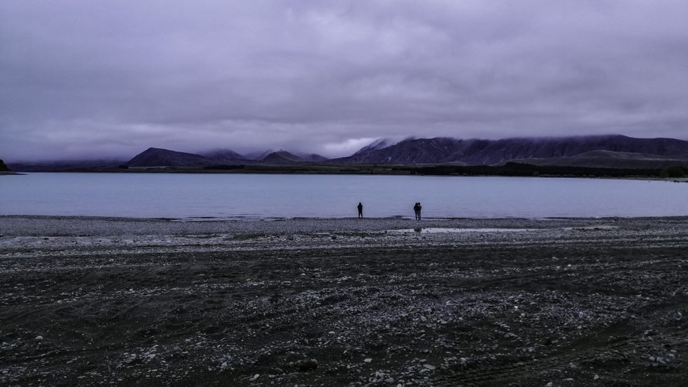
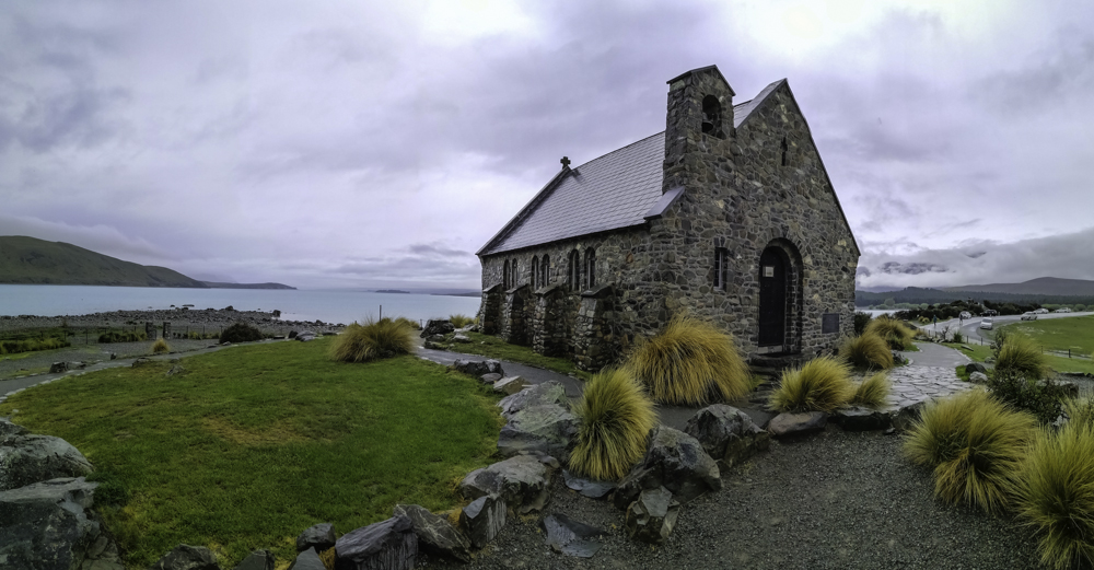
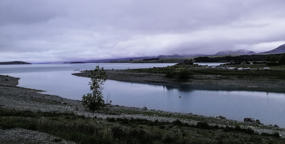
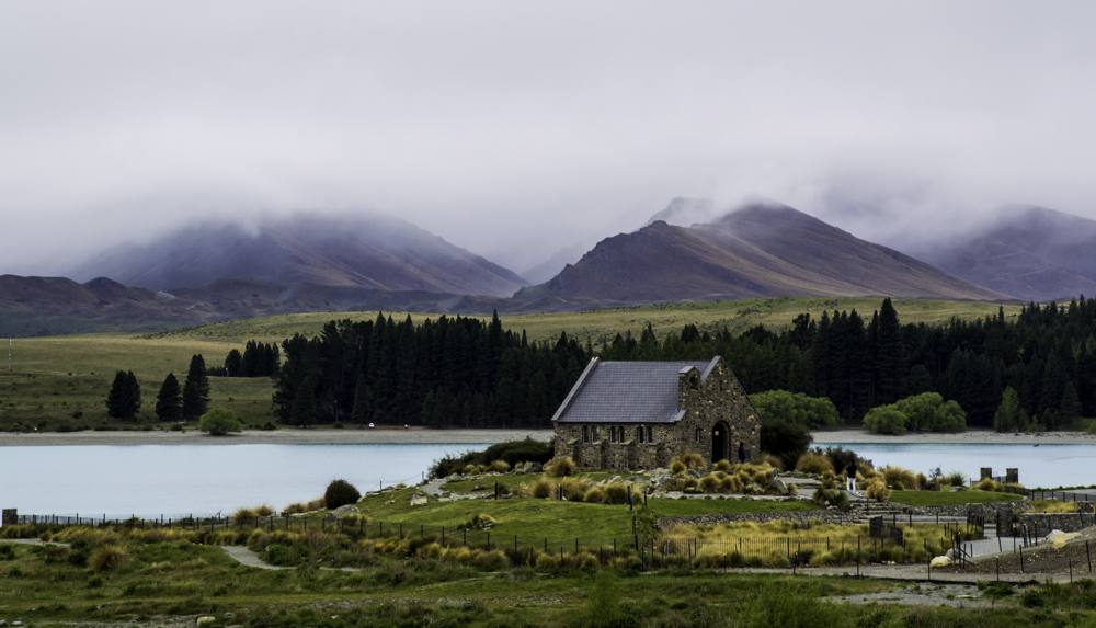
This my first time to Tekapo, in Mackenzie Country. Its location between the mountains and a stunning turquoise blue glacial lake is the major drawcard. We donned our raincoats and headed off the the iconic Church of Good Shepard. Built in 1935 as a memorial to commemorate early settlers. It is in a stunning location – framed between the lake, river and the partially obscured Southern Alps. Nearby is a bronze sheep dog statue to commemorate its valuable contribution to the early farming settlers.
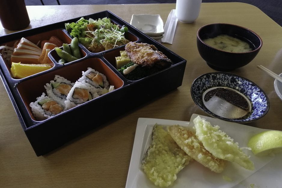
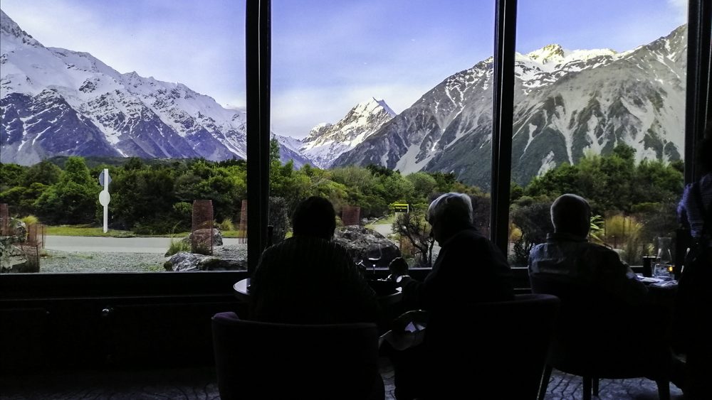
Trying to dodge the unrelenting rain, we headed to Kohan, a Japanese Restaurant. The views of the church, lake and alps is framed through a long wide glass window. The food is amazing too.
Although with cloudy weather, we headed to Mt John Observatory, at least to get a overview of Tekapo. The entrance is closed tot he public today due to poor weather. On a good day, this is the place to observe the southern night sky under the Dark Sky Project. The alternate, perhaps strenuous, way to arrive here is through a short hike on the Mt John Walkway which starts at Tekapo Springs.
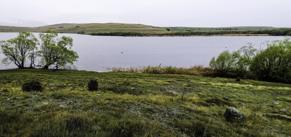
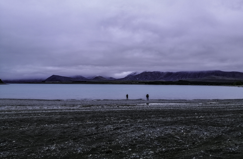
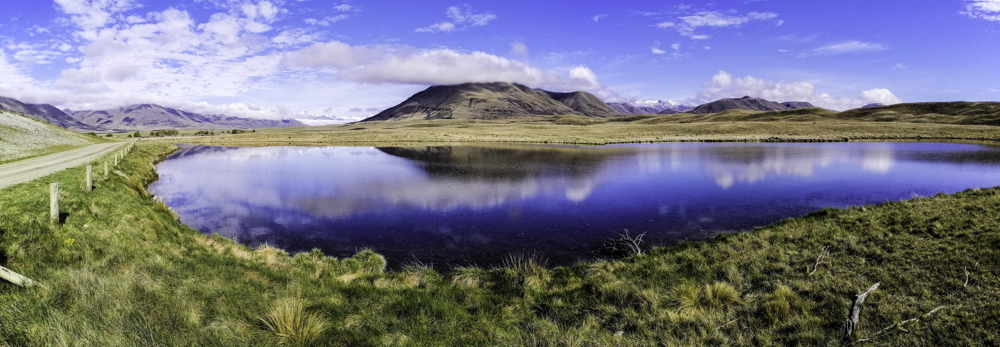
Although disappointed, we can’t beat the weather. We continued on the same road and explored the area. We came across Lake McGregor and Alexandria. This is a great place to seek alternate views of Lake Tekapo but also to enjoy a serene environment. Only the swans seemed happy with the weather. Even a small campervan site by Lake Benmore was quiet. Another highlight in this area is viewing the colorful Lupins flowers in late November. We were too early.
Well the only thing left for us to do was head straight to Tekapo Springs. We jumped into the hot pools. It was soothing under the light rain. Besides the hot pools, with different temperatures setting, there are spas, café and a playground. Even a star gazing opportunity is available here. After all the hikes and walking around, soaking our bodies in the hot pools was the best thing.
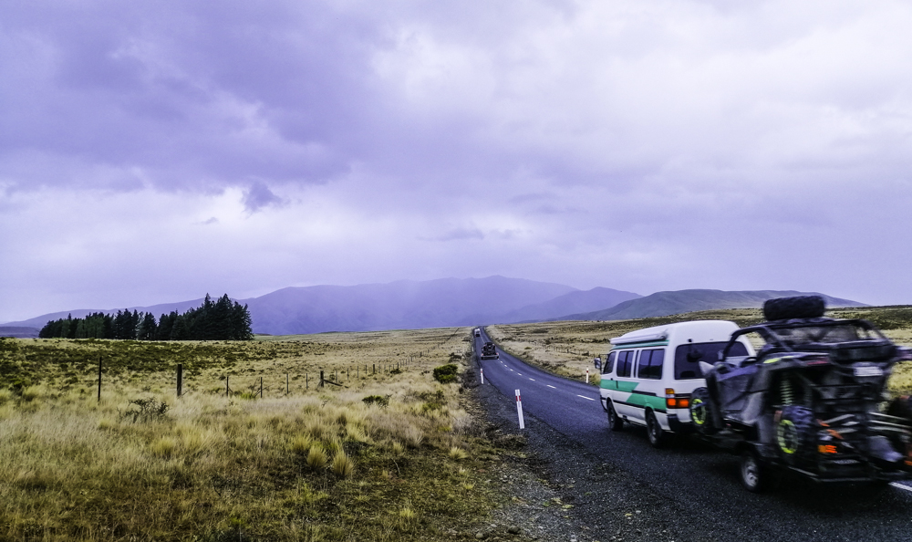
We wanted to cycle to Ohau, an alpine lake resort village, from Lake Ohau Weir. However, this Alps 2 Ocean route was closed due to fire that ravaged this little village. Instead, we drove from Twizel to Ohau.
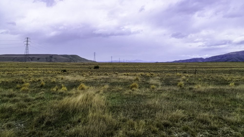
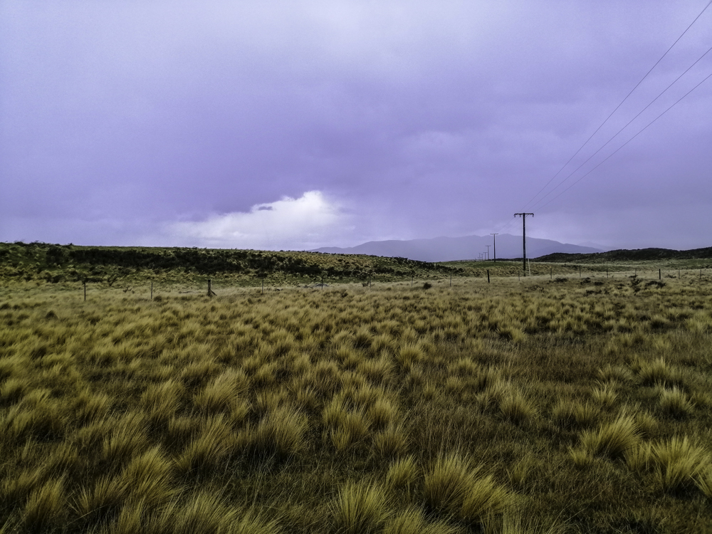
The drive off the main highway is quite striking. The dry land is vegetated with shrubs and golden tussock grasses. The basin is relatively flat flanked by mountains. Power lines stretched from horizon to horizon, east to west. Farm fences bordered the road.
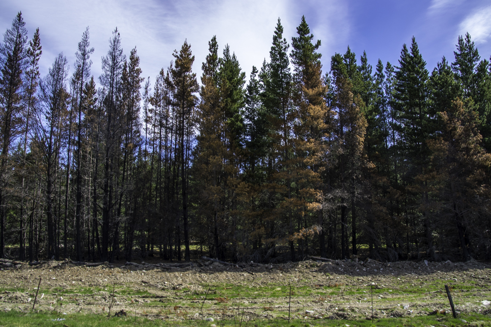
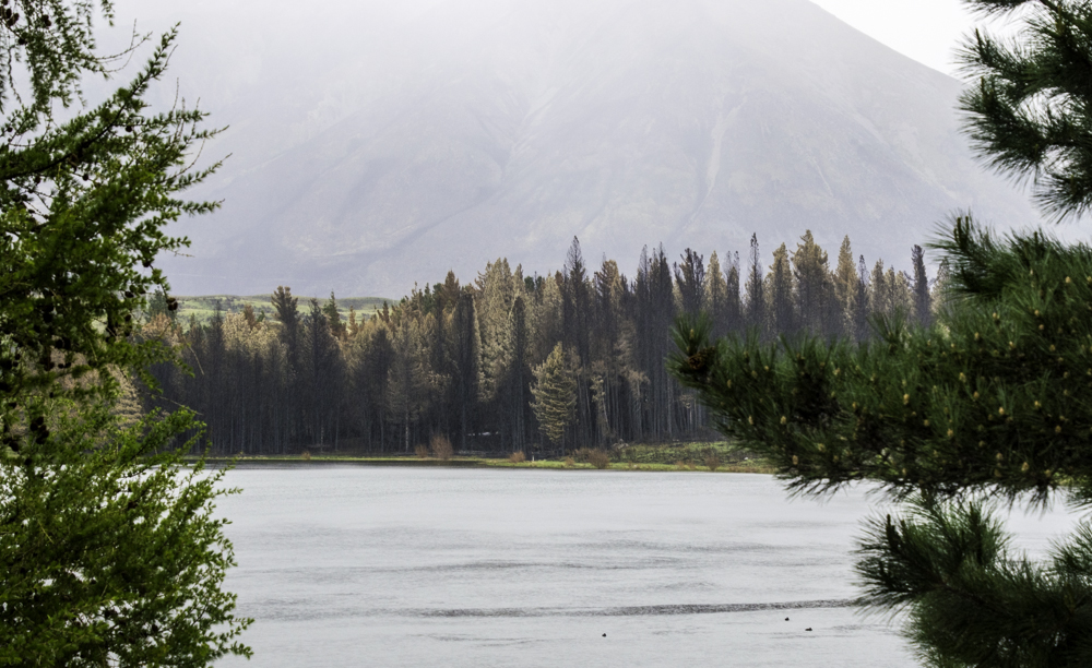
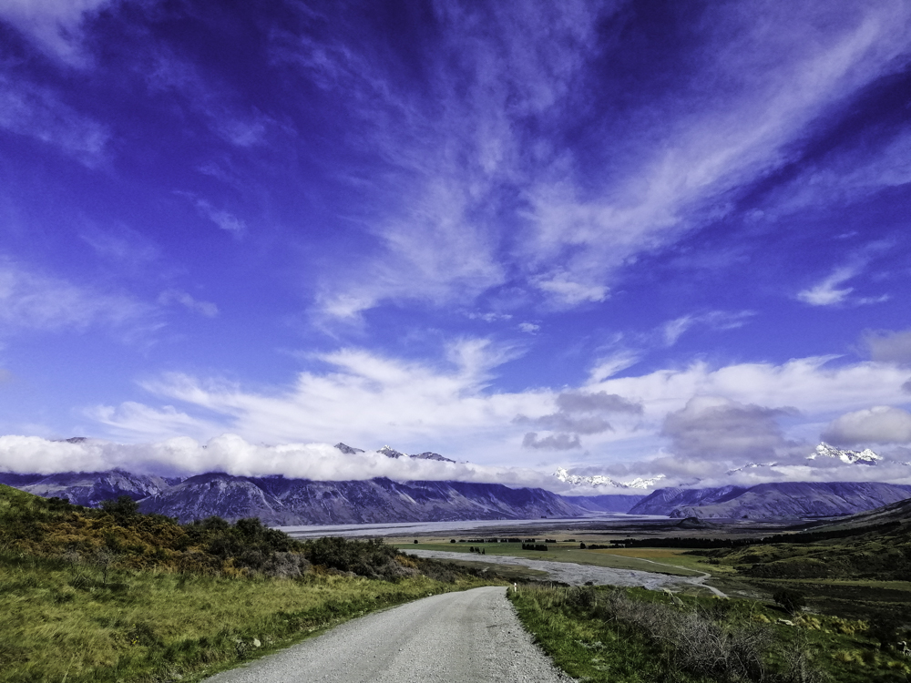
After a short drive on a lonely road, Lake Ohau appeared as a pale blue line obscured by low rain clouds. In the foreground however, evidence of burnt grasses and charred pine trees. It was in August (less than two months ago) when wildfire broke out in this dryland. It went out of control fanned by strong winds and dry weather. Strangely, the spread seem sporadic as amongst the burnt trees and shrubs, fresh green ones were left untouched. This unexpected phenomenon continued all along the road towards the lake.
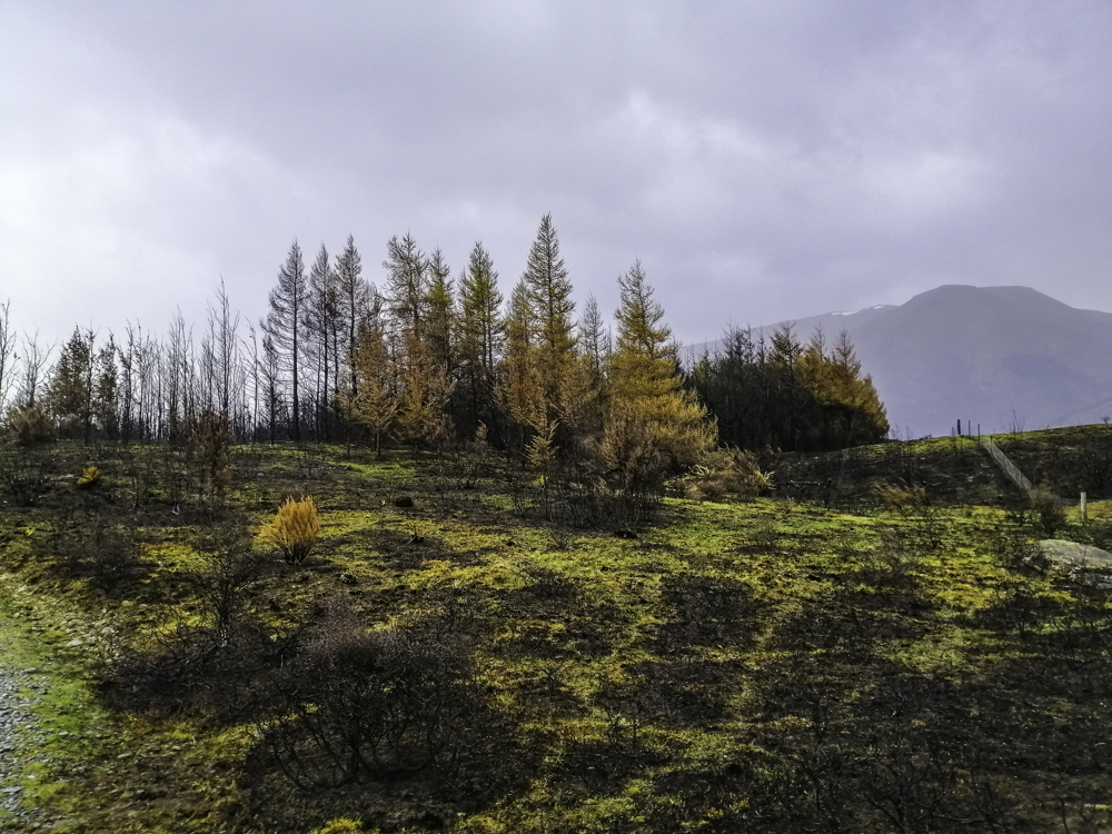
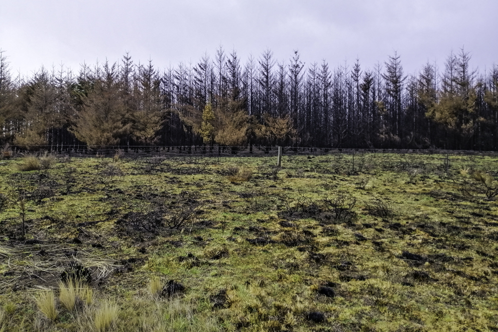
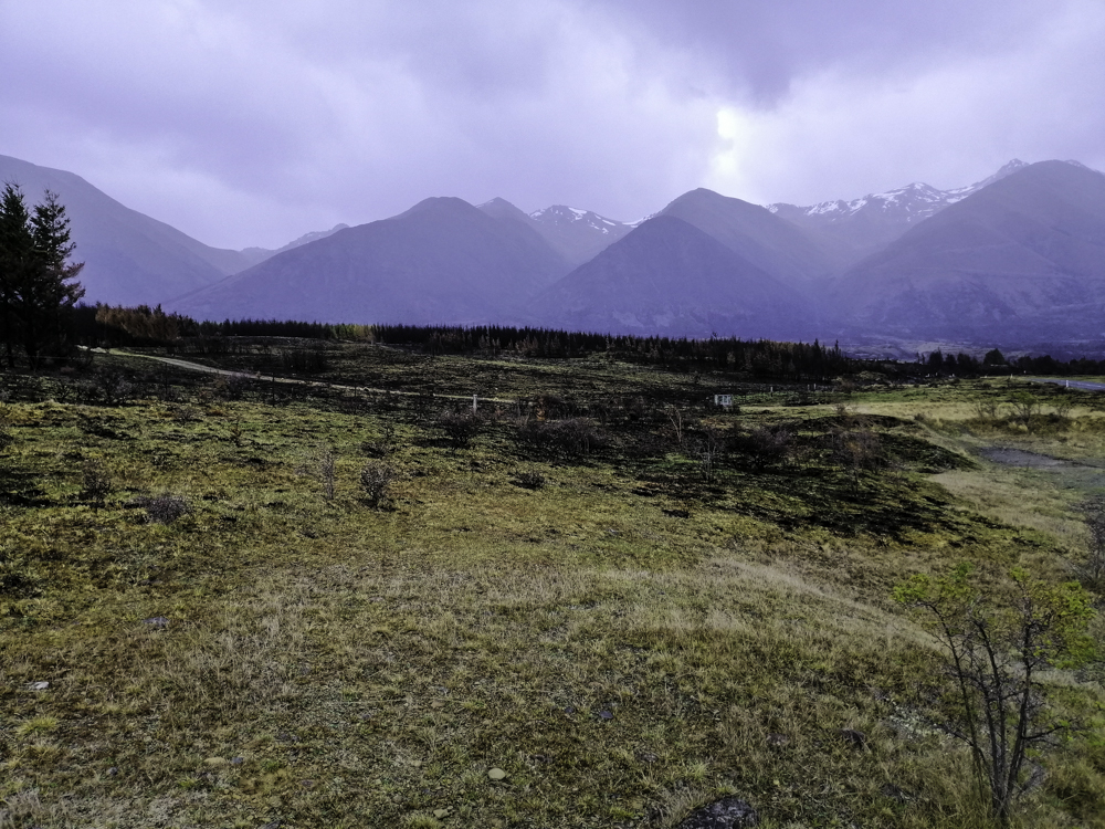
Trees skeletons line the shores of the lake closer to the village. A temporary entry ban on non-residents was placed to help recovery and assistance when we arrived here around 6pm. This is an isolated place but endowed with a magical lake and snow-covered Ohau Range. This is a winter resort – the play field for skiers. Like many tourist depended places in New Zealand, Covid 19 travel restrictions compounded by the fire, this is a major set back.
On our exit, we stopped at Lake Middleton to witness the destruction. Across the placid lake, rows of completely burnt pine stood like sentinels and the land scared black with scattered ashes. It is depressing to see the devastation. The title – From scenic idyll to scene of destruction – read the Otago Times. The village is mostly destroyed, fortunately no fatalities occurred. Despite the grim landscape today aided by perpetual dark rain clouds – Ohau Village is utterly scenic and spectacular.
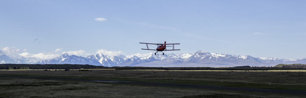
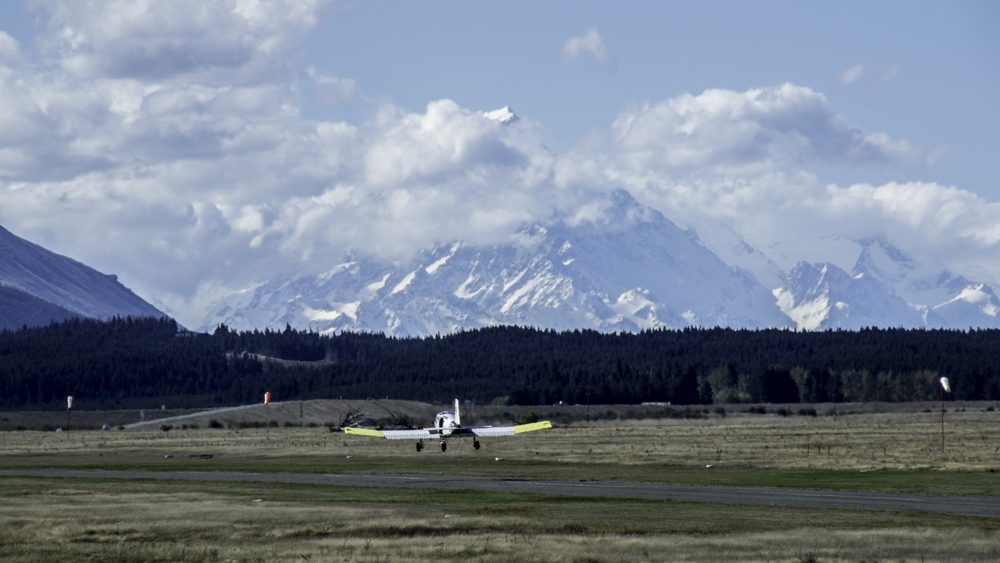
After a fantastic adventure in Aoraki Mt Cook, we returned to Twizel but stayed at Pukaki Air Lodge which located next to the Pukaki Airport’s runway. It is a fantastic place with a views of McKenzie Country and the snowy Alps in the background. From our bed, we can see small planes, including the bright Red Cat bi-plane (redcat ), a two person sightseeing flight towards the mountains, on the runway.
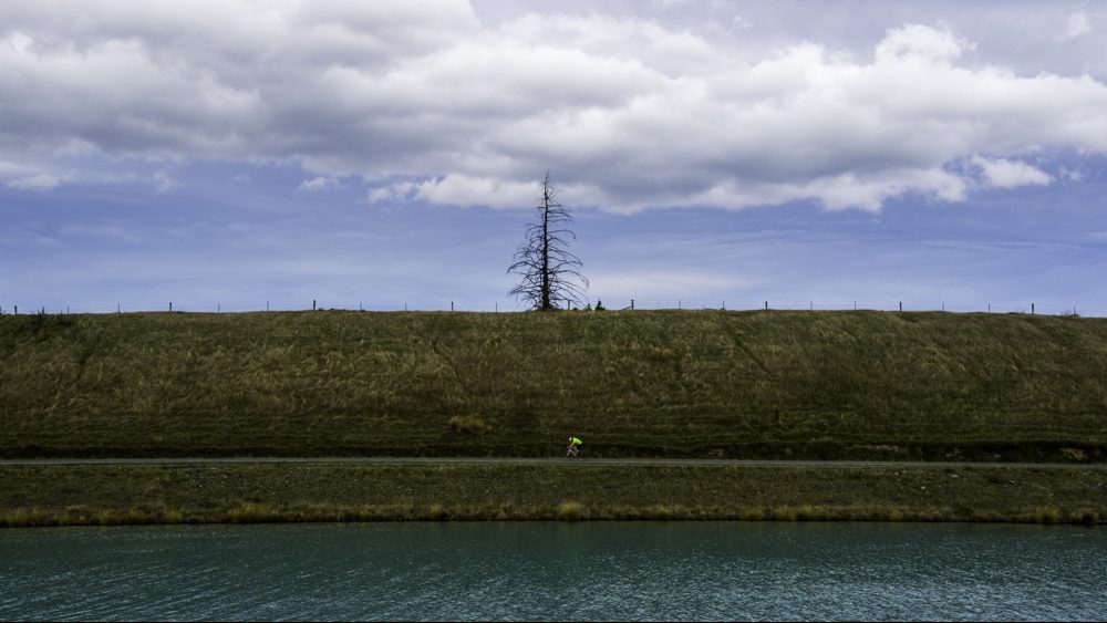
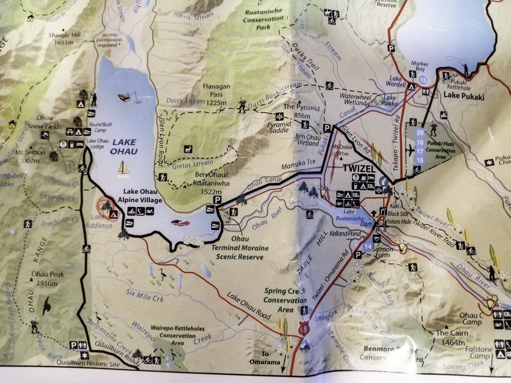
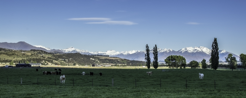
Twizel, an alpine town, is a great place to relax surrounded with mountains and several picturesque lakes. We decided to cycle part of the Alps 2 Ocean Cycle trails (alps-2-ocean-cycle-trail). We headed to Cycle Journeys and got ourselves electric bikes ($75/3hrs). The topography around Twizel is relatively flat. We headed off, with a map of the region, towards Glen Lyons Rd. The day was cloudy and rain was imminent. Along the road we saw groups of runners and families participating in a local race. The bikes were great. We peddled with ease and covered distance quickly. At the road junction, we arrived at the Pukaki Canal. This was a surprise. Just past this junction, we passed one of the Lord of the Rings movie site – the Pelennor Fields. A flat farmland basin with snow covered mountains in the background.
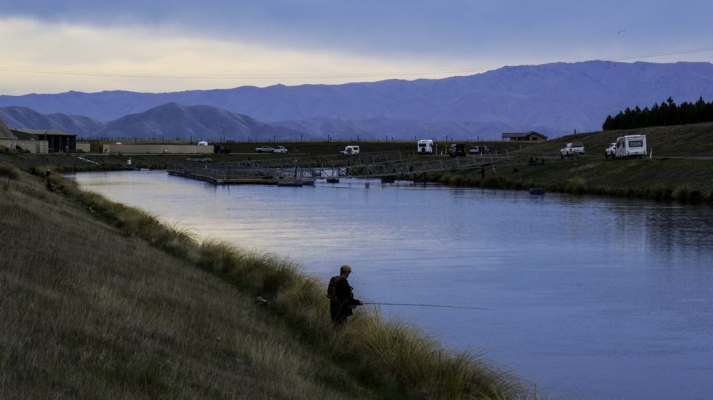
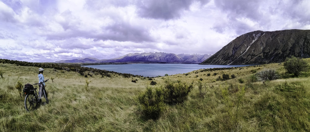
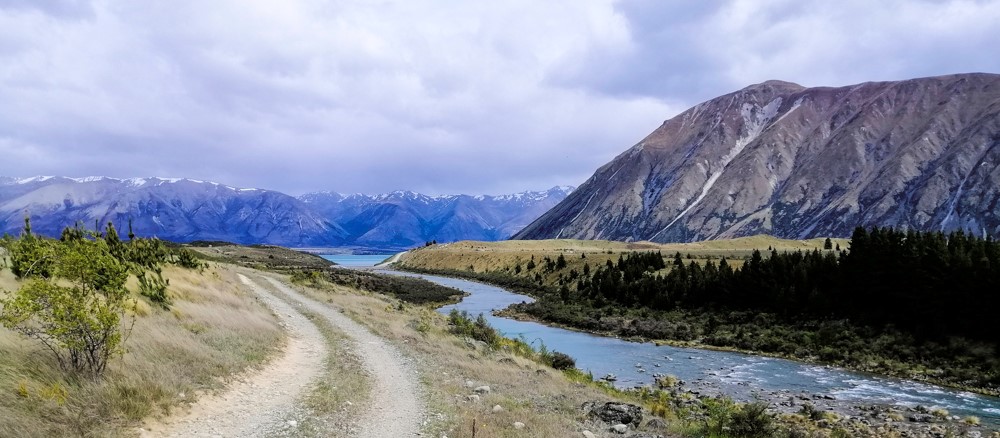
The water in the canal was deep blue and stretched endlessly. Clusters of fishermen gathered along the canal fishing for trout and salmon. The water is calm. These are part of a series of canals built connecting Lakes Ohau, Pukaki and Tekapo for the production of hydroelectric power. Towards the end of this long flat road is Lake Ohau. The views were stunning in this cloudy sky – golden grasses on the shores against a deep blue lake and treeless brown mountains topped with snow on the summits. It was time to pause and enjoy the serene scenery.
Our ride continued towards the Ohau Wier, a small dam across the Ohau River. However, our onward journey on the Alps 2 Ocean trail towards Ohau Village was closed. Perhaps, due the recent fire that devastated the village in August. Alternately, we turned east and cycled along winding Ohau River. The sealed road disappeared and earth road prevailed. However, the trail later turned into gravel. There was no one on the trail. We passed the hydro power station, on the opposite side of the river. Finally we some fellow cyclist (without e-bikes) and was assured that this trail will end in Twizel.
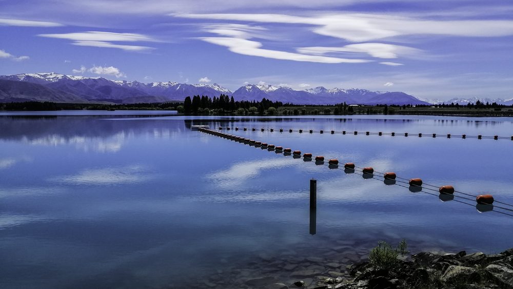
Beautiful Lake Ruataniwha appeared as we peddled on. Campervans were parked on the shore and speed boats on the lake. We finally arrived near Highway 8, the main road into Twizel. Cage salmon farming is a feature here and across the highway. We watched a feeding frenzy in the water below. A restaurant offered these south island delicacies. Lake Ruataniwha was stunning with the mountains in the backdrop.
We cycled along the busy highway and to avoid fast moving lorries and trailers, we opted a narrow track along the road all the way into town. With our electric bike, we managed a not too strenuous 32km of mountains and vast farmlands of beautiful and captivating Mackenzie Country.
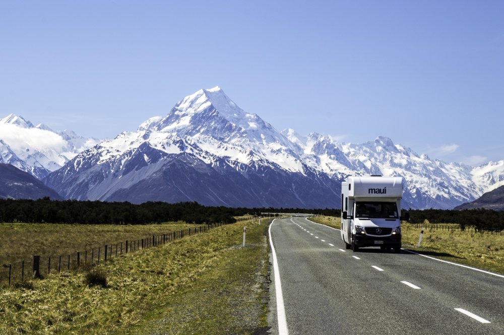
The road journey to Aoraki Mt Cook National Park is passed through some amazing landscape. Past Twizel, we left Highway 8 and turned left into Highway 80 towards Aoraki Mt Cook. A signage at the entrance indicated the road condition. Immediately, we could see recent fire damage in the vegetation on both sides of the road. Over 3000 ha were damaged in August. The fire seemed to have moved quickly as both stands of chard and green pine stood side by side.
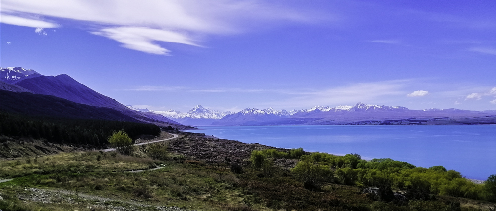
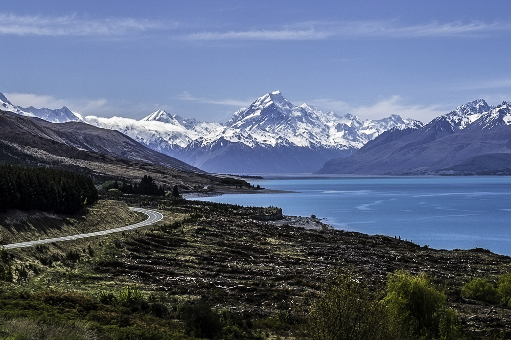
The jewel-like Lake Pukaki appeared beyond the charred pine trees. The dazzling turquoise lake contrasted with the greener and blackish foreground. After a short drive, we reached Peter’s Lookout. The vista is a stunning view of the Lake Pukai and the Southern Alps with Mt Cook prominently positioned.
We passed NZ Alpine Lavender Farm which was out of season. A single road led to Mt Cook and the road seemed to head straight into the highest mountain in NZ. Sheep grazed in the fenced farmlands hemmed between the mountains and the road.
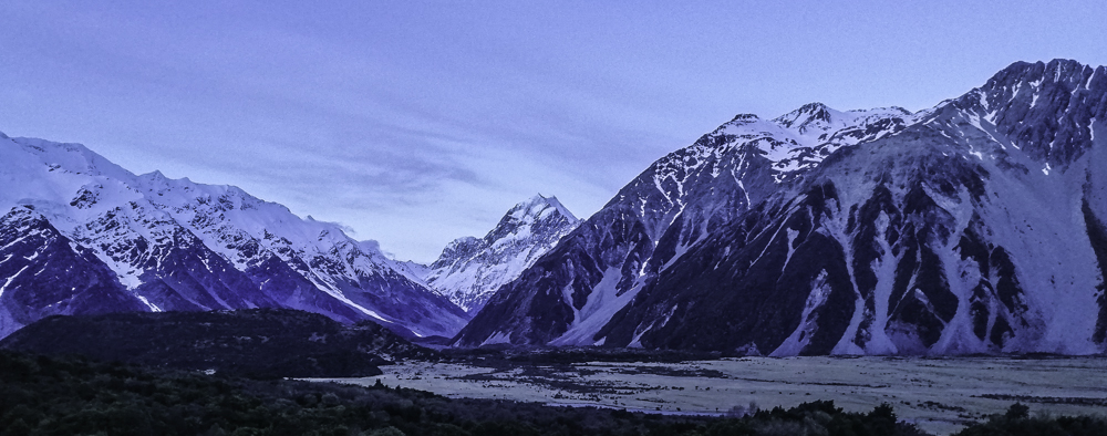
Mt Cook village is a small collection of accommodations, tour operators and petrol station. Aoraki Mt Cook National Park is enviable located at the base of the Southern Alps with Mt Cook it crowning glory. Many day walks are available to explore this stunning alpine region including Hooker Valley , Red Tarn, Tasman Lake and Kea Point Tracks. A passive, well almost, way to get close to the mountain and the magnificent glacier is to take a boat journey to Tasman Glacier. A stunning two-day hike to Muller is the closest to getting ‘eye-level’ view of Mt Cook. Our accommodation was the luxurious Hermitage Hotel .
From our balcony, Mt Cook is framed in the middle flanked by the massive Mt Seffton and Mt Wakefield, and the wide Hooker Valley. Simply superb views. With restaurants and bar, it is not a bad place to unwind after a good day’s hike. If only they had a spa!
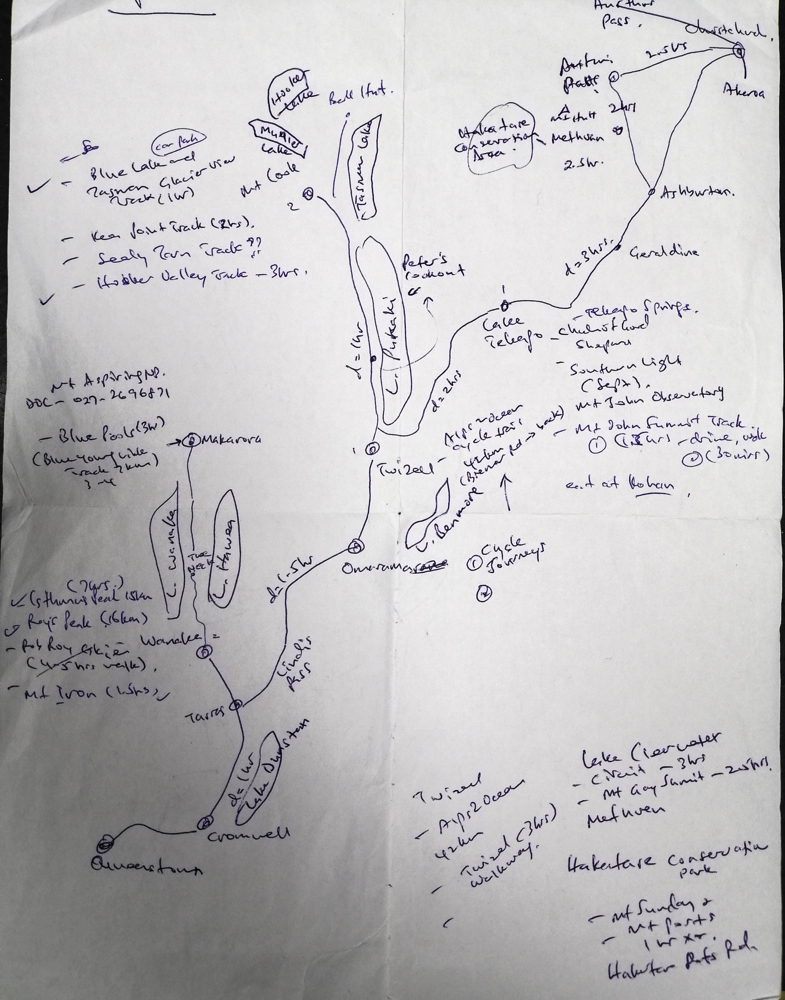
Our New Zealand’s South Island October 2020 road trip started with a plan.
Days 1-2 -3- Wanaka
My wife and I arrived in Queenstown, picked up a rental car and immediately drove to Wanaka via the winding Crown Range and Cardrona (hotel – break) with ski fields in background. The weather was not great on this leg of the journey.
At Cardrona, the ski fields had just closed for the season with little snow remaining. We stopped for a break in this iconic hotel before moving on to Wanaka. The valley road, mostly farming, is hemmed between mountains and parallel to Cardrona River. At Wanaka, we headed to our delightful accommodation, with stunning views of Roy’s Peak, Lake Wanaka and the snow covered mountains, in Albert Town, just 15 minutes for Lake Wanaka.
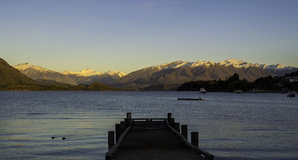
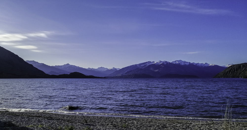
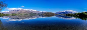
Wanaka – a resort town which sits on the shores of Lake Wanaka with the Southern Alps as the backdrop. Both summer and winter is the main season here. A relaxed township with several day and multi-days hike including the magnificent Mount Aspiring National Park – wilderness area with native forests, towering snow peaked mountains, glaciers, glacial lakes and numerous river valleys. All provide stunning scenery with a variety of landscapes. A hiker’s paradise. Besides exploring the beautiful Lake Wanaka, nearby is equally stunning Lake Hawea.
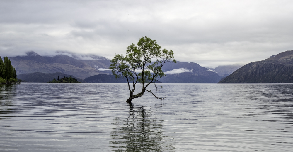
One of the interesting sites in Wanaka is “that Wanaka Tree”. A solitary structural willow trees resting in the lake’s edge with the Southern Alps in the background. The image is dictated by the seasons and the mood of the lake. Sunrise and sunset views from Bremner and Roys Bay will set you into a soothing mood.
The first day track we embarked on is Hiking Isthmus Peak Track and continue to Blue Pools. The start is along the road from Wanaka to Makarora. The drive to the starting is quite exhilarating. The main road hugged Lake Hawea for most of the way until “the Neck”. At this point, both Hawea and Wanaka Lakes appear next to each other. The single road continues until we reach the starting point, Isthmus car park.
The following day, I decided to hike Roys Peak. However, it was closed for lambing season (Oct-Nov). Alternatively, I headed out towards Matukituki Valley and hiked The Rocky Mountain Summit Track. Wanaka is a hiker’s paradise with many day and multi-day hikes to suit an individual’s fitness and preparedness.
Day 4-5 – Aoraki/Mt Cook National Park
We left beautiful Wanaka and onto Highway 6 south towards Tarras, a one-cafe-gas pump-village, along the Clutha River. The views of mountains and vast farm lands of Central Otago is quite picturesque.
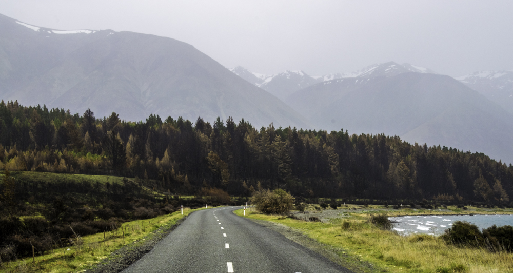
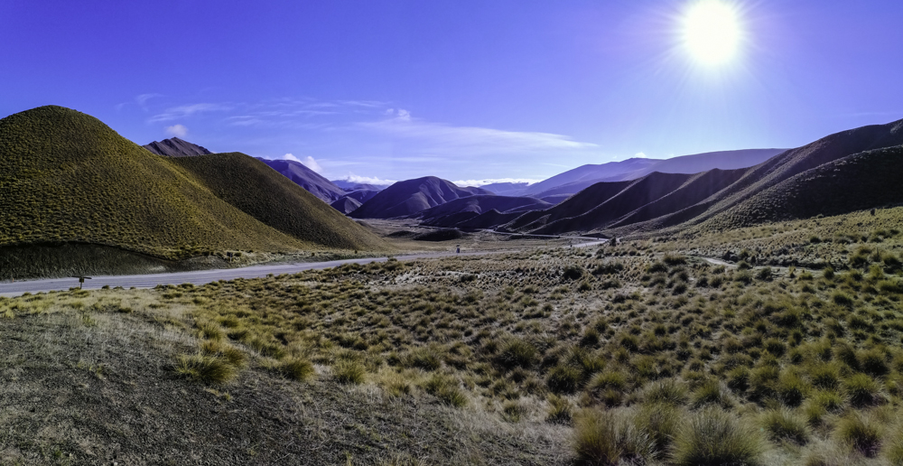
Continuing on Highway 8, took us through stunning Lindis Valley along the Lindis River. Treeless mountains rose above this lonely highway. With more twist and turns, always gaining elevation we entered the dramatic saddle – Lindis Pass that linked Central Otago with Mackenzie Basin. At an altitude of 970m, the landscape is dominated by golden tussocks grasses. The mountain tops were dusted with powdery snow as the road snaked between them. There is a great spot to stop and view this uplifting alpine landscape.
Still on the Highway, we broke our journey in Omarama. I had no information and any idea what is available around here. At a cafe, I read a magazine about Clay Cliffs in this region. After an enquiry with the staff, it seems there are quite a few things to do around here. We continued on the highway for another 10km and turned left into Quailburn Rd and discover Omarama and the Clay Cliffs.
We passed salmon farms and Twizel an eventually, veered off into Highway 80 towards Lake Pukaki and Aoraki Mt Cook National Park. This is my first time in this national park. I was quite excited about the prospects of hikes and tracks to discover and enjoy this unique alpine environment with the highest peak in New Zealand,Mt Cook. There are not many places where one can just drive up to the highest peak in the country. We hiked the Blue Lakes and Tasman Glacier Lake, Hooker Valley Track and Red Tarn Track. One of the causes of Covid 19 is lack of tourist in many part of the country. Prices of accommodation and excursions were reduced. The idea of passive travel on a glacial lake –Tasman Glacier Lake boat excursion – encircled by snow peaked mountains, looked rewarding.
Days 6-7 – Twizel
We retraced our drive back to Twizel, the largest town in Mackenzie District. Surrounded by mountains, a small airport, stunning picturesque blue lakes and a laid back atmosphere, Twizel is a great place to stay and explore this region. After all the hikes at Mt Cook, we opted for Cycling in Twizel. Only two months ago, fire damage many part of this region. We decided to understand the extent of the Fire damage at Ohau and perhaps contribute by visiting the village.
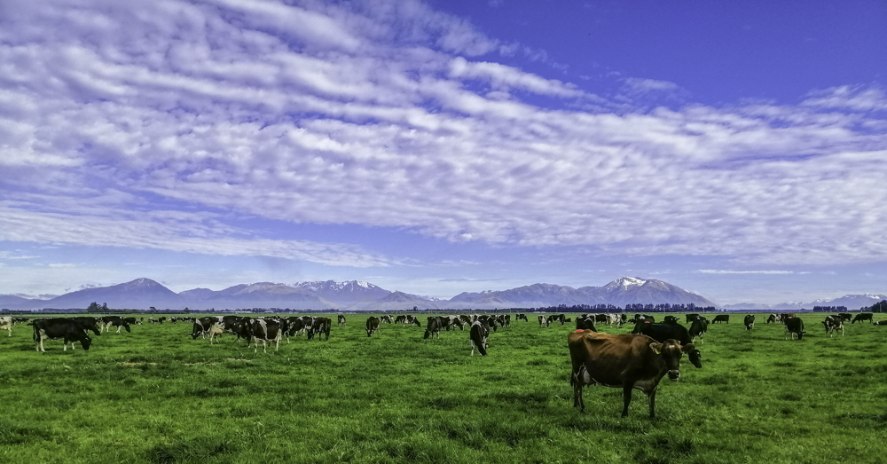
It is interesting to note that Lakes Tekapo, Ohau, Pukaki and Ruataniwha are all connected and by 58km of canals linking Tekapo, Ohau, and Pukaki. They provide controlled water to the hydro power stations. Besides that, they provide an excellent environment salmon and trout. Hence, fishing.
Day 8 – Tekapo
After a couple of restful days by the Pukaki Airport accommodation, in rather wet weather we headed to Lake Tekapo on that familiar Highway 80. We stayed at the centrally located YHA Lake Tekapo.
Days 9-10 – Methvan
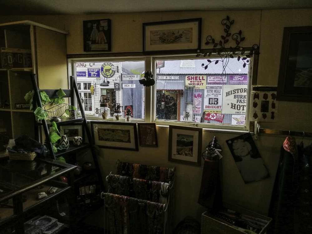
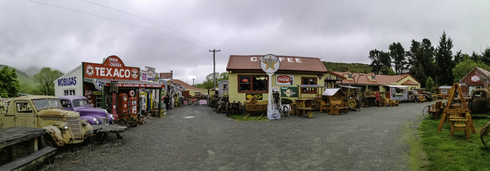
The weather today, well cloudy. Our road journey continued out of Tekapo on Highway 8 towards Burkes Pass – a small historic village. It was the last post before crossing over the tussock covered mountains into the Mackenzie Basin. it still looks and feels like a frontier town. We had to check out the Three Creeks antique store. It is choker with memorabilia from its illustrious past.
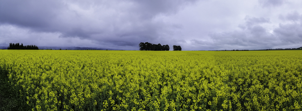
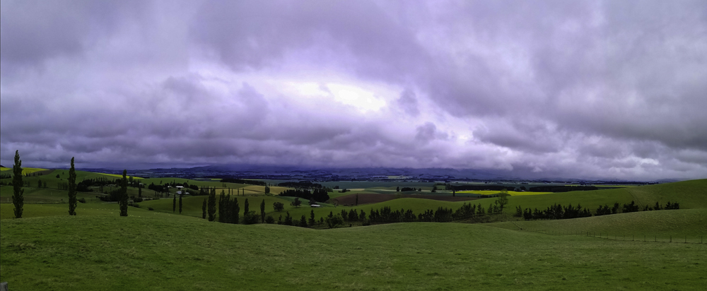
This is all farming country. An amazing sight greeted us along the way – a sea of yellow. These are mustard fields in Farlie. It was a contrast to the gray mountains and green rolling pasture fields. Further on, as we gained elevation, the expansive rural views are revealed. Past Farlie, we diverted into Highway 79 towards Geraldine.
Geraldine is a quaint little town. Due to consistent drizzle, we continued on. Past Orari Bridge, we detoured onto the Inland scenic highway 72 toward Mt Somers passing the mighty Rangitata River, and South and North Branch Asburton River /Hakatare. We briefly stopped at Mt Sommers General Store and the Holiday Park (camper vans). We finally arrived at Methvan late afternoon. Like many small towns and villages, eateries close early. Fortunately, one was just closing but served us lunch.
Methvan is not on the tourist map! I was looking for a stop between Tekapo and Christchurch. I stumbled upon Hakatere Conservation Park managed by DoC with private partnership. It is a two hours drive from Christchurch. We decided to stay at Methvan as accommodation, both in Mt Sommers and especially Hakatare Conservation Area, is limited. Our accommodation was Ski Time. It was quite empty as the main season is winter ski season. We decided to walk around Methvan as there was nothing to else to do. For dinner, there is a lovely Japanese eatery on the main road.
The following day, we headed back to Mt Somers and onward to Hakatere Conservation Area and explored the Hakatere/Ashburton Lakes Wilderness, hiked a glacial remnant – Mt Sunday and to Lake Emma Historic Hut. It was a long day but with the sun shining, blue skies and stunning landscapes – it is worth it. Perhaps, it would be great to explore this magical area in winter.
Days 11- 12 – Christchurch
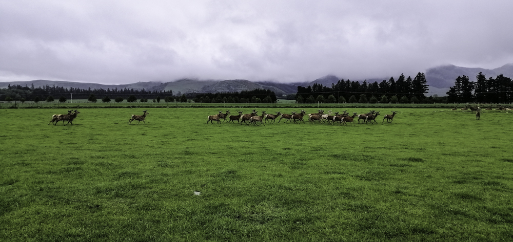
From Methvan, we continued on on Highway 77 via Peel Forest (the are several walking trails in this area) and Mt Hutt towards Christchurch. deer farming is pretty big in these parts. Mt Hutt ski fields were closed and the views were obscured by dense low clouds.
The drive along route 77 is quite scenic. We approached RakaiaGorge, with the wide but shallow Rakaia River meandering through. There are several walks including a walkway along he river.
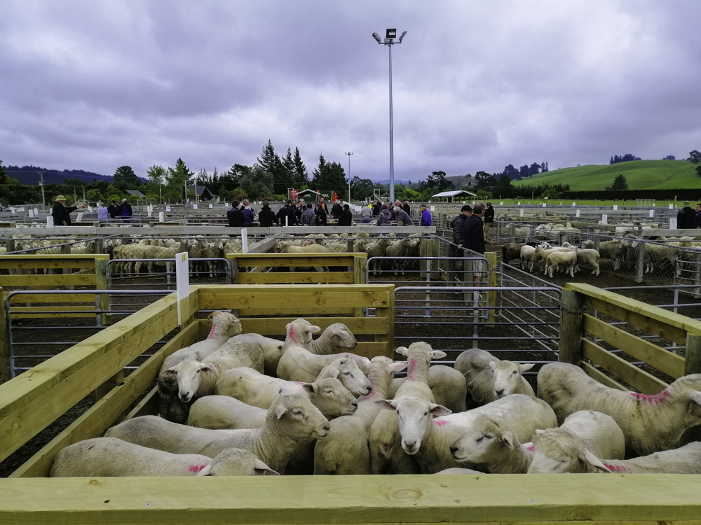
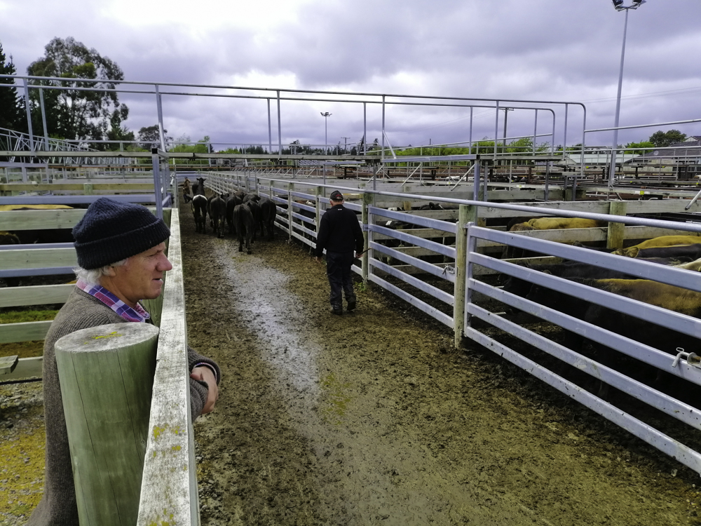
However, we continued on. At Coalgate, I noticed a yard sale. I have not witnessed one before and we in to investigate. Sheep and cattle is sold by kilos or herd blocks. The farmers and stockist were welcoming as long as you don’t get in their at auction.
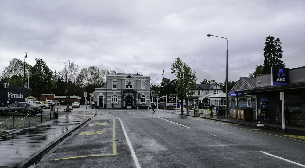
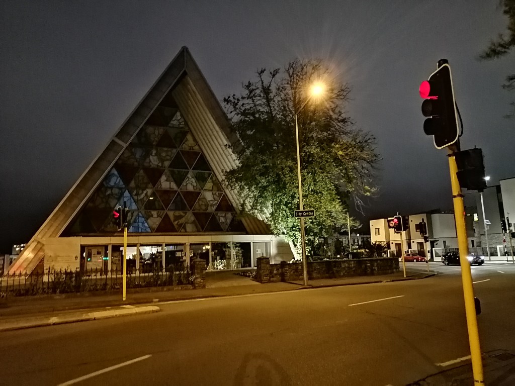
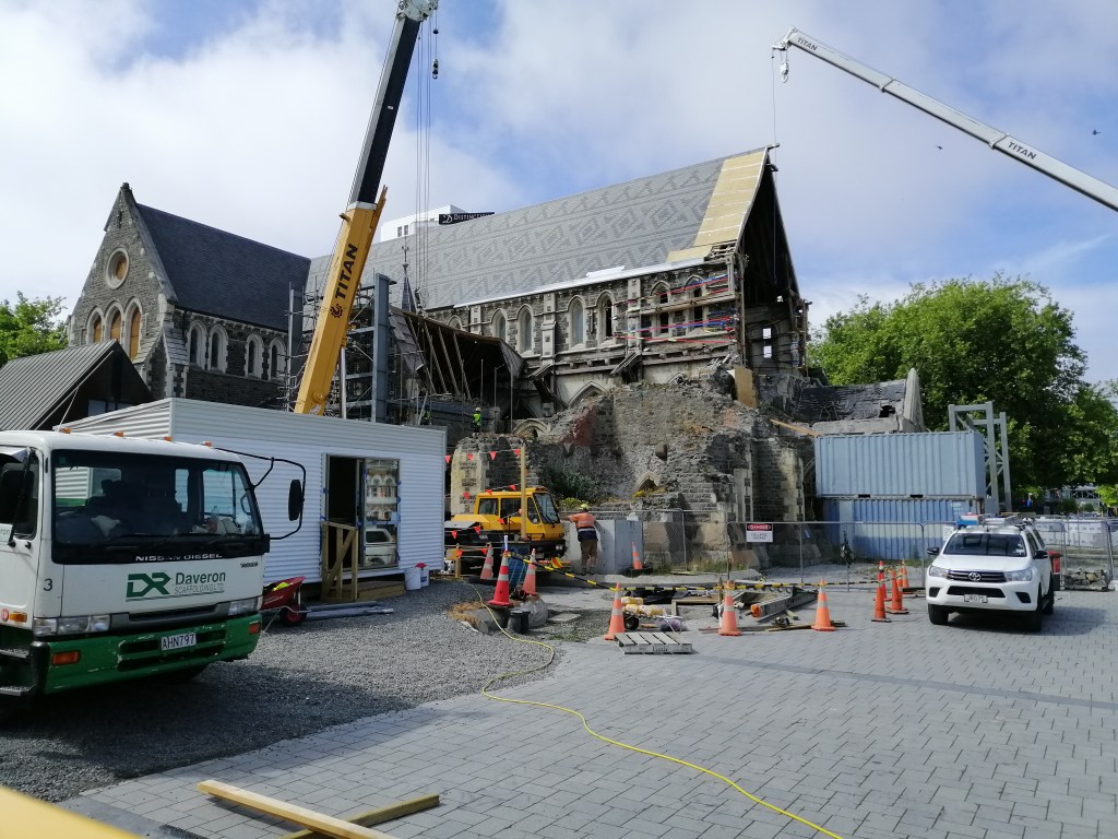
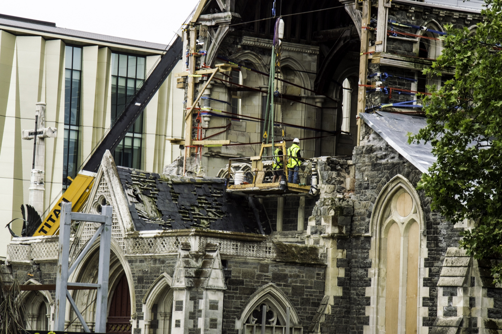
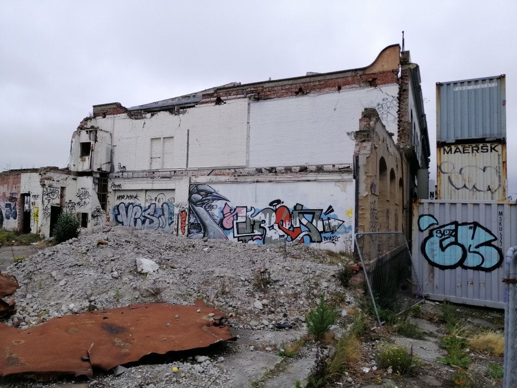
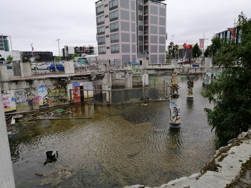
Christchurch – is a city recovering from the carnage of 2011 earthquake. Our accommodation in city central is ideal for exploring on foot. Evidence of this damage is all still there, after 10 years. Rebuilding had been slow. The centre of this damage is the iconic late 1800 Cathedral Church. Construction is on-going but painstakingly slow. A transitional one had been erected and simply called ‘Cardboard Church’. Yes, it is made mostly from cardboard.
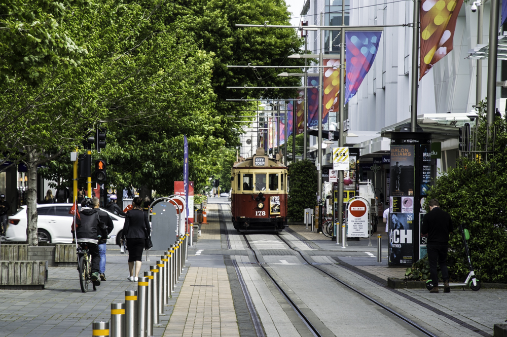
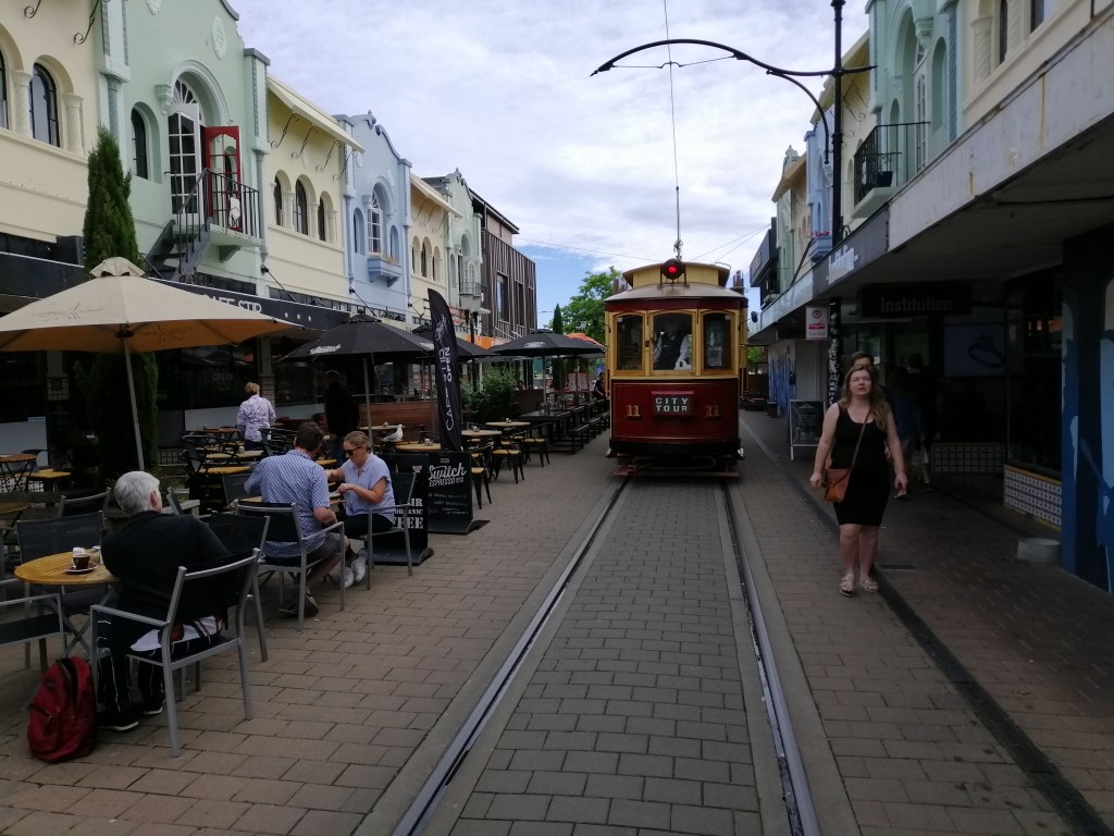
Containers had been placed to support the facade of damaged buildings. Some quite unsightly. Why has it taken so long, no one seemed to know. Bureaucracy is the answer. Another icon of Christchurch is the Tramways. Fortunately, it is still running within the CBD. Walking along the tracks through in inner CBD is quite fascinating – shops, museums, quaint craft’s shops and eateries.
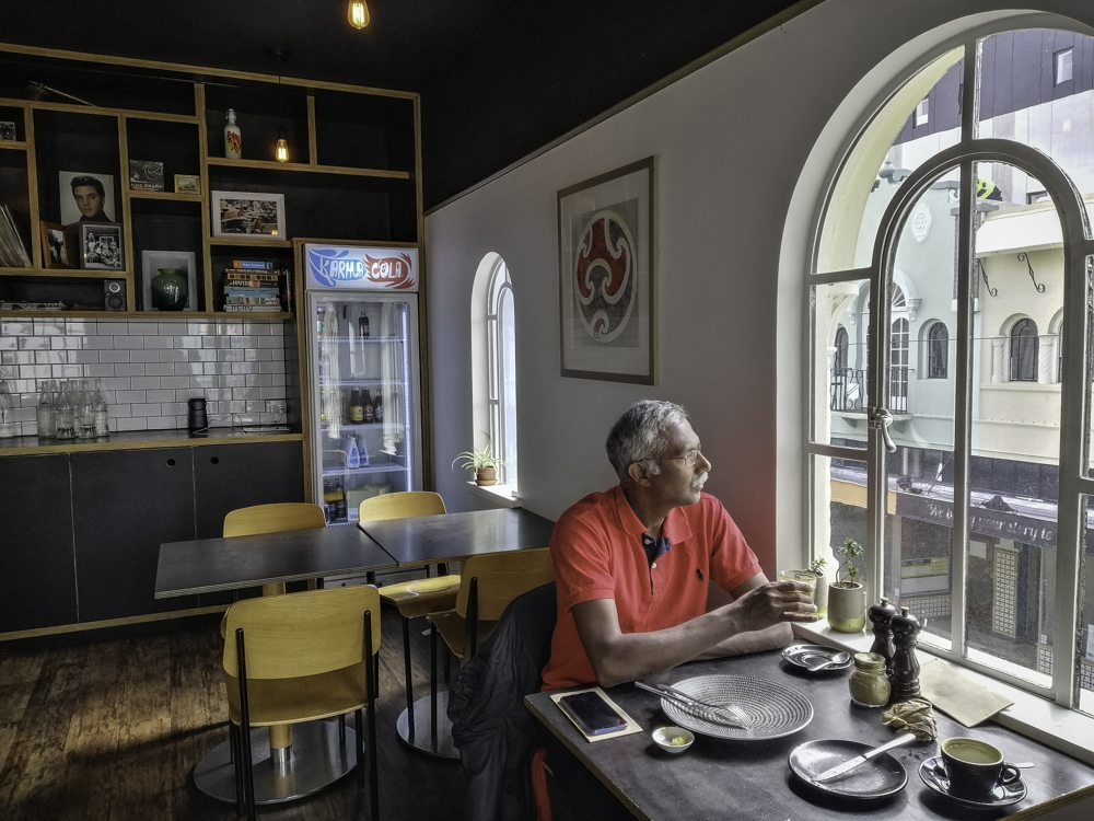
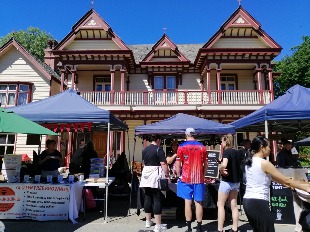
We enjoyed the CBD with it’s thriving coffee culture , eateries including the popular Riverside Market with multitude of food to tickle anyone’s palate. My favourite for breakfast is on New Regent Street. Try to get one on the upper floor with a view of the tram passing by. One of the enjoyable walk in the CBD is along the pleasant Avon River (and boat ride on a gondola) and Botanical Garden in Hagley Park. Riccarton’s Saturday Farmers market is a great place to sample artisan food and enjoy a pleasant atmosphere.
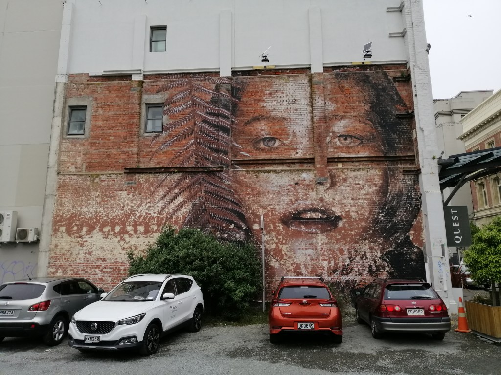
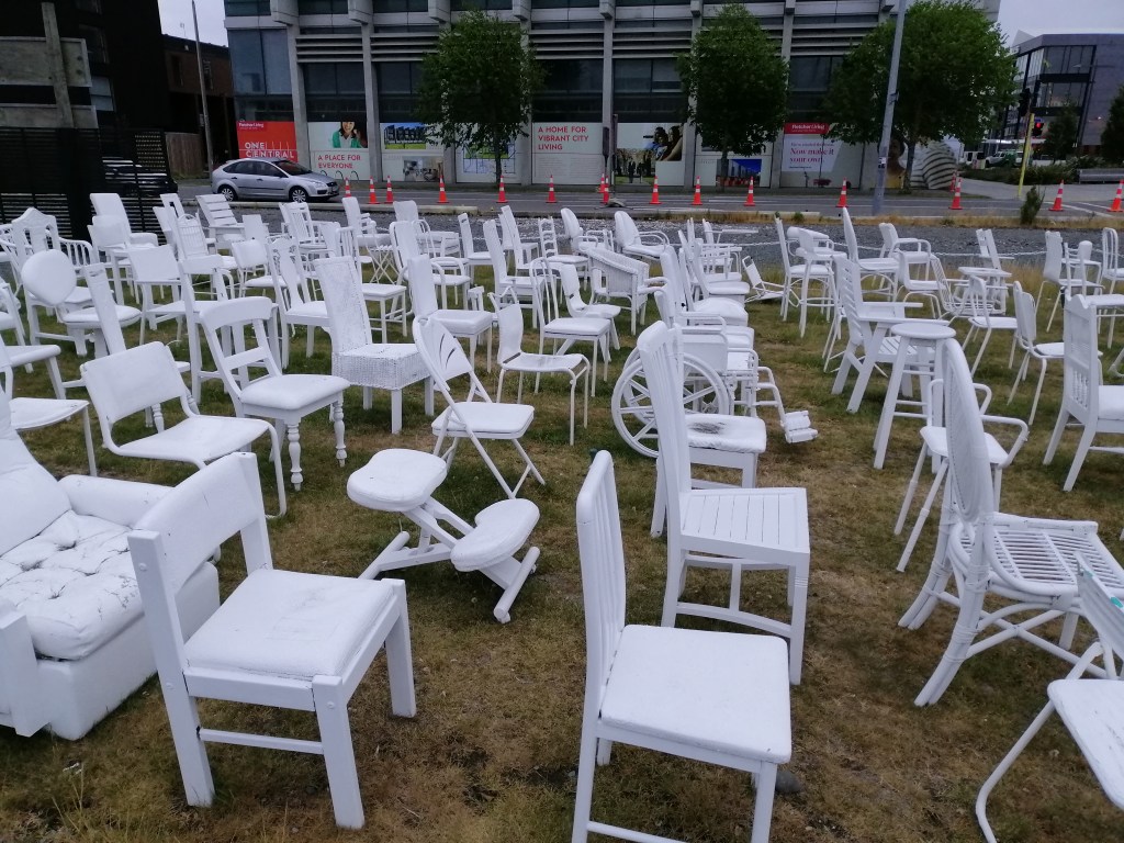
Another interesting observation is the streetscape – street art and mural that dot all over the city. Is it an expression of desperation, solace, anger or hope. To each his or her own. There is a unique memorial – 185 Chairs. A poignant tribute to the 185 whom lost the life in the 2011 tragic earthquake. A simple arrangement of white chairs (sitting objects ranging from dining, bassinets to bean bags) on a vacant lot – perhaps a message of impermanence.
Our wonderful 12 days road journey through stunning and exhilarating South Island ended here in beautiful Christchurch.
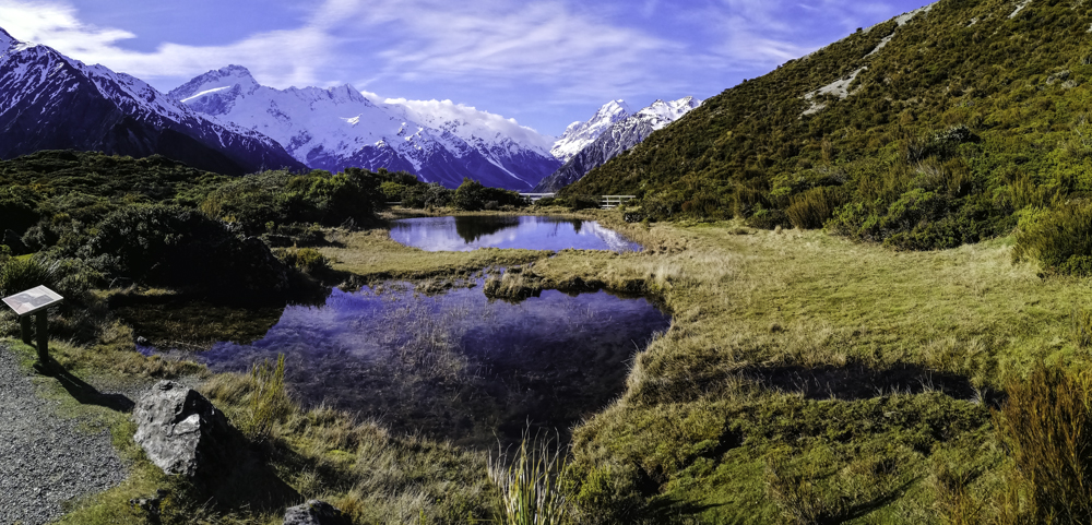
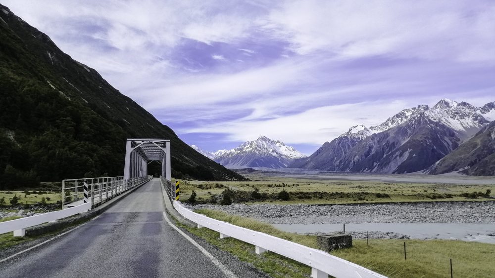
Haupapa/Tasman Glacier Track (2.7km) is one of the easier walks in Aoraki/ Mt Cook National Park. The drive towards Tasman Lake is stunning. The grand views of Mt Johmson, The Armchair, Nuns Veil and several more just before crossing the Hooker River bridge is spectacular. The drive continued along Mt Wakefield to a car park.
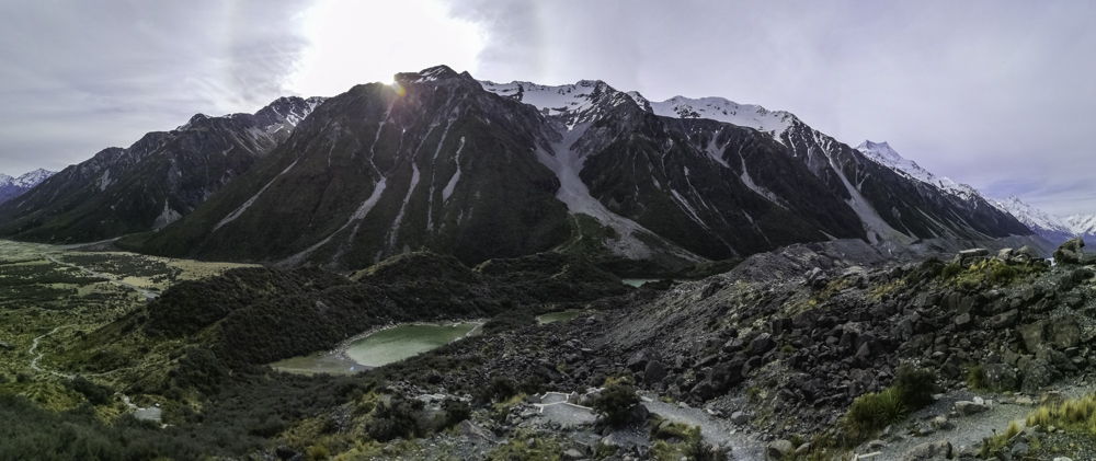
From the car park, it is a gradual climb through a series of steps. With elevation gain, the Blue Lakes became visible, nestled at the base of the mountains. They were glacial lakes with a blue tinge. The blue, in earlier days, were glacial melt-waters permeating through moraines. Over time, the glacier height dropped and water flow diminished. With rain water, algae developed and turned the colour green.
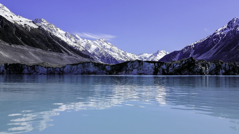
Towards the top, the track is rocks and debris left behind when the glacier retreated. Today, Tasman Glacier is 27km, the longest in New Zealand. It has retreated significantly since late 1990s. That’s when the lake was formed. At this height, the snow and ice covered mountains which included Mt Cook, Mt Tasman, The Alcolyte and Nuns Veil were stupendous.
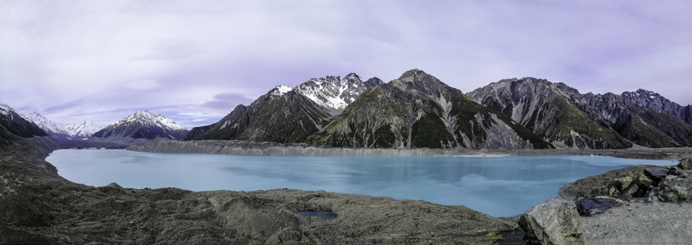
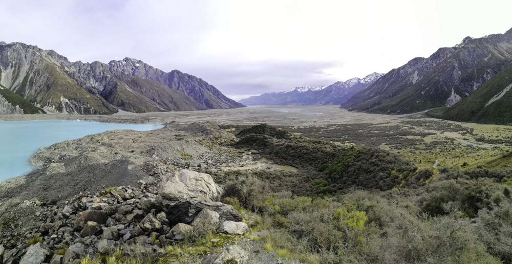
The fractured appearance of Tasman glacier’s terminal face, the dirt covered glacier head, the turquoise lake and the braided Tasman River (joined by the Hooker River) leading towards Lake Pukakai in the south, is quite a sight. Yes, the suggested walking time is 45 minutes. However, be prepared to linger much longer, in the cold, as the views here are quite captivating. Imagine, this lake was only created 20 years ago. Sadly, Tasman Glacier’s terminal face may retreat further with rise in temperature. Go now!
We stayed at the Hermitage Hotel. Due to Covid 19 travel restrictions, Kiwi’s have been travelling locally. Our hotel was near capacity. To encourage travelers to explore Aoraki Mt Cook National Park, prices for some excursions were reduced. This included Glacier Explorer – a boat ride on the Tasman Lake.
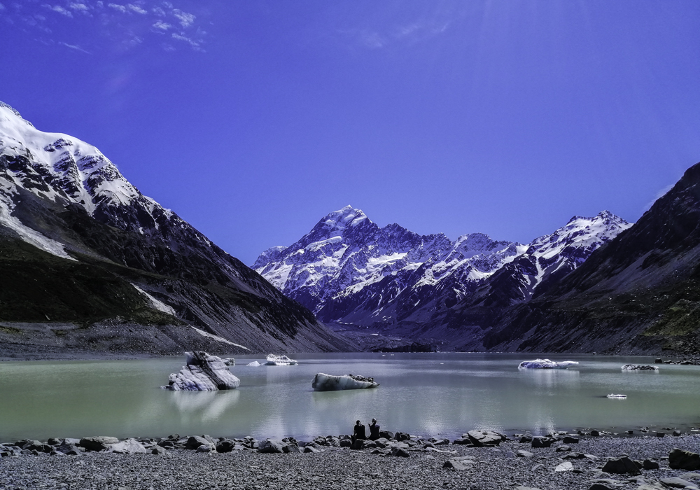
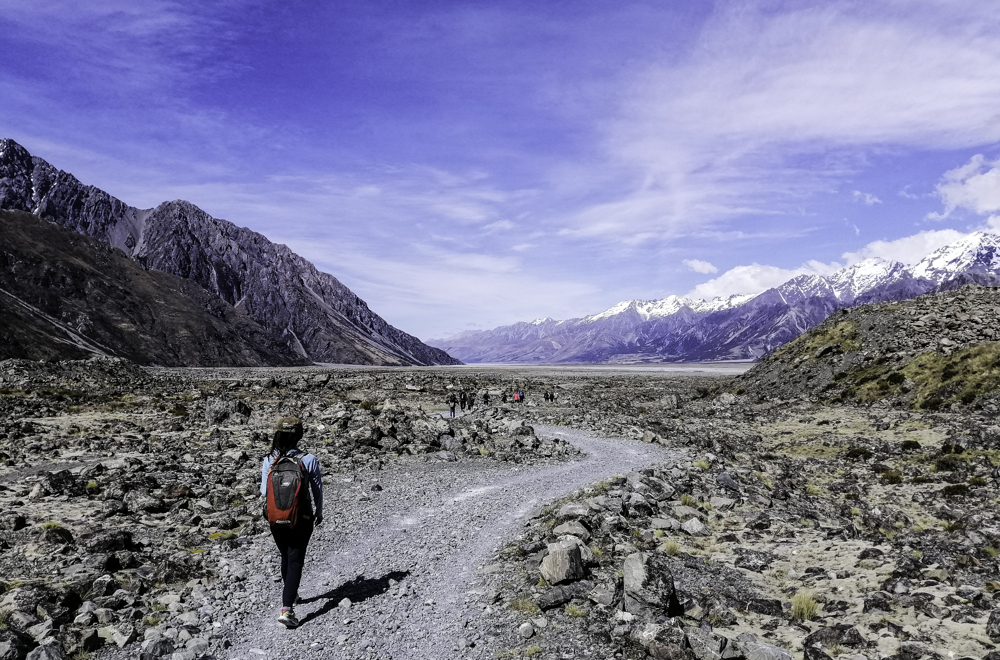
After a short drive to a car park (same starting point for the Blue Lakes and Tasman Glacier Track), we took a short walk on the moraine towards the chalky turquoise lake. After fitting on our life jackets and safety briefings, we were off. The water’s surface is cold. Surrounded by snow capped mountains including the looming Mt Cook, I was excited to see icebergs floating around. As we got closer, their sizes were enormous. The guides gave insights and short lecture on glacier-logy. These sculptured ice are several hundred years old. In the heat, water dripped rapidly. We even managed to break off some ice and taste. Cold but refreshing.
Tasman Lake is enormous. The view from glacier hike, the previous day, did not give the scale or enormity of the lake. We sped north towards the glacier’s terminal face. For safety, we viewed from a distant. The giant ice wall (4km wide) can calve without warning and cause tsunami like waves. A sharp sound burst through the silent and cold air. Then, followed by an ice wall breaking off and crashing into the water. It wasn’t big but the display was exciting.
Beyond the fractured ice face, the top of the glacier is covered with black dirt. It stretched towards the tops of the mountains. If fact, this dirt covering may extend the life of the glacier. Murchison Glacier is adjacent to Tasman Glacier. Perhaps the best overview would be aerial. Even better will be to walk (flights-and-tours ) on the glacier!
The overflow from Tasman Lake merged with Hooker River and the braided river flowed south towards Lake Pukaki.
We drove from Wanaka towards Aoraki Mt Cook National Park through farmlands and picturesque townships. The landscape is refreshing – sculptured trees, clear water flowing through rivers, streams and creeks. Some villages only had a petrol kiosk and a cafe. Eventually we climbed and negotiated through ’rounded’ hills dusted with snow and covered in tussock grass – the Lindis Pass.
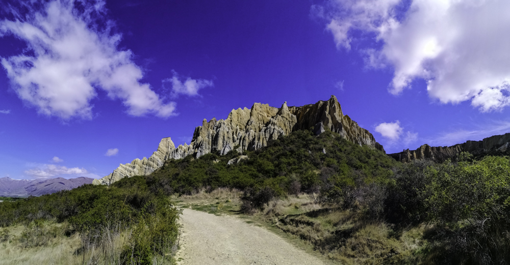
The road eventually ran parallel to Ahuriri River valley all the way to Omarama (‘place of light’). I had no information about this area. We stopped for a break and coffee. We realised from local magazines that this place is popular with Glider Flights, Hot Tubs and Clay Cliffs. We headed off to Clay Cliffs onto an unsealed road just off the main highway. We passed several farmlands and a pen with rugged Merino Rams. This is a private property. Farm gates need to be opened and closed to proceed. A $5 entrance fee is put into an honesty box.
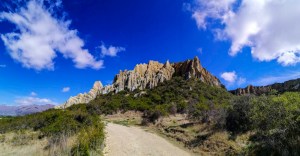
The day was a mix of clouds and sunshine. The Clay Cliffs is a stunning sight. The unique pinnacles and eroded valleys draped in chalk white and sandstone brown against a deep blue sky. It was quite unearthly. Across the valley, the braided Ahuriri River snaked gently towards the mountains.
These unique formations resulted from thousands of years of glacial activity and deposits of silt, sand and gravel of an ancient river. It lies on the Ostler Fault and eventually trusted upwards. The soft deposits are slowly eroding from weathering. The destruction is further decimated by pigeons making homes amongst these soft structures. Narrow tracks led into the heart of these towering structures with rising pinnacles separated by steep ravines. This might as well be in the Moroccan desert. Loose sand make climbing difficult in places. The colours changed with the light. The green vegetation and slow flowing Ahuriri River added contrast to the unworldly landscape.
Returning to Omarama, we headed of to Wrinkly Ram – a restaurant, souvenir shop and a sheep show (It hosts the only Merino sheep shearing show in New Zealand). The next best thing to do in Omarama is visit the Hot Tubs. It was closed in this hot afternoon. Each tub is private but had no shade. They offered us a umbrella! Not today perhaps. We continued our road journey to Aoraki/Mt Cook National Park.
The road from Wanaka passed through “That Wanaka Tree” and towards Glendhu Bay passing the start point of the popular Roys Peak Track. It was closed for lambing season. At Glendhu Bay, there were stunning views of Mt Aspiring and the surrounding mountains reflected on the pebbled beach bay.
The scenic ride continued into Matukituki Valley. The road is hemmed between mountains, pastoral land with views of Lake Wanaka. The starting point of Rocky Mountain Hike is at Diamond Lake Conservation Area. (Refer to DoC for more information).
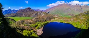
The start is a steep climb on gravel road and descends into the bush. The walk skirted the deep blue lake with sound of aquatic birds. At a junction, a series of wooden steps climbed onto the rocky mountain. It twisted and turned with buzzing sound of bees. I took the eastern track which provided elevated views of Diamond Lake. Along the track were several specimens of flowering tree Fuchsia (kōtukutuku) with their distinctive brown barks peeling off. The view of the cobalt blue Diamond Lake contrasted by the greenery of the bush was stunning.
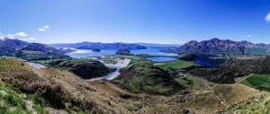
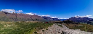
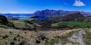
I continued on the eastern route and came into expansive views of Lake Wanaka, the surrounding farmlands and snow covered mountains including Roys Peak. It was quite exhilarating. The trail, now narrowed, zig zagged uphill over boulders and steep climb. Tui bird calls filled the mountain air. The views of the lake and mountains improved. Another choice. This time I choose the western route. Climbed over boulders, with all four limbs employed in places, on the way to the summit. There were fantastic views of Matukituki Valley. Finally a clearing and a grassy track led to the summit. On the west, snow and glacier covered peaks. A road zigzagged up the ski fields at Treble Cone Mountain. Mt Aspiring’s (Tititea, in Māori, means ‘steep peak of glistening white’) – icy sharp peaks and many more are visible.
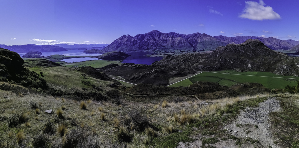
The summit of Rocky Mountain is flat with a collection of rocks. On the east, great views of stunning Lake Wanaka, islands dotted around in the lakes, tail end of Matukituki River which drained into the lake and the mountains beyond. The climb is worth just for the expansive and spectacular views.
I retraced my steps back and circled Diamond Lake. Trees were lush with bird songs. On the water’s edge, marshes covered with reeds and other aquatic plants. As I exited the lake, a single duck fed frantically on the grassy marshes. This 3 hours return intermediate hike is a great way to view this spectacular region.
We left Wanaka and head towards Makarora on one of the most scenic drive along the blue Lake Hawea. We stopped at a dam on the lake near the small Hawea township at the southern end of the lake. Towards the north, snow peaked mountains of the Southern Alps. That was enough incentive for me to continue. The road twisted and turned with sharp hairpin turns. However, with every turn, wonderful vistas appeared. About 30 minutes, we arrived at the starting point – Stewart Creek car park. The blue Lake Hawea sparkled and mountain peaks glistened in the morning sun.
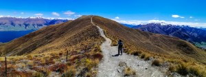
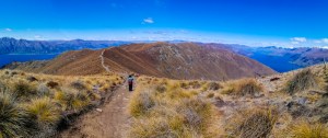
Isthmus Peak Track (16km) is in the Matatiaho Conservation Area. The track is closed from 20 November till 20 December. No booking is required for this day hike. We started the hike at 0930. The initial part of the track is climbing over a rocky terrain and passing foraging sheep and cattle. The views off Lake Hawea were stunning against the blue sky. The hike continue uphill through grassland. After 1.5 hours, the track is narrow with loose gravel cut along the slope of the mountain. The track zig zags up hugging the slope and in places with precipitous drops. Tussock grasses dominate this open landscape. It is exposed and can be very hot like today. Water (refilling) is not available and therefore it is essential to bring your own. This is an alpine area and strong wind and cold conditions can occur at any time. Some area are prone to avalanches when the mountains are covered in snow.
The strong sun was relentless and made walking harder. As the track twisted and turned, the summit seemed just there. However, upon reaching, we realised that there is another peak ahead. This continued for a while. With gain in altitude, the views across the mountains and valleys became ever panoramic and stunning. At this stage, only Lake Hawea was visible. Flowering alpine plants and shrubs appeared sporadically. We could only see a few hikers on the mountain today.
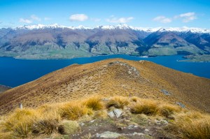
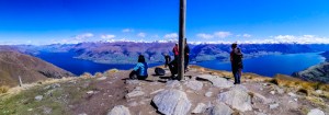
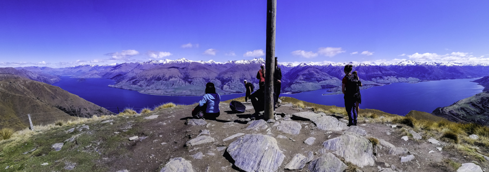
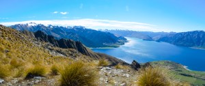
Climbing slowly from one peak to yet another seemed like the track is endless. We arrived at a sign posted junction (1386 m) – Isthmus Peak to the right and Glen Dene Ridge Track to the left. As we gained elevation along a fence, Lake Wanaka come into view with the snowy peaks of the alps in the background. The views were stunning in the bright light with deep blue sky. After several switchbacks and false peaks, we walked uphill on a grassy track. A pole was erected at the end. Finally the summit. The views of both Lakes – Wanaka and Hawea were stupendous. The pain to get here melted away by the euphoric sensation of the snowy peaks, jagged mountains and the deep blue sky and lakes.
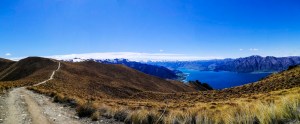
We retraced our steps back on the same track back towards the car park. The weather was relentlessly hot. Although the sun had shifted, the views of the jagged snowy peaks and the mesmerising blue lakes were stunning. Just before we descended into the bush, we managed to spot a couple of wild deer. It was an exhausting 7 hours hike but certainly worth it. This track has been comparable to Roy’s Peak Track, closer to Wanaka. Roy Peak Track is shorter and more accessible making it popular. However, Isthmus Peak Track is certainly a wonderful hike with wonderful views of both Wanaka and Hawea lakes.
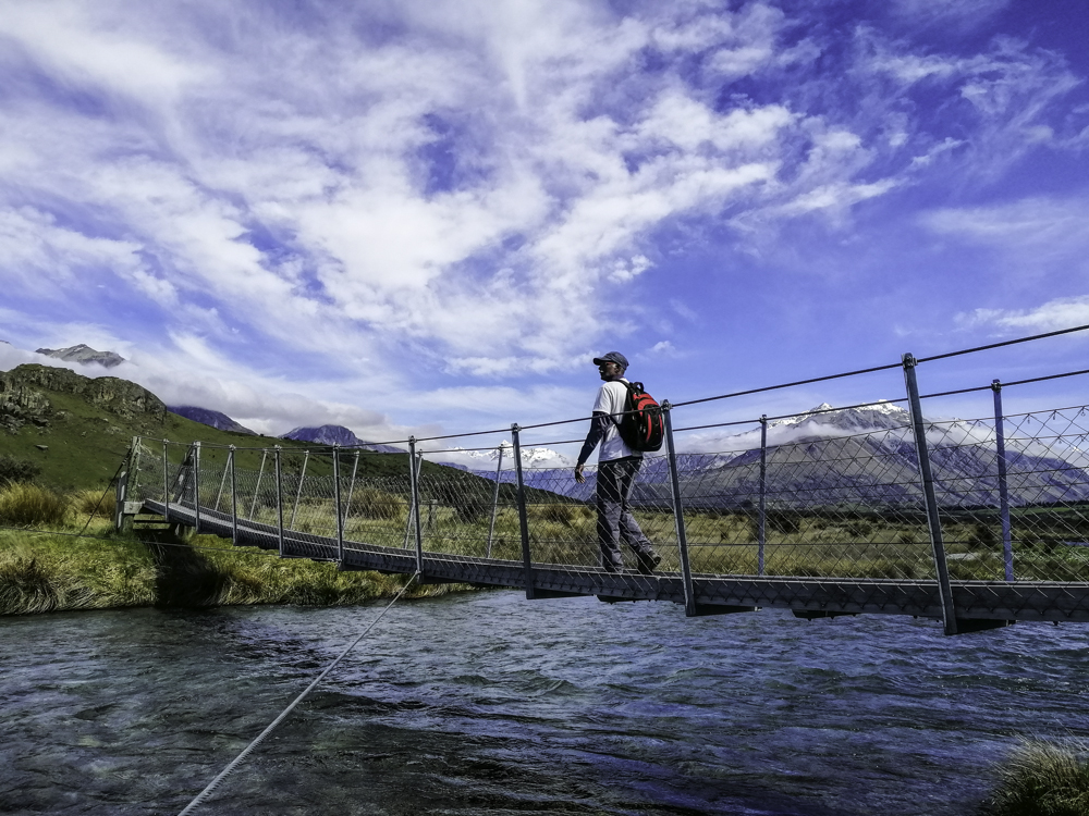
We continued on to Makarora, at the top end of Lake Wanaka along Makarora River. Stopped for a deserved lunch at Wonderland lodge. We continued towards Haast Pass to a sign posted Blue Pools, Mt Aspiring car park. After the first swing bridge over the Makarora River, it was refreshing to walk under tree canopies and board walk compared to the exposed Isthmus Peak Track. In about 20 minutes, we crossed the second swing bridge over Blue River which merged with the main Makarora River just meters away. Today, the water, although clear, was green. The blue colour is derived from the glacial melt waters from the mountains. Plus, it is also determined by the light on the day. It is certainly inviting to jump into the cold fast moving river. It is one of those natural sites that is worth visiting.


 The scenic ride continued into Matukituki Valley. The road is hemmed between mountains, pastoral land with views of Lake Wanaka. The starting point of Rocky Mountain Hike is at Diamond Lake Conservation Area. (Refer to DoC for more
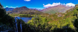
 The summit of Rocky Mountain is flat with a collection of rocks. On the east, great views of stunning Lake Wanaka, islands dotted around in the lakes, tail end of Matukituki River which drained into the lake and the mountains beyond. The climb is worth just for the expansive and spectacular views.
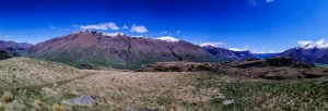

 Isthmus Peak Track (16km) is in the Matatiaho Conservation Area. The track is closed from 20 November till 20 December. No booking is required for this day hike. We started the hike at 0930. The initial part of the track is climbing over a rocky terrain and passing foraging sheep and cattle. The views off Lake Hawea were stunning against the blue sky. The hike continue uphill through grassland. After 1.5 hours, the track is narrow with loose gravel cut along the slope of the mountain. The track zig zags up hugging the slope and in places with precipitous drops. Tussock grasses dominate this open landscape. It is exposed and can be very hot like today. Water (refilling) is not available and therefore it is essential to bring your own. This is an alpine area and strong wind and cold conditions can occur at any time. Some area are prone to avalanches when the mountains are covered in snow.