Table of Contents
Track Information
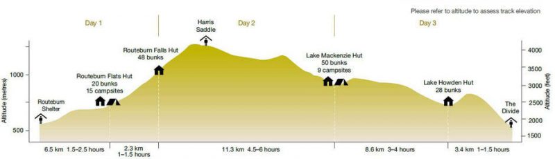
Day 1 – Divide – Lake Howden via Key Summit
Day 2 – Lake Howden Hut – Lake Mackenzie Hut
Day 3 – Lake Mackenzie Hut – Routeburn Falls Hut
Day 4 – Routeburn Falls Hut – The Shelter
Suggested Food
Suggested hiking gear
Track information
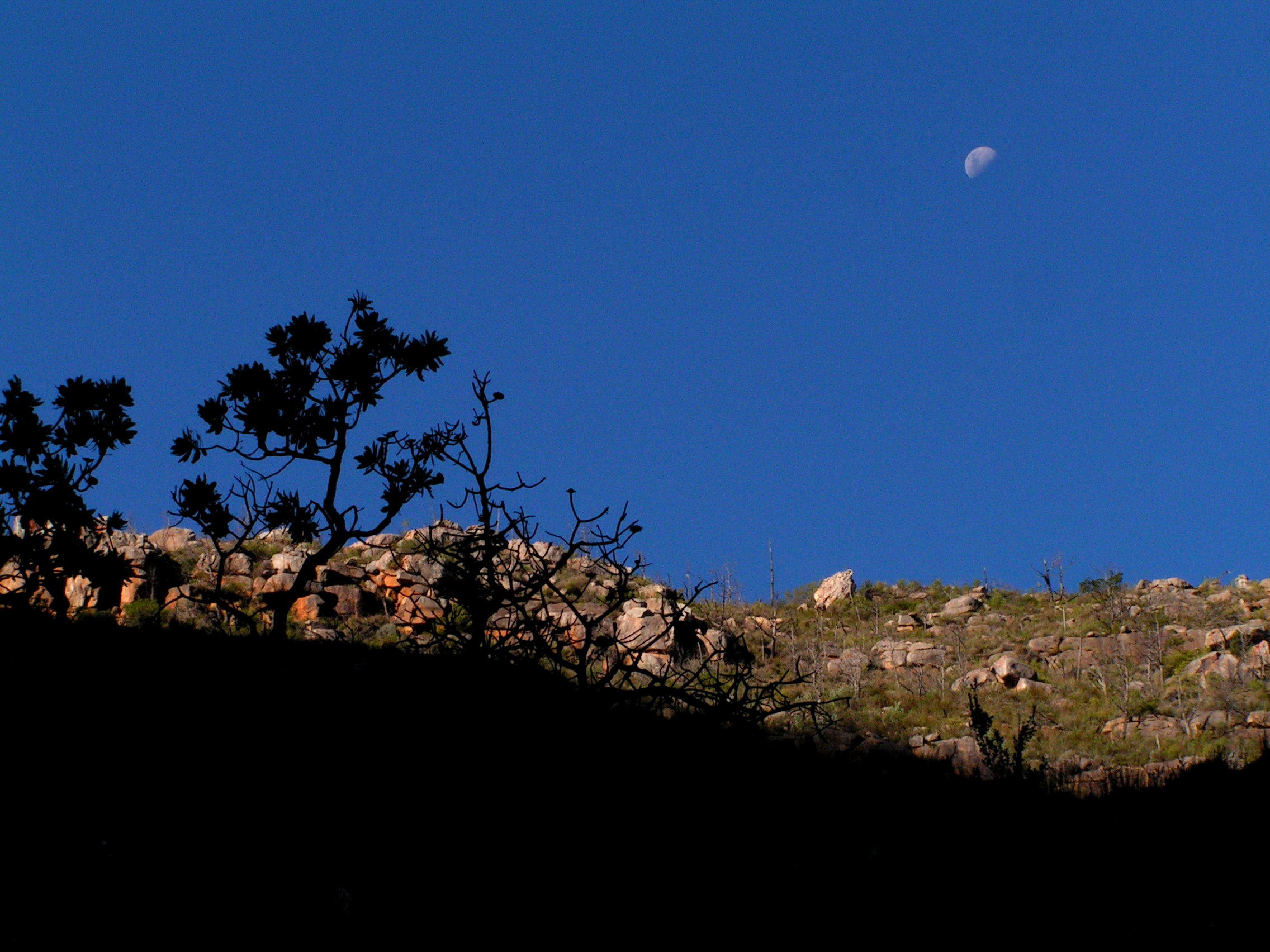
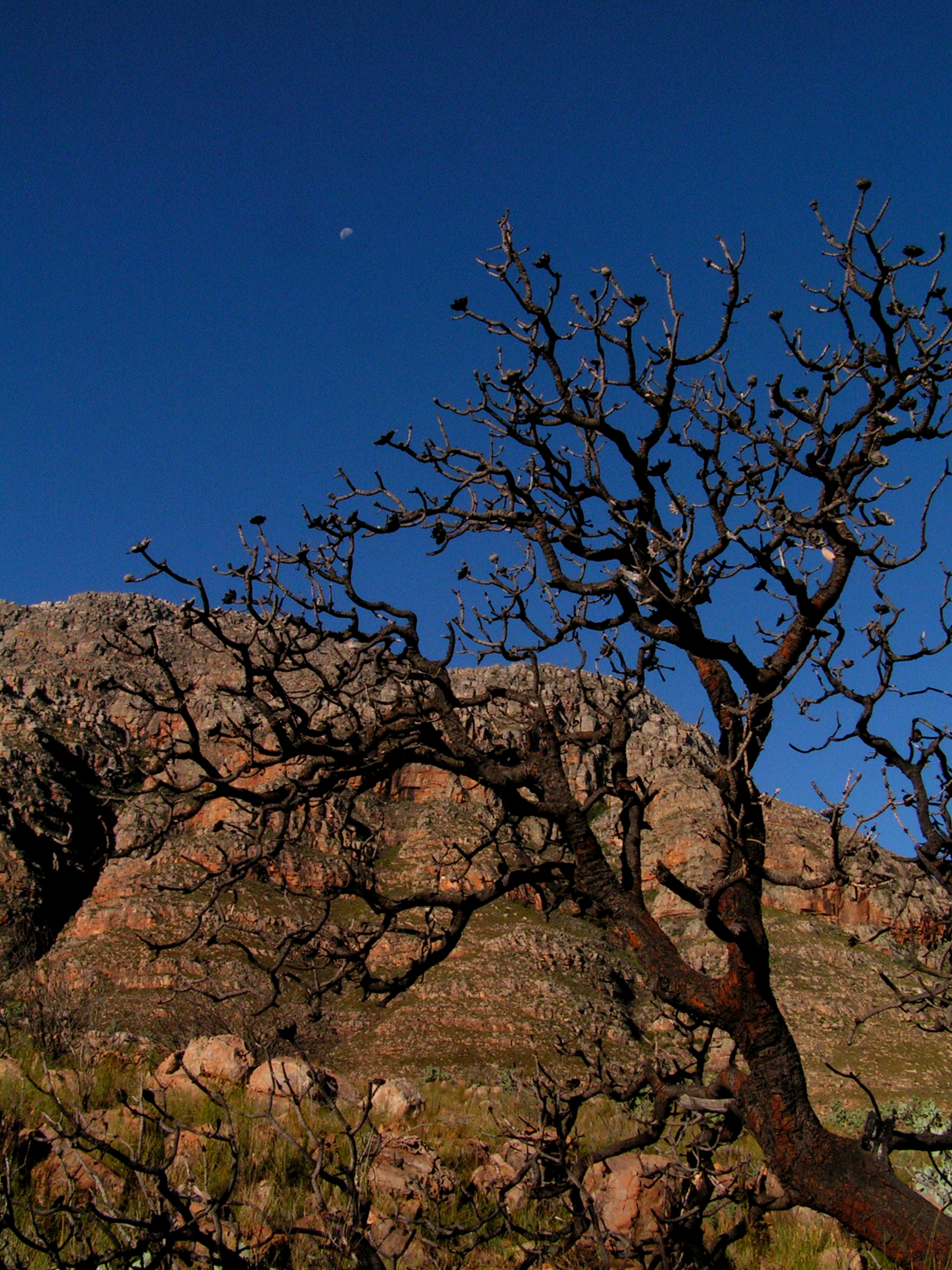
Routeburn Track is located in the unique Fiordland in New Zealand’s South Island. It is considered one of New Zealand’s Great Walks. Read about my hikes in Abel Tasman Coastal Track and Kepler Track in previous posts. You can also see my Routeburn Track photos
The tracks and huts are managed by DOC (Dept. of Conservation). As such, registration and bookings are made through the Department of Conservation, Fiordland National Park. Booking is not only essential, book early as it is popular particularly between December and March. I suggest booking on the shoulder season – early November and April to avoid the crowd. All booking must be confirmed at the DOC offices either in Queenstown or Te Anau prior to starting the track. The Fiordland weather is unpredictable. Be prepared for mainly for rain and gusty cold wind. During my track in early November, we experienced heavy rain, thunderstorms and lightning in the last two days. Avalanche warnings are also high on certain stretches especially between Lake Mackenzie and Routeburn Falls Huts. Particularly near Harris Lake.
The 32 km track can be completed in two, three or four days. We decided to do a four day track to accommodate my injured thumb plus to take in the views. (Having done it, three days is ideal). It is a one way track that can be started from either end – the Divide from Te Anau or the Routeburn shelter from Glenorchy. Walking from the Divide offers an easier hike as the track climbs gradually. Plus, walk into generous views. Start from Te Anau and finish in Queenstown. Transportation to and from Queenstown and Te Anau to the Divide and the Shelter can be organised by Tracknet or Infotrack. For relocating cars between starting and finishing points, contact Trackhopper or Easyhike.
Day 1 (Nov 6) – Divide – Lake Howden via Key Summit (3.4km + 2km)
Will, my tramping partner, and I were picked up by Tracknet (transporter) at Te Anau at 0715. It was raining lightly. Soon after entering Fiordland NP, we passed through Elington Valley, grouched out during the ice age, covered with golden tussock grasses. The slow moving Elington River meandered through it. Soon after, we made a short stop at Gunn Lake. On a good day, reflections of the surrounding mountains can be seen mirrored on the lake. We arrived at the Divide, about 1.5 hrs from Te Anau on the road to Milford Sound, around 0830, starting point of the 32 km Routeburn Track with a side track to Key Summit.

At a shelter, we organised ourselves. The weather was very cloudy and it rained sporadically.
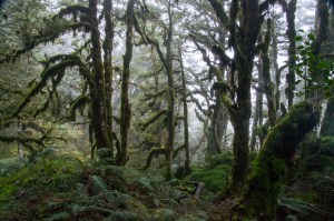
We entered Fiordland NP. Its distinct lichens hung from trees, lime green moss carpeted the forest floor with thickets of ferns. The air was crisp with clear visibility. I could almost see the individual leaves. However, clouds hung low above the tree top and mountains. We passed a few Kotukutu trees, the largest fuchsia in the world. It had a distinctive orange bark peels.

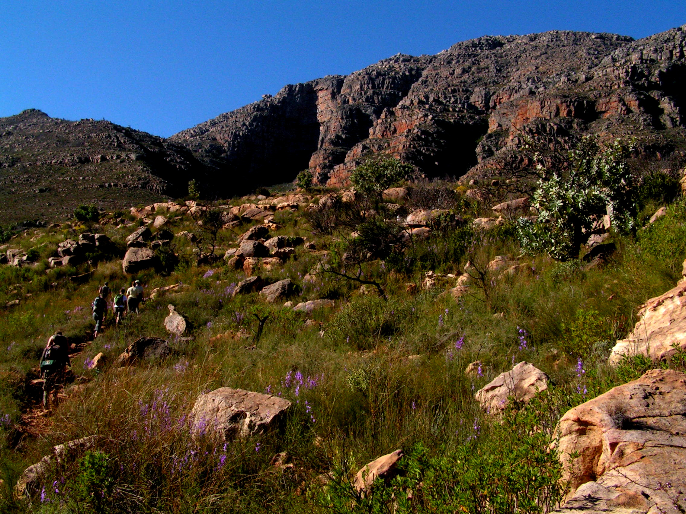
This is mainly a Silver Beech forest. We passed small waterfalls and crossed man-made bridges. The track was not too demanding at this stage. Furthermore, it is a short hike today. Secretly, I was hoping the rain clouds would clear when we approach Key Summit as we walked through the mainly silver beech forest. I was optimistic and excited. At the same time, apprehensive. How am I going to cope with my fractured thumb (sports injury just 6 days ago). Occasionally, icy peaks of the Earl Mountains emerged through the tree clearings. There were only three people on the track for now.
Once above the tree line, the Darren Mountains with the Hollyford valley and river stretched towards the horizon. My heartbeat jumped. I am always inspired by snowy peaks and high places. As hoped, the threatening dark rain clouds had thinned. The sun was out. The landscape was bathed in glorious morning sunshine and the sky blue. The flora here is mixed. Around 0930, we arrived at a junction, one descended towards Lake Howden Hut and the other, ascended towards Key Summit.

On this exposed section, we bumped into a bunch of school kids from Dunedin. The tranquility is broken with chatter and friendly banter among these kids. It was great to see these young ones enjoying the great outdoors. For a moment, the track was crowded. Eventually, once we arrived at the summit, the views were stunning. We were encircled but snowy peaks. I was mesmerised by the alpine tarns surrounded with yellow ground moss adorned with majestic peaks. On the west, the Earl and Darren Mountains. On the east – Humboldt, Ailsa and Livingstona Mountains. The clouds cleared, little cool wind and sun warm. I just had to sit and savour this natural beauty. In the background, laughter and chatter by the school kids.

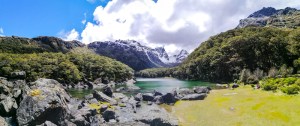
Within minutes, the cold clouds partially reclaimed the mountain tops. This is synonymous with the Fiordland. There is an Alpine Loop Walk. Yellow moss surrounded an alpine tarn. It is a delicate environment. I was stuck like a magnet in this place. Continuing on further south on the trail, there is a viewing spot and rest area. With clouds almost covering the mountain, I was not sure what I was looking at. A small signage cleared that up. The school kids had also gathered here together with a guided group op. I was in no hurry and relished this magical environment. Several ice covered peaks with bare slopes appeared. Finally, I spotted the aquamarine alpine glacial Lake Marian, literally hanging off the slopes of Mount Christina. On the right is an aptly named Mount Crosscut. The Key Summit Track can be done as a day hike from the Divide (3 hrs return).

We retraced our tracks back to the mail trail and hiked towards, mainly downhill and under tree canopy, towards Lake Howden Hut. We arrived around 1130. The group of kids we met on Key Summit were, fortunately, to the next hut. Plus, a group of guided hikers were having lunch and also preparing to leave. Placid Lake Howden is surrounded by lush green mountains as a few icy peaks. The lake water flowed out just in front of the hut. It was cold though. Alert! Be prepared for sand fly. Soon, more trackers arrived and departed.
After lunch, as the sun was still out and bright, I walked along the lake on the Caples Track. It was all under the forest canopy. Bird songs filled the air. Trying to spot them is a different issue. Several streams criss-crossed the track. In an open valley, a small stream cut a grassy bog. The sky was blue and the weather warm. The hut was half full. I looked out of the window while sipping my miso soup, the sun was still out after 1900. Most people in this hut were mainly heading towards the Divide the next day. There were a few going in our direction. Dinner time gives us an opportunity to meet other hikers and hear their stories. Huts are never easy to sleep!
Day 2 (Nov 7) – Lake Howden Hut – Lake Mackenzie Hut (8.6 km)
I did not sleep well. Noises, snoring and movements of people within the hut is unavoidable. I was up around 0700 and the hut was completely engulfed by heavy fog. The surrounding rainforest were transformed into silhouettes. A thick layer of mist hung just above Howden Lake’s surface. After breakfast, we left the hut around 0800. We know there were three other heading our way.
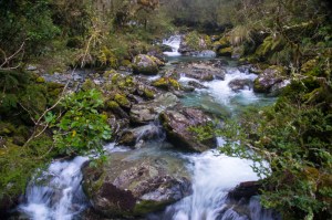
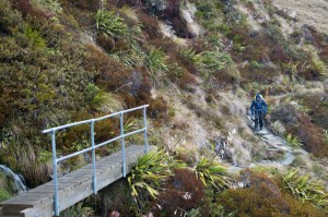
The track ascended from the hut and lead into the forest. The air was still. The only sound I heard was my heavy breath and footsteps on the gravel track. Bird songs echoed through the misty rain forest. In the background, there is a constant sound, the roar of moving water. Either from the numerous streams that criss-cross the track and waterfalls. Synonymous with the Fiordlands, the forest is enriched with with lichens on tree branches and trunks, moss carpet on the forest floor and sporadic ground ferns. Similarly we crossed several fixed bridges. We met Richard, a keen birder making his way slowly. He explained that he had hip replacement just four months ago. Brave and determined man.
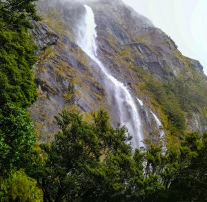
Loud roar resonated through the forest. Not long after, I could see a white column of water fall from a blackish cliff face. I felt the strong spray drift before witnessing the fall itself. This is Earland Fall (178m). Resulting from the night’s heavy rainfall, there was a lot of water. The track passed along the face of the fall. Be prepared to get wet. There is an alternative route just below the main track.
Strangely, past the fall, the ground seemed drier. Looking back at Earland Falls,it was even more impressive especially when the clouds disappeared. Snow covered mountains appeared. That brought some excitement. The canopy was thinner here. A signage said The Orchard. It is a flat area covered with grasses, thickets of ferns, flax and small ribbonwood trees. They look like apple trees. I ventured off the track towards a small pond flanked by beech trees. A couple of stunned hares hopped into the bush. In distant background, looming peaks glowed in the late morning sun.
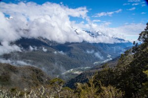
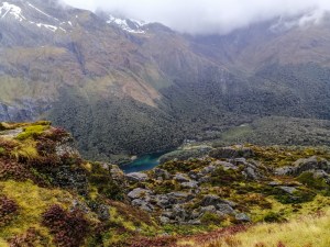
The track zig-zagged along the slopes and the was a pleasant surprise – the Darren Mountains. The range was partially visible with clouds moving rapidly. As the clouds dissipated, the Hollyford Valley and river appeared. This is a perfect place for lunch. I was totally mesmerised by the icy mountains. While having lunch, I was hoping the whole range would open up. Optimistic perhaps. At times I could see the end of the Hollyford River which drained into the Tasman Sea. I dragged away from this fantastic view. The blue sky and sunny day was welcomed. Still walking along the slopes with the Darren Mountains on the west, I reentered the forest. With beautiful weather, I was really enjoying the hike. I am almost alone throughout the track. There were only about five hiker walking in the direction. That is a great feeling. Occasionally I caught up with Will. A. tiny green bird darted around tree branches (later identified by Richard, a bird enthusiasts as the Riflemen). The final part track ended on the flats covered with shrubs. The first huts were not for independent hikers. Its a lodge. Finally, around 1230 I arrived at Lake Mackenzie Hut. There were not other boarders yet.
 It is an amazing site. I was attracted towards the emerald green glacial lake. Rough blocks of glacial rocks lay strewn on the west end of the lake. Two peaks loomed above, Ocean and Emily Peaks. With the sun shining, the views were stunning. After some hot refreshments, we headed out to explore Split Rock. There were great views of both Ocean and Emily Peaks. On the west, Christina and other Darren Mountain peaks gleamed in the midday sun. Bird calls echoed everywhere but hard to see. Near the hut, a couple of Kea made their distinct calls. Today is a fantastic day but we were warned of uncertain weather tomorrow. At dinner, we caught up with Richard. There is a sense of camaraderie amongst hikers.
Day 3 (Nov 8) – Lake Mackenzie Hut to Routeburn Falls Hut (11.3km)
Tried to get some sleep but quite unsuccessful. Late at night, the dark clouds that gathered earlier turned into torrential downpour aided with strong gusty wind. The storm lashed onto the hut with lightning and thunder. I was glad that I am tucked in my sleeping bag.
The weather forecast for today is not particularly good with potential for rain throughout the day. At breakfast, I was surprised there was no rain although dark and cloudy. We departed around 0730 hoping to take advantage of the weather. Kea calls echoed in the cold morning air from the nearby trees. I had my rain gear and thermals on. The track immediately entered the beech forest and skirted round Lake Mackenzie. The gravel track zig-zagged climbing steadily under the forest canopy. We soon emerged out of the forest and surprisingly with only a breeze. As we climbed around the slopes of Ocean Peak, there were great views of Lake Mackenzie and the surrounding mountains. The day was cloudy and rain was imminent. Above the tree line, the track passed through a high alpine plateau of tussock grasses and transformed into jagged rocky plateau. Unique hardy plants clung on to survive these harsh conditions. Then it began to drizzle.
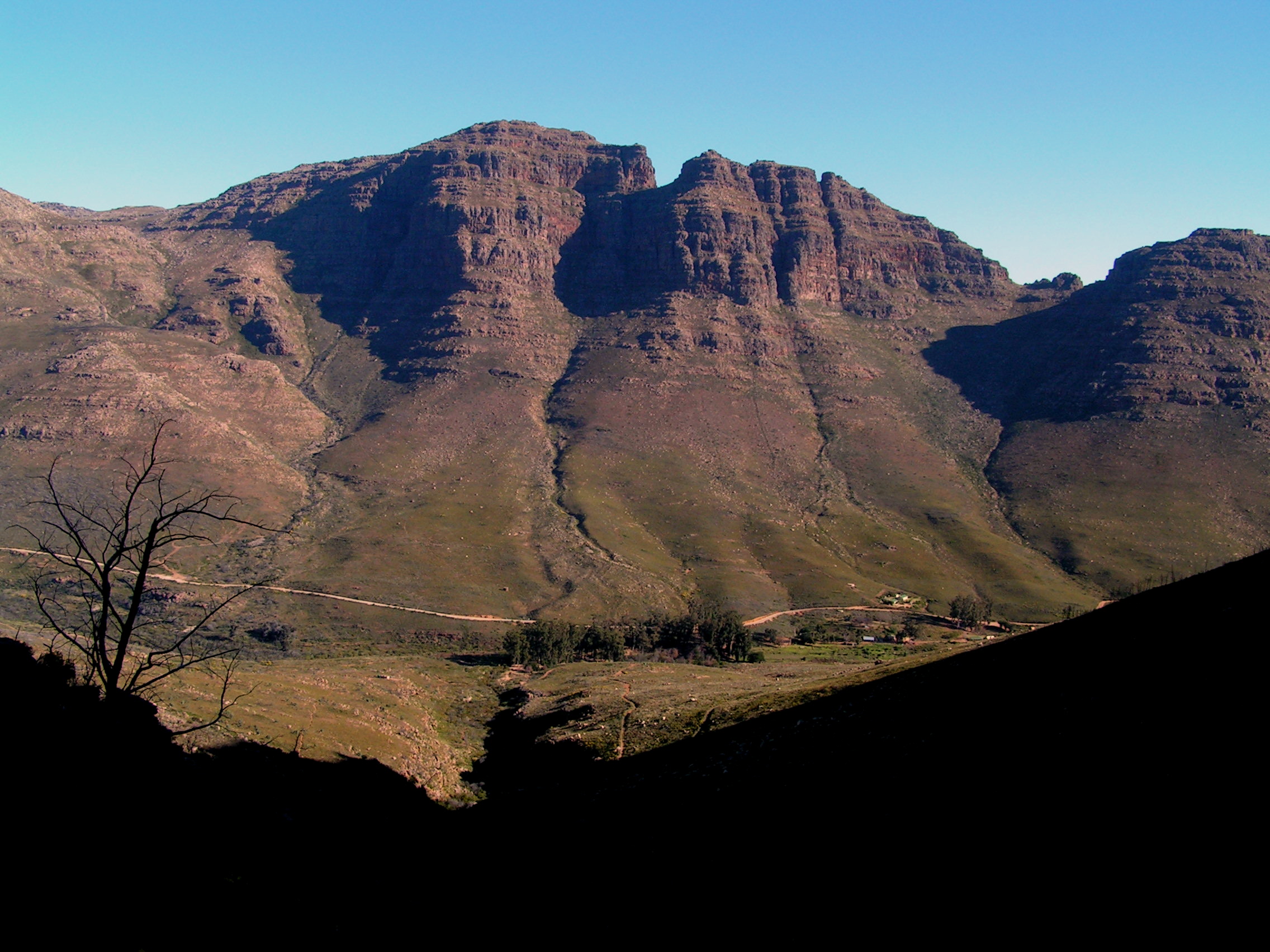
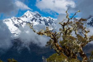
The track progresses parallel with the Hollyford Valley flanked by the great snow peaked Darren Mountains. The wind picked up so did the rain. I struggled a little keeping my bandaged hand dry. Tussock grasses covered most surfaces. Icy peaks emerged as the clouds clear. At one point, the track is a narrow ledge with steep slope. Fortunately, a pipe handle, screwed onto the cliff face, provided some support. Sudden gusts of wind threw me off balance at places. On the west, Darren Mountains were almost invisible with the rain and thick clouds. Temperatures began to drop as we climbed higher. The hike was not difficult.


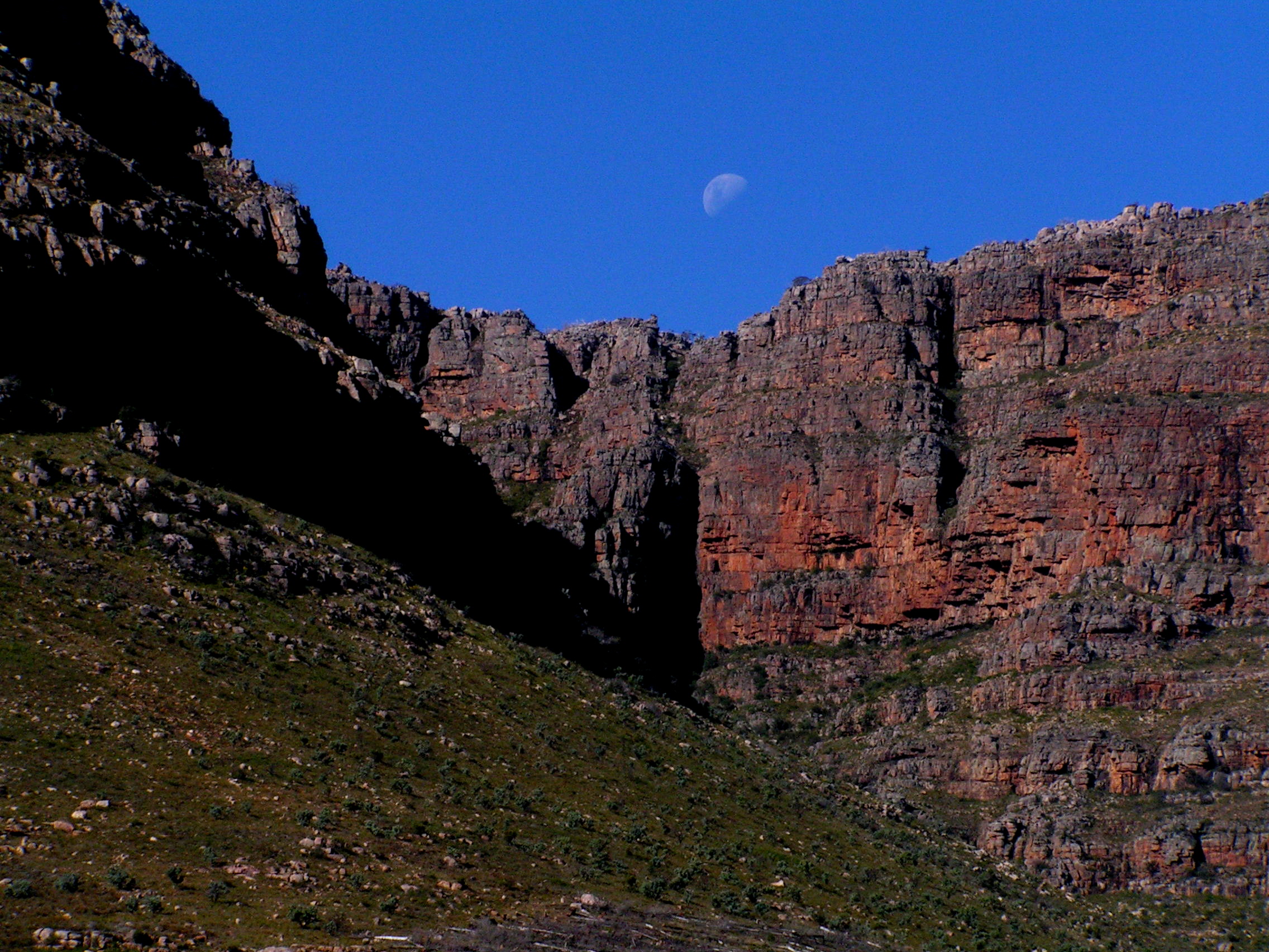
Finally we approached Harris Saddle, the highest elevation (1255m) of the Routeburn Track at midday. Hale swept through as I hurried into the shelter. I tucked in my lunch before continuing on. A few other hikers coming from the opposite direction also made a brief stop here. Unfortunately, my flimsy rain coat tore. There is no alternative rain top. Moments later, sleet dropped from the dark sky. The side trip to Conical Hill was inaccessible today due to avalanches. The views beyond the shelter was obscured by heavy mist and clouds. Fortunately, the orange track markers, provided guide and direction. These are invaluable during poor weather and visibility.
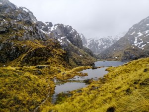
For hereon, we entered the Mount Aspiring NP. After a short walk over sandstone rocks, the dark hued glass-like glacial Harris Lake appeared. Although cloudy, raining and dark, the expansive views were amazing. Snow peaked mountains were almost silhouetted in the background. It was in black and white. Just past the shelter, in an tarn, was a rare blue duck (Whio). The narrow track skirted above and around the lake. With a series of wooden steps, I descended through a lump of ice. Continuous rain had made the track slippery in places. There are great views of Harris Lake and the drainage outlet. A river is formed and flowed downhill. In the distant, a greenish valley. Avalanche warning appear sporadically over this stretch.

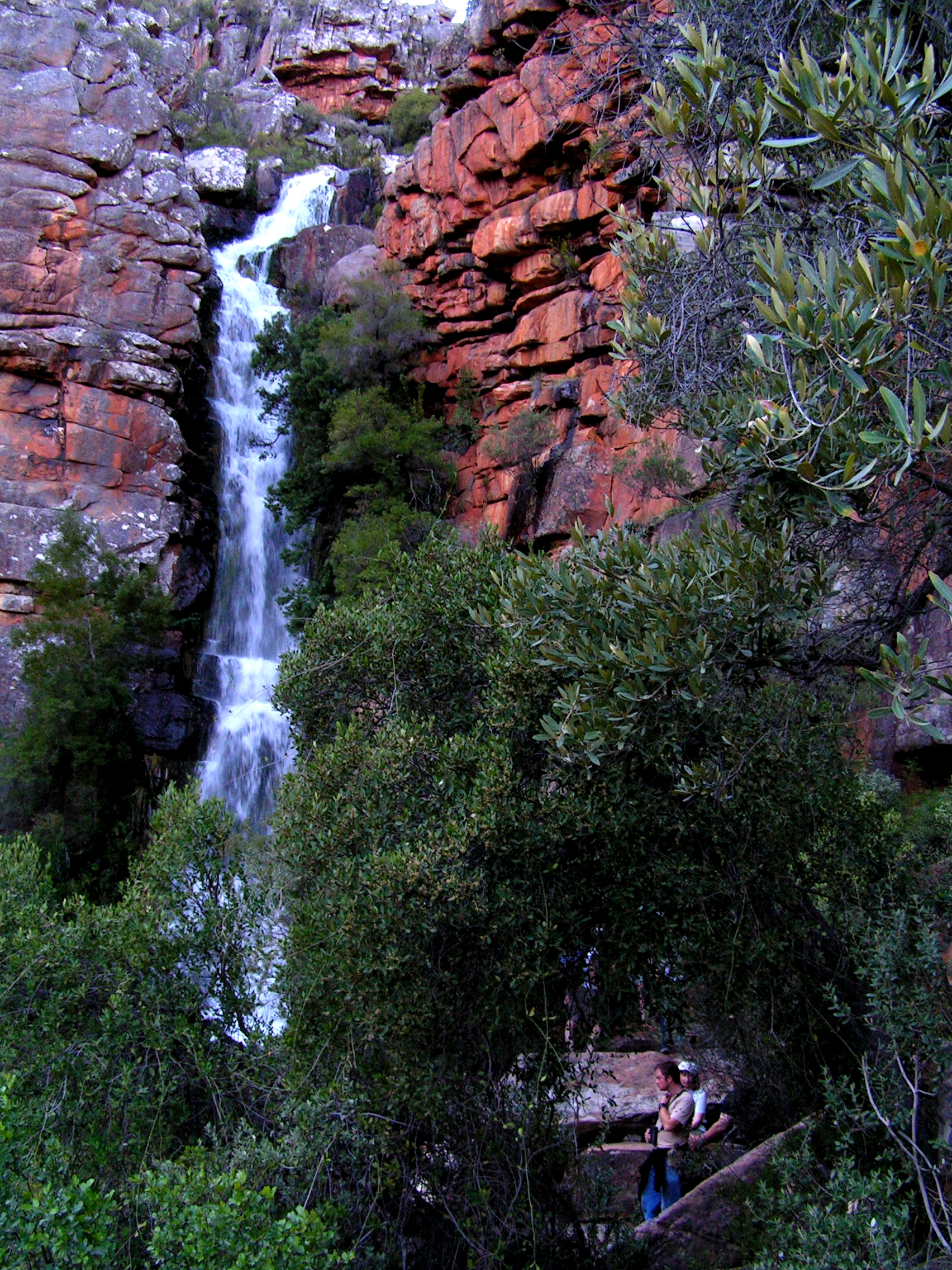
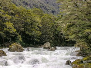
On this rugged landscape of tussock flats and boulders , the beginning of Routeburn River cascaded down and meandered towards the rain mist covered valley below. The river splits into fast flowing streams. Various coloured stones including greenstones are strewn along the track. This area is rich in “pounamu” (jade like greenstone). Drenched in rain, the bush is green. As I approach the flats, a loud consistent roar can be heard. Aided by iron railing, I walked gingerly over sandstone rocks. There, the torrent Routeburn Falls tumbled into a deep canyon at three separated sections. Due to heavy downpours, aided by numerous ad-hoc streams, the river had swelled.
 Below, a cluster of corrugated iron roof tops buildings. These included a upmarket accommodation and the humble DOC Routeburn Falls Huts. A helicopter landing pad is clearly marked. Drenched and cold, I was relieved to arrive. It was around 1230pm. A quick change, organising my bunk bed, I looked forward to a hot meal. Three Kea birds played on a nearby tree. From the balcony of the hut, the lemon green flats and black slopes of the Humboldt Mountain were barely visible. Waterfalls seemed to appear and disappear on the mountain slope with the ebb and flow of the rain. This hut is an enviable location.
A helicopter ferried passengers to the luxury lodge. It caused a flurry of excitement. Time to settle into hut life. We met fellow kiwis Mellisa and Marisa. along with Richard and formed a small dinner table group. All from different walks of life with a common interest in Hiking. Richard offered an emergency rain cover ( a bright yellow plastic bag). Perhaps, with bad weather forecast, I may have use for it.
Day 4 (Nov 9) – Routeburn Falls Hut to Routeburn Shelter (8.8km)
Left at 8am. Severe storm warning arrived at night. Gale force winds packed with rain, thunder and lightning. It was cold but once inside sleeping bag, warm. After 2 days of little or disturbed sleep, managed to get sound sleep. Next morning weather was uncertain. What time shall we depart? Play by ear.

Morning was cold but surprisingly the heavy early morning storm seemed to have passed. However, those heading towards Harris Saddle were warned of later bad weather – continued heavy rain and plunging temperature. Fortunately, we were heading towards Routeburn Shelter. A Kea just perched itself on a wire just above the ranger’s hut. We left at 8am and hoped to pass the imminent storm. Sky was laden with thick dark clouds. The nearby snow covered mountains were visible. Sound of the falls nearby seemed louder than when arrived. The Routeburn River must have been swollen with the big rainfall. The track was well laid with compacted gravel and the terrain level and descending. We entered the mainly Mountain Beech forest. Fiordland is living up yo its reputation – wet and unpredictable. Streams criss-crossed the track. In places, the track became mini-streams. We walked close to the river valley as the track meandered in and out of the beech forest. It began to rain. Out came the (torn) raincoat. The torrent Routeburn River entered a grassy flat valley and meandered calmly surrounded by the Humboldt Mountains. Numerous waterfalls of various magnitude fell over the mountain sides. The typical Fiordland forest emerged – moss covered forest floor, ground ferns, lichen hanging off tree trunks and branches. Birdsong echoed somewhere in the forest.
 Later along the track, the river merged and with contribution from the numerous streams, it swelled and cut thunderously through narrow chasms and gorges. Under one bridge, I felt its volatile power as it cascaded over buried rocks. This morning’s heavy downpour certainly aided to the river strength. We forged through some flooded section on the track. Some via suspension bridges and one make-shift tree trunk bridge. We have now entered the mainly Red Beech Forest. On a nature’s walk trail, tree saplings sprouted out from rotting tree trunks. Fungus mycelium quietly eating away decaying leaves and other plant materials and converting them into organic matter and eventually nutrients to the living plants. The light rain continued. The storm held for now. We crossed a swing bridge and was relieved, from the weather, when we arrived at the Routeburn Shelter around 11am.
We were being picked up by pre-arranged transport (Track and Info) back to Queenstown. Some hikers were just beginning their track. Around 12pm, It poured. I am glad we were not out on the track. Overall, the track is not too difficult but the weather and bandaged fractured thumb was challenging. The Routeburn Track is worthy of a hike in this unique UNESCO Heritage Fiordland.
Suggested Food :-
Food takes a big part of your pack weight. For a three day hike, estimate about 3kg. Think light but sometimes comfort food
Breakfast – Coffee, Oats/Cereals, Roti (tortilla), Porridge
Lunch – Croissant, Cheese, Snack Bars, Nuts, Dried fruits, Dried Meat (jerky), dried fruits and nuts, chocolates
Dinner – Udom Noodles with Miso and boiled egg, Ready to eat meals including dehydrated (western and Indian), pasta with tuna (can)
Suggested hiking gear : –
My overall pack weight for this track was 10kg. However, my camera and filled water bottle is 4kg! I am comfortable with 14 kg.
Polypropylene thermal top and pant
Wind and Rain proof jackets and over-pants
Socks – three pairs (thermal and cotton)
Lightweight Back Pack – 50L – 60L (2kg or less)
Rubbish Bag – pack in, pack out
Cooking Utensils (stove and gas provided)
Inner liners for back pack – to keep dry
Clothing – one change for night use
Gloves – optional
Fleece/Jersey (woolen and lightweight)
Hat and sunglasses
Walking stick – if needed
Sleeping Bag – down with three seasons
Water Bottle – 1.5L/Bladder bag
Torch/headlamp
Toiletries – Toilet Paper
First Aid and personal medication- including Blister pads, plaster, pain killers, etc
Quick Dry Light weight Towel
Shoes/jandals(hut use)
Insect repellent – Deet
Sunscreen
Lightweight Swimming gear